 Antiques (US)
-
$29.99

 1879 MAP OF THE COUNTRY PENINSULA OF FLORIDA CONSTRUCTION OF A SHIP CANAL MAP!
-
$29.99
 1919 ST. JOHNS RIVER FLORIDA JACKSONVILLE TO TROUT CREEK SHOWING OWNERSHIP MAP!
-
$19.99
 1876 COLTON POCKET MAP OF MASSACHUSETTS AND RHODE ISLAND
-
$9.99
 1890's MAP POSITION PACIFIC FOREST RESERVE & PROPOSED WASHINGTON NATIONAL PARK!
-
$19.99
 1920 TERMINAL FACILITIES PORT OF ASTORIA OREGON SHOWING THREE PIERS MAP!
-
$199.99
 La Salle County Illinois Antique ATLAS & Plat Book Hand Colored Maps 1929
-
$12.00
 SAN FRANCISCO & Surrounding Area Berkeley U. 1894 Original plan map USA
-
$24.50
 ALABAMA Map: Genuine 1907 (dated) Counties, Towns, Topography, Railroads
-
$14.00
 NEW ORLEANS Original plan map 1894 Louisiana
-
$21.51
 Rare 1852 Map ~ CENTRAL AMERICA - WEST INDIES, JAMAICA ~ (9.5x12) #P280
-
$24.95
 Southern MICHIGAN Railroad Map Peninsula Original Pere Marquette Railway PM
-
$19.99
 1919 TAMPA HARBOR FLORIDA HILLSBORO BAY SHOWING WATER TERMINALS & TRANSFERS MAP!
-
$5.00
 1886 The People's Atlas Map of Virginia, West Virginia and Maryland
-
$59.88
 1921 LENAWEE MICHIGAN ADRIAN Map ORIGINAL Plats Railroads Property Owners
-
$180.00
 Framed Antique 1610 Bertius Peter Map Lake Como Italy
-
$42.98
 Original 1861 Antique Map California Minnesota San Francisco Bay ++
-
$26.78
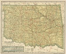 OKLAHOMA Map: Authentic 1908 (dated) with Counties Towns Topography Railroads
-
$17.00
 Original 1882 Map of Missouri by Phillips & Hunt. Antique
-
$28.00
 Civil War Map Atlanta Savannah Georgia 20th Army Blakely Mobile Defenses Alabama
-
$17.00
 Original 1891 Map of North America by Hunt & Eaton. Antique
-
$39.88
 1905 Michigan County Map Saginaw Genesee Livingston Clinton Congressional RARE
-
$32.76
 Vintage 1903 ARIZONA TERRITORY Map 14"x22" Old Antique Original GLOBE TOMBSTONE
-
$31.94
 Vintage 1896 OKLAHOMA INDIAN TERRITORY Map 14"x11" Old Antique Original SEMINOLE
-
$69.99
 1920 NEW YORK HARBOR N.Y. WATER TERMINAL & TRANSFER FACILITIES MAPS 5 MAPS!
-
$5.00
 1886 The People's Atlas Map of Palestine
-
$19.99
 Vintage 1963 Roscommon & Missaukee County Higgons Lake Road Forest Map (M6)
-
$12.95
 1914 Vintage IDAHO Railroad Map Wall Art Decor Old Original Boise Antique
-
$174.95
 Original 1920 Schuyler County Illinois IL Atlas by Kenyon Co Plat Book
-
$115.00
 Johnson's 1864 Large colored map of Minnesota
-
$24.87
 1884 North America Hand Coloured Original Antique Map by Johnston
-
$44.00
 1876 Plat Map WASHINGTON GEORGETOWN Ohio DEFIANCE County LARGE ORIGINAL
-
$58.00
 1899 Canada Map ORIGINAL Steamships Railways Newfoundland Hudson Bay Greenland
-
$21.51
 1831 Map ~ PACIFIC OCEAN - NEW HOLLAND - SANDWICH ISLANDS ~ (9x12) #P277
-
$149.00
 1847 Map Battle of Sacramento Chihuahua Mexican War (about 175 years old): Rare
-
$18.00
 Illinois - Original 1882 Map by Phillips & Hunt. Antique
-
$19.99
 1916 SAN DIEGO HARBOR IMPROVEMENTS AND LANDS ADJACENT COLOR MAP 15.75 x 22!
-
$15.00
 US Dept of Ag - 1908 Soil Map - Modesto-Turlock California #34
-
$25.00
 Marysville California 1896 Geologic Atlas USGS Folio 4 Maps = Colusa Yuba City
-
$37.25
 1875 Iowa 17" Map Des Moines Downtown Plan Plat Polk County Engraved Antique S2
-
$155.00
 Vintage mercantile marine atlas 14th Edition 1952
-
$600.00
 NORTH AMERICA CALIFORNIA AS AN ISLAND 1706 DE LA FEUILLE ANTIQUE MAP
-
$45.95
 1857 Colton Atlas Map ~ KENTUCKY - TENNESSEE ~ (14x17) ~ Free S&H -#511
-
$45.95
 1825 Map ~ NORTH AMERICA, MEXICO incl. TEXAS - EARLY AMERICA - RUSSIAN AMERICA
-
$9.99
 1916 U.S. WEATHER BUREAU COLOR MAP LOWEST TEMPERATURES EVER OBSERVED!
-
$255.71
 Vintage Antique Pocket Map Ohio 1829
-
$6.22
 1902 state map of South Dakota antique vintage Britannica 10th
-
$21.51
 1889 Map ~ CHICAGO, IL ~ (12x17) ~ Good Condition ~ Free S&H-#044
-
$9.99
 1917 McNally Map Louisiana New Orleans Baton Rouge Lake Charles Pontchartrain LA
-
$29.99
 Louisiana ORIGINAL Antique State Map from Rand McNally 1899 Atlas 28" x 21.5"
-
$40.96
 Vintage 1888 TEXAS Map 22"x13" Old Antique Original AUSTIN DALLAS - FORT WORTH
-
$49.16
 Vintage 1902 TOPOGRAPHICAL UNITED STATES Map 22"x14" Old Antique Original USA DC
-
$29.99
 Vermont Vintage ORIGINAL Antique State Map from Rand McNally 1899 Atlas 14x21.5
-
$11.99
 Harper Civil War Map General Wilson Calvary Campaign Georgia Alabama Atlanta
-
$19.99
 1920 BALTIMORE HARBOR MARYLAND TERMINALS W/WIND CHART ENGINEERING MAP 22 x 30.50
-
$36.86
 1888 SAN FRANCISCO CALIFORNIA Map 11"x14" ~ Old Antique Original TELEGRAPH HILL
-
$9.75
 1910 Antique Color Map of The World 17" x 27"
-
$35.18
 Baltimore, MD 1903 Authentic (Dated) City Street Map Landmarks, Stations, Rails
-
$32.76
 Vintage 1912 OKLAHOMA Map 22"x14" ~ Old Antique Original GUTHRIE STILLWATER OK
-
$49.99
 Large Antique 1936 Map Of Mesa Verde National Park, Colorado, Topographical Map
-
$31.99
 Vintage ORIGINAL Antique United States Map from Rand McNally 1899 Atlas 28x21.5
-
$19.51
 Vintage WESTERN NEW YORK Map Railroad New York Central RR LARGE Antique
-
$10.00
 1953 ALLEGHENY COUNTY MARYLAND General Highway USED Map 18" x 32"
-
$10.00
 City of Cumberland, Allegany County, Maryland map October 1968 24X48
-
$27.99
 1881 Rand McNally Railroad Map Michigan Upper Peninsula Marquette Mackinaw City
-
$99.00
 1847 Emory Map Battle of Rio San Gabriel Whittier California History: Rare
-
$21.51
 1889 Map ~ BALTIMORE, MD ~ (12x17) ~ Good Condition ~ Free S&H-#043
-
$45.95
 1887 Map IDAHO, MONTANA & WYOMING TERRITORIES - INDIAN RESERVATIONS (15x24)-#020
-
$27.84
 Vintage 1902 UNITED STATES of AMERICA Map 22"x14" Old Antique Original USA DC
-
$36.00
 Large Original 1898 Antique Map GEORGIA Macon Rome Athens St Simons Tybee Island
-
$11.99
 1884 McNally Map Ohio Columbus Cleveland Cincinnati Toledo Dayton Youngstown
-
$17.00
 Vermont & New Hampshire - Original 1902 Map by Dodd Mead & Company
-
$10.00
 1868 FRANCIS MCNALLY ORIGINAL ANTIQUE ATLAS MAP OF COLORADO-HANDCOLORED
-
$300.00
 New Century Picture Company Antique Map Massachusetts And Rhode Island Rare...
-
$22.00
 Three MAPS OF THE UNITED STATES from Stielers Handatlas. Perthes, Gotha, Germany
-
$31.84
 Antique 1886 FLORIDA Map 11"x13" ~ Old Original JACKSONVILLE ORLANDO TALLAHASSEE
-
$21.21
 ca1902 Vintage VIRGINIA Map LARGE Old Original Antique KING GEORGE FAIRFAX
-
$29.95
 Death Valley Map CA NV U.S. Army Topographic Command 1954 Revised 1970 1:250,000
-
$34.99
 Vintage 1960's County Plat Maps Michigan Dept of Conservation Lakes Forest Book
-
$75.00
 1846 Mitchell's Atlas original New Hampshire Vermont map, 14"x17", hand color
-
$11.99
 1937 Map Portland Oregon City Plan Washington Park Mt. Tabor Willamette River OR
-
$40.96
 Vintage 1902 LONG ISLAND NEW YORK Map 14"x11" ~ Old Antique Original SUFFOLK CTY
-
$19.95
 Old 1883 Historical OREGON Map, Framed, Color, Detailed, RR, Great Gift
-
$24.00
 Mexico - Original Map c1906 by G Philip & Son. Antique
-
$230.00
 NEWFOUNDLAND 1683 ALAIN MANESSON MALLET ANTIQUE MAP 17TH CENTURY FRENCH EDITION
-
$29.99
 LARGE ANTIQUE TOLEDO OHIO MAP - LUCAS CO. - MAUMEE RIVER - VIBRANT PLAT MAP
-
$28.50
 1910 Plat Map New Lenox Township Will County Illinois Marley Spencer Original
-
$26.87
 FLORIDA Map: Genuine 1907 (dated) Counties, Towns, Topography, Railroads
-
$59.95
 Antique 1912 Book: 'The Library Atlas of the World' Vol. II Foreign Countries
-
$19.99
 1937 Map New York City Manhattan Central Park Wall Street Time Square Broadway
-
$48.88
 1871 Plat Map ~ MIDDLEBURY Township, ADDISON Co., VERMONT ~ Free S&H
-
$17.50
 Arkansas - Cool Vintage 1897 Map by The Century Company! (44)
-
$20.68
 1857 Colton Atlas Map ~ The CITIES of LOUISVILLE & NEW ORLEANS ~ (14x17) -#529
-
$45.95
 1855 Map ~ KENTUCKY - TENNESSEE ~ Authentic Colton Atlas Map (15x17) -#018
-
$14.50
 1912 Map State of Minnesota Original Color 15" x 23"
-
$10.00
 Vintage Maps
-
$139.99
 1800's Hand Colored Rochester VT Framed Business Directory Map
-
$27.84
 Vintage 1903 VERMONT Map 14"x22" ~ Old Antique Original MONTPELIER WOODSTOCK VT
-
$14.99
 vintage map 1852 Middle States USA Mitchell Maps
-
$55.00
 1861 Ohio River Engraving View Print Steamboats Nautical ORIGINAL Kentucky
-
$250.00
 1838 William Bartlett Antique Shenandoah Valley Print ~ Framed


