 Antiques (US)
-
$63.00

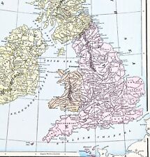 1898 British Isles Historical Map England Ireland Scotland Wales London
-
$187.36
 100% ORIGINAL SEA CHART PORTLAND BILL DORSET MAP ENGR. BY COLLINS C1760 VGC
-
$11.24
 County map of Dorsetshire England hand coloured c1860
-
$31.16
 100% ORIGINAL LARGE HAMPS DORSET SOMERSET GLOS MAP BY BACON C1886 RAILWAYS
-
$48.88
 1889 Switzerland Map ORIGINAL Zurich Geneva Bern Cantons Townships Railroads
-
$48.00
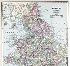 ENGLAND WALES Map 1889 ORIGINAL London Dover Railways Counties Townships G. CRAM
-
$37.46
 DEVON DORSET SOMERSET EXETER PLYMOUTH BY EMANUEL BOWEN c1720 GENUINE ANTIQUE MAP
-
$43.70
 OXFORD SALISBURY POOLE COVENTRY DERBY ROAD MAP BY JOHN SENEX c1762 ANTIQUE MAP
-
$56.19
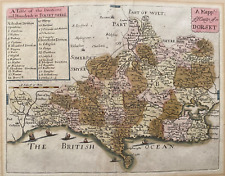 1681 (1715) Antique Map; Dorset by Richard Blome
-
$39.95
 Vintage framed Hand Stitched Map Of England And Wales 20.5" x 16.5"
-
$156.13
 DORSET SOMERSET BY WILLIAM MUDGE c1811 GENUINE 1st EDITION ORDNANCE SURVEY MAP
-
$156.13
 DORSET DORCHESTER BY WILLIAM MUDGE c1811 GENUINE 1st EDITION ORDNANCE SURVEY MAP
-
$22.00
 Sidmouth to Portsmouth Region, England - Original 1922 Ordnance Survey Map.
-
$18.67
 100% ORIGINAL DORSETSHIRE JURRASIC COAST MAP BY THOMAS MOULE C1848 VGC RAILWAYS
-
$19.97
 vintage Retro Map , DORSET area , double Sided With Guide
-
$8.12
 1902 Map of Cornwall Devon Dorset Channel Island antique vintage Britannica 10th
-
$68.70
 EXETER TO DORCHESTER ROAD MAP BY JOHN OGILBY REDUCED BY THOMAS GARDNER c1719
-
$68.70
 1610 (1650) Antique Map: Dorset Miniature Speed / van den Keere
-
$22.48
 OLD ANTIQUE MAP SCILLY ISLES c1830 ENGRAVING by JOHN CARY ORIGINAL HAND COLOUR
-
$23.11
 CREWKERNE, YEOVIL, HONITON, EXETER, DEVON, original antique road map, Bowen 1759
-
$43.72
 DORSET, GUSSAGE SAINT ANDREW, TARRANT HINTON, original antique map, MOGG, 1817
-
$325.00
 Antique Map of England by Blaeu 1663 Dorcestria Dorsettia. Dorsett UK
-
$9.00
 Dorset pictorial guide of places to visit in tourist map
-
$32.48
 1880s Map Dorsetshire by J & C Walker Hand Coloured Parliamentary Divisions
-
$68.70
 WILTSHIRE DORSET ROAD MAP BY JOHN OGILBY REDUCED BY THOMAS GARDNER c1719
-
$18.72
 1701 ROBERT MORDEN MAP OF DORSETSHIRE DORCHESTER BLANDFORD SHERBORNE AXMINSTER *
-
$31.21
 1830 Original Pigot & Co. Map: Dorset
-
$37.47
 DORSET, ASKERWELL, BRIDPORT, CHARMOUTH, original antique road map, MOGG, 1817
-
$61.20
 VINTAGE ADMIRALTY CHART. No.2620. EDDYSTONE to PORTLAND. 1920 EDITION.
-
$306.02
 SOUTH WEST ENGLAND, WALES, 'Regni Angliae', original antique map, De Wit, c.1680
-
$56.21
 VINTAGE ADMIRALTY CHART. No.2172. SWANAGE BAY. 1962 Edition.
-
$73.69
 VINTAGE ADMIRALTY CHART. No.2450. PORTLAND to CHICHESTER. 1922 Edition.
-
$47.46
 BRIDPORT, DORSET Original Street Plan, Dawson Original antique map 1832
-
$56.21
 SHAFTESBURY borough/town plan. REFORM ACT. Dorset. DAWSON 1832 old antique map
-
$43.72
 DORSET, WEST STOUR, MILBORNE PORT, SHERBORNE, original antique map, MOGG, 1817
-
$41.22
 EXETER, PLYMOUTH, DARTMOUTH, antique road map, SENEX, OGILBY, pl 76-77, 1762
-
$99.92
 Antique map of Dorset by Robert Morden 1695
-
$56.21
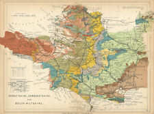 DORSET, SOMERSET AND SOUTH WILTSHIRE Geological map. STANFORD 1904 old
-
$13.10
 Poole Harbour Map - 78cm x 55cm - 1974
-
$137.40
 DORSETSHIRE antique map from CAMDEN'S BRITANNIA, Robert Morden, published 1722
-
$37.46
 c.1897 BACON'S NEW CYCLING ROAD MAP OF BOURNEMOUTH & DISTRICT
-
$16.23
 1805 Antique map: Weymouth and Portland, Dorset
-
$18.01
 1896 Dorset large antique map. 128 years old. Poole, Weymouth, Dorchester.
-
$53.71
 WAREHAM town/borough plan. REFORM ACT. Corfe Castle. Dorset. DAWSON 1832 map
-
$31.23
 Maps Of Ringwood & New Forest Fold Out Antique Map Bournemouth
-
$62.45
 OXFORD TO SALISBURY & POOLE BY JOHN OGILBY REDUCED BY THOMAS GARDNER c1719
-
$56.21
 1840 ANTIQUE ORDNANCE SURVEY MAP DORSETSHIRE - ORIGINAL SERIES ONE INCH SHEET 16
-
$7.48
 Old Victorian Railway Map of Dorset 1840 Pigot: Antique, Vintage: Reprint
-
$61.20
 VINTAGE ADMIRALTY CHART. No.2045. CHRISTCHURCH to OWERS. 1952 Edition.
-
$68.70
 Antique map of Dorset by Richard Blome 1715
-
$43.70
 SOMERSET DEVON DORSET TAUNTON BRIDPORT BY JOHN CARY GENUINE ANTIQUE MAP c1794
-
$18.72
 DORSET WEYMOUTH PORTLAND SWANAGE BY JOHN CARY c1824 GENUINE ANTIQUE MAP
-
$37.46
 HAMPSHIRE DORSET DORCHESTER WEYMOUTH BY EMANUEL BOWEN c1720 GENUINE ANTIQUE MAP
-
$106.17
 Antique Map of South West England by Petrus Bertius 1618
-
$7.49
 BRIDPORT British Geological Survey Map - 1968 Solid and Drift Edition
-
$68.70
 LONDON TO WEYMOUTH BASINGSTOKE BY JOHN OGILBY REDUCED BY THOMAS GARDNER c1719
-
$343.49
 BRIGHT'S MAP OF BOURNEMOUTH WITH INDEX 1897 - VICTORIAN SEASIDE RESORT
-
$9.99
 BOURNEMOUTH. Vintage town city map plan. Dorset 1957 old vintage chart
-
$50.00
 1736 Ogilby /Bowen The Road from London to Weymouth come Dorset
-
$218.58
 Dorsetshire: antique map by Saxton & Kip, 1607 (1610 edition)
-
$33.72
 DEVON, SOMERSET, DORSET, Pl.13, original antique map, Cary, 1794
-
$19.98
 Bridport Harbour town plan & sea coast chart. Dorset. ADMIRALTY 1943 old map
-
$12.48
 Antique/Vintage County Map of Dorset - John Heywood, 1868
-
$17.49
 Swanage Bay town plan & sea coast chart. Dorset. ADMIRALTY 1943 old map
-
$21.23
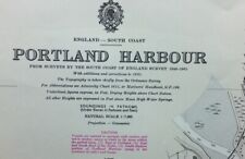
 ADMIRALTY SEA CHART. PORTLAND HARBOUR & DOCKYARD. No.2268. England S. Coast.1973
-
$16.23
 Weymouth Yeovil Taunton 37 CLOTH Ordnance Survey Map Half Inch 1915 HILL SHADED
-
$12.48
 Portland. Chesil beach. Weymouth Melcombe Regis. Dorset. Sketch map 1885
-
$13.74
 BILL OF PORTLAND to THE NEEDLES, 1974 ADMIRALTY SEA CHART. No.2615
-
$22.48
 OLD ANTIQUE MAP SOUTH DORSETSHIRE c1787 ENGRAVING by JOHN CARY DORSET COLOUR
-
$6.25
 OS MAPS LAKE DITRICT TOURIST MAPS SCOTTISH BORDERS DORSET JOB LOT
-
$43.72
 DORSET, DORCHESTER, WINTERBOURNE ABBAS, original antique map, MOGG, 1817
-
$206.09
 DORSET, Robert Morden, original antique hand coloured map 1695
-
$29.98
 LYME REGIS borough/town plan. BOUNDARY COMMISSION. Dorset. DAWSON 1837 old map
-
$10.62
 1971 ORDNANCE SURVEY MAP BOURNEMOUTH NEW POPULAR EDITION Christchurch Old Poole
-
$43.72
 SOMERSET, YEOVIL, EAST CHINNOCK, CREWKERNE, original antique map, MOGG, 1817
-
$10.99
 County of Dorset in England - Map Print -- 1907
-
$74.94
 THOMAS MOULE ORIGINAL HAND COLOURED ANTIQUE MAP OF DORSETSHIRE- CIRCA 1850
-
$12.49
 ENGLAND SOUTH. hampshire Isle of Wight Dorset Sussex; Inset Birmingham 1920 map
-
$32.48
 Maiden Castle ground plan & Cerne Abbas Giant. Francis CARY. Dorset 1789 map
-
$43.72
 DORSET, Edward Weller Original Antique Map c1870
-
$31.23
 Antique map of Dorset by Thomas Moules 1842
-
$8.12
 The Times/Geographia Contour Road Map Hampshire Dorset Wiltshire
-
$6.25
 Bartholomew's DORSET Half-Inch Sheet 4 - 1948 Vintage Cloth Map
-
$41.22
 BRISTOL TO WEYMOUTH, CAMBRIDGE TO COVENTRY, antique road map, SENEX, 64-65, 1762
-
$49.32
 OLD ANTIQUE MAP DORSETSHIRE DORSET by ODDY c1812 ENGRAVING ORIGINAL HAND COLOUR
-
$15.44
 1904 South West England & Wales map. 118 years old. Antique. Large size.
-
$7.49
 SWANAGE Institute of Geological Sciences Geology Map 1970 Solid & Drift Edition
-
$9.93
 EDW. STANFORD - BARTHOLOMEW'S LINEN BACK DISSECTED 2 ML. TO 1" MAP - DORSET
-
$212.34
 Dorset: antique map by George Bickham, 1754 (1st edition)
-
$43.72
 DEVON, HONITON, DORSET, STOCKLAND, CHARD, original antique map MOGG 1817
-
$43.72
 DORSET, BLANDFORD, WINTERBOURNE WHITECHURCH, original antique map, MOGG, 1817
-
$31.23
 Antique map of Dorsetshire by John Seller and Francis Grose 1809
-
$106.17
 POOLE TOWN PLAN c1861 HUTCHINS HISTORY OF DORSET GENUINE ANTIQUE ENGRAVED MAP
-
$56.21
 Antique map of Dorset by Henry Teesdale 1829
-
$149.89
 OS #18 Yeovil Scarplands & Somerset Hills. Crewkerne Sherborne Dorset 1811 map
-
$21.23
 ADMIRALTY SEA CHART. PORTLAND HARBOUR & DOCKYARD. No.2268. England S. Coast.1939
-
$7.49
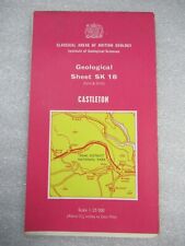 CASTLETON 1975 Geological Sheet SK 18 - Classical Areas of British Geology Map
-
$16.23
 1830 Antique map - Dorset- from Gorton's Topographical Dictionary
-
$31.23
 100% ORIGINAL LARGE WEYMOUTH DORSET FOLDING MAP BY HARDING C1920/S VGC ADVERTS
-
$8.37
 1960 ORDNANCE SURVEY MAP BOURNEMOUTH NEW POPULAR EDITION CLOTH ONE INCH 179


