 Antiques (US)
-
$28.30

 1890 ORIGINAL ANTIQUE MAP OF LAKE DISTRICT CUMBERLAND WESTMORLAND / ENGLAND
-
$435.59
 1793 Plan Manchester & Salford Large Folding Map by Charles Laurent 106 cm x 91
-
$39.88
 1912 Carolingian Empire Map EUROPE France Burgundy Germany Austria Medieval
-
$22.57
 1927 ORIGINAL VINTAGE CITY MAP OF BRIGHTON / SUSSEX / ENGLAND
-
$40.00
 Enlarged Pictorial Plan of London Foldout Map. Chas. Baker & Co. c.1912
-
$70.00
 Eighteenth Century Hand-Col. Map of London & Environs, 1787 - PRICE REDUCED
-
$57.36
 Vintage 1900 ENGLAND & WALES Map 14"x22" Old Antique Original BRITAIN UK LONDON
-
$12.99
 Original 1882 Map LONDON England Marylebone Greenwich Hackney Southwark Finsbury
-
$58.00
 1956 Europe Map Topographical Elevations France Turkey Asia Yugoslavia Germany
-
$9.95
 Vintage Map of ENGLAND Wall Art Railroad Decor Original 1950s Railway London
-
$18.00
 Europe - Original 1906 Political Map by Meyers. A German Language Antique
-
$23.95
 Britannia Romana 1695 Vintage Style Roman England Provincial Map - 24x28
-
$29.99
 1852 Antique Atlas Map / GREAT BRITAIN, IRELAND
-
$217.80
 1794 Country Around Manchester Large Folding Map by Stockdale 84 cm x 81 cm
-
$22.57
 1924 ORIGINAL VINTAGE CITY MAP OF SHEFFIELD / SOUTH YORKSHIRE / ENGLAND
-
$28.30
 1890 ORIGINAL ANTIQUE CITY MAP OF PLYMOUTH / TORQUAY / DEVON / ENGLAND
-
$9.75
 Rand, McNally & Co Antique 1899 Map Of England & Wales 7x6
-
$40.00
 1909 Antique Color Map - EUROPE - Original GIANT 22 x 16 Map - Very Rare
-
$19.99
 1970's Johnston & Bacon Southern England & Wales No 1-Highway Road Map Fold-out
-
$33.00
 Antique Map of London of Westminster Abbey Plan Great Britain
-
$20.00
 Central Europe - Original 1902 Travel Map by The Century Company. Antique
-
$24.99
 Original 1882 Bartholomew Map CENTRAL LONDON Tower Subway England Westminster
-
$14.50
 Beautiful 1883 Colorful Antique Map of Europe Approximately 13x11 inches
-
$9.50
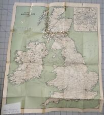 1907 British Isles Railway Map
-
$47.52
 Vintage 1901 LONDON ENGLAND UK Map 11"x14" ~ Old Antique Original REGENTS PARK
-
$45.06
 Vintage 1904 LONDON ENGLAND Map 11"x14" ~ Old Antique Original BATTERSEA CHELSEA
-
$24.90
 1902 INDUSTRIAL MAP GERMANY Vintage Economical ORIGINAL 11.5 x 9.5" C11-8
-
$92.00
 England & Wales United Kingdom London 1772 Jefferys decorative hand color map
-
$22.63
 1924 ORIGINAL VINTAGE CITY MAP OF LEEDS / WEST YORKSHIRE / ENGLAND
-
$22.57
 1924 ORIGINAL VINTAGE CITY MAP OF EXETER / DEVON / ENGLAND
-
$31.10
 1907 Railway Map Of London Overground & Underground by George Philip
-
$22.57
 1927 ORIGINAL VINTAGE CITY MAP OF WINCHESTER / CATHEDRAL / HAMPSHIRE / ENGLAND
-
$29.90
 1902 EUROPE CONTINENT Vintage Geographical Map Color 9.5 x 11.5 ORIGINAL C12-7
-
$9.75
 Antique 1869 Map Of England & Wales 8.5 x 7 Inches
-
$39.99
 1814 John Cary Road Map Kent Canterbury Margate Maidstone Rochester England UK
-
$22.00
 Yorkshire - Bridlington to Kilnses - Large Original 1922 Ordnance Survey Map.
-
$15.99
 1835 Bradford Map - Northern Europe Germany Sweden Norway Holland Britain Russia
-
$53.26
 Vintage 1892 LONDON ENGLAND Map 22"x14" Old Antique Original HYDE PARK
-
$59.88
 1852 Spain France Italy Portugal Map Rome Madrid Paris Lisbon Normandy Sicily
-
$24.88
 1863 Kent Original Antique Hand Coloured Weekly Dispatch Map
-
$14.99
 Original 1902 Map VICINITY OF LONDON England Oxford Cambridge Suffolk Railroads
-
$17.00
 England & Wales - Original 1891 Map by Hunt & Eaton. Antique
-
$39.99
 1814 John Cary Road Map Cornwall Lands End Truro St. Ives Falmouth England UK
-
$80.90
 ARMS OF THE COLLEGES CAMBRIDGE BY EMANUEL BOWEN c1720 GENUINE ANTIQUE ENGRAVING
-
$357.33
 Original 1617 Braun Hogenburg Map of Richmond Shrewsbury & York w. Early Color
-
$15.00
 Vintage Longmans Map of Western Europe in 1558 at the Accession of Elizabeth
-
$18.50
 Vintage Historical Folding Cloth Map Of England & Wales By L.G. Bullock 1965
-
$57.36
 Vintage 1887 LONDON ENGLAND Map 21"x13" ~ Old Antique Original KENSINGTON PARK
-
$9.99
 1892 Crowell Kirkpatrick Map - England & Wales London Liverpool Bristol Cornwall
-
$24.90
 1909 BRITISH COLONIES MERCATOR Map Vintage Sea Travel ORIGINAL 11.5 x 9.5" C12-3
-
$39.88
 OLD 1853 ENGLAND IRELAND Map ORIGINAL Wales Scotland London Dublin Glasgow
-
$19.99
 1869 Antique Mitchell COLOR Map / GREAT BRITAIN AND IRELAND
-
$24.90
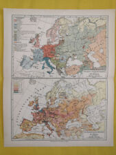 1905 EUROPE POPULATION DENSITY Map Vintage Eng ORIGINAL 11.5 x 9.5" C12-7
-
$33.00
 Antique Map of London Palace of Westminster Plan Thames
-
$12.43
 Vintage Admiralty Nautical Chart Sheerness and Approaches No. 3683 (1954)
-
$12.43
 Vintage Admiralty Nautical Navigation Sea Chart Dover Harbour No. 1698 (1952)
-
$39.99
 England Angleterre original 1748 Vaugondy hand color map
-
$24.88
 Vintage Admiralty Nautical Navigation Chart Lamlash Harbour No. 1619 (1966)
-
$22.00
 London England & Vicinity - Original 1908 Map by Meyers. Antique
-
$19.99
 c 1850 Thomas Moule Map Durham County Raby Castle Hartlepool Darlington England
-
$12.43
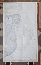
 Vintage Admiralty Nautical Chart River Thames Woolwich to Erith No. 3191 (1954)
-
$4.00
 ORIGINAL HAND COLORED MAP - DERBYSHIRE (ENGLAND) by THOMAS MOULE c1843
-
$12.43
 Vintage Admiralty Nautical Navigation Chart Edinburgh Channels No. 1605 (1956)
-
$12.43
 Vintage Admiralty Nautical Sea Chart The Downs South East No. L(D5) 1828 (1958)
-
$12.43
 Vintage Admiralty Nautical Chart South Foreland South Falls Head No. 1828 (1973)
-
$16.00
 Original 1891 Map of Northern Lancashire County, England by G Philip. Antique
-
$31.94
 Vintage 1901 ENGLAND & WALES Map 14"x22" Old Antique Original CARDIFF LONDON
-
$11.20
 1937 McNally Map British Isles Great Britain & Ireland England Scotland London
-
$24.75
 1919 Antique London England City Map Street Map of London Wall Art 1234
-
$27.97
 Vintage framed Hand Stitched Map Of England And Wales 20.5" x 16.5"
-
$40.00
 1869 ORIGINAL ANTIQUE MAP DISTRICT CUMBERLAND Westward / ENGLAND
-
$9.95
 1919 U.S. SHIPPING BOARD HARBOR COMMISSION-GARSTON DOCKS LIVERPOOL ENGLAND MAP
-
$12.95
 1921 Vintage ENGLAND Map Railroad Railway Old Original United Kingdom Wall Art
-
$22.00
 Middlesex Hertfordshire & Essex, England. Original 1922 Ordnance Survey Map.
-
$12.99
 Original 1888 Map HERTFORDSHIRE England St. Albans Hatfield Stevenage Watford
-
$24.90
 1905 EUROPE MERCATOR Map Vintage Sea Travel Climate ORIGINAL 11.5 x 9.5" C12-2
-
$6.21
 ESSO Boat Cruising Guide River Thames Richmond to Lechdale 1962
-
$68.45
 ENGLAND SOUTH BRITAIN BY COWLEY / BOWEN c1777 GENUINE ANTIQUE COPPER ENGRAVING
-
$6.21
 Vintage Admiralty Navigation Chart Netherlands Noordzeekanaal No.124 (1971)
-
$12.43
 Vintage Admiralty Sea Chart The Solent Nab Tower To Spithead No.L(D5)2050 (1955)
-
$16.00
 Europe - Original 1903 Dated Physical Map by Dodd Mead & Company. Antique
-
$15.00
 Vintage Longmans Map of England in the Years 584 and 626 AD
-
$11.86
 Antique Map of ENGLAND WALES Map Wall Art Decor ca 1890 Vintage London
-
$124.46
 Map "A Plan of Sr Christopher Wren's first design of St Paul's Cathedral" c.1730
-
$9.99
 Battle of Agincourt 1415 & Battle of Edge Hill 1642 England History Antique Map
-
$14.00
 Vintage Map of Central Britain 1715-1745 by Longmans Green 1914.
-
$20.00
 Lot of 7 Vintage Ordnance Survey ENGLAND & WALES 1" Maps
-
$9.95
 1919 U.S. SHIPPING BOARD HARBOR COMMISSION-BUTE DOCKS CARDIFF ENGLAND MAP
-
$29.90
 1889 EUROPE CONTINENT Geographical Map Political View Color ORIGINAL C12-3
-
$11.99
 1911 Stieler Map Scotland England Edinburgh Glasgow Loch Ness Orkney Shetland Is
-
$34.99
 1865 Cassell's Map of England & Wales 25.5" x 34.5"
-
$22.57
 1924 ORIGINAL VINTAGE CITY MAP OF CENTRAL MANCHESTER / ENGLAND
-
$38.90
 1905 WORLD MERCATOR Currents Vintage Large Map ORIG. Italian 12.5 x 10.5" C13-1
-
$5.99
 Vintage 1940 World Atlas City Map of Central London, England World War WWII OLD
-
$20.19
 1912 ANTIQUE MAP OF NORTHERN ENGLAND / YORK / WALES / VERSO MANCHESTER LIVERPOOL
-
$14.00
 Vintage Longmans Map of England & France in the Year 1259
-
$23.52
 antique geological map England Wales R Murchison 1842 British geology art poster
-
$52.00
 rare 1908 KARL BAEDEKER REISEHANDBUCH Index Streets & PLANS OF LONDON 4 maps EX
-
$45.88
 1899 Central Europe Map ORIGINAL France Belgium Germany STEAMSHIPS RAILWAYS
-
$28.30
 1894 ORIGINAL ANTIQUE MAP OF LONDON ZOO / LONDON ZOOLOGICAL GARDENS


