 Antiques (US)
-
$74.25

 Very old, antique Map of Ireland - Robert Rob Morden Cartography -
-
$200.00
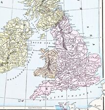
 VINTAGE PULL DOWN PHYSICAL POLITICAL MAP OF GREAT BRITAIN & IRELAND 50"x 42 3/4"
-
$78.40
 Ireland Dublin Galway Waterford Limerick Derry 1830 miniature map
-
$62.17
 1747 Roman Britain Original Antique Map by Richard Seale
-
$199.00
 1927 Booklovers Map of the British Isles pictorial mounted framed P Paine Bowker
-
$28.88
 1855 Great Britain Map ORIGINAL England Ireland Scotland Wales London Dublin
-
$28.00
 1853 Europe Map ORIGINAL Turkey Russia Prussia Iceland Sardinia England Sweden
-
$19.50
 SMALL WHITECLIFF FRAMED MAP OF IRELAND MADE IN LEIXLIP, IRELAND 5 X 7
-
$28.00
 1899 Europe Map ORIGINAL France Germany Austria Spain England Italy Turkey
-
$23.98
 Vintage 1920 Ireland Map Connaught Galway London Edinburgh Dublin City Insets
-
$28.88
 OLD 1897 Europe Map Russia Switzerland Baltic States Ireland Denmark Hungary
-
$20.25
 1943 Vintage IRELAND Map Antique Atlas Map of Ireland Gallery Wall Decor 1510
-
$24.50
 1906 Vintage IRELAND Map Antique Atlas Map of Ireland Gallery Wall Decor 1593
-
$76.00
 Dublin Ireland 1874 detailed City Plan River Liffey Black uncommon map
-
$38.00
 Print of Ancient MAP OF IRELAND, "For Mr Tindals Continuation of Rapins History"
-
$108.00
 Ireland Leinster Munster Connaught Ulster Dublin 1788 Kitchin map
-
$53.00
 1898 British Isles Historical Map England Ireland Scotland Wales London
-
$9.99
 Vintage Map "Political Map of Great Britain and Ireland"
-
$19.99
 1900 Ireland Map Westmeath County Mullingar Castlepollard Athlone Kinnegard
-
$9.99
 1892 Map Western Ireland Athlone Galway & Scotland Glencoe 1691 Original Antique
-
$24.99
 Original 1897 Streetcar Map DUBLIN Ireland Bedlam Trinity Guinness Lunatic Docks
-
$9.75
 Antique 1869 Map Of Ireland 8.5 x 7 Inches
-
$9.99
 1986 AAA Great Britain & Ireland Road Map - Distance in Miles
-
$28.88
 OLD 1853 ENGLAND IRELAND Map ORIGINAL Wales Scotland London Dublin Glasgow
-
$12.71
 Vintage IRELAND Map Wall Art ca 1890 Old Original Dublin Antique Sepia Tone
-
$19.99
 1900 Ireland Map Cork County Mallow Macroom Midleton Skibbereen Blarney Fermoy
-
$19.99
 1869 Antique Mitchell COLOR Map / GREAT BRITAIN AND IRELAND
-
$19.99
 1900 Ireland Map Kerry County Ireland Kilarney Tralee Listowel Dingle Killorglin
-
$29.25
 Antique Map IRELAND: Dublin to Waterford; Kilkenny to Thomastown
-
$100.00
 Ireland Dublin Derry Galway Cork Ulster Munster Connaught c. 1780 engraved map
-
$78.40
 Island of Ireland Leinster Munster Connacht Ulster Dublin 1802 Whitehead map
-
$250.00
 Leinster Coal District Survey (Ireland) 1814. Map, plan,geology appendix. RARE
-
$19.51
 ca 1904 IRELAND Map Wall Art Old Vintage Original Antique Edinburgh Dublin
-
$35.00
 Vintage Maps - Ireland, Scotland, England and Wales, British Isles
-
$19.99
 Vintage Map "Great Britain and Ireland" 1841
-
$19.99
 1900 Ireland Map Tyrone County Cookstown Dungannon Strabane Castlederg Fintona
-
$28.00
 1843 Europe Map Prussia Germany Iceland Ireland POLITICAL Russia Moscow Austria
-
$21.19
 Vintage Tourist Map of Great Britain and Northern Ireland United Kingdom 1960
-
$78.40
 Ireland Population Demographics showing change 1882 scarce Bevan folio color map
-
$132.00
 Ireland country Dublin Waterford Killarney 1749 Senex? fine hand colored map
-
$31.08
 IRELAND, MULLINGAR, ATHLONE, TRIM, antique road map, Taylor & Skinner, 1783
-
$38.88
 1898 British Islands ENGALND Map Anglo-Saxon and Celtic Kingdom Ireland Scotland
-
$10.99
 Collins Visitors Map Ireland Golf Courses
-
$8.08
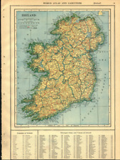
 1902 Map of Ireland antique vintage Britannica 10th
-
$39.56
 Vintage 1900 EUROPE Map 11"x14" ~ Old Antique Original EU UK IRELAND SCOTLAND
-
$23.52
 Dublin Large Medieval Map 66cm x 86cm (1978) Scarce
-
$18.94
 1900 ORIGINAL ANTIQUE MAP OF IRELAND DUBLIN CORK KILLARNEY WICKLOW
-
$55.00
 Ireland Leinster Connaught Ulster counties Belfast 1907 huge old map
-
$279.75
 BRITISH ISLES Britain, Frederick De Wit original antique map circa 1675
-
$24.99
 1880 Antique Atlas Map / GREAT BRITAIN AND IRELAND
-
$19.99
 1900 Ireland Map Waterford County Dungarvan Tramore Lismore Tallow Ardmore
-
$15.99
 1835 Bradford Map - Northern Europe Germany Sweden Norway Holland Britain Russia
-
$15.99
 1900 Ireland Map - Carlow County Tullow Clonegall Bagenalstown Rathvilly Myshall
-
$10.00
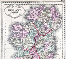
 1844 AUTHENTIC ORIGINAL MORSE ANTIQUE ATLAS MAP-IRELAND-SCOTLAND-HANDCOLORED
-
$9.25
 Rand, McNally & Co Antique 1899 Map Of Ireland 7x6
-
$93.25
 1627 Antique Map: Munster, Ireland - Miniature Speed / van den Keere
-
$60.00
 Ireland & Scotland United Kingdom 1867 A.J. Johnson scarce large hand color map
-
$167.85
 Antique Map of Great Britain by Christoph Weigel 1718
-
$48.88
 1953 Europe Map Italy Germany Prussia England Russia Crimea Spain Paris London
-
$44.88
 1899 Central Europe Map ORIGINAL France Belgium Germany STEAMSHIPS RAILWAYS
-
$19.99
 1900 Ireland Map Galway County Salthill Loughrea Connemara Ballinasloe Tuam
-
$11.99
 1937 McNally Map France Paris Marseilles Toulouse Bordeaux Nantes Lyon Tours FR
-
$12.00
 1892 Antique Map Ireland Desmond Ormande Family in 1570 Dublin Munster Leinster
-
$14.00
 1937 McNally Map Ireland Dublin Cork Wexford Galway Kerry Belfast Limerick Clare
-
$19.99
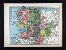 1900 Ireland Map Mayo County Ireland Castlebar Belmullet Balla Killala Westport
-
$28.88
 OLD 1896 Map PARIS LONDON BERLIN DUBLIN ROME ST PETERSBURG VIENNA EDINBURGH
-
$19.99
 1900 Ireland Map Wexford County New Ross Enniscorthy Courtown Gorey Rosslare
-
$19.99
 Rand McNally Hallwag Map EUROPE With Distoguide 1992/93, ISBN 0528914731 Vintage
-
$48.00
 1891 Ireland Map ORIGINAL Kerry Dublin Belfast Counties RAILROADS Townships
-
$11.86
 1921 Antique IRELAND Map of Ireland Vintage United Kingdom Gallery Wall Art
-
$11.20
 1937 McNally Map British Isles Great Britain & Ireland England Scotland London
-
$17.76
 1919 Vintage Map Ireland Original Color Collier Atlas
-
$12.00
 Antique Map of Ireland..1894...by Philips, London. 7" X 8-1/2"
-
$11.99
 GREAT BRITAIN (ENGLAND and SCOTLAND) & IRELAND - 1947 Post War Map w/ BONUS
-
$16.96
 Antique Edinburgh Scotland Map City Street Vintage ca1901 Original Wall Art
-
$19.99
 Rand McNally Hallwag Map EUROPE With Distoguide 1994/95, ISBN 052895080
-
$48.57
 Taylor Skinner Ireland Map Drogheda Dunleer Newry Dundalk Castlebellingham
-
$78.40
 Ireland Dublin Galway Limerick Cork 1771 decorative engraved map
-
$9.75
 Rand, McNally & Co Antique 1899 Map Of Ireland 7x6
-
$48.00
 1956 Europe Map Topographical Elevations France Turkey Asia Yugoslavia Germany
-
$19.99
 1900 Ireland Map Londonderry County Derry Dungiven Castlerock Maghera Coleraine
-
$399.99
 RARE original political 1918 MAP OF THE IRISH REPUBLIC in color wb
-
$4.95
 Original 1797 George Kearsley Color Map Ireland North & Sou Irish Sea Nymph Bank
-
$45.00
 1844 1-page Atlas Map by Olney "BRITISH ISLES" including Ireland / Eire
-
$15.07
 1896 Louth, Meath, Cavan, Monaghan map. Victorian Ireland print. Ulster Leinster
-
$44.88
 1898 DUBLIN Ireland Map Liffey River College Park Merrion Square Steam Railroads
-
$9.89
 CENTURY ATLAS MAP PAGE PLATE NO. 79 IRELAND 1911 VINTAGE
-
$15.99
 1902 Ireland Map - Wicklow County - Arklow Brides Head Shellelagh Dunlavin Mizen
-
$11.99
 1835 Map x 2 - Europe Political & Physical - Austria Italy Spain Britain
-
$23.99
 1902 Johnston Oxford Map Barbarian Europe 565-720 AD Franks Goths Slavs Saxons
-
$25.99
 VINTAGE FOLDING PAPER GEOLOGIC MAP N. DONEGAL IRELAND WALLACE PITCHER 1972 NICE!
-
$27.99
 1902 Johnston Oxford Map Ireland English Plantations & Settlements c 1641 Dublin
-
$9.05
 Giant ’S Causeway Clochán An Aifir Northern Ireland Wood Engraving Um 1880
-
$19.99
 1900 Ireland Map Limerick County Adare Askeaton Kilmallock Newcastle Foynes Glin
-
$80.00
 RARE 1857 Large Color Map of . EUROPE . Edward Stanford - ORIGINAL ANTIQUE MAP
-
$19.99
 1900 Ireland Map Louth County Dundalk Drogheda Dunleer Ardee Greenore Blackrock
-
$48.57
 Taylor Skinner Ireland Map Emyvale Clogher Omagh Strabane Lifford Newtownstewart
-
$19.99
 1900 Ireland Map Clare County Ireland Ballyvaghan Kilrush Ennis Carrotin Kilkec
-
$76.00
 Belfast Ireland 1874 detailed City Plan River Lagan uncommon map
-
$137.50
 Antique Print-DUBLIN-WATERFORT-LONDONDERRY-CORKE-IRELAND-Le Rouge-1756


