 Antiques (US)
-
$37.34

 1930 Vintage Folding Map Liverpool England John Bartholomew 10.5" x 6"
-
$24.88
 ORDNANCE SURVEY WALL CHART / MAP LIVERPOOL Merseyside #93 1" : 1 MILE 1961
-
$15.72
 1896 Liverpool & Manchester area map. Victorian England. Bolton, Warrington.
-
$16.33
 1895 Liverpool city map. Victorian print. River Mersey. For Framing.
-
$27.97
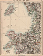
 Vintage framed Hand Stitched Map Of England And Wales 20.5" x 16.5"
-
$16.33
 1895 Lancashire South county map. Victorian. Liverpool, Manchester, Bolton.
-
$31.11
 LIVERPOOL & BIRKENHEAD, MERSEYSIDE Map 1899 Antique John Barholomew, A & C Black
-
$6.22
 c1950 OLIVER'S ROAD GUIDE and MAP For MOTORISTS Routes & Distance From LIVERPOOL
-
$18.61
 1898 Liverpool, River Mersey & North Wales large map. 126 years old. Chester.
-
$18.61
 1898 Liverpool & Manchester environs large map. 125 years old. Birkenhead Bolton
-
$17.41
 Liverpool. Merseyside & environs. Birkenhead Runcorn St helens. Sketch map 1885
-
$7.47
 ORIGINAL VINTAGE : GEOGRAPHIA LARGE SCALE STREET PLAN OF ROCHDALE
-
$12.45
 c1910 Bartholomew's LIVERPOOL to MANCHESTER MAP For Tourists & Cyclists Linen #8
-
$29.87
 OLD BIRDS EYE VIEW MAP OF LIVERPOOL 1886 - 20" x 16" PHOTOGRAPHIC PRINT
-
$12.45
 c1920 Bacon's "Ever-Ready" Cycling and Motoring MAP of LIVERPOOL & NORTH WALES
-
$6.22
 c1950 OLIVER'S ROAD GUIDE and MAP For MOTORISTS Routes & Distance From LIVERPOOL
-
$24.89
 LIVERPOOL Wigan Southport Wirral St Helens Chorley 3 x OS MAPS 1840 1902 & 1924
-
$41.07
 North-west England. Peak District Merseyside Manchester ORDNANCE SURVEY 1922 map
-
$99.55
 Original Pieter Van Der Aa Map (1670) North Wales, Cheshire - Hand Coloured, F/G
-
$34.85
 MERSEYSIDE. LIVERPOOL & BIRKENHEAD town city plan. Bootle Everton 1910 old map
-
$12.45
 c1920 Geographia LIVERPOOL & MANCHESTER District LINEN MAP - VG Cond Cloth
-
$124.44
 1695 MAP OF THE COUNTY PALATINE OF LANCASTER by ROBERT MORDEN LIVERPOOL BURNLEY^
-
$28.62
 MERSEYSIDE NE WALES CHESHIRE N SHROPS.Liverpool Warrington Chester.CARY 1794 map
-
$16.17
 Old Map of Liverpool 1795 by Stockdale 45cm x 32cm PRINT
-
$31.11
 MERSEYSIDE DEESSIDE. Liverpool Chester Rhyl Wirral Birkenhead Denbigh 1903 map
-
$62.22
 1750 COLOUR MAP BRITISH ISLES INSULARUM BRITANNICARUM FACIES ANTIQUA CELLARIUS *
-
$27.37
 Liverpool Water Works, per H Beloe. Reservoirs. Merseyside. Sketch map 1885
-
$12.43
 Vintage Bartholomew Folding Map; Liverpool & Manchester (c1930s) Stanford 8
-
$34.85
OLD BIRDS EYE VIEW MAP OF LIVERPOOL 1886 - 30" x 20" PHOTOGRAPHIC PRINT
-
$22.40
 LIVERPOOL & MANCHESTER environs. Wirral Merseyside Oldham Bolton Bury 1898 map
-
$31.11
 MERSEYSIDE DEESSIDE Liverpool Chester Rhyl Wirral Birkenhead Denbigh 1939 map
-
$41.07
 NORTH WALES & NW ENGLAND. Shropshire Merseyside Cheshire. SDUK 1845 old map
-
$199.13
 LIVERPOOL BAY. Merseyside, Dee Estuary & Wirral. Lancs Flintshire. CARY 1832 map
-
$7.45
 Southport & Lytham - Ordnance Survey Map - First Edition Reprint - Merseyside
-
$93.34
 MERSEYSIDE Liverpool Birkenhead Wirral St Helens Knowsley antique map BACON 1898
-
$161.79
 Liverpool Bay Wirral Dee Merseyside North Wales ADMIRALTY chart 1886 (1956) map
-
$12.45
 Reproduction Historic map G. Coke and J. Riper Liverpool Merseyside
-
$56.00
 WALES. Inset Merseyside & Cardiff plans. HARMSWORTH 1920 old antique map chart
-
$38.58
 NW ENGLAND & WALES COAST.Merseyside Irish Sea Morecambe Bay Deeside IOM 1906 map
-
$435.59
 The River Dee or Chester-Water sea chart. Wirral Merseyside. COLLINS 1693 map
-
$185.44
 LIVERPOOL BAY. Merseyside, Dee Estuary & Wirral. Lancs Flintshire. CARY 1832 map
-
$199.13
 LIVERPOOL BAY. Merseyside, Dee Estuary & Wirral. Lancs Flintshire. CARY 1832 map
-
$68.45
 Agricultural Land Classification 100 Merseyside Lancashire Plain Wirral 1969 map


