 Antiques (US)
-
$58.00

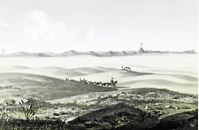
 1855 Eastern Montana Missouri River Basin ORIGINAL LITHOGRAPH Landscape View
-
$48.88
 1855 Montana Native Americans Gov Stevens LITHOGRAPH ORIGINAL Washington Terr.
-
$29.43
 1927 MAP OF NW USA WASHINGTON SEATTLE OREGON IDAHO BRITISH COLUMBIA VANCOUVER
-
$37.37
 1922 MAP OF WESTERN USA CALIFORNIA OREGON WASHINGTON MONTANA COLORADO ARIZONA
-
$6.87
 Vintage MONTANA Atlas Map - 1968 Collector's Edition EBC Atlas of the World
-
$12.95
 Vito Corleone Fear Murdered Godfather Newspaper Headlines 12 x 18 Poster
-
$23.76
 Vintage Map of MONTANA State Wall Art Decor Original Antique Flathead Lake
-
$48.88
 1887 Map IDAHO, MONTANA & WYOMING TERRITORIES - INDIAN RESERVATIONS (15x24)-#020
-
$22.88
 1938 Colorful Pictorial Map MONTANA by Norman Reeves for 1939 World's Fair
-
$20.25
 1950s Vintage Montana State Map Animated Montana Picture Map Wall Decor BW 1095
-
$19.99
 Canvas Reproduction Vintage Pictorial Map of Montana Print Ruth Taylor 1935
-
$99.00
 1878 Colorado Montana Dakota & Wyoming Mitchell antique map 22.9" x 15.1"
-
$12.89
 USGS Geologic Map: Upper Red Rock Lake Quad, Southwestern Montana, Idaho
-
$49.88
 1855 Montana Gros Ventres Indians LITHOGRAPH ORIGINAL Native Americans
-
$59.00
 1855 Montana Rocky Mountains ORIGINAL LITHOGRAPH Lewis Clark Pass RARE
-
$49.00
 1897 WYOMING IDAHO Map ORIGINAL Montana YELLOWSTONE Missoula Cheyenne Boise
-
$35.50
 1891 MONTANA MAP WYOMING IDAHO ANTIQUE FULL COLOR RAILROADS RIVERS MOUNTAINS VTG
-
$60.00
 1914 Rand McNally Montana Large Color Folding Map & Guide Highways Railroads
-
$19.95
 c.1944 Finlen Hotel Advertising Street Map of Butte Montana WWII era Vintage VG
-
$16.96
 Vintage MONTANA Map Auto Trails Highway Old Original Flathead Lake Antique Road
-
$175.00
 1875 Map Yellowstone Montana Captain William Ludlow US Army Corps Engineers
-
$12.95
 Marilyn Monroe Dies Newspaper Headlines 12 x 18 Poster
-
$125.00
 1883 General Sherman Route Map Fort Ellis Montana to Fort Hope British Columbia
-
$7.00
 1951 Montana Official State Highway Comission Road Map
-
$8.00
 1952 Montana Official State Highway Comission Road Map
-
$15.30
 1893 MONTANA Map, Color Counties, Historical Points, 14" x 10.5"
-
$29.95
 MONTANA TERRITORY Original 1884 Map. Rand, McNally & Co 6 1/2 x 9 5/8" VG-Fine
-
$9.99
 1954 Montana Official State Highway Comission Road Map
-
$29.43
 1911 ORIGINAL ANTIQUE MAP NW USA WASHINGTON MONTANA CALIFORNIA OREGON COLORADO
-
$59.00
 1855 Cadotte's Pass Montana Rocky Mountains ORIGINAL LITHOGRAPH Landscape View
-
$32.67
 1930 VINTAGE MAP NORTH AMERICA UNITED STATES CANADA AFRICAN AMERICAN POPULATION
-
$185.00
 Rare 1940 Western Montana National Forest Map John B Lacasse & Sunday Missoulian
-
$50.00
 1864 Dakota Montana Nebraska Kansas CO by Johnson Ward antique map 17.3" x 13.8"
-
$8.99
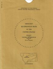 USGS Geologic Map: Vaughn Quadrangle, Montana
-
$7.25
 NINEMILE RANGER DISTRICT, LOLO NATIONAL FOREST, MONTANA, WORK MAP, 1961
-
$19.94
 Antique 1890s Montana Idaho Wyoming Color Map Atlas Page
-
$27.99
 1911 Stieler Map United States Washington Oregon Montana Wyoming California NV
-
$16.96
 Map Custer National Forest Pryor Area Montana Wyoming Visitors Map 1976 USDA
-
$100.00
 Wyoming Idaho Montana Yellowstone Boise Helena 1887 Bradley-Mitchell map
-
$59.88
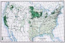 OLD 1900 United States Map ORIGINAL LARGE Farming Agriculture Barley Grain
-
$12.89
 Geologic Map: Drummond Area, Central-Western Montana
-
$59.95
 MONTANA STATE Pictorial Map Vintage 1937 Shining Mountains Irvin Shope Highway
-
$14.95
 Prohibition End at last NY Newspaper Headlines 12 x 18 Poster
-
$12.95
 1914 Vintage MONTANA State Map Antique Map of Montana Wall Art Home Decor
-
$6.65
 MONTANA, THOMPSON FALLS RANGER DISTRICT, Lolo National Forest 1966 Work Map
-
$22.00
 Old 1906 Atlas Map ~ MONTANA ~ Free S&H
-
$29.95
 1879 Original Engraved color MAP OF WESTERN STATES AND TERRITORIES new 11x14 mat
-
$13.95
 Butte City Montana 1884 Historic Panoramic Town Map - 16x24
-
$100.00
 Idaho Montana Wyoming Yellowstone Boise Helena Cheyenne1888 Bradley-Mitchell map
-
$12.89
 USGS Geologic Map: Northern Part of Ruby Range, Montana
-
$8.50
 TALLY LAKE, FLATHEAD NATIONAL FOREST MONTANA, AREA/OWNERSHIP MAP, 1981,
-
$13.95
 1891 Great Falls Montana Vintage Old Panoramic City Map - 16x24
-
$21.75
 USGS Topographic Map SWEET GRASS HILLS Montana USA Alberta Canada -1984- 100K
-
$19.99
 1887 Antique Peoples COLOR Map of MONTANA, WYOMING, and IDAHO
-
$12.89
 USGS Geologic Map: Mammoth, Part of Gardiner Quadrangle, Wyoming, Montana
-
$7.50
 MONTANA GALLATIN RANGER DISTRICT GALLATIN NATIONAL FOREST WORK MAP 1964
-
$12.89
 USGS Geological Survey Map: Montana Custer Battlefield 1891 - Reprint
-
$24.00
 USGS BLM edition topographic map Montana PLAINS 2002
-
$12.89
 USGS Geologic Map: Strip Along Centennial Fault, Southwestern Montana, Idaho
-
$39.99
 Sheridan Montana Lot of 3 Survey Maps Madison County COS Jefferson River
-
$11.95
 Vintage MONTANA Map Topographic Wall Art Original 1920s Antique Flathead Lake
-
$12.89
 USGS Geologic Map: Wallace 1 x 2 Quadrangle, Montana and Idaho
-
$38.65
 USDA National Forest Service Map SELWAY BITTEROOT Wilderness Idaho Montana 1989
-
$17.95
 Lonesome Dove Gus and Call Trail Map To Montana ON A Cattle Drive 12 x 18
-
$7.50
 USGS Topography Map Quadrangle Wolf Point, MT; ND; 1954 Rev 1975 1:250,000
-
$21.21
 Vintage MONTANA Auto Trails Map Highway US Route 2 LARGE Missoula Flathead Lake
-
$13.95
 1884 Missoula Montana Vintage Old Panoramic City Map - 16x24
-
$12.89
 USGS Geologic Map: Coeur D'Alene District, Montana, Idaho
-
$20.00
 1954 Lewistown, Montana Topographic Geological Map / 32" x 22" Size / CV Tools
-
$30.00
 1880s Hand-Colored Map Of Oregon, Kansas, California, & The Territories Mitchell
-
$33.63
 USDA National Forest Service Map BITTERROOT Montana Idaho 1981
-
$29.73
 1898 Map of the State of MONTANA Hand Colored Lithograph 10.75 x 7.25
-
$22.05
 1908 Antique MONTANA MAP Vintage State Map of Montana Gallery Wall Art 9943
-
$12.89
 USGS Geologic Map: Townsend and Duck Creek Pass Quadrangles, Montana
-
$48.88
 1889 Railroad Map ~ MONTANA ~ Authentic McNally Map (14x20) #030
-
$39.00
 1878 Oregon Washington MT ID Mitchell antique map 15.1" x 12.3" - nice color
-
$21.95
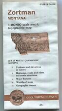 USGS Topographic Map ZORTMAN Montana 1984 47108-E1-TM-100 WD Bad
-
$23.99
 1937 US Air Commerce Map American Operated Airline Route Distances United States
-
$12.89
 USGS Geologic Map: Bannack-Grayling Area, Beaverhead County, Montana
-
$39.00
 1878 Western Hemisphere Mitchell antique map 15.1" x 12.1" - nice color
-
$8.00
 1955-67 ASHTON, MONTANA, IDAHO, WYOMING Interior, Geological, Topographical Map
-
$19.99
 1906 Johnston Map United States Midwest Missouri Colorado Dakota Nebraska Texas
-
$24.30
 1893 MONTANA Map w/ Colored Counties, Reverse NORTH DAKOTA, Dated, 14" x 10.5"
-
$12.89
 USGS Geologic Map: Henrys Lake Quadrangle, Idaho and Montana
-
$53.26
 Vintage 1900 YELLOWSTONE PARK Map 11"x14" ~ Antique Original OLD FAITHFUL GEYSER
-
$78.40
 Utah Salt Lake City Montana Idaho Wyoming 1876-9 O.W. Gray color fine large map
-
$19.99
 1966 Survey Map Butte Montana Silver Bow County Higgins Ave Main St Safeway Fair
-
$12.95
 Vintage MONTANA FORESTRY MAP LOT Deerlodge Gallatin Custer Interagency Philipsbg
-
$15.99
 1937 McNally Railroad Map United States Routes Distances New York San Francisco
-
$9.99
 c1970 McNally Cosmo Map - Idaho Montana Boise Butte Helena Bitter Root Mountains
-
$2250.00
 1921 USGS Copper Printing Map Plates Drummond , MT set of 3 Topographic Survey
-
$43.50
 MONTANA - Original 1886 Antique Color Map - Cram's Atlas - MONTANA
-
$12.89
 USGS Geologic Map: Lower Red Rock Lake Quadrangle, Montana, Idaho
-
$10.00
 Vtg 1954 Montana Resources Products Economic Illustrated Map Hammond Doubleday
-
$25.95
 Billings Montana 1904 Historic Panoramic Town Map - 24x36
-
$14.89
 1978 Deerlodge National Forest, Montana, USDA Forest Service Visitors Map
-
$599.99
 RARE Original Antique Kessler's Brewery Perspective Map of Helena, Montana 1890
-
$4.00
 1930 ANTIQUE SURVEY MAP-JEFFERSON, MADISON, & GALLATIN RIVERS-MONTANA
-
$29.43
 1927 MAP OF CENTRAL USA MONTANA WYOMING YELLOWSTONE NORTH SOUTH DAKOTA NEBRASKA
-
$58.00
 1902 MONTANA Map Yellowstone River Billings Park City Northern Pacific Railroad


