 Antiques (US)
-
$243.56

 100% ORIGINAL LARGE NORTHUMBERLAND MAP BY J BLAEU C1646 HADRIANS WALL NEWCASTLE
-
$24.97
 1883 Northumberland Hand Coloured Antique County Map by G.W. Bacon
-
$22.47
 1720 Carlisle - Jedburgh - Kelso - Berwick Antique Road Map by Emanuel Bowen
-
$97.49
 1964 TAYLOWE BRITISH MUSEUM 1576 SAXTON'S MAP NORTHUMBERLAND ENGLAND PRINT
-
$24.97
 CUMBERLAND NOTHUMBERLAND SCOTLAND BY EMANUEL BOWEN c1720 GENUINE ANTIQUE MAP
-
$39.95
 Vintage framed Hand Stitched Map Of England And Wales 20.5" x 16.5"
-
$22.00
 Cumberland, Northumberland & Durham - Large Original 1922 Ordnance Survey Map.
-
$6.25
 1902 Map of Northumberland Durham Isle of Man antique vintage Britannica 10th
-
$31.21
 SCOTLAND EDINBURGH HADINGTON DUNBAR BY PATERSON c1785 GENUINE ANTIQUE MAP
-
$56.21
 Coquet Island, Amble & Warksworth. Northumberland coast chart. COLLINS 1693 map
-
$187.36
 Durham & Northumberland Large John Cary Maps, 1821 Census, Town Distances
-
$15.25
 1940s Antique Animated England Map NORTHUMBERLAND England Picture Map 1435
-
$21.57
 Antique Map NORTHUMBERLAND, ENGLAND
-
$24.97
 1863 Northumberland Original Antique Hand Coloured Weekly Dispatch Map
-
$18.74
 WOODHALL HEXHAM NORTHUMBERLAND HOSPITAL ESTATE SURVEY 1736 FINE MOUNTED CHART
-
$15.61
 Dugdale & Neele 1819 Antique Map. Northumberland
-
$15.93
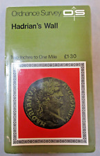 Vintage Retro Ordnance Survey Map - Hadrians Wall - 2 inch to 1 Mile Historical
-
$56.21
 Antique map of Northumberland by Richard Blome 1715
-
$15.44
 1873 Northumberland map. 150 years old. Victorian print. Haltwhistle, Morpeth.
-
$31.23
 Rare antique road map NORTHUMBERLAND, ALNWICK, Mostyn Armstrong, 1776
-
$11.24
 County map of Northumberland England hand coloured c1860
-
$28.00
 1830 Nathan Hale Map England Wales London Liverpool Oxford Cornwall Bristol UK
-
$7.85
 1894 Vintage NORTHUMBERLAND Atlas Map Authentic Antique Encyclopedia Britannica
-
$24.97
 1830 Original Pigot & Co. Map: Northumberland
-
$9.93
 100% ORIGINAL NORTHUMBERLAND MAP BY THOMAS MOULE C1848 VGC RAILWAYS
-
$29.43
 1884 ANTIQUE MAP OF COUNTY OF NORTHUMBERLAND / NEWCASTLE TYNEMOUTH / ENGLAND
-
$32.17
 Saxton's Map Northamptonshire, Bedfordshire,Cambridge,Rutland 1576 Lithograph
-
$93.68
 Antique Map of North England by Petrus Bertius 1618
-
$91.17
 RARE Antique Map , J Archer, 1832 , England , Northumberland
-
$162.49
 1610 Norfolk, Lincolnshire, Cambridgeshire. Hand coloured map by Hondius
-
$5.46
![1950s The Motor, Map of England, Southern Scotland, 37x27cm [26785]](https://i.ebayimg.com/thumbs/images/g/ALIAAOSwpJxj2Upw/s-l225.jpg) 1950s The Motor, Map of England, Southern Scotland, 37x27cm [26785]
1950s The Motor, Map of England, Southern Scotland, 37x27cm [26785]
-
$112.41
 NORTHUMBERLAND Richard Blome, Thomas Bakewell Original antique map c1735
-
$7.68
![Unframed map NORTHUMBERLAND C19th George Philip & Son, 19x15 inch [24060]](https://i.ebayimg.com/thumbs/images/g/E~MAAOSwj9pl00Gr/s-l225.jpg) Unframed map NORTHUMBERLAND C19th George Philip & Son, 19x15 inch [24060]
Unframed map NORTHUMBERLAND C19th George Philip & Son, 19x15 inch [24060]
-
$655.75
 Antique Map of Northumberland by John Speed 1611
-
$49.95
 NORTHUMBERLAND NEWCASTLE BY JOHN ROCQUE c1769 GENUINE ANTIQUE ENGRAVED MAP
-
$156.13
 NORTH ENGLAND, ISLE OF MAN, 'Regni Angliae' original antique map, De Wit, c.1680
-
$16.87
 1894 Durham, North Yorkshire & South Northumberland antique map. Sunderland.
-
$43.70
 NORTHUMBERLAND NEWCASTLE BY EMANUEL BOWEN c1720 GENUINE ANTIQUE ENGRAVED MAP
-
$24.98
 100% ORIGINAL NORTHUMBERLAND MAP BY ROBINS/NEELE C1815 VGC HAND COLOURED
-
$61.20
 ANTIQUE ADMIRALTY CHART. No.1626. BLYTH, NORTHUMERLAND. 1916 Edition.
-
$395.00
 Set 5 English Road Maps From Britannia Depicta, 1720s John Owen & Emanuel Bowen
-
$12.48
 Antique/Vintage County Map of Northumberland - John Heywood, 1868
-
$199.85
 Antique copperplate map by Blaue ‘Insula Sacra vulgo Holy Island’ 1645
-
$56.21
 CARLISLE TO BERWICK ON TWEED BY JOHN OGILBY REDUCED BY THOMAS GARDNER c1719
-
$45.00
 18th century Northumberland England Antique Map by Thomas Kitchin
-
$18.72
 NORTHUMBERLAND BLYTH SOUTH SHIELDS BY JOHN CARY c1824 GENUINE ANTIQUE MAP
-
$23.11
 ANTIQUE COLOUR MAP NORTHUMBERLAND HOLY ISLAND FARNE ISLANDS ALNWICK 1895
-
$39.47
 map Yorkshire Durham Northumberland Original John Senex Road copperplate 1767
-
$56.21
 LONDON TO BERWICK CHESTER BY JOHN OGILBY REDUCED BY THOMAS GARDNER c1719
-
$56.21
 TYNEMOUTH TINMOUTH TO CARLISLE BY JOHN OGILBY REDUCED BY THOMAS GARDNER c1719
-
$12.48
 Vintage decorative sheet map of Northumberland John Speede 1610
-
$14.68
 Vintage Retro Ordnance Survey Map - Hexham - 1 inch - No 77 - 7th Series
-
$23.11
 ANTIQUE COLOUR MAP CUMBERLAND NORTHUMBERLAND WESTMORLAND PORTIONS 1895
-
$22.48
 NORTHUMBERLAND TOWNS.Newcastle-upon-Tyne North Shields Morpeth Berwick 1835 map
-
$37.46
 NORTHUMBERLAND ROXBURGH ROAD MAP BY ARMSTRONG c1776 GENUINE ANTIQUE ENGRAVED MAP
-
$23.11
 CUMBERLAND, CARLISLE, SCOTLAND, KELSO, original antique road map, Bowen, 1759
-
$14.99
 Old Tudor Poster map of Northumberland: Speed 1600's 15.5" x 12 Reprint Antique
-
$22.48
 OLD ANTIQUE MAP NORTHUMBERLAND c1787 ENGRAVING by JOHN CARY ORIGINAL COLOUR
-
$18.01
 1904 Northumberland old map. Large size. 119 years old. Newcastle, Haltwhistle.
-
$62.45
 Joseph Ellis: Northumberland. 1766
-
$37.47
 Northumberland map by John Aikin England Delineated Original text 1803
-
$18.72
 1719 Antique Road Map, York, Durham, Newcastle, Tadcaster - John Senex
-
$34.97
 Antique Map NORTHUMBERLAND, Thomas Moule, Original c1840
-
$15.61
 NORTHUMBERLAND Stannington,Morpeth,Fenrother ,Antique Pictorial Road Map c1920
-
$99.91
 1695 MAP OF THE BISHOPRICK OF DURHAM by ROBERT MORDEN SUNDERLAND NEWCASTLE ^
-
$81.19
 Antique map of Northumberland by Kitchen & Bowen 1767
-
$18.67
 1898 Northumberland large map. 125 years old. Bamburgh, Alnwick, Morpeth.
-
$24.98
 MORPETH borough/town plan. BOUNDARY COMMISSION. Northumberland. DAWSON 1837 map
-
$61.20
 VINTAGE ADMIRALTY CHART. No.3104. BLYTH to HARTLEPOOL. 1963 Edition.
-
$7.48
 Old Victorian Railway Map of Northumberland, UK 1840 Pigot, Antique: Reprint
-
$87.43
 Antique Map of Northumberland by John Harrison 17989
-
$74.94
 Antique Map of Northern England by Von Reilly 1789
-
$368.47
 Antique Sea Chart ENGLAND EAST COAST London ,Berwick North Sea, Collins Map 1756
-
$11.24
 Antique/Vintage County Map of NORTHUMBERLAND - Phillips Handy Atlas , 1887
-
$7.18
 HALTWHISTLE NORTHUMBERLAND RERINT FIRST ONE INCH OS MAP
-
$25.59
 OLD ANTIQUE ROAD MAP DURHAM DARLINGTON by OWEN BOWEN c1740s NEWCASTLE MORPETH
-
$43.70
 NORTHUMBERLAND ALNWICK ROAD MAP BY ARMSTRONG c1776 GENUINE ANTIQUE MAP
-
$149.87
 1675 OGILBY COLOUR STRIP MAP OF CARLISLE TO BARWICK UPON TWEED BERWICK CUMBRIA *
-
$9.93
 EDW. STANFORD -BARTHOLOMEW'S LINEN B. DISSECTED 2M. TO 1" MAP - LAKE DISTRICT
-
$59.95
 BERWICK upon TWEED, Northumberland, Street Plan Dawson Original antique map 1832
-
$22.48
 Antique map of Northumberland by Samuel Lewis 1834
-
$37.47
 NORTHUMBERLAND, original antique map from 'Britannia Depicta', E. Bowen, 1759
-
$87.43
 Antique Map of Northumberland by John Cary 1813
-
$19.97
 NORTHUMBERLAND MINIATURE MAP LEIGH / HALL HAND COLOUR GENUINE ANTIQUE c1826
-
$45.59
 NEWCASTLE MORPETH MAP PLATE 76 BARTHOLOMEW'S SURVEY ATLAS OF ENGLAND WALES 1939
-
$43.72
 1832 Newcastle upon Tyne Map & Text Town Plan Dawson Reform Act Boundaries Old
-
$49.96
 Antique map of Northumberland by Alexander Hogg and Thomas Conder 1784
-
$18.74
 Cheviot Hills Large Vintage Military Map Pennines Northumberland
-
$7.18
 Vintage Surveyors Town Map 1949 Northumberland Bolam LNER Morpeth Branch Railway
-
$156.13
 BRITISH ISLANDS BY MERCATOR c1648 ANGLESEY WIGHT JERSEY GENUINE ANTIQUE MAP
-
$156.13
 Northumberland: antique map by Richard Blome, 1673
-
$52.49
 1823 ORIGINAL MAP UNITED KINGDOM ENGLAND WALES LONDON CAMBRIDGE LANCASTER YORK
-
$22.48
 Original antique map NORTHUMBERLAND, NEWCASTLE, ALNWICK, HEXHAM, John Cary, 1819
-
$49.95
 RADNORSHIRE RADNOR HOLY FARNE ISLAND c1769 BY JOHN ROCQUE GENUINE ANTIQUE MAP
-
$237.32
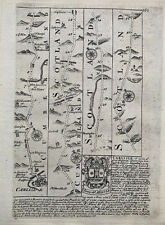
 Northumberland: antique map by Johan Blaeu, 1648-64
-
$243.56
 NORTHUMBERLAND, Saxton & Hole, Camden Original antique map 1637
-
$31.23
 Original antique copper-engraved map NORTHUMBERLAND, Badeslade & Toms, 1742
-
$18.72
 Northumberland Antique Colour Map Thomas Moule County Maps of Old England 14“
-
$16.23
 vintage map 'Northumberland' County Durham area
-
$16.18
 100% ORIGINAL LARGE NORTHUMBERLAND BERWICK MAP BY ORDNANCE SURVEY C1922 VGC


