 Antiques (US)
-
$31.70

 1922 PHYSICAL MAP OF NEW ZEALAND AUCKLAND CHRISTCHURCH DUNEDIN WELLINGTON ALPS
-
$26.03
 1927 VINTAGE ITALIAN PHYSICAL MAP OF OCEANIA PACIFIC OCEAN / AUSTRALIA HAWAII
-
$20.19
 1937 VINTAGE PHYSICAL MAP OF AUSTRALIA
-
$18.94
 1936 VINTAGE PHYSICAL MAP OF THE PACIFIC OCEAN / SOUTH AMERICA POPULATION MAP
-
$15.00
 Australia & New Zealand - Original 1874 Hydro-Orographic Map by Meyers.
-
$18.00
 1881 Andrees Map Pacific Ocean Oceania Australia Hawaii Tonga Japan Asia America
-
$27.99
 1881 Andrees Map Australia New Zealand Caledonia Oceania Sydney Melbourne Perth
-
$5.99
 Vintage Lithography Map of Antarctica - National Geographic 1957 - South Pole
-
$18.94
 1901 ANTIQUE PHYSICAL MAP / AUSTRALIA OCEANIA PACIFIC GERMAN COLONIES NEW GUINEA
-
$968.02
 Antique Map "Carte Reduite Des Terres Australes" (Australia) J. N. Bellin, 1753
-
$19.95
 Antique Map Oceanica Australia Indonesia ++ 1897 Very Good Condition 12x16"
-
$14.90
 Antique 1899 Color Map Luzon Philippine Islands 11" X 16" #4156
-
$14.90
 Antique 1899 Color Map Pacific Ocean and Oceania 11" X 16" #4155
-
$18.00
 1928 VINTAGE PHYSICAL MAP OF AUSTRALIA AND NEW ZEALAND / REV SIDE SOUTH AFRICA
-
$18.00
 1925 VINTAGE PHYSICAL MAP OF EASTERN AUSTRALIA / MOUNTAINS
-
$20.19
 1901 ANTIQUE PHYSICAL MAP OF AUSTRALIA OCEANIA PACIFIC GERMAN COLONIES HAWAII
-
$20.68
 Old Antique 1860 H. COWPERTHWAIT Map MALAYASIA - AUSTRALASIA - POLYNESIA - ANAM
-
$199.00
 1840 Australia map by Greenleaf ~ 14.2" x 11.9" scarce 1st edition Antique
-
$14.95
 Hawaii Map 1899 Honolulu and Vicinity
-
$85.00
 Australia Antique Map circa 1850 by Sidney Hall Engraved Outline Color
-
$30.00
 1864 Australia by Johnson Ward antique map 18.1" x 14.25" - nice color
-
$36.76
 TWO New Zealand Maps: North & South Island; 1906 (Dated) City Topography Rails
-
$10.00
 Australia For The Tourist-Maps-Bank Of New South Wales-Book-Mortimer Cobb Estate
-
$98.65
 Vintage Map "Guadalcanal" Nigel D. Oram, 1976
-
$29.99
 1860 Oceanica, Australia + more Mitchell's map 15.4" x 12.6" Antique - Authentic
-
$85.00
 1876 Australia & Palestine antique map ~ 19.5" x 14.2" hand colored
-
$36.00
 1879 Map Australia Colonies And Oceania Victorian Geography 1st Edition DWAA9
-
$25.00
 Large Vintage Map Of Australia Rand Mcnally 44"×31"
-
$20.19
 1908 ANTIQUE PHYSICAL MAP OF PACIFIC OCEAN OCEANIA HAWAII AUSTRALIA AMERICA
-
$18.00
 1943 VINTAGE WWII PHYSICAL MAP OF AUSTRALIA VERSO MAP OF SOUTH AMERICA ANDES
-
$245.00
 1991 Large Vintage School Map - Australia,New Zealand Physical and Economic Map
-
$500.00
 Antique Map "Océanie" V. Lavasseur, 1850 Framed RARE FIND
-
$12.99
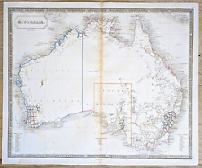
 COUNTRY & PHYSICAL MAP of AUSTRALIA, Bartholomew - 1891 Antique Map
-
$271.29
 Antique Map "Australien entuorfen und gezeichnet von C.F. Weiland" Weimar, 1823
-
$271.29
 Antique Map "Carte de la Nouvelle-Zelande" (New Zealand) Dumont-D'Urville, 1835
-
$154.14
 Antique Map "Chart of Van Diemen’s Land" W. Bligh, 1785
-
$9.99
 ANTIQUE 1901 AUSTRALIA POLITICAL PHYSICAL MAP HAWAII PACIFIC ISLANDS MAP OCEANIA
-
$25.00
 1901 Tunison Australia & South Africa antique map ~ 22.8" x 14.6" nice color
-
$50.00
 1849 Oceana & Australia by Mitchell antique map ~ 17.4" x 13.8" hand colored
-
$200.00
 1845 New South Wales & Australia Felix by A.K. Johnston ~ 25.8" x 21.2" Antique
-
$24.99
 CENTRAL EUROPE GERMAN EMPIRE AUSTRIA BAVARIA POLAND 1880 COLORED COLTON'S MAP
-
$19.99
 AFRICA ORIGINAL 1880 COLORED COLTON'S POLITICAL MAP of OLD AFRICAN COUNTRIES
-
$135.65
 Antique Map "Plan of Adventure Bay on Van Diemens Land" Capt. James Cook, 1784
-
$172.64
 Antique Map "Carte de L'Oceanie ou Cinquième Partie du Monde" A. Tardieu, 1821
-
$85.00
 1876 Oceania & environs antique map ~ 19.5" x 13.7" hand colored
-
$120.00
 1829 Map of Pacific, George Pollard, Whaleship "Essex", Nantucket "Two Brothers"
-
$200.00
 1845 Australia map by A.K. Johnston ~ 25.8" x 21.2" Antique Pastel color
-
$200.00
 1845 New Zealand by A.K. Johnston ~ 25.8" x 21.2" Antique Pastel Color - Huge
-
$150.00
 1840 Australia antique map by W.H. Lizars - Scarce & attractive color
-
$29.99
 AUSTRALIA NEW ZEALAND HAWAII PHILIPPINE JAVA ORIGINAL 1880 COLORED COLTON'S MAP
-
$24.99
 ASIA CHINA INDIA PERSIA RUSSIA AFGANISTAN ARABIA JAPAN 1880 COLORED COLTON'S MAP
-
$357.61
 Antique "A New and Accurate Map of New South Wales" (Australia) Wilkinson, 1794
-
$172.64
 Antique Map "Nlle Galles Meridle" (Eastern Australia) R. Bonne, 1787
-
$43.16
 Antique Engraving "An untitled view of Tahiti" W. Woollett, 1773.
-
$200.00
 1845 Tasmania or Van Diemen's Land by A.K. Johnston ~ 25.8" x 21.2" Antique
-
$308.29
 Antique Map "Oceania" Jose Pilar Morales, 1880
-
$24.99
 BRITISH ISLES SCOTLAND IRELAND WALES 1880 COLORED COLTON'S MAP SHOWS RAILROADS
-
$26.00
 2 1906 Maps New Zealand, North & South, Towns, Railroads, Chromolithgraph (inv54
-
$200.00
 1845 Islands in the Pacific Ocean by A.K. Johnston ~ 25.8" x 21.2" Antique
-
$1500.00
![[Cook’s Discovery of Eastern Australia] Carte de la Nle. Galles Merid. ou [...]](https://i.ebayimg.com/thumbs/images/g/sA0AAOSwvq9l6dee/s-l225.jpg) [Cook’s Discovery of Eastern Australia] Carte de la Nle. Galles Merid. ou [...]
[Cook’s Discovery of Eastern Australia] Carte de la Nle. Galles Merid. ou [...]
-
$48.09
 Map: 1848 Physical Chart of the Pacific Ocean or the Great Sea (Mare Pacifico)
-
$182.00
 1831 Rare Map Oceania Australasia Polynesia, Pacific Ocean, Pablo Alabern
-
$67.82
 Map "Southern Alps of New Zealand" Royal Geographical Society, 1910
-
$98.65
 Antique Map "Nuove Ebridi.Isole degl'Amici" A. Rabatta - Bailou / Lamberti, 1779
-
$924.86
 Antique Map "Carta della Nuova Zelanda" Jean François de la Harpe, 1785
-
$18.48
 Antique c1904 Colour Maps WESTERN AUSTRALIA showing the GOLDFIELDS HARMSWORTH
-
$9.00
 1911 EAST INDIA ISLANDS by The Century Co,
-
$20.00
 1942 Petermann map: Polynesian, Melanesian Micronesian & Indonesian languages
-
$123.32
 Vintage Map "Honiara Town West-East" Nigel D. Oram, 1976
-
$351.45
 Antique Map "Atlas des Ganzen Erdkreises" C. G. Reichard, 1803
-
$17.25
 MICRONESIA. Bubelthuap. physical. WW2 ROYAL NAVY INTELLIGENCE MAP 1944 old
-
$98.65
 Antique Map "Royal Relief Atlas - Australia" Phillips Bevan, 1885
-
$20.00
 1884 Steiler Map: South East Australia: New S. Wales, Queensland & S Australia
-
$6.17
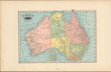
 Australia Physical. BARTHOLOMEW 1949 old vintage map plan chart
-
$24.99
 WESTERN EUROPE GERMAN EMPIRE AUSTRIA FRANCE SPAIN ++ 1880 COLORED COLTON'S MAP
-
$43.00
 Australia Philippines Goode Physical Map Rand McNally Folding School Wall Map
-
$13.00
 map of New Zealand, made out of wood and painted green and blue.
-
$73.99
 Antique Map "Tarawera District, New Zealand" Royal Geographical Society, 1886
-
$373.29
 "CARTE DE LA CÔTE SUD-OUEST DE LA NOUVELLE GUINÉE", VINCENDON DUMOULIN, 1842.
-
$24.99
 1842 Britannica Antique Map Australasia Australia New Zealand Oceania
-
$308.93
 "CARTE DES ILES SALOMON", VINCENDON DUMOULIN, from Dumont d'Urville Voyage, 1842
-
$11.10
 AUSTRALASIA. Physical. Railways steamship routes telegraph cables 1909 old map
-
$129.48
 Antique Map "Océanie" V. Lavasseur, 1850
-
$1190.66
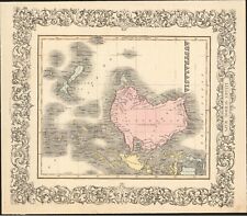
 "CARTE RÉDUITE DES TERRES AUSTRALES" (Australia), Jacques Nicolas BELLIN, 1753.
-
$630.73
 "CARTE DE LA ROUTE...À TRAVERS LE DÉTROIT DE TORRES" VINCENDON DUMOULIN, 1842.
-
$301.30
 "CARTE DES ILES SALOMON", VINCENDON DUMOULIN, from Dumont d'Urville Voyage, 1842
-
$615.15
 "CARTE DE LA ROUTE...À TRAVERS LE DÉTROIT DE TORRES" VINCENDON DUMOULIN, 1842.
-
$40.00
 1884 Steiler Maps: Polynesia in the Pacific Ocean (two map set)
-
$2091.70
 VINCENZO CORONELLI, "NUOVA ZELANDA", First separate Map of NEW ZEALAND , 1696.
-
$33.30
 Rare vtg 1917 BACON'S NEW SERIES OF PHYSICAL WALL ATLASES Australia Rainfall map
-
$45.00
 1899 Pacific Ocean & Oceania Map - J Martin Miller Chicago, Illinois Print
-
$244.57
 “CARTE DES ISLES DE PAPOUS” (Papua New Guinea), JEAN LATTRÉ, c.1750.
-
$804.50
 CARTE DES EXPLORATIONS DANS LES REGIONS CIRCUM-POLAIRE, VINCENDON DUMOULIN, 1842
-
$707.96
 "CARTE DE L'ILE DE BORNEO", VINCENDON DUMOULIN, Dumont d'Urville Voyage, 1842.
-
$690.47
 "CARTE DE L'ILE DE BORNEO", VINCENDON DUMOULIN, Dumont d'Urville Voyage, 1842.
-
$1272.43
 "CARTE RÉDUITE DES TERRES AUSTRALES" (Australia), Jacques Nicolas BELLIN, 1753.
-
$59.12
 1921 MAP ~ OCEANIA ~ AUSTRALIA & TASMANIA PHYSICAL NEW ZEALAND SYDNEY MELBOURNE
-
$246.24
 “CARTE DES ISLES DE PAPOUS” (Papua New Guinea), JEAN LATTRÉ, c.1750.
-
$784.62
 CARTE DES EXPLORATIONS DANS LES REGIONS CIRCUM-POLAIRE, VINCENDON DUMOULIN, 1842


