 Antiques (US)
-
$24.85

 1884 Southeast Wales Original Antique Coloured Map by Letts
-
$24.85
 1885 South East Wales Original Hand Coloured Antique Map by G.W. Bacon
-
$24.85
 1883 Southeast Wales Hand Coloured Original Antique County Map by G.W. Bacon
-
$22.00
 Merionethshire, Montgomery & Radnor, Wales. Original 1922 Ordnance Survey Map
-
$18.59
 1898 Brecon (Brecknock), Radnor & Herefordshire large map. 125 yrs old. Hereford
-
$16.15
 1812 Genuine Antique Map; South Wales by Neele from New British Traveller
-
$23.99
 1831 Lewis Map Radnorshire Rhayader Knighton Llandrindod Presteigne Wales UK
-
$55.95
 CHESTER LLANBEDR TO CARDIFF BY JOHN OGILBY REDUCED BY THOMAS GARDNER c1719
-
$24.85
 WORCESTER HEREFORD LEOMINSTER RADNOR BY EMANUEL BOWEN c1720 GENUINE ANTIQUE
-
$14.09
 1895 Radnor map. Mid Wales. Original print. Llandrindod Wells, Presteigne.
-
$16.15
 1932 WAR OFFICE MAP - LLANDRINDOD WELLS WALES - LMS GWR RAILWAY
-
$110.66
 Antique Map Of Radnor / Radnorshire C.1610 By Saxton / Kip
-
$55.95
 PRESTEIGNE TO CARMARTHEN BY JOHN OGILBY REDUCED BY THOMAS GARDNER c1719
-
$19.37
 1897 Central Wales large map. Cardigan, Montgomery, Radnor. 125 years old.
-
$20.02
 1922 Central Wales large map. 101 yrs old. Cardigan Pembroke Radnor Montgomery
-
$42.51
 1769 Radnorshire Antique Map Original Copper Plate Engraving 250+ Year Old
-
$34.81
 SALISBURY TO CAMPDEN, WILTSHIRE, antique road map, SENEX, OGILBY, pl 92-93, 1762
-
$18.64
 HEREFORD WORCESTER RADNOR BY PATERSON c1785 GENUINE ANTIQUE MAP
-
$43.50
 RADNORSHIRE RADNOR WALES BY EMANUEL BOWEN c1720 GENUINE ANTIQUE ENGRAVED MAP
-
$37.42
 Radnorshire map 1840 by Archer Towns Parks Rail & Roads with hand colour
-
$55.94
 NORTH WALES c1786 BY THOMAS CONDER GENUINE ANTIQUE COPPER ENGRAVED MAP
-
$48.00
 Antique 1809 Map of Radnorshire in England by James R Thompson & John Roper
-
$18.64
 1720 Antique Map, Radnorshire, Wales - Owen & Bowen
-
$192.72
 SOUTH WALES, Pembroke, Glamorgan, Carmarthen etc Robert Morden antique map 1695
-
$22.37
 1852 Antique map: South Wales by Charles Knight
-
$18.64
 WALES RADNORSHIRE BRECKNOCK MONTGOMERY BY EMANUEL BOWEN c1720 GENUINE ANTIQUE
-
$9.33
 Bartholomews Revised Map Half Inch Vale of severn No 18 Vintage Old Antique 1968
-
$18.64
 HEREFORD LEOMINSTER WORCESTER RADNOR BY PATERSON c1785 GENUINE ANTIQUE MAP
-
$37.30
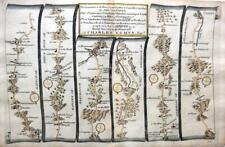
 Set of Four Victorian Welsh County Maps by William Mackenzie Showing The Unions
-
$43.52
 PERSHORE, WORCESTER, ABERYSTWYTH, antique road map, SENEX, OGILBY, Pl 2-3, 1762
-
$23.00
 Original antique road map WLAES, RADNORSHIRE, CARMARTHENSHIRE, Bowen c.1724
-
$24.87
 c1854 Wales Antique County Map of RADNORSHIRE by Joshua Archer
-
$205.15
 RADNORSHIRE, WALES, Saxton & Kip, Camden Original antique map 1637
-
$31.08
 Late 1700s Radnorshire Wales Original Seller/Grose Coloured Antique Map
-
$33.57
 SOUTH WALES. Glamorganshire Brecknockshire Radnorshire. WELLER 1863 old map
-
$19.89
 GEORGE COLE c1835: Radnorshire
-
$18.64
 WALES RADNORSHIRE BY SIDNEY HALL GENUINE ANTIQUE MINIATURE MAP c1826
-
$21.14
 Antique Map Of Herefordshire By Thomas Kitchin c1786
-
$23.00
 PRESTEIGNE, RADNOR, BUILTH, CARMARTHEN, original antique road map, Bowen, 1759
-
$23.00
 PERSHORE, WORCESTER, LEOMINSTER, original antique road map, Owen & Bowen, 1759
-
$279.75
 Countie of Radnor. Shire/county map by John Speed. Bassett/Chiswell edition 1676
-
$23.61
 WALES CARMARTHEN RADNOR PRESTAIN BY EMANUEL BOWEN c1720 GENUINE ANTIQUE MAP
-
$49.72
 RADNORSHIRE RADNOR HOLY FARNE ISLAND c1769 BY JOHN ROCQUE GENUINE ANTIQUE MAP
-
$16.15
 1833 Antique map - South Wales - from Hall's New British Atlas
-
$136.77
 Ogilby Original Engraved Road Map Continuation Chester to Cardiff Plate 2 ca1675
-
$12.42
 1833 Antique Map: Radnorshire by Creighton
-
$55.94
 SOUTH WALES BY BADESLADE & TOMS c1742 GENUINE ANTIQUE MAP ORIGINAL HAND COLOUR
-
$49.73
 Antique map of Radnorshire by John Seller 1701
-
$21.14
 Original antique road map, Radnor, Worcester, Paterson 1785
-
$6.20
 Old Antique Tudor map of Radnorshire, Wales: John Speed 1600's 15" x 11" Reprint
-
$31.08
 RADNORSHIRE, WALES original antique map from 'Britannia Depicta', Bowen 1759
-
$23.00
 Original antique road map RADNORSHIRE, CARMARTHENSHIRE, Owen & Bowen, 1724
-
$37.30
 WALES, PRESTEIGNE, BUILTH, CARMARTHEN, Pl 92 antique road map, Jefferys 1775
-
$12.42
 Old Tudor Poster map Radnorshire, Wales 1600s 15" x 12 Reprint Antique Speed
-
$37.30
 Original antique map, WALES, RADNORSHIRE, HOLY ISLAND, LINDISFARNE, Rocque, 1769
-
$23.00
 Antique road map WALES, MONTGOMERYSHIRE, RADNOR, BRECON, Owen & Bowen, 1724
-
$19.88
 OLD ANTIQUE MAP RADNORSHIRE WALES c1840's by J ARCHER ORIGINAL HAND COLOUR
-
$41.03
 CHESTER TO CARDIFF, antique road map, SENEX, OGILBY, 70-71, 1762
-
$31.08
 Original antique county map, WALES, RADNORSHIRE, Emanuel Bowen, c.1724
-
$22.38
 RADNORSHIRE "The County of Radnor" Wales BARTHOLOMEW 1890 old antique map
-
$18.65
 Antique Repro Framed 11"x8.5" Map of Radnorshire c.1818
-
$22.38
 RADNORSHIRE "The County of Radnor" Wales BARTHOLOMEW 1885 old antique map
-
$31.07
 1819 Antique Map; South Wales by James Wallis, Ellis's New & Correct Atlas
-
$18.64
 1833 Antique Map; South Wales by Robert Scott
-
$6.22
 Radnorshire Replica of Map by Langley & Belch, 1818 Maps of Britain No.93
-
$16.15
 1809 Antique Map; Radnorshire by Thompson & Roper.
-
$136.77
 Original Antique Map, Radnorshire, 1840 ca. 27 x 21 cm.
-
$149.20
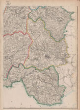
 MID WALES & SHROPSHIRE HILLS Radnorshire Montgomery Herefordshire. CARY 1832 map
-
$37.30
 RADNORSHIRE, WALES, HOLY ISLAND, original antique county map, ROCQUE, 1769
-
$12.42
 Original Welsh Antiquarian Map of Radnorshire, c1850 Victorian Wales Geography
-
$9.95
 Radnorshire miniature county map by Samuel Leigh / Sidney Hall c1820 old
-
$8.64
 100% ORIGINAL RADNORSHIRE MAP BY LEWIS C1846 VGC ORIGINAL COLOUR RAILWAYS
-
$18.65
 Radnorshire county map. Principal/contributory boroughs. REFORM ACT. DAWSON 1832
-
$22.38
 Original antique miniature county map RADNORSHIRE, WALES, S. Leigh, 1820-31
-
$37.29
 WALES RADNORSHIRE BY JOHN SELLER AND FRANCIS GROSE GENUINE ANTIQUE MAP c1787
-
$23.00
 Original antique road map MONTGOMERYSHIRE, RADNORSHIRE, WALES, Bowen, c.1724
-
$9.95
 RADNORSHIRE county map by ARCHER & DUGDALE. Seats polling places canals c1845
-
$9.95
 RADNORSHIRE county map by ARCHER & DUGDALE. Seats canals polling places 1845
-
$22.38
 RADNORSHIRE "The County of Radnor" Wales BARTHOLOMEW 1882 old antique map
-
$24.87
 Antique map, Leigh/Hall, Radnorshire
-
$23.00
 WALES, MONTGOMERYSHIRE, RADNORSHIRE, original antique road map, Bowen, 1759
-
$136.77
 Original Antique Map, Radnorshire, 1850 ca. 25 x 21,2 cm.
-
$32.33
 Original antique road map HEREFORDSHIRE, RADNOR, CARDIGAN, Laurie, 1823
-
$12.42
 Victorian Colour Map of Radnor (c1894) British Topography, Mid Wales/Radnorshire
-
$9.95
 RADNORSHIRE county map by ARCHER & DUGDALE. Seats canals polling places c1845
-
$20.00
 CARTE RADNOR SHIRE 1750 CA.
-
$9.93
 RADNORSHIRE Antique Map c1845 by Archer for Dugdales
-
$111.89
 1724 Antique Map; South Wales by Herman Moll
-
$49.72
 1835 Antique large map: South Wales by Henry Teesdale / Robert Rowe
-
$111.90
 OS #56 Radnorshire Hills & Cambrian Mountains. Rhayader Clun Presteign 1833 map
-
$273.54
 17th Century copper engraved map of Radnorshire by Joan Blaue from Atlas Major
-
$20.52
 RADNORSHIRE, WALES, original antique map, railways, JOSHUA ARCHER, c.1848
-
$12.42
 RADNORSHIRE Antique Coloured Map c1840s by Archer for Dugdales
-
$24.80
 c1840s Rare Antique Original Radnorshire County Map Archer Dugdales Print Wales
-
$11.18
 1894 Vintage antique County Map of Radnor Radnorshire Powys by FS Weller colour
-
$4.96
 Colour reprint Tudor map Radnorshire Wales for framing 15 3/4 x 12 inches
-
$28.60
 'A Map of Radnor Shire'. County map by J. OWEN & E. BOWEN. Radnorshire 1753
-
$46.00
 Radnorshire Brecknockshire Glamorganshire antique map. WALKER. Railways 1870
-
$54.71
 WALES (South East) Glamorgan Brecknock Radnorshire Powys GW BACON 1891 old map
-
$29.84
 OLD MAP OF RADNORSHIRE 1611 BY JOHN SPEED 24" x 16" PHOTOGRAPHIC PRINT


