 Antiques (US)
-
$13.95

 1876 New York City, New York Vintage Old Panoramic NY City Map - 18x24
-
$63.20
 ANTIQUE FRAMED CITY ILLUSTRATION CUM PRIVILEGIO ( FRAME 6.5” x 21.5” )
-
$13.00
 1943 Vintage Map - Texas 1820-1836 - San Antonio - The Alamo - San Jacinto
-
$149.99
 1879 Railroad Map US Industrial Commercial Victorian Geography 1st Edition DWAA9
-
$19.99
 1914 THE DELTA OF COLORADO RIVER SALTON SEA & IMPERIAL VALLEY COLOR MAP!
-
$2200.00
 Mitchell's National Map and Route Book S Augustus Mitchell 1846 Printer Kay and
-
$9.99
 1914 OFFICE OF INDIAN AFFAIRS FORT PECK PROJECT MONTANA MAP 9 x 12!
-
$16.95
 North America 1771 Colonial Map - 13 Colonies - 20x24
-
$9.99
 1914 SOUTH DAKOTA STANDING ROCK INDIAN RESERVATION SHOWING YELLOWSTONE TRAIL MAP
-
$16.95
 "A Map of the United States of Mexico" 1846 Vintage Mexican Map - 20x24
-
$59.99
 1914 YAKIMA INDIAN RESERVATION WASHINGTON MAPS SHOWING DAMS 4 MAPS!
-
$9.99
 1914 UNITED STATES INDIAN SERVICE FLATHEAD PROJECT MONTANA MAP 8.75 x 9!
-
$16.95
 1835 Texas, Indian Territory & Mexican States Map Wall Map - 20x24
-
$79.99
 1879 North Central States Group US Victorian Atlas Geography 1st Edition DWAA9
-
$150.00
 1941 Vermont Forest Service Ski Runs & Ski Tails Mount Mansfield Map
-
$59.88
 1921 LENAWEE MICHIGAN ADRIAN Map ORIGINAL Plats Railroads Property Owners
-
$1431.23
 Original 1903 US Senate Report - Restoration of The White House - Floor Plans
-
$13.95
1846 Map of the United States of Mexico - American Southwest Map - 16x20
-
$22.50
 1912 Antique Arizona State Map Vintage Map of Arizona Gallery Wall Decor 1586
-
$48.88
 Old 1909 Plat Map ~ AMBOY Twp., COTTONWOOD Co., MINNESOTA ~Free S&H
-
$30.00
 1837 Map of Pittsylvania County, Virginia - Educational Poster (18x24in)
-
$16.95
 1680s Early Map of North America - New Mexico - English Empire - 20x24
-
$9.99
 1914 DEPT OF THE INTERIOR OFFICE OF INDIAN AFFAIRS BLACKFEET PROJECT MONTANA MAP
-
$17.95
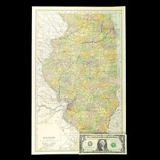
 1941 Vintage ILLINOIS Map Antique State Map of Illinois Atlas Map Decor 1583
-
$22.95
 Vintage Southern GEORGIA Map Highway Auto Trails RARE Savannah Coastline
-
$11.86
 1917 Vintage CLEVELAND Map City Street Old Original Cleveland Ohio Antique Road
-
$27.50
 1943 Vintage MANHATTAN City MAP New York City & The Bronx Map Set of 2 Maps 1258
-
$25.00
 The Spokane Valley WA - Rathdrum Prarie ID Aquifer Atlas / Map - 5th Edition NEW
-
$255.71
 Vintage Antique Pocket Map Ohio 1829
-
$149.99
 Antique 1920 Standard Atlas Of Saline County, Kansas
-
$250.00
 1838 William Bartlett Antique Shenandoah Valley Print ~ Framed
-
$22.57
 1912 ORIGINAL ANTIQUE MAP OF MEXICO / YUCATAN / BAJA CALIFORNIA / TEXAS
-
$16.96
 Vintage ILLINOIS Map Railroad Wall Art Old Original Electric Rail Lines
-
$16.95
 Historic Map of New England 1747 Vintage Style Colonial Map - 20x24
-
$16.95
 1940s Vintage California Picture Map Antique California State Map Wall Art 1563
-
$25.95
 Colton's 1861 Map of the State of North Carolina - 24x36
-
$19.99
 United States Hammond Map In Its Original Package
-
$32.99
 Vintage CUBA Map Wall Art LARGE Old Original Antique DATED 1898
-
$200.00
 Central America Mexico Yucatan Honduras Guatemala 1754 Bellin engraved map
-
$90.00
 Johnson's MAP VERMONT & NEW HAMPSHIRE antique
-
$16.95
 1747 Map of the Gulf Coast - Louisiana to Florida - 20x24
-
$13.95
 1650s “Insulae Americanae” Vintage Style US Caribbean Map - 18x24
-
$13.95
 1875 Salt Lake City Utah Vintage Old Panoramic City Map - 18x24
-
$37.49
 Map Seboomook Maine 1954 Topographic Geo Survey 1:62500 Antique 21 x 17" TOPO1
-
$37.49
 Map Smyrna Mills Maine 1955 Topographic Geo Survey 1:62500 Antique 21x17" TOPO1
-
$345.00
 antique UTICA NY ATLAS MAPS in 1899 sanborn ferris 1906-22 index 25.5x23" 116pg
-
$79.99
 1879 Map West Central States Group Victorian Atlas Geography 1st Edition DWAA9
-
$304.91
 Map "Carte de la Nouvelle Angleterre, Nouvelle York et Pensilvanie" Bellin,c1750
-
$12.89
 USGS Geologic Map: Deep Creek Area, Washington
-
$79.99
 1879 Map Connecticut United States Victorian Atlas Geography 1st Edition DWAA9
-
$13.95
 Bird's Eye View 1851 New Orleans Louisiana Vintage Style City Map - 18x24
-
$13.95
 Carolina 1732 Interesting Old Historic Map - 18x24
-
$12.71
 Vintage KANSAS CITY Map Street Missouri Wall Art Original Antique DATED 1895
-
$18.95
 1890 Portland Oregon Vintage Old Panoramic City Map - 20x30
-
$79.99
 1879 Map South Central Atlantic US Victorian Harpers Geography 1st Edition DWAA9
-
$79.99
 1879 Map New England USA Victorian Atlas Harpers Geography 1st Edition DWAA9
-
$29.99
 National Geographic 26 Map Lot ~ World US Canada Texas West Indies Mount Everest
-
$79.99
 1879 Map Massachusetts Boston US Victorian Atlas Geography 1st Edition DWAA9
-
$37.49
 Map Amity Maine 1958 Topographic Geological Survey 1:62500 21 x 17" TOPO1
-
$37.49
 Map Greenville Maine 1951 Topographic Geological Survey 1:62500 21 x 17" TOPO1
-
$37.49
 Map Bucksport Maine 1955 Topographic Geological Survey 1:62500 21 x 17" TOPO1
-
$79.99
 1879 Map US Mid Atlantic States Victorian Harpers Geography 1st Edition DWAA9
-
$18.95
 1941 Vintage CLEVELAND City Street Map of Cleveland Ohio Gallery Wall Decor 1579
-
$79.99
 1879 Map West Pacific NW & Southwest Group Victorian Geography 1st Edition DWAA9
-
$79.99
 1879 Map Maine United States New England Victorian Geography 1st Edition DWAA9
-
$37.49
 Map Wytopitlock Maine 1941 Topographic Geo Survey 1:62500 Antique 21 x 17" TOPO1
-
$37.49
 Map Moosehead Lake Maine 1954 Topographic Geo Survey 1:62500 21 x 17" TOPO1
-
$37.49
 Map First Roach Pond Maine 1952 Topographic Geo Survey 1:62500 21 x 17" TOPO1
-
$16.99
 VTG 1953 Nat Geo Fold-Out Historical Map of the United States
-
$23.50
 USGS Topographic Map ATHENS Georgia South Carolina 1:250K 1988 1x2° - old stock
-
$37.49
 Map Gilmanton New Hamphire 1956 Topographic Geo Survey 21 x 17" TOPO1
-
$15.00
 1950s Toketee Falls Oregon Willamette USGS Topographical Geological Survey Map
-
$17.95
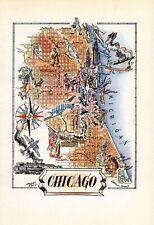 1940s Vintage Chicago Picture Map Liozu Chicago Illinois Map Wall Art Decor 1562
-
$26.95
 Historic Map of New York City 1865 - 16x48
-
$18.95
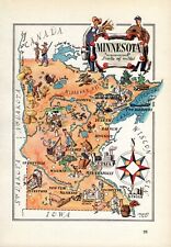 1940s Vintage Minnesota Picture Map Minnesota State Map Wall Art Decor 1561
-
$13.56
 ca1920 Antique BROOKLYN Street Map of Brooklyn New York Gallery Wall Art Decor
-
$79.99
 1879 Map Texas & Southern Plains States US Victorian Geography 1st Edition DWAA9
-
$13.95
 Bird's Eye View 1898 Milwaukee Wisconsin Vintage Style City Map - 8x24
-
$20.95
 NYC New York 1879 Historic Panoramic Town Map - 20x36
-
$18.95
 1940s Vintage Boston Picture Map Liozu Boston Print Wall Art Decor 1560
-
$44.99
 Map Dover Foxcroft Maine 1932 Topographic Geo Survey 1:62500 21 x 17" TOPO1
-
$39.99
 Map Mass RI CT Index Chart Geological Topographic Survey 1984 51 x 32" DWX6A
-
$17.95
 Historical map of New York City 1932 Vintage Style Illustrated Map - 20x28
-
$16.95
 The Old Spanish and Mexican Ranchos Map of Los Angeles County - 20x24
-
$11.95
 Vintage INDIANA Map Wall Art Old Original 1940s Terre Haute Indianapolis
-
$16.95
 1940s Vintage Wisconsin Picture Map Wisconsin State Map Wall Art Decor 1565
-
$13.95
 Albany New York 1879 Historic Panoramic Town Map - 16x24
-
$24.50
 1888 Antique TINY Texas Map MINIATURE Vintage Texas State Map 1550
-
$20.25
 1921 Antique MICHIGAN State Map Gallery Wall Decor Vintage Map of Michigan 1544
-
$14.95
 Prohibition End at last NY Newspaper Headlines 12 x 18 Poster
-
$24.50
 1888 TINY Vintage Texas Map MINIATURE Antique Texas State Map 1556
-
$13.95
 Bird's Eye View 1889 Williamstown Massachusetts Vintage Style City Map - 16x24
-
$13.95
 1867 New Mexico & Arizona Historic State Map - 16x20
-
$29.50
 Vintage 1981 Burnett County Wisconsin Land Atlas & Plat Book WI
-
$13.95
 Bird's Eye View 1889 Dubuque Iowa Vintage Style City Map - 16x24
-
$39.00
 N.E. Minnesota Large State 1889 M Bradley & Bros Detailed Hand Colored Old Map
-
$249.99
 c.1941 Essex Co Salem Massachusetts Map New Post Office Location ? Delivery Area
-
$29.99
 Map Mt Ascutney Vermont NH Geological Topographic Survey 1984 24 x 38" DWX6A
-
$76.00
 Boston Massachusetts City Plan 1853 scarce hand colored cerographic map
-
$54.88
 1889 Mississippi Map ORIGINAL Jackson Monticello Southaven Biloxi RAILROADS


