 Antiques (US)
-
$63.20

 ANTIQUE FRAMED CITY ILLUSTRATION CUM PRIVILEGIO ( FRAME 6.5” x 21.5” )
-
$19.99
 Topographic Map Barre Massachusetts Antique Printed 1942 16x20 Wall Art
-
$3.99
 🦚 Pittsburgh Zoo & PPG Aquarium Visitor's Map & Guide: Anteater! 🗺️🐜
-
$19.99
 Antique Original Crawford West Virginia Topographic Map Printed 1939 Wall Art
-
$49.99
 Vintage 1967 Reproduction of 1858 Map of the Plantations along Mississippi River
-
$45.00
 Vintage 1929 New York City Pictorial Map in 1658 Color Lithograph New Amsterdam
-
$89.99
 Original Rare Large Folding Black And White Map Of The Territory Of Arizona 1886
-
$68.95
 antique UPPER UWCHLAN PA MAP cochranville knauertown st mary huge 28.5"x20.5"
-
$50.00
 Original, antique, hand-drawn Property Plat Map - 1829 (John Cunningham)
-
$13.50
 Isothermal Map United States Victorian 1856 Art Plate Print Antique DWT15
-
$19.99
 New Martinsville West Virginia Antique Topographic Map Printed 1918 Wall Art
-
$79.99
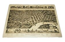
 Original Large 38" X 40" Birds Eye View Wall Map Of Lincoln NE 1963: Detailed!
-
$35.00
 1876 org. Plat Atlas pg. SPARTA & TYRONE TOWNSHIP, CASNOVIA, Kent Co. MI map
-
$74.99
 Lot 7 antique U. S. State maps Wyoming Idaho Washington Nebraska Railroads B24
-
$99.99
 Lot 11 antique U. S. State maps California Minnesota Florida Alaska Dakotas B25
-
$19.99
 Antique Original Clymer New York Topographic Map Printed 1930 Art Wall Décor
-
$30.00
 A Map of The Travels of George Washington National Geographic 1931
-
$26.00
 1882 Chittenden County Vermont Color Map Childs Gazetteer & Directory
-
$22.00
 1891 Wilton Junction, Iowa MapSheet Topographical Antique Original
-
$18.99
 Vintage Reproduction Perspective Map of Montgomery State Capitol Alabama 1887
-
$300.00
 Antique Original Map Of Ventura County California 22" X 35.5"
-
$20.57
 Antique Engraved Map New Jersey, Railroads - Post Offices - Villages
-
$16.95
 ANTIQUE COLORED MAP OF CONNECTICUT, USA. Dated 1921
-
$48.50
 antique MAP of BYERS STATION and ROCK RUN and KEMBLESVILLE PA atlas pg 12"x15.5"
-
$60.00
 Chicago Area 1933 Advert Map Of Lombard DuPage Co: Lombard Terrace Acres REPRO
-
$750.00
 VTG Harvard VE RI TAS Alumni SIGNED Quotes HUMOR Pictorial Campus ART Wall MAP
-
$15.53
 Antique 1884 Map Of Mississippi
-
$26.00
 Talbot County Realtors map 1875 printed as 17" X 22"
-
$200.00
 Chicago Area Antique Map Of 1868 ORIGINAL Village Of Glencoe, IL ANTE-FIRE REPRO
-
$14.00
 USGS Topographic Map 1980 Survey 30"x60" NY, VT Willsboro Bay New Old Stock
-
$24.00
 ANTIQUE 1890 MAINE MAP MEASURES 18 1/2" BY 12"
-
$30.82
 1911 antique fold out map - texas
-
$16.03
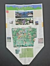 Vintage In The Ozarks. Springdale On The Move Map Nice condition
-
$35.00
 1876 org. Plat Atlas pg. CANNONSBURG, CEDAR SPRINGS, GRANDVILLE, Kent Co. MI map
-
$19.24
 Vintage Map Of Downtown Los Angeles And State Of California And Nevada Good
-
$13.50
 1970 Map Maine Province Topographical Art Print Vintage 1795 Version 2.1
-
$68.95
 antique MAP of UWCHLAN PA colored PAGE from ATLAS 20"x15"
-
$7.99
 National Geographic 1925 Map Of Washington DC. Approx 13 By 17 Inches. Frameable
-
$30.00
 Outline Map Fairfield Ohio Vintage Topographic - Unknown Year
-
$49.99
 Pair antique maps Lawrence Massachusetts North South Side Merrimack River B22
-
$48.50
 photocopy of antique map of the city of Olean ca 1870 Olean, NY
-
$13.50
 1970 Map Maine New Brunswick Boundary Print Vintage 1842 Treaty of Washington
-
$23.00
 1952 Panora, Iowa Map Topographical Not a Modern Copy Vintage
-
$50.00
 1923 UNITED STATE of AMERICA MAP The National Geographic Magazine
-
$8.99
 Topographic Map Dept interior Boston North 1986 Melrose Somerville Waltham more
-
$48.50
 antique MAP plan of EAST LAMPETER TOWNSHIP w Property Owners names from atlas
-
$13.88
 Vintage Sunbird Lodge Vacation Planning Map Of Vail & Vicinity 1978 nice
-
$48.50
 antique MAP of WARWICK TOWNSHIP pa colored from ATLAS brunnerville lititz etc
-
$22.99
 1941 Crow Lake, South Dakota Map Topographical Vintage - Not a Modern Copy
-
$32.00
 1876 original Plat Atlas page WYOMING & BYRON TOWNSHIP, Kent Co. MI map
-
$29.00
 1876 original Plat Atlas page BOWNE & ALPINE TOWNSHIP, Kent Co. MI map
-
$50.00
 Undated (circa 1890-1900) Map of San Francisco
-
$89.99
 1877 MAP of NEW HANOVER - ZIEGLERVILLE & LIMERICK SQUARE MONTGOMERY CO PA
-
$29.00
 1876 original Plat Atlas pg. SOLON & NELSON TOWNSHIP, SAND LAKE, Kent Co. MI map
-
$39.00
 1876 org. Plat Atlas pg. ROCKFORD, LOWELL, ADA, SPENCER TOWNSHIP, Kent Co MI map
-
$48.50
 antique MAP of UWCHLAN PA colored PAGE from ATLAS 12"x15.5"
-
$90.00
 Rare C. 1900 Colored Promotional Wall Map Of The excellent Coast To Coast
-
$12.99
 Vintage Rand McNally 1984 Knoxville 1989 Memphis Tennesse US Maps
-
$17.49
 ANTIQUE WEST BRANDYWINE TOWNSHIP PENNSYLVANIA MAP 20.5" X 28" HAND COLORED
-
$30.00
 photocopy of antique map of Otto, New York ca 1870 Waverly, NY
-
$78.00
 Very EARLY Undated c18th Century MAP of NORTH / SOUTH AMERICA & UNITED STATES
-
$23.42
 1911 antique map - alaska
-
$44.39
 ANTIQUE MAP UNITED STATES, THIRTY-EIGHT STATES, TEN TERRITORIES & DISTRICT OF CO
-
$24.65
 1911 antique map - michigan
-
$25.00
 1894 Goose Lake Iowa/ Illinois Map Topographical Antique Not a New Copy
-
$10.00
 Laminated 1916 Bernadotte, IL Township Map - Fulton County
-
$19.00
 Antique Print of the View of The Narrows, New York
-
$28.00
 c 1870's MAP of PART of COATSVILLE - CHESTER COUNTY PA
-
$49.95
 ANTIQUE MAP SHOWING PART of BRIDGEPORT PA & VALLEY FORGE
-
$25.00
 Circa 1900 map of Greater New York
-
$25.00
 1889 Surveyed Tipton, Iowa Map Topographical Antique Not a New Copy
-
$60.24
 Addison County Map 1871 Vermont Monkton Township
-
$25.00
 Antique Original 1939 USGS Map of Massachusetts, Rhode Island & Connecticut
-
$28.88
 RARE / ANTIQUE COLORED MAP of DOMINION of CANADA & New Foundland. Dated 1921
-
$20.00
 Vintage Original USGS Topographic Dennis MA Quadrangle 1943 16"x22" Color Litho
-
$23.42
 kansas - 1911 antique map
-
$14.95
 Vintage 1954 Canada Mines Map & Technical Surveys 30" x 24"
-
$40.00
 Chicago 1955 AD Map of Northbrook IL-Wyatt & Coons Landwehr Estates U 2&3 REPRO
-
$447.30
 Antique Paper Fabric Map of the AMERICAN CONTINENT c.1831+
-
$58.20
 USGS Topographic Map Plympton Mass Printed 1941 16x20 Wall Art Great condition
-
$58.20
 USGS Topographic Map New Bedford Ma Printed 1941 16x20 Wall Art Great condition
-
$41.74
 USGS Topographic Map Fall River East Mass Printed 1944 16x20 Great condition
-
$17.99
 North Wilmurt NY USGS Topographical Geological Survey Quadrangle Map 22 x 27
-
$23.42
 1911 antique folded map - kentucky
-
$2499.95
 Very Fine, Early Map Of The United States, Circa The 1760's, From A Copper Plate
-
$11.10
 Vintage Map Atlantic Provinces 1972 New Brunswick, Nova Scotia,Prince Edward Isl
-
$24.65
 1911 antique map - missouri
-
$28.35
 1911 antique color map - canada
-
$23.42
 1911 antique map - arkansas
-
$24.65
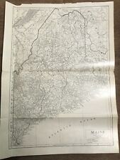 1911 antique map - maine
-
$58.20
 USGS Topographic Map Wareham Quadrangle Mass Printed 1947 16x20 Great condition
-
$80.02
 United States Department of the Geological Survey Clear and Round Lake Map
-
$28.35
 1911 antique color map - united states of america
-
$23.42
 1911 antique map - south dakota
-
$58.20
 USGS Topographic Map Snipatuit Pond Ma Printed 1942 16x20 Great condition
-
$58.20
 USGS Topographic Map Snipatuit Pond Mass Printed 1942 16x20 Great condition
-
$9.99
 Vintage 1977 United States Map Poster Scholastic 31 x 21” Collect or Student Use
-
$80.00
 Vintage 1937 Soundings in Fathoms Map Canada British Columbia Hecate Strait
-
$22.50
 Map WEST INDIES Cent/No So Amer c1875 Hammond? 13.75"x10.75" color S&H $4-USA
-
$2499.95
Early Map Of The United States, Circa The 1760's, From A Copper Plate, Very Fine


