 Antiques (US)
-
$95.95

 Admiralty 5124(11) ROUTEING CHART NORTH ATLANTIC OCEAN NAUTICAL MARINE Map Chart
-
$95.95
 Admiralty 2957 TAWITAWI GROUP TO SULAWESI INDONESIA & PHILIPPINE ISLANDS Map
-
$86.45
 Admiralty 4910 SAN DIEGO TO LONG BEACH INCLUDING CORTES BANK Map Chart Maritime
-
$55.00
 Cruising Guide New York To Nantucket And Cape May
-
$64.98
 World War II Era (May 1943) Nantucket Sound & Approaches Nautical Map 8th Ed.
-
$12.99
 1978 Upper Mississippi River Navigation Charts U.S. Army Corps of Engineers
-
$13.58
 Vintage Navigational Condition Report Chart Kieler Forde Germany Nautical Chart
-
$22.95
 Massachusetts Geodetic Survey Map USC & GS Essex County Haverhill Vintage
-
$25.00
 1986 Straits Of Florida & Approaches Chart Marine Soundings In Fathoms.43X36”
-
$9.90
 Vintage Vancouver Canada Washington Nautical Chart Map 1983 Haro Strait
-
$29.99
 Florida West Coast Reefs Wrecks Fishing Hot Spots Navigational Charts NOAA
-
$9.98
 Sunken Buried Treasure Shipwreck Map Pirates Captain Kidd Blackbeard Calico Jack
-
$19.95
 Vintage Nautical Map North Carolina Cape Hatteras, Cape Henry To Cape Fear
-
$86.45
 Admiralty 1947 WASHINGTON ADMIRALTY INLET AND PUGET SOUND Map Chart Maritime
-
$95.95
 Admiralty 2894 INDONESIA TANJUNG MANIMBAYA TO BOLITUWATTAN Map Chart Maritime
-
$86.45
 Admiralty 1754 MAZU LIEDAO TO DONGTOU LIEDAO CHINA - DONG HAI GENIUS Map Chart
-
$26.95
 1639 Island of Cuba Caribbean Ocean Exploration Map - 24x42
-
$34.95
 U. S. East Coast Maine "Damariscotta+" Maritime 47 X 36" Map # 13293 1989 28 Ed
-
$34.99
 1963 Navigation Charts Mississippi River Map Book 100+ pages US Army Corp. Book
-
$29.99
 Lot of 4 Vintage Nautical Charts Maps - Sandy Hook, Chesapeake Bay
-
$2.99
 Canadian Nautical Chart Jan 1972; Southern British Columbia coast, Vancouver isl
-
$150.00
 1952 US ARMY LAKE SURVEY CHARTS OF NEW YORK CANALS Erie Canal Champlain Seneca
-
$45.00
 Vintage Nautical Charts Maine Casco Bay • Large 46"x36"
-
$37.00
 Vintage 1960 Deer Island Casco Passage Maine Nautical Chart Map - 35”x 22”
-
$299.99
 Original Sea Captain's 1873 Canvas Backed Nautical Chart Great Bahama Bank
-
$19.99
 Vintage Hydrographic Chart Bougainville Strait Solomon Islands 1940s WW2
-
$17.95
 1583 Earliest European Sea Chart Historic Vintage Style Wall Map - 20x28
-
$13.95
 1639 Virginia and New England Historic Vintage Style Wall Map - 16x24
-
$76.95
 Admiralty 47 US-West Coast Washington Puget Sound Point No Point-Alki Point Map
-
$76.95
 Admiralty 2965 Indonesia Ports & Approaches In Southern Sumatera Vintage Map
-
$95.95
 Admiralty 2490 UNITED STATES MAINE MONHEGAN ISLAND TO CAPE PORPOISE Map Chart
-
$95.95
 Admiralty AUS811 CROWDY HEAD TO NAMBUCCA HEADS NEW SOUTH WALES NAUTICAL Map
-
$19.94
 NAUTICAL CHART MAP #1074 CANSO HARBOUR & APPROACHES 1955 TO 1965
-
$10.00
 Lake Survey Charts/ Nautical New York Canals. 1956 Vintage Corps of Engineers US
-
$2.99
 Vtg Nautical Chart: C&GS 880/879 Louisiana Intracoastal Waterway
-
$104.86
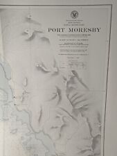 Vintage US Navy WWII Nautical Chart of Papua New Guinea - Port Moresby WW2 Naval
-
$25.00
 Army Corps of Engineers Barge Canal Navigation Charts NY State 1964
-
$13.95
 1639 “Atlantic Coast of North America” Vintage Style Early Land Map - 16x24
-
$86.45
 Admiralty 3785 OMAN SOUTH EAST PORT SALALAH ( MINA RAYSUT ) TO MASIRAH Map Chart
-
$86.45
 Admiralty 1163 BUSAN NEW PORT KOREA - SOUTH COAST Map Chart
-
$20.00
 Nautical Chart Catalog 2 Pacific Coast Hawaii Guam April 1979
-
$25.00
 Vintage Nautical Chart 12346 Hudson River Yonkers Piermont. NOAA 1984 24.5" x48
-
$9.95
 Five Vintage Seamanship/Navigation Booklets
-
$42.95
 Nautical Chart Long Island Sound #216 N Shore 1937- 28 3/16 x 36 5/8" Vintage
-
$5.75
 Vintage Nautical Chart Map, 1964, St. Lawrence River, Lake Ontario LAKE ERIE etc
-
$15.00
 NAVIGATIONAL CHART # 3102 - TAKORADI & SEKONDI BAY W. COAST AFRICA GHANA - 1967
-
$19.99
 Vintage Hydrographic Chart Hawaiian Islands to Samoa Pacific Ocean 1940s WW2
-
$74.95
 Vintage Large 43" Nautical Map Long Block Island Sound Montauk New London 1941
-
$33.00
 Vintage 1931 Approaches To Cape Fear River Nautical Chart Map - 45.5” x 35”
-
$13.95
 1650 Map of California shown as an Island! Unusual Error Map - 16x24
-
$20.68
 1855 M F MAURY Hydrography Map / Chart ~ HURRICANE of AUGUST SEPTEMBER 1848
-
$19.99
 Vintage Hydrographic Chart Yap Islands West Caroline Islands 1940s WW2
-
$59.00
 RI Mass 1973 nautical Noaa chart narragansett bay  36 by 48 navigation map
-
$10.00
 Marine Chart, Laminated Michigan NW Lower Peninsula, 11x17, West Marine
-
$22.00
 C&GS Coastal Map - New Jersey/Delaware- Cape May To Fenwick #12244 28th Ed. 1975
-
$33.00
 Vintage 1929 Fenwick Island Light Chincoteague Inlet Nautical Chart Map -41”x35”
-
$39.95
 Vintage 1979 Map Martha’s Vineyard To Block Island Large 2x sided 48”by 36
-
$19.99
 Antique Sailing Chart Map Nautical Navigation VTG PRINT 18.5 x 13 - EUROPE 1560
-
$19.00
 NAUTICAL CHART # 2142 - ANNAPOLIS BASIN - NOVA SCOTIA CANADA
-
$39.99
 1961 US Dept Of Commerce Nautical Vintage Map Habana To Tampa Bay 31 X 45 Cuba
-
$17.00
 Vintage Bahamas Nautical Sketch Chart Map - Rum Cay - 11x17
-
$19.99
 Vintage Hydrographic Chart Samoa Group Upolu Mulifanua Anchorage 1943 WW2
-
$19.99
 Vintage Hydrographic Chart Savaii Samoa Islands 1928 with WW2 Revisions
-
$13.95
 Peninsula of Florida 1639 Vintage Style Vinckeboons Map - 18x24
-
$26.00
 NOAA Piney Point Lwr Cedar Point- 12286 Navigation Survey Map POTOMAC RIVER vtg
-
$15.00
 WW2 Hydrographic Chart Okisollo Channel British Columbia Canada 1940s
-
$16.76
 Virgin Islands "Virgin Gorda to St. Thomas" Maritime Map 14.75 by 23" Cruzan Rum
-
$47.98
 1975 55th Ed. United States New York Jamaica Bay&Rockaway Inlet Navigation Chart
-
$9.99
 1976 NOAA Sound Chart #11430 Florida Lostmans River To Wiggins Pass 8th Ed. (43)
-
$17.00
 Vintage Bahamas Nautical Sketch Chart Map - Hog Cay Cut - 11x17
-
$15.00
 NOAA Chart Charleston Harbor And Approaches 11521
-
$10.00
 Nautical Detroit River Lake St Clair, River.1963 Corps of Eng. US Survey Chart
-
$49.99
 1961 US Dept Of Commerce Nautical Vintage Map Lemon Bay To Passage Key Inlet
-
$34.95
 U. S. East Coast Maine "CASCO BAY" Navigational 47 X 36" Map # 13290 1990 29 Ed
-
$25.00
 West Indies Antigua Island Marine Chart Parham Sound 1st Ad1943 Update 1970 Navy
-
$42.95
 Map Nautical Chart Approaches To NY Nantucket Shoals 5 Fathom Bank 1939 Vintage
-
$19.99
 Vintage Hydrographic Chart Islands Anchorages in the Ellice Islands 1940s WW2
-
$41.95
 Massachusetts Geodetic Survey Map x 2 USC & GS Essex County WPA Vintage
-
$12.00
 West Bay to Santa Rosa Sound Florida Nautical Chart 11385 1984 Edit. 11 NOAA
-
$16.48
 4 Pirate Wall Art Posters Treasure Chest Map Weapons Pistol Sword Gun Home Decor
-
$20.00
 1957 Nautical Maritime Chart Puerto Rico San Juan Quadrangle 29" x 32"
-
$24.88
 1989 Upper Mississippi River Navigation Charts U.S. Army Corps of Engineers
-
$24.99
 UK Hamilton's Broads Maritime Navigation 2 Chart and Index 21st Edition 1967
-
$4.00
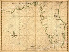
 Chart of the New World - 1526 - Juan Vespucci - Navigational Map - 13”x9.75”
-
$17.00
 Vintage 1985 Dominican Approaches Bahia De Samana Nautical Chart Map - 47” x 34”
-
$2.99
 Vtg Nautical Chart: C& GS Vermilion Bay and Approaches . Louisiana Gulf coast
-
$19.99
 VTG Hydrographic Chart East Coast of Vancouver Island British Columbia 1940s WW2
-
$13.95
Sea Chart of Europe 1583 Vintage Style Navigational Map - 18x24
-
$24.95
1639 Florida Coast Historic Vintage Style Wall Map - 24x32
-
$33.00
 Vintage 1929 Chesapeake Bay Smith Point To Cove Point Nautical Map - 43.5” x 33”
-
$34.95
 U.S. E. Coast ME "Muscongus Bay" Maritime 47 X 36" Map # 13301 1984 17 Ed
-
$25.00
 NOAA Upper Green Bay Door County Nautical Sound Chart Map LORAN-C ~ 48” x 36”
-
$20.00
 1975 Lake George Navigational Chart Book 9 Colored Charts 11" x 14"
-
$2.99
 Vtg Nautical Chart: C&GS 1260 Horseshoe point to Rock Islands, FL Gulf Coast
-
$19.99
 Vintage Hydrographic Chart San Pedro Bay California 1940s
-
$19.99
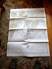
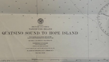 Vintage Hydrographic Chart Quatsino Sound Vancouver Island British Columbia WW2
-
$19.99
 WW2 Hydrographic Chart Phoenix Islands South Pacific Ocean Vintage 1940s
-
$690.00
 Georgetown Harbor SC Cape fear River NC 1887 book US Army Engineer report
-
$86.45
 Admiralty 1721 BEIJI LIEDAO TO TAIZHOU LIEDAO CHINA - DONG HAI GENIUS Map Chart
-
$95.95
 Admiralty 2369 DARLOWO TO MYS TARAN INCLUDING GULF OF GDANSK BALTIC SEA WALL Map


