 Antiques (US)
Africa Maps
Asia Maps
Australia/Oceania Maps
Celestial Maps
Central America/Caribbean Maps
Curiosities Maps
Digital Maps
Europe Maps
Map & Globe Mixed Lots
Map & Globe Reproductions
North America Maps
South America Maps
World & Celestial Globes
World Maps

-
$16.99

 Carte Des Isles Philippines 1752 Map 11"x 8.5"
-
$85.00
 Brest Brittany France coastal survey 1700 Moll detailed engraved harbor map
-
$360.00
 Korea Great Joseon State Seoul c. 1750's scarce lovely engraved hand color map
-
$125.00
 Scandinavia Sweden Denmark Norway Finland c. 1755 decorative Jefferys map
-
$13.00
 1943 Vintage Map - Indian Land Cessions 1784-1798 - Kentucky - Ohio - Tennessee
-
$17.95
 1700s New World Spanish Colonies Old Map - 20x28
-
$600.00
 NORTH AMERICA CALIFORNIA AS AN ISLAND 1706 DE LA FEUILLE ANTIQUE MAP
-
$16.95
 North America 1771 Colonial Map - 13 Colonies - 20x24
-
$45.00
 1750 Hand-Colored Map of Europe by Robert De Vaugondy
-
$1365.00
 Antique Map North America & Caribbean Matthaus Seutter Hand Colored 1740 Framed
-
$16.99
 Carte Des Isles Philippines 1752 Map 11"x 8.5"
-
$4.95
 Original 1797 George Kearsley Color Map Sweden Norway Denmark Finland Lapland
-
$23.95
1771 Early American 13 Colonies - East Coast Map - 24x28
-
$100.00
 Chao Phraya River Thailand Siam Bangkok Menam River 1752 Bellin hand color map
-
$116.00
 Kingdom of Scotland Edinburgh Glasgow Shetland UK 1770's Kitchin hand color map
-
$299.99
 AUTHENTIC LARGE COLOR MAP FROM 18TH CENTURY - Museum Grade Quality
-
$225.00
 An Accurate Map of North America with the New Discoveries 1799 D. Ogilby Wow!!
-
$59.00
 Historic Map Groton Conn 1655-1799 Town Owner Names Genealogy Date Unknown
-
$70.00
 Eighteenth Century Hand-Col. Map of London & Environs, 1787 - PRICE REDUCED
-
$12.95
 1796 PENNSYLVANIA CYRUS HARRIS MAP MANY OLD TOWN NAMES WITH LONG “S”(f) PRINTING
-
$125.00
 Antique Hand Drawn Map / Platt Drawing clapper's creek ,Patapsco river Baltimore
-
$20.00
 1760 Gentleman's Magazine - Map of Kassel - Jamaica Uprising - Cherokee Battles
-
$1070.00
 1717 MAP of AMERICA antique authentic CALIFORNIA AS AN ISLAND L'Amerique
-
$16.95
 1750s L' Amerique Septentrionale New World Map - 20x24
-
$24.00
 St. Croix Danish Reproduction Map of 1767 Caribbean Plantation, Paul Kuffner
-
$92.00
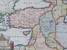 Eastern Ottoman Empire Anatolia Syria Holy Land Armenia 1772 decorative HC map
-
$16.95
 Historic Map of New England 1747 Vintage Style Colonial Map - 20x24
-
$68.00
 Mughal India Roadways Infrastructure Calcutta Lucknow Madras c. 1795 Fraser map
-
$300.00
 Siamese Capital Thailand Ayutthaya 1752 French detailed city plan hand color map
-
$248.90
 1728 VERY RARE Herman Moll Map , Genuine Antique, Voyage Of Aeneas Greece
-
$200.00
 Central America Mexico Yucatan Honduras Guatemala 1754 Bellin engraved map
-
$68.00
 Champagne France Rheims Sedan 1737 De Lat engraved scarce map
-
$19.99
 Spain and Portugal antique map 1795 by William Guthrie
-
$85.00
 Map Bonne, Les isles Philippines celle de Formose, le sud de la Chine 1780
-
$60.00
 1780 Bonne Map Caspian Sea Iran Persia Georgia Independent Tartary Turkestan
-
$13.95
 1720 Old World Exploration Map Historic Print - 16x24
-
$13.95
 1740s Early Map of the Gulf Coast - Texas, Louisiana, Florida - 16x20
-
$199.99
 1794 AMERICAN UNIVERSAL GEOGRAPHY 9 MAPS 1ST US SCHOOL GEOGRAPHY COMPLETE
-
$316.00
 Southeast Asia Kingdom of Siam Thailand Cambodia 1752 Bellin fine hand color map
-
$52.00
 North Africa Egypt Libya Nile River Cairo Tripoli 1781 Bonne engraved map
-
$275.00
 1780 Bonne Map of Southwest America and New Spain
-
$75.00
 1812 Lapie Map of Great Britian Scotland and Ireland
-
$59.99
 1873 rare ORIGINAL ANTIQUE MAP HUNGARY ROMANIA TRANSYLVANIA Sibiu Brasov
-
$18.95
 Dublin Ireland Vintage Irish City Map - 20x30
-
$100.00
 1780 Bonne Map West Indies Caribbean Antilles Puerto Rico Guadeloupe Martinique
-
$60.00
 1732 Herman Moll Map Navigatio Ulysses Voyage Ancient Greece Italy Homer Odyssey
-
$75.00
 1780 BONNE UNUSUAL ANTIQUE ORIGINAL WORLD MAP ON MERCATOR'S PROJECTION
-
$225.00
 1787 PF Tardieu Ohio River Tributary Maps Muskingum Beaver Sioto Indian Villages
-
$195.00
 An Correct Map of the World with the Latest Discoveries 1799 Original Look!!!
-
$16.95
1747 Map of the Gulf Coast - Louisiana to Florida - 20x24
-
$13.00
 1943 Vintage Map - British Florida 1763-1783 - St. Augustine Alabama, Louisiana
-
$68.00
 1732 Herman Moll Map Roman Empire Caesar Pompeius Civil War 45 BC Rome Italy
-
$200.00
 Rare Antique "New Map of England by John Senex" (Framed 29"x26")
-
$149.99
 Framed 18th C. Johann Baptista Homann Nova Anglia Map of New England
-
$215.00
 Antique Map - 1770 Original Map of North America by Thomas Bowen
-
$78.40
 World Map Mercator's Projection c. 1790's Capt. Cook Death map w/ hand color
-
$13.95
 Carolina 1732 Interesting Old Historic Map - 18x24
-
$18.66
 MAP OF BUCKINGHAMSHIRE ROBERT MORDEN 1722 46 x 38cm 1970'S REPRODUCTION
-
$13.95
 1770s Early Map of Connecticut, New Jersey, New York & Long Island - 16x20
-
$23.95
1740s Map of the New Orleans and the Gulf Coast - 24x30
-
$24.95
 Map of the Mississippi River and Louisiana 1730 Vintage Style US Map - 24x32
-
$16.95
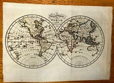
 1700s “Map of the World” Remarkable Vintage Style Map - 20x24
-
$100.00
 Astronomy Original Colored Engraving Celestial Map (N) - 1779
-
$17.95
 Map of the Republic of Ireland 1700s - 20x28
-
$13.95
 North America 1718 Louisana Territory Historic Map - 18x24
-
$25.00
 View of Lisboa Portugal - Original Print Mallet - 1718
-
$13.95
 1700s “Map of New France” Vintage Style Early United States Map - 16x20
-
$29.99
 Map of Louisiana & Mississippi River by John Senex Antique 1721 Reprint
-
$13.95
1750s Early North America New World Exploration Map - 16x20
-
$99.00
 18th Century Map of Massachusetts W. Barker Sculpt.
-
$35.00
 Astronomy Comet (B) - Original Print by Mallet - 1718
-
$92.00
 England & Wales United Kingdom London 1772 Jefferys decorative hand color map
-
$150.00
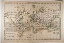
 1787 Rigobert Bonne Mappemonde Occidental Western Hemisphere Antique Map
-
$1.00
 Virginia Revolutionary War Map 1774 1783 Independence Bicentennial Commission
-
$21.99
 antique print 1750 Robert Benard Direxit Encyclopedia Astronomy France Jupiter
-
$140.00
 Holy Roman Empire Germany Austria Prussia 1708 rare decorative 16 flags map
-
$31.99
 1830 Nathan Hale Map West Indies Cuba Jamaica Florida Keys Bahamas Caribbean Sea
-
$45.00
 Astronomy Celestial Map May by Bode - Original Engraved Map - 18th century
-
$23.95
1718 Carte De La Nouvelle France Historic Vintage Style Wall Map - 24x28
-
$23.95
1705 Map of the World Historic Vintage Style Wall Map - 24x30
-
$108.00
 Scythia & Sarmatia Ancient World Asia 1719 Mallet map
-
$13.00
 1943 Vintage Map - Boston in 1775 and 1776 - Revolutionary War - Bunker Hill
-
$80.90
 ARMS OF THE COLLEGES CAMBRIDGE BY EMANUEL BOWEN c1720 GENUINE ANTIQUE ENGRAVING
-
$49.90
 Universe Cosmography - Original Print Mallet - 1718
-
$25.00
 Geocentric System Astronomy - Original Print from Bion - 1751
-
$78.40
 Cranganor Kodungallur India Portuguese Fort Dutch Colony 1761 city plan map
-
$23.95
 1759 North America Map of New Spain Spanish Colonies - 24x30
-
$26.95
 1790s Historic World Map of the Discoveries of Captain Cook - 24x42
-
$15.00
 Vintage Longmans Map of The Netherlands in 1702
-
$78.40
 Ottoman Empire Balkans Greece Serbia Romania Croatia 1744 Senex hand color map
-
$9.99
 American Revolutionary War Washington's March to Yorktown New Jersey Virginia
-
$68.45
 c1760 French Map By Bellin - Great Yarmouth Norfolk Plan De La Ville Et Environs
-
$13.50
 Map Revolutionary War South Colonies 1871 Victorian Woodcut Print History DWAA12
-
$564.00
 Antique Aquatint Print Hamilton Grecian Vase Oedipus Sphinx Mythology
-
$30.00
 Regni Mexicani Nova Hispania New Spain 1725 Map Framed 14"x 12.5 Off Set Litho
-
$93.34
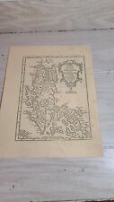
 Rare Engraved C17th/C18th Framed Map Insularum Britannicarum Facies Antiqua
-
$45.00
 1760 Gentleman's Magazine- Correct Chart of the Irish Sea - Lord Sackville Trial
-
$75.00
 Carte du Perou Avec Un Partie Des Pays Qui En Sont A L'est by R Bonne, c. 1790
-
$180.00
 Lopburi Thailand Louvo Chao Phraya River 1752 Bellin hand color city plan
-
$140.00
 Zhoushan Island China Zhejiang Province Chusan c. 1749-50 Bellin hand color map


