
-
$36.99

 Vintage 1938 Topographic Map - Syracuse, Kansas - 19.75" x 16.5"
-
$125.00
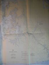
 Palm Beach Atlas Sheet 23-A - Jungle Point - Everglades Island
-
$36.99
 Vintage 1933 Topographic Map - Lakin, Kansas - 19.75" x 16.5"
-
$36.99
 Vintage 1939 Topographic Map - Larned, Kansas - 19.75" x 16.5"
-
$20.00
 West Virginia North America Map 1935 United States 14 x 11" LGAD99
-
$15.00
 Mifflintown Pennsylvania Antique USGS Topographic Map Printed 1937 16x20 Art
-
$15.00
 Del Sur California Antique Original USGS Topographic Map 1936 16x20
-
$24.99
 Cohoes NY USGS Topography Map Halfmoon, Stillwater, Waterford, Brunswick, Easton
-
$15.00
 USGS Topographic Map Smyrna Hills Maine Antique Printed 1937 16x20 Art
-
$15.00
 Cima Mesa California Antique Original USGS Topographic Map 1939 16x20
-
$15.00
 Antique Ady Texas Original USGS Topographic Map 1936 16x20
-
$11.00
 1932 Great Russian Plain Siberia Interpretive Map Print Van Loon Geography Art
-
$99.99
 VINTAGE PARCEL MAP THOMAS BROS CITY OF ORANGE ANAHEIM ORANGE COUNTY CA c1930
-
$36.99
 Vintage 1937 Topograpic Map - Minneapolis, Kansas - 19.75" x 16.5"
-
$80.00
 Chicago Area Vintage U.S.G.S. Evanston Quadrangle Map REPRO
-
$199.99
 OLD GERMAN Turkey MAP 1930s 40s Dr. Ulrich Frey 80*60
-
$18.95
 Vintage Map Print WWII History Color Norway Finland Sweden France Great Britain
-
$375.00
 COLORADO STATE MAP General Land Office original Nationa Parks topographical 1934
-
$31.37
 Geological Map edition of 1900. County Quarter Sheet Dumfriesshire V. SE.
-
$18.95
 Vintage Map Print WWII History Color 2 Sided Ontario Manitoba
-
$25.00
 European Colonies - About 1650 - Original Print (c. 1931)
-
$15.00
 Antique Alma Michigan USGS Topographic Map Original Printed 1938 16x20 Art
-
$15.00
 Guilford Maine Antique Original USGS Topographic Map 1937 16x20
-
$350.00
 SHANGHAI Japanese Antique Map International & French Concessions China 1937 b557
-
$8.00
 Map 1930 Magellan's Route c1521-22 5.5 x 9" Expedition History Ephemera DWEE2
-
$8.00
 Map 1930 Seven Days Battle Richmond 5.5 x 9" Virginia History Ephemera DWEE2
-
$20.00
 Texas North America Map 1935 United States 14 x 11" Southwest LGAD99
-
$8.00
 Map 1930 Gettysburg Campaign Civil War 5.5 x 9" Military History Ephemera DWEE2
-
$36.99
 Vintage 1938 Topographic Map - Clay City, Kansas - 19.75" x 16.5"
-
$24.99
 1939 Tully Onondaga County New York Antique USGS Topographic Map Vintage
-
$63.75
 US Department Of The Interior Geological Survey, Georgia Warm Springs Quad 1934
-
$36.99
 Vintage 1937 Topographic Map - Lyons, Kansas - 19.75" x 16.5"
-
$18.95
 Vintage Map Print WWII History Color 2 Sided India West Burma Germany Poland
-
$18.95
 Vintage Map Print WWII History Color 2 Sided Folded East China South East Europe
-
$8.00
 Map 1930 U.S. Colonies In 1760 5.5 x 9" Settlement History Ephemera DWEE2
-
$15.00
 Antique Newfield Maine Original USGS Topographic Map 1937 16x20
-
$8.00
 Map 1930 Caribbean Sea In Colonial Era 5.5 x 9" World History Ephemera DWEE2
-
$5.95
 1920 Mooseleuk Lake, ME Maine USGS Topographic Topo Map
-
$34.99
 Vintage 1930 Topographic Map - Ashland, Kansas - 19.75" x 16.5"
-
$60.00
 WWII Era - US ENGINEERS SPECIAL ROAD MAP OF ENGLAND & WALES (SHEET 6)
-
$8.00
 Map 1930 General Grant's Campaign Vicksburg 5.5 x 9" History Ephemera DWEE2
-
$286.00
 1936 Flag Map of California, Goodacre, W.J. Pictorial Map
-
$225.00
 1933 WORLD MAP with VARIOUS COUNTRIES ARMY & NAVY ARMAMENTS & JAPAN'S COLONIES
-
$15.00
 USGS Topographic Map Genesco Illinois Antique Original Printed 1934 16x20 Art
-
$8.45
 Original 1939 Panama Canal Map by US Coast and Geodetic Survey
-
$18.95
 Vintage Map Print WWII History Color 2 Sided North America & The World
-
$8.00
 Map 1930 Eastern US Theatre Of War 5.5 x 9" Military History Ephemera DWEE2
-
$18.95
 Vintage Map Print WWII History Color 2 Sided Europe South America
-
$18.95
 Vintage Map Print WWII History Color 2 Sided Folded East Indies Americas
-
$18.95
 Vintage Map Print WWII History Color 2 Sided Australia New Zealand Tasmania
-
$24.99
 Paradox Lake NY Topography Map Ticonderoga, Hauge, Crown Point, Schroon, Horicon
-
$15.00
 Vintage 1931 USGS Topo Map-Belton / Moffat, Texas 17X 20.75"
-
$18.95
 Vintage Map Print WWII History Color 2 Sided Folded Pacific Ocean Arabia
-
$28.89
 Vintage Clason's Guide MAP Colorado OIL LEGEND 1920s 1930s RARE
-
$20.00
 Vintage 1943 USGS Topo Map Donaldsonville, Louisiana 18 X 21"
-
$24.99
 NY VT Hoosick Topography Map Cambridge, Pittstown, Grafton, Petersburg, White Cr
-
$15.00
 Dudley Ridge California Antique Original USGS Topographic Map 1936 16x20
-
$35.00
 1932 Yale Expedition to N. India Map C 1934 Amer. Geographical Society, NY
-
$18.95
 Vintage Map Print WWII History Color Mexico West Indies Central America +
-
$23.21
 MEDITERRANEAN SEA East Cyprus Isreal 6 x 8" (15 x 20 cm) - 1934 German Map
-
$8.00
 Map 1930 The West Transylvania c1763-77 5.5 x 9" Europe History Ephemera DWEE2
-
$20.00
 Vintage 1939 USGS Topo Map, Trigo Peaks Mts. Yuma, Arizona 20 X 16.5"
-
$15.00
 Antique Huron California Original USGS Topographic Map Printed 1937 Art
-
$15.00
 Antique Blacksville West Virginia Original USGS Topographic Map 1940
-
$44.99
 1933 Blue Hills Reservation Map Roads Paths and Trails 22" x 15" Original Print
-
$25.95
 1935 Vintage Antique MT. WASHINGTON NH New Hampshire USGS Topographic Map
-
$18.95
 Vintage Map Print WWII History Color 2 Sided Folded China Burma India Italy USSR
-
$7.00
 1937 South America & 1949 Europe and the Near East National Geographic Maps
-
$15.00
 1939 Marcus Hook Quadrangle Topographic Original PA DE NJ Vintage Map Nice
-
$20.00
 Brazil Guianas South America Map 1935 Atlas Bolivia Argentina 14 x 11" LGAD99
-
$24.84
 1936 MAP - GERMANY Deutscheland Duisburg Dusseldorf City Town Plans
-
$50.19
 JAVA - Western Portion, SUNDA STRAIT. 1934 ADMIRALTY SEA CHART. No. 1653a.
-
$125.00
 1941 Nautical Chart Hilo Bay Hawaii Restricted WWII 25" x 27" #4103
-
$20.00
 Vintage 1939 USGS Topo Map, Yreka, California. 16.5 X 20"
-
$10.00
 Map 1930 State Claims Western Lands c1783-1802 5.5 x 9" Offset Lithograph DWEE2
-
$35.99
 Vintage 1933 Topographic Map - Montezuma, Colorado - 20.75" x 17"
-
$17.50
 1934 MAP 6 x 10" (15 x 25 cm) - AEGIAN SEA North Part Bosphorus Greece Turkey
-
$18.00
 US Geological Survey Map Scale 1/125000 Topographic Sheet Mount Vernon Stanwood
-
$18.00
 US Geological Survey Map Scale 1/125000 Topographic Sheet Mount Vernon Standwood
-
$15.00
 Vintage 1931 USGS Topo Map- Elm Mott / Waco, Texas 16.5X 20"
-
$17.50
 1936 MAP GERMANY Deutscheland - STUTTGART City Plan + Environs
-
$29.90
 1936 MISSOURI STATE Cultural Thematic Map Chromo Litography C13-2
-
$8.45
 Groton Mass. N.H. New Hampshire 17" X 20" Vintage 1930 USGS Topographic Topo Map
-
$25.00
 1930 CAVE CREEK, ARIZONA USGS Quadrangle Map
-
$12.49
 VTG 1935 Where to Stay in Boson A Street Map Boston Chamber of Commerce 26 x 17
-
$160.00
 1887-1937 Pacific Ocean Map Admiralty Chart 39 1/2 X 40 inch W.J.L Wharton
-
$17.16
 1936 MAP GERMANY Deutscheland - Wiesbaden & Koblenz City Plans
-
$24.99
 1937 USGS Topo Map WHITE SWAN YAKIMA INDIAN RESERVATION Washington Fort Simcoe
-
$9.99
 MAINE USGS Topo MAP ALLAGASH 1945 Reprint of 1933 Edition
-
$11.31
 1931 BAEDEKER MAP - Italy GRADO AQUILEIA City Plan + Railroads
-
$11.28
 Devon Map Vintage Okehampton Army Camp Hamlets Park East Hill Dated 1932
-
$15.00
 Vintage 1939 USGS Topo Map Coleman, Texas 16 1/2 X 20" Santa Anna Mountains
-
$24.84
 1936 MAP - GERMANY Deutscheland Poland Szczecin Lubeck Town City Plans
-
$29.95
 Greystone Greene County Tennessee NC 1939 Geological Survey Map 27x22 VG
-
$18.95
 Vintage Map Print WWII History Color 2 Sided Mediterranean Sea Western Med Sea
-
$18.53
 1935 Antique County Map J Thomas Co Wisconsin WI Lake Superior Madison
-
$24.87
 CONSTANTINOPLE City Plan Turkey 9 x 11" (23 x 8cm) - 1934 German Map
-
$11.00
 1932 Italy Mediterranean Geometric Interpretive Map Print Van Loon Geography
-
$34.00
 Arkansas - Waldron Quadrangle (1939 survey) Original...
-
$60.00
 WWII Era - US ENGINEERS SPECIAL ROAD MAP OF ENGLAND & WALES (SHEET 3)


