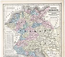
 Antiques (US)
-
$54.40

 Beaumont Belgium Bird's Eye View City Walls Churches c. 1750 hand color map
-
$84.50
 Antique Map-OOSTENDE-OSTEND-BELGIUM-Guicciardini-1660
-
$58.00
 1956 Europe Map Topographical Elevations France Turkey Asia Yugoslavia Germany
-
$54.40
 Netherlands & Belgium Luxembourg Holland Low Countries 1846 engraved map
-
$14.97
 Travel Map Europe Belgium Belgique Commerce Vintage Brochure Circa 1969
-
$23.99
 1857 Desilver Mitchell Map Holland Belgium Luxemburg Amsterdam Antwerp Brussels
-
$12.80
 WWII Map Allied Occupation Zones US British French Russia Berlin Germany 1945
-
$11.99
 1835 Charle Map x 2 Central Europe France Germany Switzerland Holland Belgium
-
$9.99
 1882 Drioux Map Euorpe in 1715 after Louis XIV France
-
$9.75
 Beautiful Antique 1923 Map Of Netherlands & Belgium 9x6 Inches
-
$18.00
 Europe - Original 1906 Political Map by Meyers. A German Language Antique
-
$11.99
 1885 Drioux Map - Europe 1556-1648 Thirty Year War Charles V & Henry III France
-
$37.64
 1955 VINTAGE MAP OF BELGIUM BRUSSELS BRUXELLES / LUXEMBOURG / SCALE 1:500,000
-
$54.40
 Oudenaarde Flanders Belgium City Plan Fortifications c. 1710 hand color plan map
-
$45.00
 1897 Netherlands Belgium Map Amsterdam Brussels Bruges, Antwerp Ghent RAILROADS
-
$20.76
 1910 ANTIQUE CITY MAP OF KORTRIJK COURTRAI KORTRYK / FLANDERS / BELGIUM
-
$18.31
 Netherlands Belgium Luxemburg 1907 Map Authentic (Dated) City Topog'y Rail Canal
-
$20.00
 Central Europe - Original 1902 Travel Map by The Century Company. Antique
-
$49.00
 1853 Germany Prussia.Map Europe States Austria Berlin Hanover Belgium Italy
-
$9.75
 Rand, McNally & Co Antique 1899 Map Of France, Belgium & Switzerland 7x6
-
$16.00
 1881 Andrees Map Religions Europe Catholic Protestant Muslim Christian Orthodox
-
$15.99
 1835 Bradford Map - Northern Europe Germany Sweden Norway Holland Britain Russia
-
$100.00
 Belgium & Luxembourg Kingdom of the Netherlands c. 1840 Lizars large folio map
-
$24.90
 1895 BELGIUM LUXEMBOURG Vintage Map ORIGINAL 11.5 x 9.5 Color C12
-
$27.99
 1855 Johnston Military Map - Napoleon Campaigns 1792 Netherlands Holland Belgium
-
$60.00
 1844 Smith Map Roman Empire Europe Mediterranean Italy Rome Greece Athens Africa
-
$21.90
 1895 ORIGINAL VINTAGE MAP - Brussels, Belgium - C10-3
-
$43.56
 1782 Seven United Provinces & Dutch Netherlands Antique Map by Alexander Hogg
-
$247.50
 Antique Map-BELGIUM-LUXEMBOURG-NAMUR-Tirion-1738
-
$23.76
 1885 ANTIQUE CITY MAP OF LIEGE LIÈGE LÜTTICH / BELGIUM
-
$59.88
 ANTIQUE MAP 1907 BELGIUM BRUSSELLS ANTWERP LUXEMBURG BATTLEFIELDS RAILWAYS
-
$20.90
 1937 ORIGINAL VINTAGE MAP OF NORTHERN FRANCE PARIS / BELGIUM LUXEMBOURG
-
$24.00
 1850 Johnston Military Map - Battle of Neerwinden 1793 - Leau Belgium - Napoleon
-
$16.00
 Europe - Original 1903 Dated Physical Map by Dodd Mead & Company. Antique
-
$24.00
 Cartes Taride French Map of Belgium Belgique Vintage
-
$9.56
 Vintage Belgium Map by Budget European stmap Abz
-
$38.90
 1905 WORLD MERCATOR Currents Vintage Large Map ORIG. Italian 12.5 x 10.5" C13-1
-
$12.80
 WWII Map Rhineland Campaign Coblenz Mainz Luxembourg France Germany Feb Mar 1945
-
$22.57
 1905 ANTIQUE CITY MAP OF NAMUR / NAMEN / WALLONIA / BELGIUM
-
$24.88
 1882 Holland & Belgium Hand Coloured Antique Map by Edward Stanford
-
$35.00
 Original 1918 WWI Map France Belgium Battle Line battlefield old
-
$19.99
 1855 Johnston Military Map - Napoleon Battle of Quatre Bras 1815 Belgium
-
$11.99
 c 1840 Sydney Hall Map - Holland Belgium Netherlands Amsterdam Brussels Ghent
-
$12.80
 WWII Map Battle of Flanders Netherlands Belgium Holland Luxemburg Germany 1940
-
$15.99
 1896 Andrees Map - Netherlands Belgium Holland Europe Amsterdam Brussels
-
$11.99
 1901 Andrees Europe Map Rainfall & Population Density France Italy Germany Spain
-
$19.99
 1832 Delamarche Map - Holland Belgium Netherlands Amsterdam Brussels Zeeland
-
$9.99
 1872 Vuillemin Map Europe Austria Prussia Turkey Italy
-
$18.00
 Erfurt, Germany - Original 1904 City Map by Meyers. Antique
-
$39.99
 1696 Colom Map Flandre Gallicane Flanders France Belgium Tournay Douay Wervik
-
$34.99
 ANTIQUE 1859 COLTON'S ATLAS HAND COLORED ENGRAVING MAP OF HOLLAND & BELGIUM
-
$19.99
 1847 Flemming Map Netherlands Belgium Holland Amsterdam Brussels Utrecht Europe
-
$15.99
 1900 Meyers Map Belgium Luxembourg Brussels Antwerp Gent Mons Loweu Netherlands
-
$16.00
 1860 Johnson Map - Holland Belgium Amsterdam Brussells France Paris Netherlands
-
$14.50
 Antique 1914 Map Of Netherlands, Belgium & Luxemburg 11x15 Inches
-
$9.99
 1867 Vuillemin Map - Europe - Agriculture Distribution
-
$19.00
 Brussels, Belgium - Original 1905 City Map by Meyers. Antique
-
$20.00
 Netherlands & Belgium - Original 1899 Map by Velhagen & Klasing. Antique
-
$16.00
 1887 Bradley Map Denmark Iceland & Holland Belgium Netherlands Amsterdam Europe
-
$11.99
 1885 Drioux Map - Political & Physical Netherlands Holland Belgium Amsterdam
-
$18.00
 WWII Map Western Europe Allied Invasion Omaha Beach Normandy France June 6, 1944
-
$15.99
 1885 Drioux Map Europe French Empire France Germany Italy Austria Spain Holland
-
$11.99
 1835 Map x 2 - Europe Political & Physical - Austria Italy Spain Britain
-
$24.00
 Europe - Original Map c1906 by G Philip & Son. Antique
-
$14999.00
 ORIGINAL Republic of Texas Sealed Contract: Consulate Antwerp Belgium + 1845 Map
-
$39.00
 1843 Europe Map Prussia Germany Iceland Ireland POLITICAL Russia Moscow Austria
-
$49.99
 1809 ORIGINAL MAP FRANCE BELGIUM HOLLAND ITALY napoleonic wars Piedmont NAPOLEON
-
$9.99
 1900 Times Map Belgium & Luxemburg Brussels Antwerp Liege Ghent Maastricht Lille
-
$15.99
 1900 Times Map Germany Berlin Bavaria Bohemia Holland Belgium Prussia Europe
-
$8.50
 1907 Netherlands, Belgium Grand Duchy of Luxemburg Dodd, Mead Co.Map
-
$12.95
 Original 1923 Political Map of Europe showing realignment after World War I
-
$23.99
 1885 Stanford Map Spain Portugal Lisbon Porto Madrid Toledo Barcelona Antique
-
$58.88
 1916 Netherlands Map Belgium Luxembourg Flanders Amsterdam Brussels Antwerp
-
$28.00
 1830 Huntington Map Europe Spain France Austria Germany Italy Sweden Holland UK
-
$36.86
 Vintage 1901 NETHERLANDS BELGIUM LUXEMBURG Map 14"x22" Old Antique Original
-
$27.99
 1815 Wilkinson Map Gallia Antiqua Ancient France Belgium Gaule Lutecia Aquitania
-
$16.00
 1867 Mitchell Map - Europe - Austria Italy Germany France Britain Spain Iceland
-
$15.99
 1900 Meyers Map Holland Belgium Amsterdam Rotterdam Antwerp Brussels Netherlands
-
$16.00
 1835 Bradford Map - Holland Belgium Luxemburg - Brussels Amsterdam Zealand Ghent
-
$49.99
 Vintage 1940s map Antwerpen Antwerp Map WW2? building plots Belgium
-
$17.00
 Belgium - Original 1905 Map by Meyers. Antique
-
$65.00
 Leige Liege Belgium Meuse River Wallonia c.1720 small detailed city plan color
-
$58.88
 1953 Europe Map Italy Germany Prussia England Russia Crimea Spain Paris London
-
$27.99
 1836 Arrowsmith Map Europe France Italy Spain Austria Germany Russia Sweden
-
$39.88
 1853 MAP Europe Germany Prussia Austria Italy Hanover Berlin Holstein Switzerlan
-
$19.99
 1855 Johnston Military Map Napoleon Europe in 1812 France Spain Austria Belgium
-
$19.99
 Rand McNally Hallwag Map EUROPE With Distoguide 1992/93, ISBN 0528914731 Vintage
-
$9.99
 1835 Levasseur Map - Europe in 1300 - Italy Germany France Spain Britain Greece
-
$16.00
 1851 Vuillemin Map Belgium Brussels Bruges Anvers Atlas
-
$16.95
 1888 Antique TINY GERMANY Map MINIATURE Map of Germany Belgium Netherlands 1558
-
$47.99
 1696 Colom Map Wester-Goe Friesland Leewarden Sneek Harlingen Ijlst Netherlands
-
$9.99
 1857 Morse Map - Europe - Spain France Italy Germany Britain Russia Austria
-
$39.88
 1853 EUROPE Map ORIGINAL Prussia German Empire States Austria Frankfort Berlin
-
$89.00
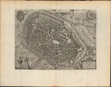 c 1613 Mons Belgium antique map ~ 17" x 13.2" by Guicciardini / Blaeu
-
$39.99
 1839 Stieler Physical Map Europe River Basins Mountain Ranges Rhine Danube Seine
-
$39.99
 1847 Stieler Map Europe France Spain Italy Germany England Austria Sweden Norway
-
$9.99
 1887 Cowperthwait Map - Europe France Italy Germany Spain Britain Russia Norway
-
$7.99
 1846 Bocage Map - Europe - Italy Spain France Germany Austria Britain Sweden
-
$54.40
 Russian Empire Baltic States Scandinavia Belgium Netherlands 1870 Mitchell map
-
$32.83
 1912 ANTIQUE MAP OF EUROPE RACES LANGUAGES AND RELIGION GERMANY POLAND UKRAINE


