 Antiques (US)
Africa Maps
Asia Maps
Australia/Oceania Maps
Celestial Maps
Central America/Caribbean Maps
Curiosities Maps
Digital Maps
Europe Maps
Map & Globe Mixed Lots
Map & Globe Reproductions
North America Maps
South America Maps
World & Celestial Globes
World Maps

-
$381.19

 John Richard 17th Century Caernarvon Decorative Reproduction Framed Map Exclent
-
$48.88
 2007 Aspen Colorado Map Pictorial Chris King Ski Hill Alps Main Street LARGE
-
$59.99
 1946 CARTOON MAP YOSEMITE A WILLY NILLY MAP BY BARNES 1946 REPRODUCTION 19"x13"
-
$6.20
 Ordnance Survey Map Landranger Series 128 Derby & Burton upon Trent Area
-
$31.07
 Unique Media Map: The World Laminated
-
$95.00
 1852 Map of San Francisco, digitally restored, giclee print, framed, $95
-
$9.09
 New York State Canalway Trail Map-cycling/biking Trail
-
$16.15
 Admiralty Chart Map Da Buonfornello A Castel Di Tusa Italy Italian Nautical Map
-
$7.40
 Old Ordnance Survey Maps Acock's Green & South Yardley Warwickshire 1913
-
$4.34
 Ordnance Survey (OS) Map 1:25,000 Pathfinder Sheet SK 21/31 Ashby-de-la-Zouch
-
$9.93
 West Devon Ordnance Survey Map SW Roadford Lake Broadwoodwidger Large 1992 SX49
-
$14.92
 ADMIRALTY ROUTEING CHART SOUTH ATLANTIC OCEAN 5125 (9) SHIPPING MAP
-
$4.34
 Ordnance Survey Map 1:25000 Pathfinder Sheet SP 03/13 Broadway, Chipping Campden
-
$6.20
 Ordnance Survey Map Landranger Series 146 Lampeter & Llandovery Area
-
$8.08
 Ordnance Survey Map Landranger Series Sheet No.114 Anglesey.
-
$7.45
 Ordnance Survey Map Landranger Series Dorchester and Weymouth area Sheet No.194
-
$9.93
 Devon Ordnance Survey Map Large 1992 SX49 NW Halwill Witherdon Wood Upcott
-
$14.92
 ADMIRALTY SHIPPING CHART ROUTEING NORTH ATLANTIC OCEAN 5124 (9) SHIPPING MAP
-
$4.96
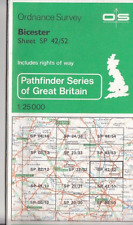 Ordnance Survey (OS) Map 1:25,000 Pathfinder Sheet SP 42/52 Bicester
-
$14.92
 ADMIRALTY SHIPPING CHART ROUTEING NORTH PACIFIC OCEAN 5127 (1) SHIPPING MAP
-
$3.72
 Bartholomew 1:100,000 National Map Series 34: The Lake District
-
$3.72
 Bartholomew 1:100,000 National Map Series 14: Oxford
-
$14.92
 ADMIRALTY SHIPPING MAP PORTSMOUTH HARBOUR NORTHERN PART 2628 WALL ART MAP
-
$3.72
 Bartholomew 1:100,000 National Map Series 19: Birmingham & Northampton
-
$9.33
 CHART MAP DEFENSE MAPPING DMAAC Soundings 52” X 35" TURKEY GREECE 54407
-
$4.96
 Ordnance Survey (OS) Map 1:25,000 Pathfinder Sheet SO 80/90 Stroud
-
$4.34
 Ordnance Survey (OS) Map 1:25,000 Pathfinder Sheet SO 63/73 Ledbury, Much Marcle
-
$8.69
 neots kimbolt HUNTINGDONSHIRE new art print repro ANTIQUE COUNTY MAP moule 1800s
-
$21.12
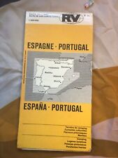 Vintage Large Pullout Map To Spain And Portugal
-
$6.83
 Ordnance Survey Map Landranger Series Snowdon & Surrounding Area Sheet No.115
-
$21.12
 Vintage Large Pullout Map To Walsall The Black Country
-
$6.20
 Ordnance Survey Map Landranger Series Sheet No 163 Cheltenham & Cirencester Area
-
$4.34
 Ordnance Survey (OS) Map 1:25,000 Pathfinder Sheet SK 63/73 Radcliffe on Trent
-
$31.07
 Garnons Williams Framed Map of the QE2 & Other Historic Atlantic Ocean Crossings
-
$12.42
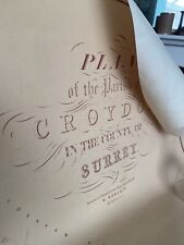 Old map Of croydon - 1847
-
$3.72
 Bartholomew 1:100,000 National Map Series 9: London & Surrey
-
$7.40
 OLD ORDNANCE SURVEY MAP PONTYPOOL (NORTH) 1899
-
$8.69
 uni college CAMBRIDGE new art print repro ANTIQUE CITY TOWN MAP moule 1800s
-
$21.12
 Vintage Large Pullout Map To Ben Nevis , Fort William
-
$6.83
 Ordnance Survey Map Landranger Series Weston-super-Mare area Sheet No.182
-
$8.69
 guildford etc SURREY new art print repro ANTIQUE COUNTY MAP thomas moule 1800s
-
$7.40
 Old Ordnance Survey Map Warrington 1893 Lancashire Sheet 116.01a
-
$8.69
 ledbury leomins HEREFORDSHIRE new art print repro ANTIQUE COUNTY MAP moule 1800s
-
$14.92
 ADMIRALTY SHIPPING MAP ROUTEING SOUTH ATLANTIC OCEAN 5125 (10)
-
$4.96
 Ordnance Survey Map 1:25,000 Pathfinder Sheet TQ 23/33 Crawley
-
$4.96
 Ordnance Survey (OS) Map 1:25,000 Pathfinder SP 01/11 Northleach & Andoversford
-
$31.07
 Unique Media Map: Niagara Falls Laminated
-
$9.93
 West Devon Ordnance Survey Map NE Beaworthy Northlew South West Large 1992 SX49
-
$14.92
 ADMIRALTY SHIPPING CHART ROUTEING SOUTH ATLANTIC OCEAN 5125 (5) SHIPPING MAP
-
$4.96
 Ordnance Survey (OS) Map 1:25,000 Pathfinder Sheet SJ 02/12 Tanat Valley
-
$4.96
 Ordnance Survey (OS) Map 1:25,000 Pathfinder Sheet SO 80/90 Stroud
-
$7.40
 OLD ORDNANCE SURVEY MAP CAMBRIDGE (NORTH) 1901
-
$4.96
 Ordnance Survey (OS) Map 1:25,000 Pathfinder SS 83/93 Exford & Brendon Hills (W)
-
$4.96
 Ordnance Survey (OS) Map 1:25,000 Pathfinder Sheet SK 03/13 Uttoxeter
-
$4.34
 Ordnance Survey (OS) Map 1:25,000 Pathfinder Sheet SE 06/16 Grassington, Pateley
-
$12.00
 Tartan Map Of Scotland
-
$31.07
 STANFORD 1998 ERA 1/25000 LARGE MAP CHART FOLDED LIGHT WEAR NORFOLK -
-
$4.96
 Ordnance Survey (OS) Map 1:25,000 Pathfinder Sheet SP 04/14 Vale of Evesham
-
$4.96
 Ordnance Survey (OS) Map 1:25,000 Pathfinder Sheet SO 80/90 Stroud
-
$3.72
 Bartholomew 1:100,000 National Map Series 41: The Borders
-
$18.65
 Daily Telegraph Roger Lascelles Map of the World 3rd Ed 2004 Encapsulated Rolled
-
$14.92
 ADMIRALTY SHIPPING CHART ROUTEING SOUTH ATLANTIC OCEAN 5125 (6) SHIPPING MAP
-
$3.72
 Bartholomew 1:100,000 National Map Series 15: Herts & Bucks
-
$31.07
 STANFORD 1998 ERA 1/25000 LARGE MAP CHART FOLDED LIGHT WEAR NORFOLK
-
$8.69
 EAST RIDING YORKSHIRE new art print repro ANTIQUE COUNTY MAP thomas moule 1800s
-
$3.72
 Bartholomew 1:100,000 National Map Series 55: Inverness & Moray Firth
-
$6.20
 Ordnance Survey Map Landranger Series No.140 Leicester & Coventry Area
-
$4.96
 Ordnance Survey 1:25,000 Outdoor Leisure Map 7 English Lakes South Eastern Area
-
$7.46
 Worcester Map Fast Find
-
$8.69
 dorchester dorset DORSETSHIRE new art print repro ANTIQUE COUNTY MAP moule 1800s
-
$8.69
 newport MONMOUTHSHIRE new art print repro ANTIQUE COUNTY MAP moule 1800s
-
$8.69
 grimsthorpe LINCOLNSHIRE new art print repro ANTIQUE COUNTY MAP moule 1800s
-
$8.69
 environs PLYMOUTH & DEVONPORT new art print repro ANTIQUE COUNTY MAP moule 1800s
-
$8.69
 norwich NORFOLK new art print repro ANTIQUE COUNTY MAP moule 1800s coloured
-
$8.69
 peterborough NORTHAMPTONSHIRE new art print repro ANTIQUE COUNTY MAP moule 1800s
-
$8.69
 london MIDDLESEX new art print repro ANTIQUE COUNTY MAP moule 1800s coloured
-
$7.40
 MAP OF BIRTLEY 1895 (REVISED EDITION)
-
$4.96
 Ordnance Survey Map 1:25000 Pathfinder Sheet SP 03/13 Broadway, Chipping Campden
-
$8.69
 SUSSEX brighton lewes new art print repro ANTIQUE COUNTY MAP thomas moule 1800s
-
$6.83
 Ordnance Survey Map Landranger Series sheet 80 Cheviot Hills Kielder Forest area
-
$4.96
 Ordnance Survey Map 1:25000 Pathfinder Sheet SX 69/79 Belstone & Cheriton Bishop
-
$7.45
 Ordnance Survey Map of Worcester & Malverns - Landranger Sheet 150 (1980) WORCS
-
$8.69
 hemel albans HERTFORDSHIRE new art print repro ANTIQUE COUNTY MAP moule 1800s
-
$6.20
 Ordnance Survey Landranger Map No.110 Sheffield & Huddersfield Area 1:25,000
-
$8.69
 devon DEVONSHIRE new art print repro ANTIQUE COUNTY MAP thomas moule 1800s
-
$8.69
 empingham stam RUTLANDSHIRE new art print repro ANTIQUE COUNTY MAP moule 1800s
-
$8.69
 SAFFRON colchester etc ESSEX new art print repro ANTIQUE COUNTY MAP moule 1800s
-
$8.69
 darlington auckland DURHAM new art print repro ANTIQUE COUNTY MAP moule 1800s
-
$8.69
 BOSTON LINCOLNSHIRE new art print repr ANTIQUE CITY TOWN MAP ENGLAND moule 1800s
-
$6.83
 Ordnance Survey Map Landranger Series Ashford & Romney Marsh area Sheet No.189
-
$8.69
 ramsgate broad ISLE OF THANET new art print repro ANTIQUE COUNTY MAP moule 1800s
-
$6.20
 Ordnance Survey Map Landranger Series Denbigh & Colwyn Bay Area Sheet No.116
-
$8.69
 CARLISLE cumbria CUMBERLAND new art print repro ANTIQUE COUNTY MAP moule 1800s
-
$6.83
 Ordnance Survey Outdoor Leisure Map No.2 Yorkshire Dales Western Area
-
$8.69
 wallingford etc OXFORDSHIRE new art print repro ANTIQUE COUNTY MAP moule 1800s
-
$8.69
 morpeth NORTHUMBERLAND new art print repro ANTIQUE COUNTY MAP moule 1800s
-
$8.69
 preston LANCASHIRE new art print repr ANTIQUE COUNTY illustrated MAP moule 1800s
-
$8.69
 KENT new art print repro ANTIQUE COUNTY MAP moule 1800s COLOURED ILLUSTRATED
-
$6.83
 Ordnance Survey Map Landranger Series Leeds, Bradford & Harrogate Sheet No 104
-
$21.12
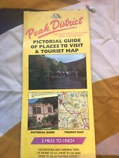 Vintage Large Pullout Map And Guide To The Peak District


