-

$55.96
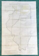 Antique 1837 Historical ILLINOIS Map, Detailed, Shows Very Early Chicago, VG+++
-
$15.16
 Original Antique 1837 ST. HELENA, LOUISIANA DISTRICT MAP, Very Scarce
-
$61.16
 1826 Edward Mogg Large Antique Map of the Roads of England, Wales & Scotland
-
$15.96
 Antique 1837 SOUTH WESTERN DISTRICT LOUISIANA MAP, Sabine & Red Rivers, Color
-
$15.96
 Original Antique 1837 DISTRICT NORTH OF THE RED RIVER LOUISIANA Map, Very Scarce
-
$15.96
 Antique 1837 SOUTH EASTERN DISTRICT LOUISIANA MAP, Mississippi River, Bayou’s
-
$62.72
 1811 Ordnance Survey Folding Map mile=1 inch. Sht. 16. Swanage env.
-
$62.72
 1811 Ordnance Survey Folding Map mile=1 inch. Sht. 15. Cranborne env.
-
$12.53
 1900 Ordnance Survey Folding Map mile=6 inch. Tring, Buckland, Hertfordshire
-
$12.53
 1926 Ordnance Survey Folding Map mile=6 inch. Berkhamstead, Herts
-
$62.72
 1811 Ordnance Survey Folding Map mile=1 inch. Sht. 17. Dorchester env.


