
-
$199.00

 1904 HAWAII TERRITORY GENERAL LAND OFFICE LARGE FOLDING MAP by FRANK BOND H/C
-
$150.99
 VINTAGE 1940s JAPAN TOURIST MAP "BIRD'S-EYE-VIEW KYOTO AND ITS ENVIRONS" 30x10"
-
$125.00
 Rare 1924 Poates Highway and Regional Guide of the United States Leather case
-
$250.00
 MAP of CHICAGO FIRE 1871 SHOWING THE BURNT DISTRICT ANTIQUE COLBERT & CHAMBERLIN
-
$21.30
 1891 KANSAS MAP ANTIQUE FULL COLOR RAILROADS RIVERS MOUNTAINS MISSOURI RIVER
-
$12.00
 Vintage 1952 Tourist Map STOCKHOLM SWEDEN b&w photos
-
$3.95
 Map CASPIAN SEA National Geographic Magazine 1999 Sea Between Iran and Russia
-
$16.89
 Topographic Map of Charles County, Maryland
-
$5.91
 THE CLOSING OF THE FAILASE "POCKET" AS AT 18-20 AUGUST 1944, WW2 Map
-
$17.95
 1918 MAP OF THE WESTERN THEATRE OF WAR National Geographic Society Antique
-
$9.88
 Vintage 1982 National Geographic Map Southwest USA The Making Of America L👀k!
-
$104.99
 Antique Colonial NY Map New York Province North America Land Grants Pease 1849
-
$11.00
 Vieques Puerto Rico Discovery Map 2024 Puerto Rico 17” X 22”
-
$377.00
 SALE - 1834 Ohio Augustus Mitchell Tourist Pocket Book Map Framed
-
$49.73
 1882 Map of the Nguru mountain district Tanzania coast antique vintage
-
$150.00
 Circa 1848 US Map Of Upper And Lower Gold Mines Of Mormon Diggings
-
$18.50
 vintage lot 1955 MAP / brochures Germany: Baden-Wurttemberg, Bavaria, Stuttgart
-
$24.90
 Antique Map 1906 Pontotoc County Mississippi Ecru Buckhorn Goodfood Robbs #13201
-
$10.95
 Vintage 1970-71 City of Garland, Texas Official Street Map W4
-
$69.99
 1920 NEW YORK HARBOR N.Y. WATER TERMINAL & TRANSFER FACILITIES MAPS 5 MAPS!
-
$24.99
 Ketchum Blaine County Idaho T4N R17E Plat Map Blueprint OldPaperMaps
-
$31.50
 1891 ALASKA MAP ANTIQUE FULL COLOR RAILROADS RIVERS MOUNTAINS ALEUTIAN ISLANDS
-
$21.30
 1891 PENNSYLVANIA MAP ANTIQUE FULL COLOR RAILROADS MOUNTAINS VICTORIAN ERA ERIE
-
$89.95
 1917 antique MAP of ALASKA ATLIN YUKON white pass yukon railroad 31x 22 w color
-
$9.99
 1913 DRAINAGE BASIN OF THE MISSISSIPPI RIVER COLOR MAP 12 x 17!
-
$88.99
 Antique New England Map New Belgium Original 1849 Pease Litho of Lucini 1634 Map
-
$9.99
 1911 BRONX RIVER NEW YORK ENGINEERING MAPS 2 MAPS!
-
$9.99
 1916 SHOALS IN POINT JUDITH HARBOR RHODE ISLAND ENGINEERING MAP!
-
$111.90
 * Rare * Copperplate Engraved Map of Essex By John Seller Hand Coloured 1695
-
$187.50
 Rocky Mountains Canada Geological Range 1886 Dawson large folding map
-
$74.50
 Antique 1870 Mineral Chart Map Of Japan Nippon Kiusi Sikok & Part Of Korea
-
$3999.16
 RARE! Antique 1916 Street Tree System NYC Manhattan Orig. Hand Colored Map/Book!
-
$21.30
 1891 NORTH CAROLINA MAP ANTIQUE FULL COLOR RAILROADS MOUNTAINS VICTORIAN ERA
-
$20.00
 Lot of 6 Vintage Bartholomew's GREAT BRITAIN Cloth 1" to Mile Maps
-
$9.99
 1916 INLAND WATERWAYS BEAUFORT HARBOR-NEW RIVER & SWANSBORO-NEW RIVER N.C. MAP!
-
$70.00
 Eighteenth Century Hand-Col. Map of London & Environs, 1787 - PRICE REDUCED
-
$60.00
 1914 Rand McNally Montana Large Color Folding Map & Guide Highways Railroads
-
$12.89
 Geologic Atlas of Texas: Clovis Sheet, Geologic Map
-
$500.00
 1885 Map Of Egyptian Soudan & Large Scale Map Of Egypt Showing Lower Nile
-
$133.20
 Old Antique Vtg Ca 1854 Map Harbor of Hakodadi Japan 18X24 Commodore Perry USN
-
$12.00
 1962 Benton County Iowa Electric Co-op Map 18 X 24" Vintage Map
-
$15.00
 Bartholomew Clan Map 'Scotland of Old', Sir Iain Moncreiffe; Don Pottinger, Fold
-
$14.99
 Corsica Tourist Map Sardinia Large Italy Italian Corse Agence du Tourism 2000s
-
$40.00
 Enlarged Pictorial Plan of London Foldout Map. Chas. Baker & Co. c.1912
-
$10.00
 Vintage French Military Battle Map 22in By 18in
-
$9.99
 1916 U.S. WEATHER BUREAU COLOR MAP NORMAL ANNUAL PERCIPITATION INCHES!
-
$9.99
 1914 INLAND WATERWAY FROM NORFOLK VA. TO BEAUFORT INLET N.C. MAP 13.25 x 20.75!
-
$35.50
 1891 MONTANA MAP WYOMING IDAHO ANTIQUE FULL COLOR RAILROADS RIVERS MOUNTAINS VTG
-
$99.00
 1834 Map Of The TOWNSHIPS In The Province of UPPER CANADA
-
$21.75
 USGS Topographic Map SWEET GRASS HILLS Montana USA Alberta Canada -1984- 100K
-
$24.20
 OAHE RESERVOIR--8--different- Fishing Topo Structure - Graphic. Map-Waterproof
-
$19.99
 1910 SEA LEVEL PROJECT BETWEEN PAMLICO SOUND AND BEAUFORT INLET N.C. GENERAL MAP
-
$12.89
 Geologic Map: Bear Creek Quadrangle, Texas
-
$38.95
 1884 antique CHICOPEE FALLS ma MAP foldout likely from directory
-
$9.99
 1911 NEW BEDFORD & FAIRHAVEN HARBORS MASS. EXTENDING TO BELLEVILLE WHARF 2 MAPS!
-
$10.00
 Vintage French Military Map Castiglione Maneuver 22in By 18in
-
$6.99
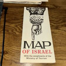 Map of Israel, Ministry of Tourism 1978 Fold out Map Guide travel info
-
$25.00
 Bartholomews Historical Map Of London Cloth + Geographia LONDON Street Plan
-
$145.00
 1964 BOHEMIAN GROVE FOLD OUT MAP WITH LIST OF ALL CAMPS AND MEMBERS EX CONDITION
-
$12.00
 Vintage French Military Map 43rd Division 26 1/2in By 11in Suitable For Framing
-
$1.00
 REALTOR MAP OF JEFFERSON AND ORLEANS PARISHES LOUISIANA
-
$10.00
 Vintage French Military Map The Attack 1st Phase 22in By 18in
-
$10.00
 Vintage French Military Map Attack fronts in 1918 22in By 18in
-
$20.00
 Vintage 1957 Gibraltar Michigan Zoning Map
-
$24.85
 Vintage Ordnance Survey Map, Aldershot Command c1925 Military, 1" - 1 Mile
-
$19.95
 Hagstroms Map Of Queens New York 1950's Subways, Elevated Surface Lines
-
$10.00
 Vintage French Military Map French And German Trenches In 1916 22in By 18in
-
$10.00
 Vintage French Military Map Division from October 9 to 11, 1918 22in By 18in
-
$10.00
 Vintage French Military Map Maneuvers Of The 1st Army 22in By 18in
-
$10.00
 Vintage French Military Map The 4th Corps at Virton 22in By 18in
-
$9.99
 1911 INTRA-COASTAL WATERWAY ANCLOTE RIVER TO SOUTH END CLEARWATER HARBOR FL MAP
-
$21.30
 1891 VIRGINIA MAP WEST VIRGINIA ANTIQUE COLOR RAILROADS MOUNTAINS VICTORIAN ERA
-
$12.00
 Vintage French Military Maps Of Defense 22in By 18in Suitable For Framing
-
$21.45
 USGS Topographic Map NEWBERRY - South Carolina - 1986 - 100K -
-
$12.00
 Vintage French Military Map Battle Of Bautzen 18in By 22in Suitable For Framing
-
$12.00
 Vintage French Military Map Battle Of Lutzen 22in By 18in Suitable For Framing
-
$14.99
 USGS Planimetric Map St Louis Missouri Illinois 1985
-
$12.89
 USGS Geologic Map: John Day Quadrangle, Oregon
-
$24.90
 Antique Map 1907 Talladega County Alabama Estaboga Lincoln Eureka Curry #13126
-
$22.99
 Large-Format 1932 Boundary Disputes WORLD MAP Railroads Manchuria Bolivia Peru
-
$19.99
 1919 NORFOLK HARBOR VIRGINIA WATER TERMINALS ENGINEERING MAP 22 x 30.50!
-
$25.00
 1913 Map of Central America, Cuba, Porto Rico & Islands Of The Caribbean Sea
-
$24.90
 Antique Map 1915 Davidson Cty N Carolina Lexington Thomasville Hornytown #13012
-
$9.99
 1916 NEWARK BAY NEW JERSEY ENGINEERING MAP 18.25 x 27.75!
-
$29.99
 1890 MISSOURI RIVER SHOWING LAND ERODED BETWEEN 1879 AND 1890 COLOR MAP!
-
$6.50
 USGS Topographical maps, Sierra Nevada, California 15 minute series, choice of 3
-
$14.99
 USGS Planimetric Map Rolla Missouri 1986
-
$12.00
 Vintage French Military Map Of Montdidier 18in By 12 1/2in Suitable For Framing
-
$14.99
 USGS Planimetric Map Joplin Missouri Kansas 1986
-
$19.99
 1920 BALTIMORE HARBOR MARYLAND TERMINALS W/WIND CHART ENGINEERING MAP 22 x 30.50
-
$12.89
 USGS Geologic Map: Paradise Quadrangle, Utah
-
$19.99
 1927 TOUR EUROPE IN YOUR OWN CAP BROCHURE MAP INTERNATIONAL MERCANTILE MARINE CO
-
$18.50
 Vintage Historical Folding Cloth Map Of England & Wales By L.G. Bullock 1965
-
$26.10
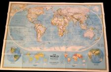 National Geographic Society THE WORLD MAP Physical Political 1994 43 x 30 inches
-
$14.99
 USGS Topographic Map Mountain Grove Missouri 1983 quadrangle
-
$24.95
 Vintage Map Contour Town Buildings KASTRO SIFNOS GREECE Historical Brochure 1972
-
$7.90
 SINCLAIR HC GASOLINE INDIANA ROAD MAP & SIGHT SEEING GUIDE VINTAGE
-
$7.95
 North Cascades National Park 1974 USGS Topo Map Ross Lake Chelan Washington
-
$75.00
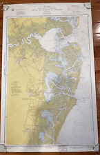 1960 Vintage Nautical Map Atlantic City to Cape May NJ Shore C.&G.S. 38”x24
-
$129.00
 1966 (Honshu-NW Coast) Niigata Ko Japan Survey Map


