
-
$74.99

 1936 Territory of Alaska Steamship Company Map Vintage McCaffrey Damaged
-
$377.00
 SALE - 1834 Ohio Augustus Mitchell Tourist Pocket Book Map Framed
-
$159.99
 Vintage 1938 Map Historic & Scenic Reaches of the Nation's Capital Washington DC
-
$175.00
 Large 28 x 44 Soviet Union Map, 1986, Vintage, near mint condition, in Russian
-
$12.95
 Lake Palestine, Texas, Map 1988 - Emerald Bay, Dogwood City, Chandler
-
$7.95
 Mount Adams Washington Green Trails Map 2001 South Cascades #367S Topographic
-
$21.30
 1891 SCOTLAND NORTH SEA ATLANTIC ICEAN HEBRIDES ANTIQUE MAP COLOR VICTORIAN ERA
-
$21.30
 1891 AUSTRIA HUNGARY TYROL BOHEMIA MONARCHY ANTIQUE MAP COLOR VICTORIAN ERA
-
$21.30
 1891 ASIA CHINA INDIA PERSIA ARABIA SIBERIA SIAM ANTIQUE MAP COLOR VICTORIAN ERA
-
$21.30
 1891 ENGLAND WALES IRISH SEA NORTH SEA CHANNEL MAP ANTIQUE COLOR VICTORIAN ERA
-
$19.99
 1914 THE DELTA OF COLORADO RIVER SALTON SEA & IMPERIAL VALLEY COLOR MAP!
-
$49.99
 Antique 1890 Railroad Map of Pennsylvania Folded in Binder, Large 56x37 in. GC
-
$11.95
 Vintage Idaho Centennial 1890-1990 Official Highway Map - MINT
-
$31.15
 1882 Map of Lake Tanganyika Tanzania Congo Zambia Burundi Africa antique vintage
-
$299.00
 The Netherlands Map. The region Around the city of Utrecht. 1660?s by W. Blaeu
-
$218.08
 1794 Country Around Manchester Large Folding Map by Stockdale 84 cm x 81 cm
-
$9.99
 1915 BUFFALO HARBOR NY INNER HARBOR ENTRANCE CHANNEL MAP 19.25 x 27!
-
$21.30
 1891 IRAN AFGHANISTAN TURKESTAN CENTRAL ASIA ANTIQUE MAP COLOR VICTORIAN ERA
-
$19.95
 Hagstroms Map Of Queens New York 1950's Subways, Elevated Surface Lines
-
$19.99
 1920 Antique California Road Map -- Folding, 28x33" Unfolded, Good (OFFERS?)
-
$12.89
 USGS Geologic Map: Spring Canyon Quadrangle, New Mexico
-
$12.89
 USGS Geologic Map: United States 37th Parallel Geologic & Crustal Cross Section
-
$19.99
 USGS NOAA Topographic-Bathymetric Map Seattle North WASHINGTON 1:250K 1983
-
$31.50
 1891 INDIA BAY OF BENGAL CASHMERE CEYLON PUNJAB MAP ANTIQUE COLOR VICTORIAN ERA
-
$9.99
 1916 SHOALS IN POINT JUDITH HARBOR RHODE ISLAND ENGINEERING MAP!
-
$69.99
 1920 NEW YORK HARBOR N.Y. WATER TERMINAL & TRANSFER FACILITIES MAPS 5 MAPS!
-
$89.99
 Original Rare Large Folding Black And White Map Of The Territory Of Arizona 1886
-
$12.89
 Geologic Map: Dry Branch Quadrangle, Texas
-
$112.15
 * Rare * Copperplate Engraved Map of Essex By John Seller Hand Coloured 1695
-
$150.99
 VINTAGE 1940s JAPAN TOURIST MAP "BIRD'S-EYE-VIEW KYOTO AND ITS ENVIRONS" 30x10"
-
$74.99
 Vtg George Avey Pictorial Cartoon Humor Tourist Map in 1940 Arizona Highways Mag
-
$129.00
 1946 South Pacific (incls. W. Coast of South America) Oceanographic Survey Map
-
$10.23
 Geologic Map Anthracite-Bearing Rocks Pottsville Quad Schuylkill County PA 1972
-
$89.95
 1917 antique MAP of ALASKA ATLIN YUKON white pass yukon railroad 31x 22 w color
-
$31.50
 1891 WORLD MAP GLOBE WESTERN EASTERN HEMISPHERES MAP ANTIQUE COLOR VICTORIAN ERA
-
$14.89
 Geothermal Resources of Wyoming Map
-
$19.99
 Large-Format 1955 GEOLOGIC MAP CANAL ZONE & ADJOINING PARTS OF PANAMA Woodring
-
$34.20
 1940s Cardboard World Fold-O-Globe, Gerald Allen Eddy c. 1942 LA California Vtg
-
$75.00
 Rare Nova Totius Terrarum Orbis Geographica AC Hydrographica Tabula
-
$150.00
 Circa 1848 US Map Of Upper And Lower Gold Mines Of Mormon Diggings
-
$9.99
 1916 U.S. DEPT. AGRICULTURE WEATHER BUREAU COLOR MAP NORMAL ANNUAL TEMPERATURE!
-
$12.00
 Vintage 1952 Tourist Map STOCKHOLM SWEDEN b&w photos
-
$5.00
 Map Bird Migrations of North Americas
-
$14.99
 USGS Planimetric Map Joplin Missouri Kansas 1986
-
$1.00
 REALTOR MAP OF JEFFERSON AND ORLEANS PARISHES LOUISIANA
-
$9.99
 1911 U.S. TRANSPORTATION ROUTES SHOWING RAILROADS ENGINEERING MAP 18 x 27!
-
$15.00
 ARIZONA PICTURE MAP Brochure Pic.Tour Art by Don Bloodgood
-
$104.99
 Antique Colonial NY Map New York Province North America Land Grants Pease 1849
-
$6.99
 National Geographic Magazine Map Supplement July 1991 China
-
$21.30
 1891 GEORGIA MAP ANTIQUE FULL COLOR RAILROADS RIVERS MOUNTAINS VINTAGE COAST
-
$9.88
 Vintage 1982 National Geographic Map Southwest USA The Making Of America L👀k!
-
$24.90
 Antique Map 1906 Pontotoc County Mississippi Ecru Buckhorn Goodfood Robbs #13201
-
$52.50
 MANHATTAN NYC MAP 1664 DUKE'S PLAN FINE LITHOGRAPH HAND-DRAWN 1957 FULL COLOR
-
$11.00
 Vieques Puerto Rico Discovery Map 2024 Puerto Rico 17” X 22”
-
$9.99
 1911 BRONX RIVER NEW YORK ENGINEERING MAPS 2 MAPS!
-
$225.00
 An Accurate Map of North America with the New Discoveries 1799 D. Ogilby Wow!!
-
$18.50
 vintage lot 1955 MAP / brochures Germany: Baden-Wurttemberg, Bavaria, Stuttgart
-
$88.99
 Antique New England Map New Belgium Original 1849 Pease Litho of Lucini 1634 Map
-
$23.99
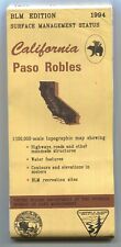 USGS BLM edition Topographic Map PASO ROBLES California 1994 -100K-
-
$9.99
 1911 NEW BEDFORD & FAIRHAVEN HARBORS MASS. EXTENDING TO BELLEVILLE WHARF 2 MAPS!
-
$70.00
 Eighteenth Century Hand-Col. Map of London & Environs, 1787 - PRICE REDUCED
-
$21.30
 1891 MONTANA MAP WYOMING IDAHO ANTIQUE FULL COLOR RAILROADS RIVERS MOUNTAINS VTG
-
$17.95
 1918 MAP OF THE WESTERN THEATRE OF WAR National Geographic Society Antique
-
$39.90
 Antique 1903 Map Leesburg Virginia area Harpers Ferry Bloomfield 22"X26" #21009
-
$19.00
 1891, California, Big Trees Quadrangle,USGS Survey Map,Land Class/Timber Density
-
$10.20
 2014 Map Of Paris Printemps Paris Fold Out Map
-
$9.99
 1911 INDEX MAP OF MISSOURI RIVER VICINITY OF OMAHA NEBRASKA & COUNCIL BLUFFS IA.
-
$9.99
 1916 INLAND WATERWAYS BEAUFORT HARBOR-NEW RIVER & SWANSBORO-NEW RIVER N.C. MAP!
-
$12.99
 Geologic Atlas of Texas: Abilene Sheet, Geologic Map 1972
-
$9.99
 1916 U.S. WEATHER BUREAU COLOR MAP NORMAL ANNUAL PERCIPITATION INCHES!
-
$10.89
 Vintage 1940s Travel Bureau Pocket Map Of Panama w Points of Historic Interest
-
$69.99
 1954 Kroll SEATTLE New City Limits Street Map Bus Routes Piers Lake Washington
-
$42.00
 1914 New York City Guide Book & Large Map, "King's How To See NY" - NEW PRICE
-
$16.89
 Topographic Map of Charles County, Maryland
-
$24.99
 Ketchum Blaine County Idaho T4N R17E Plat Map Blueprint OldPaperMaps
-
$9.99
 1914 INLAND WATERWAY FROM NORFOLK VA. TO BEAUFORT INLET N.C. MAP 13.25 x 20.75!
-
$24.95
 Vintage Map Contour Town Buildings KASTRO SIFNOS GREECE Historical Brochure 1972
-
$20.00
 Lot of 6 Vintage Bartholomew's GREAT BRITAIN Cloth 1" to Mile Maps
-
$9.99
 1916 LAKE SUPERIOR AND MISSISSIPPI CANAL AMNICON MOOSE AND ST. CROIX ROUTE MAP!
-
$9.99
 1913 DRAINAGE BASIN OF THE MISSISSIPPI RIVER COLOR MAP 12 x 17!
-
$9.99
 1911 INTRA-COASTAL WATERWAY ANCLOTE RIVER TO SOUTH END CLEARWATER HARBOR FL MAP
-
$38.95
 1884 antique CHICOPEE FALLS ma MAP foldout likely from directory
-
$12.89
 Geologic Atlas of Texas: Clovis Sheet, Geologic Map
-
$14.99
 Corsica Tourist Map Sardinia Large Italy Italian Corse Agence du Tourism 2000s
-
$60.00
 1914 Rand McNally Montana Large Color Folding Map & Guide Highways Railroads
-
$25.00
 1913 Map of Central America, Cuba, Porto Rico & Islands Of The Caribbean Sea
-
$9.97
 Ordnance Survey Quarter-Inch Map Eastern Highlands Sheet 5 Scotland 1946 cloth
-
$6.50
 USGS Topographical maps, Sierra Nevada, California 15 minute series, choice of 3
-
$14.93
 Vintage South Dakota map Vintage 1949 Collier's Encyclopedia Rand McNally
-
$8.49
 Australia Collins Map Featuring Bartholomew Mapping 1999 Pre Owned Paper Folded
-
$59.24
 Antique Map 1915 California Riverside San Bernardino Cucamonga Rialto #13061
-
$12.00
 Vintage French Military Maps Of Defense 22in By 18in Suitable For Framing
-
$15.00
 Bartholomew Clan Map 'Scotland of Old', Sir Iain Moncreiffe; Don Pottinger, Fold
-
$9.99
 1918 COLUMBIA RIVER OREGON & YOUNGS BAY OREGON PRELIMINARY EXAMINATION MAP!
-
$14.89
 2016 Gila National Forest West Side Motor Vehicle Use Map USDA Forest Service
-
$39.99
 1853 Gunnison Survey Map FOR NEW CHANNEL FROM MILWAUKEE RIVER TO LAKE MICHIGAN
-
$38.50
 Vintage Map Of The Island Of Tobago -E10A
-
$9.99
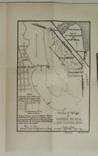 1916 HARBOR OF REFUGE AT HARBOR BEACH LAKE HURON MICHIGAN MAP!
-
$33.99
 1944 US ARMY MAP SERVICES Europe Road Series FRANCE 1:1,000,000 Corps Engineers
-
$250.00
 Very old map of Sarreguemines, France. Sarreguemi


