 Antiques (US)
Africa Maps
Asia Maps
Australia/Oceania Maps
Celestial Maps
Central America/Caribbean Maps
Curiosities Maps
Digital Maps
Europe Maps
Map & Globe Mixed Lots
Map & Globe Reproductions
North America Maps
South America Maps
World & Celestial Globes
World Maps

-
$300.00

 A Concise Gazetteer of the World for the Use of Schools by Earnshaw, 1824 7 Maps
-
$150.00
 Sacred geography a gazetteer of the bible by elijah parish 1813
-
$200.00
 the new biblical atlas and scripture gazetteer 1855
-
$34.99
 Collier's World Atlas and Gazetteer Old Maps 1940 Hardcover Color Black & White
-
$19.99
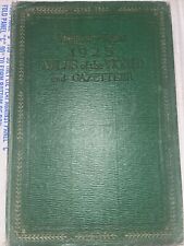
 1923 Atlas of the World and Gazetteer
-
$39.00
 Set Of 4 DeLorme Atlas & Gazetters Maryland Pennsylvania Virginia West Virginia
-
$13.00
 The literary digest 1929 atlas of the world and gazetteer
-
$15.75
 Map Oklahoma 1938 United States Print Atlas Antique Ephemera DWU7
-
$21.99
 Antique Nevada Map from Atlas 1920s 1921
-
$25.00
 The Official Maps of New England L. Crocker Topographer, National Survey Co.
-
$35.00
 1924 atlas of the world and gazetteer
-
$20.00
 Old 1855 Harper's Gazetteer Map ~ ASIA - HINDOOSTAN, ANAM, SIAM ~(LG20x24) #1110
-
$21.99
 Antique California Nevada Map from Encyclopedia 1910s 1911
-
$25.00
 The literary digest 1925 atlas of the world and gazetteer
-
$40.00
 newnes handy pocket atlas of the world and gazetteer
-
$30.00
 the literary digest atlas of the world and gazetteer 1927
-
$20.00
 Old 1855 Harper's Gazetteer Map ~ EUROPE ~(14x17) ~Free S&H -#1109
-
$185.00
 The American Gazetteer by Morse, 1810
-
$6.73
 1947 Vintage NORTH AMERICA Antique Relief Map - Hammond's Atlas & Gazetteer
-
$22.88
 1855 Harper's Gazetteer Map ~ BRITISH POSSESSIONS in NORTH AMERICA & NEW ENGLAND
-
$15.75
 Map Nevada 1938 Western United States Print Atlas Antique Carson City DWU7
-
$90.00
 Bible atlas and gazetteer 1862
-
$20.40
 Hammond's Global Strategy Maps: Containing Gazetteer & Map World with 4 Global..
-
$800.00
 New and Comprehensive Gazetteer of Virginia - Joseph Martin - 1835 - rare Va map
-
$21.99
 Antique New Mexico and New Jersey Map from Atlas 1920s 1921
-
$125.00
 a gazetteer of the state of new york by horatio spafford 1813
-
$15.75
 Map Kentucky 1938 United States Print Atlas Antique Frankfort Ephemera DWU7
-
$11.00
 Vtg 1954 Alabama Resources Products Economic Illustrated Map
-
$250.00
 A Universal Pronouncing Gazetteer With Map By Thomas Baldwin 1845
-
$375.00
 A new gazetteer of the eastern continent 1802 by jedidiah morse 17 Maps
-
$75.00
 M’Culloch’s universal gazetteer dictionary 1845 2 volume set
-
$150.00
 the universal gazetteer by john walker 1810
-
$10.00
 Vtg 1954 Montana Resources Products Economic Illustrated Map Hammond Doubleday
-
$15.75
 Map Western New York 1938 Buffalo Rochester Atlas United States Print DWU7
-
$11.00
 Vtg 1954 Africa Resource Relief Economic Illustrated Map Tanganyika Somaliland
-
$15.75
 Map 1938 United States Of America Print Antique Ephemera DWU8
-
$20.00
 Old 1855 Harper's Gazetteer Map ~ GREAT BRITAIN ~(XL20x25) -#1107
-
$99.99
 Gazetteer Of The World ATLAS 1909 Maps 34 X 39 Negros Indians Panama Canal RARE
-
$100.00
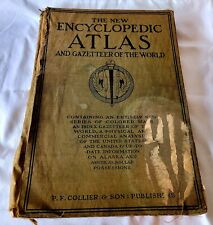
 The new encyclopedic atlas and gazetteer of the world 1917
-
$400.00
 Universal Gazetteer Being Concise Description by Walker John 1798
-
$15.75
 Map 300 BC Ancient Greece Hellas 1938 Atlas Print Dorian Ionian Aeolian DWU7
-
$24.99
 The New Encyclopedia Atlas And Gazetter Of The World 1914 Edition
-
$150.00
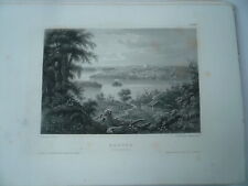 Nauvoo-Illinois, steelengraving, anno 1860, Meyers Universum, in New York
-
$9.00
 Vtg 1954 Nebraska Resources Products Economic Illustrated Map Hammond Doubleday
-
$15.75
 Map Saudi Arabia Middle East 1938 Print Antique Atlas Africa Iran DWU8
-
$34.99
 Map France Corse Spain Europe 1938 Print Antique Ephemera Atlas DWU8
-
$11.00
 Vtg 1954 Oregon Resources Products Economic Illustrated Map Hammond Doubleday
-
$15.75
 Map Dominion Of Canada And Newfoundland 1938 Print Antique Ephemera DWU8
-
$15.75
 Map Oregon 1938 United States Print Atlas Antique Pacific Northwest DWU7
-
$15.75
 Map Michigan Northern Peninsula 1938 United States Print Atlas Antique DWU7
-
$15.75
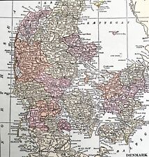
 Map Sweden Norway Denmark Europe 1938 Print Antique Atlas Scandinavia DWU8
-
$15.75
 Map Quebec Canada And Coastal Labrador 1938 Print Antique Ephemera DWU8
-
$15.75
 Map Spain And Portugal Europe 1938 Print Antique Ephemera Atlas France DWU8
-
$115.00
 Bible atlas and gazetteer 1862
-
$10.00
 Vtg 1954 South Dakota Resources Products Economic Illustrated Map Hammond
-
$6.67
 1947 Vintage EUROPE Antique Relief Map - Hammond's Superior Atlas & Gazetteer
-
$6.11
 1947 Vintage AUSTRALIA Antique Atlas Map - Hammond's Superior Atlas & Gazetteer
-
$30.00
 Antique Cairo Egypt City Map from Encyclopedia Pre-War WWI 1910s 1911
-
$15.75
 Map Colorado 1938 United States Print Atlas Antique Denver South Park DWU8
-
$15.75
 Map Connecticut 1938 United States Print Atlas Antique New England DWU8
-
$15.75
 Map South American North Section Brazil 1938 Print Antique Ephemera Atlas DWU8
-
$15.75
 Map Saskatchewan And Manitoba Canada 1938 Print Antique Ephemera DWU8
-
$15.75
 Map North Dakota 1938 United States Print Atlas Antique Northern Border DWU7
-
$6.94
 1947 Vintage PACIFIC OCEAN Antique Atlas Map Hammond Superior Atlas & Gazetteer
-
$15.75
 Map Northern California 1938 United States Print Antique Pacific Coast DWU8
-
$15.75
 Map Idaho 1938 Western United States Print Atlas Antique Boise Ephemera DWU7
-
$15.75
 Map Greece Albania Bulgaria Europe 1938 Print Antique Ephemera Atlas DWU8
-
$15.75
 Map Europe After Congress Of Vienna 1938 Atlas Print Antique Collectibles DWU7
-
$15.75
 Map 44 BC Roman Dominions Empire 1938 Atlas Print Antique Collectibles DWU7
-
$24.99
 GAZETTEER OF THE WORLD - World Map 1907
-
$15.75
 Map Mississippi 1938 United States Print Atlas Antique Southern DWU7
-
$15.75
 Map North Carolina 1938 United States Print Atlas Antique Ephemera Raleigh DWU7
-
$15.75
 Map South American South Section Argentina 1938 Print Antique Atlas DWU8
-
$15.75
 Map New Hampshire 1938 United States Print Atlas Antique New England DWU7
-
$59.95
 New England Gazetteer 1902 Book With Map Vermont New Hampshire Maine Mass
-
$15.75
 Map Louisiana 1938 Southern United States Print Atlas Baton Rouge Orleans DWU7
-
$100.00
 1909 gazetteer of the world the bullard company
-
$15.00
 Vintage Map of Milwaukee Wisconsin Gazetteer of Cities and Towns of the World
-
$15.75
 Map Of India 1938 Asia Print Antique Atlas Bay Of Bengal Arabian Sea DWU8
-
$30.00
 Antique Japan Korea Color Map from Encyclopedia 1910s 1911 Pre-war
-
$6.10
 1947 Vintage ASIA Antique Atlas Map - Hammond's Superior Atlas & Gazetteer
-
$30.00
 Antique Tibet China Color Map from Encyclopedia Pre-War WWI 1910s 1911
-
$35.00
 Antique Newark NJ New Orleans LA City Street Maps 1908 Gazetteer Page
-
$200.00
 The Graphic Atlas and gazetteer of the world 1890?
-
$15.75
 Map USSR As European Territory 1938 Print Antique Ephemera Atlas Russia DWU8
-
$15.75
 Map Finland Denmark Europe 1938 Print Antique Ephemera Atlas Scandinavia DWU8
-
$29.99
 DeLorme Atlas & Gazetteer Map: MASSACHUSETTS 1998 First Edition
-
$13.49
 Vintage Gazetteer For Greece 431 BC Map With Key Athens Sparta & Allies
-
$15.75
 Map Central America 1938 Print Antique Atlas Honduras Nicaragua Mexico DWU8
-
$24.79
 Hammond's Global Strategy Maps: Containing Gazetteer and Map of the World with 4
-
$11.00
 Vtg 1954 South Carolina Resources Products Economic Illustrated Map Hammond
-
$15.75
 Map Switzerland Europe 1938 Print Antique Ephemera Atlas Austria Italy DWU8
-
$11.00
 Vtg 1954 Ohio Resources Products Economic Illustrated Map Hammond Doubleday
-
$15.00
 Antique Arizona from Atlas 1920s 1921
-
$30.00
 Antique Italy Latium Color Map from Encyclopedia Pre-War 1910s 1911
-
$30.00
 Antique Germany German Empire Map from Encyclopedia Pre-War WWI 1910s 1911
-
$45.00
 1923 Atlas of the World and Gazetteer
-
$149.99
 S. Augustus Mitchell Color Map Kansas, Nebraska, Colorado and Idaho 1861
-
$100.00
 1907 gazetteer of the world the home educator company
-
$99.00
 Vintage 1955 West Virginia Atlas by Dr Sam E. Clagg Marshall College - Unique!


