
-
$695.00

 Original Lake Wallenpaupack Area Map Hand Drawn Property Map From 1950
-
$128.93
 South America School Map Large Display 66"x47" H Drawn By R.B Blair Made In USA
-
$129.99
 vtg art nouveau MAP antique sign MA CT NY photo crafts deco Hoover Vacuum sales
-
$79.99
 1923 ROAD MAP OF VANCOUVER ISLAND VICTORIA AND DISTRICT BLUE PRINT & MAP Co
-
$49.99
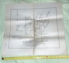 Cooke County Texas 1928 Working Sketch Linen Map by Architect John Menifee
-
$5.00
 Road Atlas of Europe - Kummerly & Frey - 1968
-
$37.48
 vintage map of brisbane queensland and places of interest australia
-
$37.48
 vintage tourist map sydney 1940s lovely pre opera house
-
$10.00
 Rand McNally Imperial Map Of The World 52x34 - All Purpose Map
-
$22.49
 1942 43 ww2 OLD map of DARLINGTON
-
$1250.00
 Original 1956 Pictorial Map Illustration of Oregon, Senator Wayne Morse Campaign
-
$150.00
 MONARCH WORLD ATLAS 338 pages maps, commerce, history, Geographical historical
-
$160.00
 1793. Map of the Swedish Empire with the Lapplands


