 Antiques (US)
-
$82.42

 MINNEAPOLIS ST PAUL MINNESOTA City Map Rand McNally 1901 Business Large Folio
-
$82.42
 MINNESOTA State Map Rand McNally 1901 Railroad RR Business City Large Folio
-
$115.00
 Johnson's 1864 Large colored map of Minnesota
-
$42.98
 Original 1861 Antique Map California Minnesota San Francisco Bay ++
-
$24.50
 4 Vintage northern Ely MN area Maps BWCA Rainy Kabetogama Moose Insula Crooked
-
$36.00
 Large Original 1898 Antique Map MINNESOTA Rochester Duluth Eagan Blaine Plymouth
-
$24.50
 3 Vintage northern Ely MN area Maps Basswood Knife Moose Seagull Agnes BWCA
-
$48.88
 Old 1909 Plat Map ~ AMBOY Twp., COTTONWOOD Co., MINNESOTA ~Free S&H
-
$69.99
 Vintage Atlas Plat Book Of BLUE EARTH County MN 1955 Thomas Nelson Minnesota
-
$14.50
 1912 Map State of Minnesota Original Color 15" x 23"
-
$59.99
 Vintage Atlas Plat Book Of COTTONWOOD County MN 1961 Thomas Nelson Minnesota
-
$48.88
 Rare Original 1874 Plat Map ~ CITY of DULUTH, ST. LOUIS CO., MINNESOTA (LG14x17)
-
$11.86
 Vintage MINNEAPOLIS Map City Street Wall Art Decor Minnesota DATED 1909
-
$55.00
 MINNESOTA Map 1912 ORIGINAL Counties Population Minneapolis St Paul Duluth
-
$23.76
 1897 ANTIQUE DATED MAP OF MINNESOTA / MINNEAPOLIS ST. PAUL
-
$20.76
 1932 ORIGINAL VINTAGE MAP OF MINNESOTA NORTH SOUTH DAKOTA NEBRASKA IOWA
-
$22.00
 Old Antique 1897 Atlas Map ~ MINNESOTA ~ (11x14) ~ Free S&H #331
-
$48.88
 1874 Map ~ DAKOTA TERRITORY & NEBRASKA, KANSAS, MINNESOTA (15x18)-#007
-
$48.88
 1914 Map GARDEN CITY Twp, LAKE CRYSTAL - LOON LAKE - BLUE EARTH Co, MINNESOTA
-
$10.00
 1875 FRANCIS MCNALLY ATLAS MAP-CALIFORNIA & MINNESOTA-GREAT DETAIL
-
$13.00
 1943 Vintage Map - The United States on March 4, 1861 - The Civil War
-
$15.30
 1893 MINNESOTA Map, Color Counties, Historical Points, 14" x 10.5"
-
$40.00
 Minnesota Twin Cities Minneapolis St Paul Duluth Mankato 1892 detailed state map
-
$14.50
 1912 Plat Map Part of White Earth Indian Reservation Clearwater County Minnesota
-
$16.96
 MINNESOTA Map Red Lake Indian Reservation White Earth Vintage 1920s Antique
-
$749.00
 1874 Illustrated Historical Atlas The State of Minnesota
-
$14.50
 1912 Plat Map Pine Lake Township Clearwater County Minnesota Gonvick
-
$20.46
 Antique 1896 ST PAUL MINNESOTA Map 14"x11" ~ Old Antique Original DAYTONS BLUFF
-
$59.88
 1916 UNITED STATES Map ORIGINAL LARGE Wisconsin Indiana Pennsylvania Delaware
-
$8.09
 1902 state map of Minnesota antique vintage Britannica 10th
-
$85.00
 Johnson's 1864 Large colored map of Mexico
-
$39.88
 1916 UNITED STATES Map ORIGINAL Rainfall Colorado Montana Michigan Wisconsin
-
$699.99
 Hanging Plat Map 1909 Minnesota Red Lake County B4 Pennington County Existed
-
$15.00
 Antique 1889 Map Dakota NC SC MN by George F Cram Unrivaled Family Atlas 13x20
-
$14.50
 1912 Plat Map Town of Gonvick Pine Lake Township Clearwater County Minnesota
-
$49.16
 Vintage 1900 ST PAUL MINNESOTA Map 14"x11" ~ Old Antique Original COMO PARK
-
$14.50
 1912 Plat Map Leon Township Clearwater County Minnesota Beard Clearbrook
-
$18.95
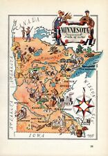 1940s Vintage Minnesota Picture Map Minnesota State Map Wall Art Decor 1561
-
$24.89
 1893 ANTIQUE MAP OF CITY OF DULUTH MINNESOTA / VERSO SIOUX CITY IOWA
-
$36.23
 1908 ORIGINAL ANTIQUE LARGE MAP OF MINNEAPOLIS / MINNESOTA
-
$5.99
 Vintage Pre World War WWII 1936 Atlas City Map St Louis, MO & St. Paul, MN L@@K!
-
$45.00
 Pope County Minnesota Atlas 1984
-
$11.95
 Vintage MINNESOTA Railroad Map 1940s Wall Art Original Minneapolis St Paul
-
$27.84
 Vintage 1903 MINNESOTA Map 14"x22" ~ Old Antique Original MINNEAPOLIS ST PAUL MN
-
$12.99
 1914 MINNEAPOLIS HARBOR MISSISSIPPI RIVER ENGINEERING MAPS 2 MAPS 14.75 x 20.25!
-
$49.99
 OFFICIAL COUNTY PLAT BOOK & FARMER'S DIRECTORY OF COTTONWOOD MINNESOTA 1950
-
$24.56
 Vintage 1902 MINNESOTA Map 11"x14" Old Antique Original STILLWATER TAYLORS FALLS
-
$69.99
 Vintage Atlas Plat Book Of FARIBAULT County MN 1955 Thomas Nelson Minnesota
-
$14.50
 1912 Plat Map Part of White Earth Indian Reservation Clearwater County Minnesota
-
$19.95
 Sanborn, Minnesota Original Vintage 1967 USGS Topo Map 27" x 22"
-
$48.88
 Old Dated 1874 Plat Map, CITY of PETER, MINNESOTA ~ Free S&H
-
$14.50
 1912 Plat Map State Park Clearwater County Minnesota Lake Itasca Elk Lake
-
$14.50
 1912 Plat Map Bear Creek Township Clearwater County Minnesota Alida
-
$36.00
 1879 Map West Central States Group Victorian Atlas Geography 1st Edition DWAA9
-
$48.88
 1910 Plat Atlas Map ~ TWIN VALLEY, NORMAN Co., MINNESOTA ~ Free S&H
-
$14.50
 1912 Plat Map Eddy Township Clearwater County Minnesota 148N 38W
-
$14.50
 1912 Plat Map Minerva Township Clearwater County Minnesota Upper Rice Lake
-
$14.50
 1912 Plat Map Town of Clearbrook Leon Township Clearwater County Minnesota
-
$27.99
 1901 Minnesota Geological Map Le Sueur County St Peter Waterville Ottawa Geology
-
$24.90
 Antique Map 1906 Minnesota Blue Earth Mankato Amboy Mapleton Good Thunder #13001
-
$39.00
 N.E. Minnesota Large State 1889 M Bradley & Bros Detailed Hand Colored Old Map
-
$15.26
 Vintage MINNESOTA Map Wall Art Decor State Original Antique St Paul Minneapolis
-
$9.99
 VINTAGE LAND ATLAS & PLAT BOOK 1996 AITKIN COUNTY MINNESOTA ROCKFORD MAP
-
$88.88
 Rare 1863 Map ~ DAKOTA TERRITORY - MINNESOTA ~ Johnson Map (14x18)-#009
-
$14.50
 1912 Plat Map City of Mallard Itasca Township Clearwater County Minnesota
-
$15.99
 1900 Rand McNally Map - Minneapolis & St. Paul Plans - Minnesota Capitol Parks
-
$23.76
 Vintage MINNESOTA Map Old Original LARGE Wall Art Duluth Minneapolis St Paul
-
$40.96
 Vintage 1901 MINNESOTA Map 14"x22" ~ Old Antique Original EAGAN EDINA WAYZATA MN
-
$48.88
 1912 Map OTTER TAIL Co MINNESOTA ~ CLITHERALL w WESTERN & AASTAD Twp on Reverse
-
$19.99
 1901 Winchell Minnesota Geological Map Carlton County Thompson Otter Creek MN
-
$27.99
 1926 Clason Auto Road Map Minnesota Minneapolis St. Paul Cloud Duluth Beaver Bay
-
$6.99
 Antique 1914 World War WWI Atlas City Map Minneapolis / St Paul, Minnesota, MN
-
$9.99
 c1905 Hammond Map Minnesota St. Pual Minneapolis Duluth Winona Brainerd Red Wing
-
$48.88
 1874 Plat Map AUSTIN, PRESTON, MINNESOTA / RUSHFORD, FILLMORE Co. on Reverse
-
$48.88
 1912 Plat Map ~ EAST ALEXANDRIA Twp., DOUGLAS Co., MINNESOTA ~ Free S&H
-
$9.99
 VINTAGE LAND ATLAS & PLAT BOOK 2021 COUNTY CARLTON MINNESOTA ROCKFORD MAP
-
$15.95
 Wisconsin & Minnesota Vintage 1894 MAP ~Unique Atlas ~ Original Color Map
-
$100.00
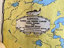
 Vintage 1950 Minnesota Boundary Water Map Big Saganaga Lake W.A. Fisher Company
-
$14.50
 1912 Plat Map Copley Township Clearwater County Minnesota Bagley Red Lake Road
-
$14.50
 1912 Plat Map Greenwood Township Clearwater County Minnesota Red Lake Indian res
-
$14.50
 1912 Plat Map Itasca Township Clearwater County Minnesota Mallard Gill Lake
-
$48.88
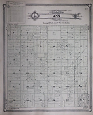 Old 1909 Plat Map ~ ANN Twp., COTTONWOOD Co., MINNESOTA ~Free S&H
-
$69.99
 Vintage Atlas Plat Book Of COTTONWOOD County MN 1954 Thomas Nelson Minnesota
-
$11.95
 Vintage MINNESOTA Topographic Map 1920s Antique Original Minneapolis Duluth
-
$7.99
 Vintage 1983 RICE County, Minnesota Rural Resident Directory Plat Book
-
$14.50
 1912 Plat Map Hangaard Township Clearwater County Minnesota Red Lake Indian Res
-
$48.88
 1912 Map OTTER TAIL Co., MINNESOTA ~ NORWEGIAN GROVE Twp. PADDOCK Twp. Reverse
-
$27.99
 1901 Minnesota Geological Map Rice County Northfield Faribault Limestone Geology
-
$14.50
 1912 Plat Map Winsor Township Clearwater County Minnesota
-
$14.99
 Antique Map of "Minnesota" 1886 Ed Britanica, Free Ship
-
$19.95
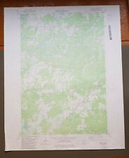 Bruno, Minnesota Original Vintage 1981 USGS Topo Map 27" x 22"
-
$39.99
 Vintage Atlas Plat Book Of Le SUENR County MN 1956 Thomas Nelson Co. Minnesota
-
$13.95
 Bird's Eye View 1879 Minneapolis Minnesota Vintage Style City Map - 16x24
-
$48.88
 Old 1880 Johnson's Atlas Map ~ MINNESOTA ~ Free S&H
-
$48.88
 1867 Map WASHINGTON TERRITORY - OREGON, MINNESOTA Johnson Atlas Map (18x26)-#014
-
$29.99
 Vintage 1941 Minnesota Minneapolis St. Paul City Street Map
-
$59.99
 Vintage Atlas Plat Book Of FARIBAULT County MN 1962 Thomas Nelson Minnesota
-
$40.14
 Vintage 1900 MINNESOTA Map 11"x14" Old Antique Original MINNEAPOLIS ST PAUL MN
-
$18.00
 1953 VINTAGE MAP OF MICHIGAN / VERSO MINNESOTA
-
$58.00
 1916 Minnesota Map Minneapolis Duluth Superior St Paul Roseau Henderson Westport


