 Antiques (US)
Africa Maps
Asia Maps
Australia/Oceania Maps
Celestial Maps
Central America/Caribbean Maps
Curiosities Maps
Digital Maps
Europe Maps
Map & Globe Mixed Lots
Map & Globe Reproductions
North America Maps
South America Maps
World & Celestial Globes
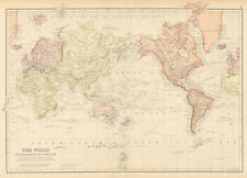
World Maps

-
$68.00

 Indian Ocean current Africa Australia c. 1850 German scientific oceanography map
-
$30.00
 map Germany WW2 westlicher Kriegsschauplatz Leipzig 1940
-
$85.00
 Johnson's 1864 colored map of Ocean Currents & Principal Plants
-
$24.90
 1893 GEOLOGICAL WORLD MAP Earth Surface Map Vintage ORIGINAL 11.5 x 9.5" C11-7
-
$17.95
 1916 Antique Map of The World Original Color Ocean Currents & Routes Railroads
-
$28.00
 1902 Century Map Physical World in Hemispheres South Pole Antarctica Mountains
-
$30.00
 WWII map Germany WW2 Turkey Italian Italy German Kriegsschauplatz Leipzig 1940's
-
$24.90
 1893 OCEAN CURRENTS Temperature Map Vintage Eng ORIGINAL 11.5 x 9.5" C12-4
-
$27.99
 1873 Guyot World Map Tidal Waves & River Basins Ocean Currents Tide Surf Antique
-
$19.99
 1883 Johnston Royal Atlas Map - World - Steamboat Routes & Ocean Currents
-
$16.00
 1874 Johnson Map World Ocean Currents River Basins Trade Winds Gulf Stream Tide
-
$24.90
 1893 OCEAN CURRENTS Temperature Map Vintage Eng ORIGINAL 11.5 x 9.5" C11-7
-
$26.46
 1899 ANTIQUE MAP OF THE WORLD VEGETATION OCEAN CURRENTS PLANTS AMERICA ASIA
-
$68.00
 Pacific Ocean Australia oceanography Ocean Currents c. 1850 scientific map
-
$60.00
 Currents of the Pacific Ocean Australia Polynesia New Zealand 1849 Berghaus map
-
$19.95
 World Map with Wind and Ocean currents by Dussieux 1846
-
$20.68
 Vintage 1896 WORLD OCEAN TIDES & CURRENTS MAP Old Antique Original & Authentic
-
$130.55
 Vintage Map Italian Govt Provisional Chart Gulf of Venice Mediterranean Sea 1956
-
$37.30
 Original antique map WORLD MAP, OCEAN CURRENTS, TELEGRAPH LINES, Stieler, 1889
-
$11.59
 The ATLANTIC OCEAN - 1895 Antique Map Print
-
$15.99
 1849 Bilder Atlas Map - Europe - Ocean Currents Alps Mountains Climate Temps
-
$18.00
 VINTAGE MAPS
-
$59.99
 1873 Color Map of the Globe in Hemispheres with Ocean Currents
-
$7.99
 ANTIQUE 1862 WORLD JOHNSON LAND GEOGRAPHY OCEAN CURRENT TIDAL MAP SURF SURFING
-
$950.00
 C. 1684 "Mappa Fluxus et Refluxus rationes in Isthmo America" NICELY FRAMED MAP
-
$62.17
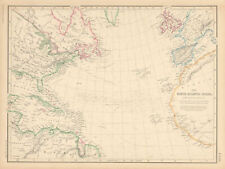
 BASIN OF THE NORTH ATLANTIC OCEAN, large original antique map, Johnston, 1871
-
$20.00
 1861 Original A.K.Johnston Map - CHART OF THE WORLD - Ocean Currents & Distances
-
$55.00
 Oceanography Ocean Currents Pacific Ocean Australia c.1850 detailed map
-
$100.00
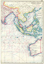
 Indian Ocean Southern Africa India Southeast Asia Currents 1856 information map
-
$159.00
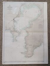 1935 Tokyo Wan Japan Hydrographic Survey Map
-
$76.00
 New Zealand 1883 Lett's map shows ocean currents submarine telegraph lines
-
$28.00
 1890 WORLD OCEAN CURRENTS Antique Map
-
$16.15
 1876 Antique map - North Atlantic Ocean, Gnomonic Projection - Bartholomew
-
$7.99
 ANTIQUE 1876 WORLD BASIN OCEAN CURRENT RAIN TIDES MAP SURFING INTEREST ASIA FINE
-
$26.00
 1910s Imperial Russian Antique map of WORLD PRECIPITATION and SEA STREAMS
-
$55.00
 Pacific Ocean showing currents oceanography 1873 von Sydow German map
-
$36.00
 1892 Rand McNally World Map Ocean Currents America Asia Africa Australia 14x21"
-
$55.00
 Indian Ocean Madagascar Southeast Asia Australia Ocean Currents 1873 map
-
$64.12
 .1922 INTERESTING LARGE MAP of THE WORLD. VEGETATION & OCEAN CURRENTS.
-
$31.08
 OCEAN CURRENTS OF THE WORLD, original antique atlas map, A.K. Johnston, 1853
-
$17.41
 NORTH ATLANTIC OCEAN. Telegraph cables/dates. Ocean currents/velocities 1882 map
-
$23.62
 Canary Islands Atlantic Ocean Climate Currents Isothermals SAMLER BROWN 1932 map
-
$37.00
 1864 Colored Info Maps ~ Meteorolgy, Industry, Land, Plant, Animal, Currents
-
$18.65
 NORTH ATLANTIC OCEAN. Telegraph cables/dates. Ocean currents/velocities 1886 map
-
$11.19
 Apparent Anomalies in the Gulf Stream surface current.Atlantic Ocean 1885 map
-
$60.00
 Oceania Pacific Ocean Australia New Zealand Ocean Currents 1883 Letts scarce map
-
$28.60
 HISPANIOLA. Ocean current directions 1888. Cuba Puerto Rico. USCGS 1889 map
-
$11.18
 Atlantic Winds and Currents. Atlantic Ocean 1885 old antique map plan chart
-
$47.25
 North Atlantic Ocean showing Gulf Stream, currents & Sargasso Sea LOWRY 1860 map
-
$17.41
 WORLD. Land surface features and Ocean currents. BARTHOLOMEW 1890 old map
-
$14.92
 World physical features ocean currents ethnographical religions 1854 old map
-
$9.95
 VINTAGE ORIGINAL COLOUR MAP-ATLANTIC OCEAN- PUBL.W&R CHAMBERS LTD.- 1901
-
$22.38
 NORTH ATLANTIC OCEAN, CURRENTS, DEPTHS, original antique map, Blackie, 1882
-
$7.46
 WORLD. Climate commercial products; Isotherms Ocean Currents Jan July 1907 map
-
$11.19
 Climate Chart, Ocean Currents & Land cultivation. World. BARTHOLOMEW 1888 map
-
$42.27
 INDIAN OCEAN WEST. Africa. British Empire.Shows winds & ocean currents 1920 map
-
$28.60
 JAMAICA. Ocean current directions 1889. Caribbean. USCGS 1889 old antique map
-
$145.00
 Voyage au Pole Sud et dan l'Océanie Dumont 1837 Old title print
-
$37.30
 INDIAN OCEAN EAST. East Indies. Shows winds & ocean currents 1920 old map
-
$18.64
 Original c1925 Antiquarian Times Map of World Vegitation and Ocean Currents
-
$22.38
 PACIFIC OCEAN currents British French German US Spanish colonies. LETTS 1889 map
-
$47.25
 North Atlantic Ocean showing Gulf Stream, currents & Sargasso Sea LOWRY 1859 map
-
$14.92
 World physical features ocean currents ethnographical religions 1856 old map
-
$46.00
 World. Cotidal Ocean lines currents Meteorology plants animals COLTON 1869 map
-
$59.68
 NEW ZEALAND Lighthouses railways telegraph cables ocean currents. LETTS 1883 map
-
$23.62
 ATLANTIC OCEAN. Showing currents & isothermals. Britannica 9th edition 1898 map
-
$17.39
 Currents of the South Atlantic and Lines of Icebergs. Atlantic Ocean 1885 map
-
$48.49
 WORLD. Mercator's projection. Ocean currents & shipping routes. BLACKIE 1886 map
-
$37.30
 World. Vegetation. Ocean currents. Continental cross sections. TIMES 1922 map
-
$53.46
 North Atlantic Ocean. Shipping routes & currents. Depths. THE TIMES 1922 map
-
$27.35
 PACIFIC OCEAN & ISLANDS. Australasia. Currents. LETTS 1883 old antique map
-
$118.12
 World Land features. Co-tidal Lines. Ocean currents. Watersheds JOHNSON 1861 map
-
$54.71
 Map: 1890 Bartholomew; World: Land Surface Features and Ocean Currents - Sheet 3
-
$38.54
 World Vegetation and Ocean Currents Map from the 1920 Times Atlas (Plate 4)
-
$118.12
 World. Animals Birds Industries Ocean Currents Watersheds. JOHNSON 1866 map
-
$24.87
 South Atlantic Ocean. Shipping routes currents ocean depths. THE TIMES 1922 map
-
$28.60
 HISPANIOLA. Ocean current directions 1889. Cuba Puerto Rico. USCGS 1889 map
-
$32.33
 WORLD VEGETATION & OCEAN CURRENTS & vertical distribution of vegetation 1912 map
-
$74.60
 INDIAN OCEAN. British colonies/Empire. Winds currents Steamship routes 1920 map
-
$43.52
 Worldl. Cotidal Ocean lines currents Meteorology plants animals COLTON 1863 map
-
$49.73
 NEW ZEALAND Lighthouses railways telegraph cables ocean currents. LETTS 1889 map
-
$18.65
 USA. Gulf stream. 1888-1889 Ocean current observations III. USCGS 1889 old map
-
$18.65
 USA. Gulf stream. 1888-1889 Ocean current observations I. USCGS 1889 old map
-
$165.00
 Denmark old map, Regi Daniae Accuratissima. Cluver 1697
-
$18.65
 USA. Gulf stream. 1888-1889 Ocean current observations II. USCGS 1889 old map
-
$118.12
 World. Animals Birds Industries Ocean Currents Watersheds. JOHNSON 1865 map
-
$18.65
 USA. Gulf stream. 1888-1889 Ocean current observations IV. USCGS 1889 old map
-
$96.06
 1873 HAND COLOURED MAP CHART OF THE WORLD OCEAN CURRENTS PORTS ROUTES
-
$53.46
 Indian Ocean. Shipping routes, currents & depths. THE TIMES 1922 old map
-
$61.53
 Antique Map 233-393 World - showing Ocean currents by Weller c.1874
-
$108.38
 1891 ANTIQUE MAP CHART OF WORLD MARCATORS POLYNESIA AMERICAS ASIA OCEAN CURRENTS
-
$83.75
 1893 INDIA EMPIRE MAP ~ INDIAN OCEAN ~ CURRENTS TIDES MONSOON DEPTHS
-
$11.19
 Climate Chart, Ocean Currents & Land cultivation. World. BARTHOLOMEW 1893 map


