 Antiques (US)
Africa Maps
Asia Maps
Australia/Oceania Maps
Celestial Maps
Central America/Caribbean Maps
Curiosities Maps
Digital Maps
Europe Maps
Map & Globe Mixed Lots
Map & Globe Reproductions
North America Maps
South America Maps
World & Celestial Globes
World Maps

-
$7.46

 1909 map street plan of St Augustine Florida USA antique vintage Baedeker
-
$54.99
 1959 USGS Topographic Map Creede Colorado CO Quadrangle Vintage
-
$31.08
 1882 Map of Lake Tanganyika Tanzania Congo Zambia Burundi Africa antique vintage
-
$49.73
 1882 Map of the Mozambique coast antique vintage
-
$42.00
 Antique Glacier National Park, Montana 1942 USGS topographic map 35"x31"
-
$11.83
 Venice California 1965 Original Vintage USGS Topography Map 22w X 27t
-
$27.15
 Old Dated 1873 (Lg 17"x28") Topographical Map of the UNITED STATES & MEXICO
-
$19.99
 USGS NOAA Topographic-Bathymetric Map Bellevue Redmond WASHINGTON 1:250K 1982
-
$28.99
 Leadville Colorado 1964 Original Vintage USGS Topo Map
-
$15.00
 USGS michigan map 22X27vintage TOPOGRAPHIC Geological Survey AU SABLE POINT 1966
-
$40.00
 Wooden Topographic map of Arizona, 3D Map, Geographic Wall Art Relief Map
-
$200.00
 Rare Antique "New Map of England by John Senex" (Framed 29"x26")
-
$12.95
 Vintage WAUSAU Map Wisconsin Topographic Old Original Antique Marathon County
-
$50.00
 Antique Mt. Rainer National Park 1938 USGS topographic map, text on back 26"x22"
-
$49.73
 1882 general and route Map of the Makua country Mozambique antique vintage
-
$19.99
 Sand Springs Tulsa Oklahoma USGS Topographic Map Vintage Original Printed 1983
-
$9.95
 Vintage Map of Palestine in the Time of Christ Early 20th c. Bible Page 7" x 5"
-
$45.00
 Lot 10 Different Vintage USGS Arizona State Topographic Maps 1910-50's 3
-
$45.00
 Lot 10 Different Vintage USGS Arizona State Topographic Maps 1910-50's 3
-
$49.99
 Large Antique 1936 Map Of Mesa Verde National Park, Colorado, Topographical Map
-
$7.46
 1909 map street plan of Savannah Georgia USA antique vintage Baedeker
-
$45.00
 Lot 10 Different Vintage USGS Washington State Topographic Maps 1910-50's 8
-
$15.00
 Antique vintage West Point, NY 1936 USGS topographical map 1:48000 26.5"x21"
-
$21.90
 1899 SOVIET EASTERN EUROPE Vintage Geographical Map Russia Soviet Original C11-9
-
$29.95
 1984 Lanai Hawaii Map by Defense Mapping Agency
-
$76.89
 Antique Syria Phoenicia Saudi Arabia Map Mesopotamia Persia c. 1700s
-
$35.24
 Vintage 1911 TOPOGRAPHICAL UNITED STATES Map 23"x15" ~ Old Antique Original USA
-
$9.99
 Vintage 1944 USSR Russia Republics National Geographic Map Soviet Union
-
$250.00
 Antique Hand Colored Map Alex Hogg A New & Correct Map of North Wales
-
$19.99
 Vintage Monmouth Junction New Jersey USGS Topographic Map Printed 1954 20x27
-
$55.95
 Antique Vintage Large Map of Gloucestershire Robert Morden 1695 Ineresting Item
-
$279.99
 Linen Backed Vintage Roll Up Map the Bible World Abingdon-Cokesbury Press 55x44
-
$19.99
 USGS NOAA Topographic-Bathymetric Map Seattle North WASHINGTON 1:250K 1983
-
$45.00
 1858 Original Levasseur Map - "Ile De La Reunion" - Réunion Island, Indian Ocean
-
$9.95
 Vintage Map The Kingdoms of Judah and Israel Early 20th c. Bible Page 7" x 5"
-
$20.25
 Map Winthrop Maine USGS 1980 Topographic Vtg Geological 1:24000 27x22" TOPO12
-
$20.25
 Map Machias Maine USGS 1977 Topographic Geological 1:24000 27x22" TOPO15
-
$140.00
 Vtg Lot of (7) California 1920s USGS Topographic Quad Map-Sierra Forest & Area
-
$36.85
 Rare Antique Original NY Asher & Adams Topographical Atlas Map of United States
-
$51.00
 U S Department Of The Interior Geological Survey Rocky Mountain National Park...
-
$11.95
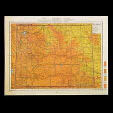 1920s Antique WYOMING Map Vintage Map of Wyoming Topographic Map Wall Art Decor
-
$19.95
 Pelham, Georgia 1971 Original Vintage USGS Topo Map
-
$25.00
 Vintage Antique 1897 30' Topographical Map Mt San Jacinto Palm Springs Hemet
-
$9.99
 CANANDAIGUA LAKE NEW YORK QUADRANT GEOLOGICAL SURVEY TOPOGRAPHIC ROAD MAP 1951
-
$16.89
 Topographic Map of Charles County, Maryland
-
$29.95
 1968 ILIO Point Hawaii Map by Defense Mapping Agency
-
$87.49
 1891 Massachusetts Topographical Map Counties North of Rhode Island & CT
-
$29.95
 1987 Oahu Hawaii Map by Defense Mapping Agency
-
$45.00
 1844 one-page School Atlas Map by Olney "MICHIGAN, WISCONSIN and Part of Iowa"
-
$21.99
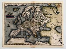 Old World Map of Europe 1600s Ancient Maps Vintage Style Poster Print
-
$24.90
 Antique Map 1906 Pontotoc County Mississippi Ecru Buckhorn Goodfood Robbs #13201
-
$24.90
 1906 AFRICA Vintage Map Cape Town Windhoek Morocco ORIGINAL 11.5 x 9.5"- C10-9
-
$19.95
 Whigham, Georgia 1974 Original Vintage USGS Topo Map
-
$24.95
 Sundale NW Oregon and Washington 1971 Original USGS Topographical Topo Map
-
$19.95
 Thomasville, Georgia 1975 Original Vintage USGS Topo Map
-
$24.95
 Quinton Oregon and Washington 1971 Original USGS Topographical Topo Map
-
$65.00
 1830 Scripture Geography Atlas Biblical Maps Worcester's Outline Hillard Gray
-
$24.20
 OAHE RESERVOIR--8--different- Fishing Topo Structure - Graphic. Map-Waterproof
-
$12.43
 1909 map street plan of Buffalo New York USA antique vintage Baedeker
-
$8.00
 Glacier Peak Wilderness Map Mt Baker Wenatchee National Forest
-
$24.95
 Esau Canyon Oregon 1969 Original USGS Topographical Topo Map John Day River
-
$6.50
 USGS Topographical maps, Sierra Nevada, California 15 minute series, choice of 3
-
$24.95
 McDonald Oregon 1964 Original USGS Topographical Topo Map John Day River
-
$24.90
 Antique Map 1915 Davidson Cty N Carolina Lexington Thomasville Hornytown #13012
-
$29.95
 Death Valley Map CA NV U.S. Army Topographic Command 1954 Revised 1970 1:250,000
-
$24.90
 1905 SWEDEN Vintage Map Norway Scandinavia ORIGINAL 11.5 x 9.5 Color C10-6
-
$24.90
 Antique Map 1907 Talladega County Alabama Estaboga Lincoln Eureka Curry #13126
-
$11.04
 USGS Topographic Map 1984 Survey 30"x60" VA Richmond 37077-E1-TM-100
-
$21.45
 USGS Topographic Map NEWBERRY - South Carolina - 1986 - 100K -
-
$29.00
 Arctic and Antarctica North Pole South Pole Antique 2 Maps Tsarist Russia
-
$7.95
 North Cascades National Park 1974 USGS Topo Map Ross Lake Chelan Washington
-
$20.25
 Map Orient Maine NB USGS 1989 Topographic Vintage Geo 1:24000 27x22" TOPO11
-
$27.99
 Civil War Map Battle of Bentonville Averasborough Savannah Bird's Point Missouri
-
$149.95
 Vtg Topographic Knoxville TN 3D Raised Map Edition 3-DMATC 32x21x2" Framed NICE!
-
$24.90
 1906 - ST. PETERSBURG Russia Vintage Geography Map ORIGINAL 11.5 x 9.5" - C11-4
-
$55.00
 1872 Pennsylvania Railway antique map 26.7" x 17.2" vibrant hand color
-
$19.99
 1940's Army topographic map Woodford South Carolina -Sheet 4751 II
-
$21.75
 USGS Topographic Map SWEET GRASS HILLS Montana USA Alberta Canada -1984- 100K
-
$19.95
 Fort Mill, South Carolina 1968 Photorevised 1980 Original Vintage USGS Topo Map
-
$49.99
 Lot Of 10 Vintage Topographical Maps Of Ontario Canada, Fly In Fishing, Canoe,
-
$19.95
 Mineral Bluff, Georgia- NC, Tenn. 1941 revised 1973 Original Vintage USGS Map
-
$20.25
 Map Big Shanty Mtn Maine USGS 1988 Topographic Geological 1:24000 27x22" TOPO18
-
$18.00
 1932 Lake Champlain Bridge Map Adirondacks, Green Mountains - Crown Point, NY GG
-
$21.90
 1890 BATTLE OF METZ IN 1870 ORIGINAL VINTAGE MAP Liezpeg Germany C10-1
-
$45.00
 two-page 1844 School Atlas Map by Olney SOUTHERN STATES of USA (TN NC AL GA SC)
-
$22.50
 1931 Geological Survey Topographic Map NH Littleton Lyman & Connecticut River
-
$7.95
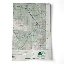 Chiwaukum Mts Washington Green Trails Map 2001 Cascades Wenatchee #177 Topo
-
$60.00
 Kentucky Lithograph Elevation Wall Map Raven Maps 29”x58” Laminated, Frame Ready
-
$7.46
 1909 map street plan of New Haven Connecticut USA antique vintage Baedeker
-
$12.95
 Vintage SYRACUSE Map Wall Art Topographic Old Original Antique Fayetteville
-
$24.99
 1894 USGS Reconnnaissance Map KENTUCKY TENNESSEE Coal Mines Williamsburg Jellico
-
$24.90
 1890 ISTRIA Vintage Map Croatia Italy Island ORIGINAL 11.5 x 9.5 Color C10-6
-
$9.99
 Bears Ears, Utah 1954 USGS Topographic Map
-
$24.90
 1895 CHINA JAPAN Vintage Map Mongolia East Asia ORIGINAL 11.5 x 9.5 Color C10-8
-
$45.00
 1971 Large Pune & Khadki Survey Guide Folding Map Of India 35" x 30"
-
$14.99
 1961 DODGE COUNTY, WISCONSIN PLAT BOOK 56 PAGES
-
$24.90
 1899 ROMANIA BULGARIA Vintage MAP Serbia Montenegro ORIG. 11.5 x 9.5 Color C10-7
-
$19.95
 Georgetown South, South Carolina 1943 Revised 1973 Original USGS Topo Map
-
$75.00
 Antique Mesa Verde National Park, Colorado 1936 USGS topographic map 46"x31"
-
$19.99
 USPS Topographic Map Vintage Moodus Connecticut Original Printed 1967 19x27


