 Antiques (US)
Africa Maps
Asia Maps
Australia/Oceania Maps
Celestial Maps
Central America/Caribbean Maps
Curiosities Maps
Digital Maps
Europe Maps
Map & Globe Mixed Lots
Map & Globe Reproductions
North America Maps
South America Maps
World & Celestial Globes
World Maps

-
$174.49

 MCM 1964 Vintage Masketeers 1628 World Map Brass and Wood Wall Metal Art 44 x 30
-
$62.99
 1839 Michigan J.H. Young engraved 17x22 Map vtg Antique United States Repro 1957
-
$179.99
 Vintage 1964 Masketeers Large Brass and Wood Map of the World in 1628 43” X 30”
-
$27.34
 16-17th CENTURY MAGNIFICENT MOUNTED PLAN MAP OF GOA INDIA
-
$45.00
 1876 Illinois Atlas 1972 Re Print
-
$15.00
 Ordnance Survey Monastic Britain North Sheet Second Edition 1955
-
$84.95
 Combined Atlas 1871 1894 1913 Stephenson County Illinois IL Plat Book
-
$50.00
 Vintage Gold Ancient World Map Framed Nova Totivs Terrarvm Orbis Lithograph
-
$12.95
 Vito Corleone Fear Murdered Godfather Newspaper Headlines 12 x 18 Poster
-
$50.00
 Old World Globe with Zodiac & Astrology Signs on A Wooden Stand Made in Italy
-
$350.00
 Virginia Historical Society Framed Reproduction 1612 John Smith Map +Free Ship
-
$39.99
 1876 Beers Somerset County Atlas Pennsylvania PA 1994 Ltd Printing Repro New
-
$32.50
 2 reproductions of old maps. Hemispheres of heaven and earth
-
$224.25
 Vintage Map: Portraiture of City of Philadelphia in The Province Pennsylvania
-
$260.00
 Globe World Tripod Map Stand Nautical Wooden Floor Antique Decor Vintage Atlas
-
$24.85
 Old Map Of Warwickshire 1610 Replica
-
$65.00
 Large Watercolor Virgin Islands 1990 by J Longacre. Prof Framed And Matted 36x28
-
$12.95
 Marilyn Monroe Dies Newspaper Headlines 12 x 18 Poster
-
$29.99
 Accvrat Map Of The World 1626. Nicely Framed.
-
$17.95
 Lonesome Dove Gus and Call Trail Map To Montana ON A Cattle Drive 12 x 18
-
$35.00
 MAP OF OLD ROME ROMA ITALY ENGRAVING PRINT ITALIAN ART GIAMBATTISTA NOLLI NEW!
-
$24.00
 St. Croix Danish Reproduction Map of 1767 Caribbean Plantation, Paul Kuffner
-
$19.99
 Canvas Reproduction Vintage Pictorial Map of Montana Print Ruth Taylor 1935
-
$19.99
 Canvas Reproduction Vintage Pictorial Map of New York Print Ruth Taylor 1935
-
$19.99
 Canvas Reproduction Vintage Pictorial Map of Colorado Print Ruth Taylor 1935
-
$19.99
 Canvas Reproduction Vintage Pictorial Map of New Jersey Print Ruth Taylor 1935
-
$5.70
 Map 1882 Virginia West Virginia Norfolk Richmond Charleston Population Railroads
-
$49.99
 Vintage 1967 Reproduction of 1858 Map of the Plantations along Mississippi River
-
$45.00
 Vintage Saxton’s Map of England and Wales 1579 -High Quality Old Map / Poster
-
$189.00
 Reproduction French Framed engraving map of Paris 15th century 21 x 17 inches
-
$27.34
 16-17th CENTURY MAGNIFICENT MOUNTED PLAN MAP , ST LAWRENCE RIVER QUEBEC
-
$237.47
 18"Vintage Brass Armillary Sphere Engraved Nautical Astrolabe Desktop Decorative
-
$84.95
 Combined Atlas 1872 1894 Morgan County Illinois IL Plat Book
-
$110.00
 HAWAII hawaiian group sandwich islands LARGE FRAMED MAP by J.H. Cloton
-
$21.99
 Historic Forts of the Old West 1776-1976 Vtg Map US Army Vanguard of Freedom
-
$30.00
 Regni Mexicani Nova Hispania New Spain 1725 Map Framed 14"x 12.5 Off Set Litho
-
$8.00
 Monde Ltd (16" x 26") Caribbean Map. Printed in Italy 1996.
-
$1.00
 Virginia Revolutionary War Map 1774 1783 Independence Bicentennial Commission
-
$35.42
 10" Inch World Desk Atlas Globe with Zodiac, Wooden Base, Vintage Reproduction
-
$387.00
 Modern Standing Globe With Wooden Tripod World Map Globe WDE03
-
$14.99
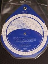 THE NIGHT SKY 2-sided Planisphere 30°-40° N Lat 1992 David Chandler Astronomy
-
$29.99
 Map of Louisiana & Mississippi River by John Senex Antique 1721 Reprint
-
$19.95
 Vintage world map reproduction desktop size globe
-
$99.95
 New Old Stock Vintage Sky & Telescope Replogle 12 In Venus Globe w/ Display Base
-
$14.95
 Prohibition End at last NY Newspaper Headlines 12 x 18 Poster
-
$29.95
 Vintage Foil World Map Nova Totivs Terrarvm Orbis Geographica Ac Framed
-
$24.99
 Canvas Color Reproduction 1851 New Map Of The Gold Region In California-C Gibbes
-
$18.75
 Wall Art Reproduction 1775 Map of the Town of Boston 13x19
-
$19.99
 Canvas Reproduction Vintage Pictorial Map of Maine Print Ruth Taylor 1935
-
$242.00
 Flower Blossoms Pull Down Chart, Botanical School Science, Botanical School Map
-
$19.99
 Canvas Reproduction Vintage Pictorial Map of New Mexico Print Ruth Taylor 1935
-
$31.49
 Modern Print from 1772 Engraving - The Northern States & Kingdoms Sweden Denmark
-
$19.99
 Canvas Reproduction, Vintage Pictorial Map of USA Ruth Taylor 1935
-
$220.00
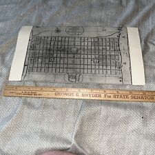
 Tarboro NC #1-9: 1908 Sanborn Insurance Maps - Set of 9 - Detailed Map/ Poster
-
$19.99
 Canvas Reproduction Vintage Pictorial Map of Connecticut Print Ruth Taylor 1935
-
$25.00
 Copy of a 1836 Map of the Seat of War in Florida by Major Genl. W. Scott, 1860
-
$10.00
 Greece Crete Island Ottoman Period Reproduction Map Girit New Print 2 Size
-
$19.99
 Canvas Reproduction Vintage Pictorial Map of Missouri Print Ruth Taylor 1935
-
$14.85
 Vintage Rand McNally Repro "The New World" Color Map 1695 Coronelli
-
$150.00
 Vintage 1964 Masketeers 43”x 32” Hanging Brass/Wood Map of the World 1628 Clean
-
$39.99
 Vintage Africae nova descriptio 1672 By WILLEM JANSZOON BLAEU (Print Poster)
-
$27.95
 Kentucky Atlas of Bath & Fleming Counties D J Lake 1884 Reproduction 11" x 17"
-
$89.95
 Russell Lee County Alabama Indian Territory Map 1832 RP 24x30" FREE SHIPPING!
-
$89.95
 Alabama & Georgia Indian Territory Map 1823 AL & GA RP 24x30" FREE SHIPPING!
-
$25.00
 CALIFORNIA GOLD RUSH MAP, 1850_SAN FRANCISCO_ PROFESSIONALLY REPRODUCED IN 1982.
-
$24.99
 Yellowstone National Park Map 1986 Reprint of 1961 Map USGS 41 X 37
-
$19.99
 Canvas Reproduction Vintage Pictorial Map of Arizona Print Ruth Taylor 1935
-
$9.99
 8" A NEW AND ACCVRAT MAP OF THE WORLD vintage england print framed
-
$39.95
 Vintage Atlas copy of 1870 Map Princeton New Jersey includes College D&R canal
-
$19.95
 Reprint Atlas of Somerset County New Jersey 1873 - F.W. Beers Vesey St. New York
-
$450.00
 Map and Chart of the Chesapeak, York & James Rivers VIRGINIA, Seat of War, 1781
-
$24.95
 Vintage Map of London England, Fine Art Reproduction 24" x 20" Historical Giclee
-
$299.99
 Historical Atlas of Indiana 1876 reprinted 1968 rare Greenburg
-
$5.25
 West Indies Caribbean Sea Map - Replica- Full Color - 22"x17"
-
$34.95
 Pasadena 1888 Sanborn Map, Exquisitely Detailed Map - Poster
-
$97.99
 atlas of Illinois 1876 Mayhill COUNTY, CHICAGO REPRINTED 1972 108 PAGES
-
$60.00
 Vintage Armillary Zodiac Engraved Sundial Arrow Sphere 18x15 temple foundery
-
$250.00
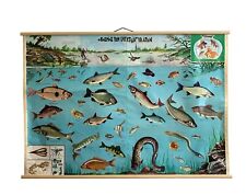 Vintage Freshwater Fish chart, Freshwater Fish Poster, Fish Pull Down Map
-
$4.99
 Virginia Revolutionary War Map 1774-1783 Independence Bicentennial Commission
-
$39.00
 Vintage Hammond Map Print of Europe by Guilielmo Blaeuw 17th Century
-
$19.99
 Canvas Reproduction Vintage Pictorial Map of Nebraska Print Ruth Taylor 1935
-
$89.95
 Chambers County Alabama Indian Territory Map 1832 RP 24x30" FREE SHIPPING!
-
$10.50
 VINTAGE MINIATURE GLOBE JAPAN 6.25" TALL
-
$19.99
 Canvas Reproduction, Vintage Pictorial Map of Tennessee Ruth Taylor 1935
-
$19.99
 Canvas Reproduction, Vintage Pictorial Map of Oregon Ruth Taylor 1935
-
$8.95
 Vintage York County Maine Board of Commissioners 17.5" X 22.5" Colored Map
-
$14.95
 Vintage Reproduction 1778 – 1780 West Point Map
-
$25.00
 1708 Antique Map North American Reproduction British American Colonies Vtg
-
$19.99
 Canvas Reproduction, Vintage Pictorial Map of Wisconsin Ruth Taylor 1935
-
$621.68
 Superb CASSINI'S 1790 TERRESTRIAL GLOBE 13 inch + Stand GREAVES & THOMAS
-
$18.64
 London environs Antique Colour Map Thomas Moule County Maps of Old England 14“
-
$19.99
 Canvas Reproduction, Vintage Pictorial Map of Texas Ruth Taylor 1935
-
$24.00
 1927 STANFORD'S WALL MAP CENTRAL LONDON ENGLAND W/ Subways & Rails - Repro
-
$100.00
 1888 Map of San Jose, California (1972 Reprint)
-
$14.99
 Era of Exploration Hispanic History 1400-1600, Vintage SEARS 1992 Map Collection
-
$13.50
 1970 Map Maine New France Art Print Vintage 1540 Italian Jacomo di Gaftaldi
-
$19.99
 Canvas Reproduction, Pictorial Map of Pennsylvania Ruth Taylor 1935
-
$36.95
 1884 Historical Fire Maps Tallahassee Florida 17" X 20" - 2 Maps VERY DETAILED
-
$27.34
 MAGNIFICENT ANTIQUE MOUNTED PLAN MAP OF TIBET
-
$312.71
 Nautical Brass Sphere Engraved armillary Antique Vintage Astrolabe Compass 18"


