 Antiques (US)
-
$139.99

 1926 JAPAN WORLD AIR ROUTE MAP SUGOROKU CHINA KOREA Lambert projection print
-
$13.95
 1530s Old Map of the World as seen from the North & South Poles - 16x24
-
$170.00
 the new biblical atlas and scripture gazetteer 1855
-
$212.50
 Geographical Dictionary
-
$69.95
 peerless atlas of the world 1898 1899 LARGE MAPS
-
$485.00
 Vintage Copyright 1932 Geographical Pull Down School Map (Beautiful Colors) Nice
-
$8.99
 Colorprint World Map Mercator Projection American Map Co 50"x38" & USA Map Vtg
-
$20.00
 Old 1886 National Atlas Map ~ AFRICA ~ (LG14x17) ~ Free S&H-#999
-
$23.96
 Beautiful 1905 Color GEOLOGIC MAP OF JUNEAU VICINITY, ALASKA, 18” X 21.5”
-
$28.04
 Vintage 1903 WORLD Map 22"x14" ~ Old Antique Original NORTH AMERICA AFRICA ASIA
-
$34.95
 c. 1930s 1940s Cleartype 54" X 38" General World Map Vintage WWII Era American
-
$2500.00
 WORLD MAP 1685 JUSTUS DANCKERTS LARGE ANTIQUE ENGRAVED MAP 17TH CENTURY
-
$24.99
 Nova Totivs Terrarvm Orbis Geographica Vintage Spanish World Map 8x6
-
$63.75
 Colton’s new common school geography 1872
-
$76.50
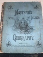 Monteith’s physical and political geography 1866
-
$212.50
 Geographical And Historical Grammar 1802
-
$13.95
 1661 Celestial Map of the Constellations Historic Vintage Style Map - 16x20
-
$9.95
 Vintage Colorprint World Atlas
-
$31.64
 Vintage 1902 WORLD Map 22"x14" ~ Old Antique Original NORTH AMERICA EUROPE ASIA
-
$50.00
 Vintage Gold Ancient World Map Framed Nova Totivs Terrarvm Orbis Lithograph
-
$160.00
 Vintage World Atlas Map, Classroom Wall Tapestry Geography School Chart
-
$14.97
 Maps Salesman Sample Miniature Western Hemisphere Outlines Continental Press
-
$10.00
 1899 Vintage "Map of the World" from an antique Encyclopedia old cartography
-
$15.99
 1872 Muller North Pole Map Magnetic Meridians Canada Alaska Arctic Ocean Climate
-
$35.00
 1873 GUYOT'S PHYSICAL GEOGRAPHY World Maps Atlas History
-
$47.00
 1904 North Polar Region Map Arctic Exploration Russia Canada Siberia Alaska
-
$29.98
 The New Encyclopedic Atlas and Gazetteer of the World 1919 Edition
-
$800.00
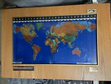 Kilburg Geochron World Map with Wood Frame
-
$106.25
 The peerless atlas of the world 1889
-
$153.00
 A Dictionary, Geographical, Statistical and Historical Places 1846
-
$106.25
 geographical chronological and historical atlas by john blake 1826
-
$24.85
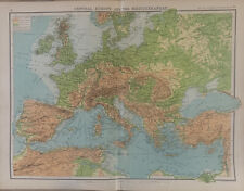 1902 Europe, Mediterranean, Black Sea Physical Map By John Bartholomew
-
$45.00
 Geography Made Easy 1818 by Jedidiah Morse maps pictures
-
$45.00
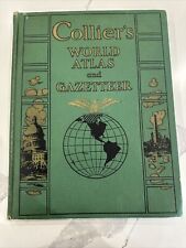 Collier's World Atlas and Gazetteer Maps Book - 1943 Oversized Green Hardcover
-
$6.99
 Handsome Vintage Color World Map of Distribution of Volcanoes and Earthquakes
-
$26.95
 1565 Exploration World Map Large Terra Wall Print 24x42
-
$22.00
 Atlas of the World at War 1942 Vintage Maps
-
$2.00
 Old atlas map of Eastern Hemisphere, Copyright 1875 Rev. 1886
-
$24.85
 1902 Ancient World Original Antique Map by G.W. Bacon over 120 Years Old
-
$102.00
 a compendium of geography by william scott 1827
-
$68.95
 1910 antique HAND DRAWN MAP LOT signed WILLIAM SHAEFERLY lot 10pc PENCIL ART
-
$20.95
 1500s Waldseemuller Map of America - First Map to Name "America" - 20x36
-
$20.95
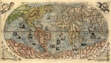
1565 Known World Map Gastaldi Bertelli Americas - 20x36
-
$30.00
 Sport Sumo Wrestling Japan - Original Engraving Montanus - 1670
-
$22.96
 Hammond’s New Era Atlas of the World 13.5” by 10” Colorful
-
$23.95
 1689 Interesting Detailed Old World Exploration Map Poster - 24x28
-
$20.00
 1867 Map ~ PALESTINE - JERUSALEM - SYRIA ~ Johnson Map (14x18)-#1930
-
$20.00
 1867 Map of THE ROMAN EMPIRE ~ Johnson Map (18x23)-#1938
-
$120.00
 1856 Cartee's Physical Atlas School of Physical Geography 13 Maps WW
-
$19.90
 Vintage Soviet Poster USSR Political Advertising Communist Party Propaganda
-
$19.98
 CAPPER'S 1935 (Pre-WW2) ATLAS OF THE WORLD by Lloyd E. Smith RARE
-
$13.95
 1630 Historic Old World Illlustrated Vintage Map - 16x24
-
$19.99
 1901 Antique Map / THE WORLD
-
$20.00
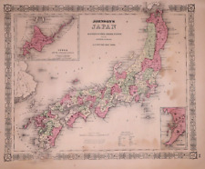 1867 Map ~ JAPAN ~ Johnson Map (14x18)-#1926
-
$25.50
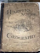 harper’s school geography 1881
-
$5.99
 Vintage 1944 Atlas Map of Location of Stars & Constellations & Analysis Of World
-
$5.99
 Hammonds Comparative World Atlas ; 1956 New Desk Edition
-
$22.50
 1932 Map Of The Bible Lands Holy Land Maps Palestine Map George Cram Book
-
$19.00
 1921 Literary Digest Atlas of New Europe and The Far East
-
$25.00
 Colton’s Common School Geography 1881 Minnesota - Damaged
-
$20.00
 Old 1886 National Atlas Map ~ HINDOSTAN / BRITISH INDIA ~ (LG14x17) -#997
-
$6.99
 National Geographic Magazine Map Supplement July 1991 China
-
$12.00
 *VINTAGE* Rand McNally 1974 International Atlas EUC
-
$49.50
 1864 Map Prussia and the German States Antique Original Hand Colored Mitchell
-
$29.99
 Accvrat Map Of The World 1626. Nicely Framed.
-
$80.00
 1796 Blondeau Map World North America Africa Europe Asia Australia South America
-
$35.96
 Vintage 1901 WORLD Map 22"x14" ~ Old Antique Original NORTH AMERICA AFRICA ASIA
-
$20.00
 1865 Map of THE WEST INDIES / CARIBBEAN Authentic Johnson Map (18x27)-#1981
-
$76.50
 Bible atlas and gazetteer 1862
-
$12.00
 Antique 1869 Map Of The World East & West Hemispheres 8.5 x 7 Inches
-
$665.10
 Vtg Rand McNally 14 in 1 American History School Pull Down Roll Map
-
$150.00
 VNT 1871 Volks-Atlas German language 24 maps World map Americas Europe
-
$20.00
 Old Authentic 1912 McNally Atlas Map ~ EUROPE ~ (XXL20x28) #1315
-
$16.95
 "The New World" 1562 Historic Exploration Map - 20x24
-
$18.50
 1916 Plat Map Newton Township Calhoun County Michigan Lee's lake Cotton Lake
-
$19.51
 ca 1909 NORTH POLE Map Explorations Polar Regions Peary Antique Original Old
-
$13.95
 1720 Old World Exploration Map Historic Print - 16x24
-
$19.99
 1890 Map / ARCTIC POLAR REGIONS, b/w THE WORLD, b/w EASTERN HEMISPHERE
-
$20.00
 Large Pristine 1912 McNally Relief Map of PORTO RICO ~ (XL14x20) #1295
-
$14.95
 Globemaster World Wall Map 33 x 49 Inches Includes Country Flags 2008 Brand New
-
$20.00
 Old 1886 National Atlas Map ~ CENTRAL AMERICA - WEST INDIES ~ (LG14x17) -#1006
-
$13.95
 1840s Map - Principle Rivers Lengths and Mountains Heights in the World - 16x20
-
$174.49
 MCM 1964 Vintage Masketeers 1628 World Map Brass and Wood Wall Metal Art 44 x 30
-
$52.00
 World Map Mercator's Projection Antarctica c. 1849 detailed Meyer map
-
$20.00
 Old 1896 Historical Atlas Map ~ WEST CANADA TERRITORIES ~(11x14) ~Free S&H -#960
-
$65.00
 1830 Scripture Geography Atlas Biblical Maps Worcester's Outline Hillard Gray
-
$18.99
 1857 WORLD MAP, MORSE GASTON ANTIQUE HAND-COLORED WORLD IN TWO HEMISPHERES
-
$20.00
 Dated 1830 Universal Atlas Map of the WORLD ~(10x12)-#1246
-
$8.95
 WWII 1944 American Red Cross Map Of Paris & Map Of London
-
$12.00
 Vintage Rand McNally - America Atlas 1989 HC Large
-
$23.95
1660s “Celestial Chart of the Zodiac” Vintage Style Astrology Map - 24x28
-
$20.00
 1878 Map ~ GREECE - MOREA ~ Original Atlas Map (14x20) Free S&H -#1507
-
$28.76
 Vintage 1903 WORLD Map 22"x14" ~ Old Antique Original NORTH AMERICA AFRICA ASIA
-
$225.00
 Cram's Unrivaled Atlas Of The World Indexed 1916 Maps Pictures 15.5x12x1.5"
-
$35.96
 Vintage 1904 ATLANTIC OCEAN Map 22"x14" ~ Old Antique Original BERMUDA ISLANDS
-
$7.99
 ANTIQUE 1862 WORLD LAND GEOLOGY OCEAN CURRENT SURFING JOHNSON HANDCOLORED MAP
-
$20.00
 Old (XLG17x22) 1905 Time's Atlas Map ~ THE AUSTRIAN ALPS ~ Free S&H
-
$16.50
 1916 Plat Map Wattle's Park Green Acre Calhoun County Michigan Battle Creek
-
$63.75
 peerless atlas of the world 1908
-
$31.07
 1860 North Polar Regions Hand Coloured Antique Map by Blackie


