Antiques (US)
Antiques (US)
Antiquitäten (DE)
Antiquariato (IT)
Antiques (UK)
Antiquités (FR)
Antiques (CA)
Antiques (AU)
Antiques (US)
/
Maps, Atlases & Globes
/
North America Maps
/
1700-1799 Date Range, Manuscript/Hand drawn Printing Technique North America Maps
NOTE: When you buy through our links, we may earn a commission.
Learn more*
Best Match
Newest
Ending
Lowest Price
Highest Price
Best Match
Newest
Ending
Lowest Price
Highest Price
S
M
L
XL
Share
Share
Twitter
Facebook
Email
Share
Pinterest
Facebook
Twitter
Email
$1347.50
1790, SURVEYORS MAP, WILL COCKBURN, NY, LINWOOD, THOMAS TILLOTSON f VAN ETTEN
Share
Pinterest
Facebook
Twitter
Email
$25.00
Ca. 1790 child’s drawn map of the Americas likely English or Canadian
Share
Pinterest
Facebook
Twitter
Email
$119.99
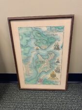
A Plan Of The Town Of Boston & The Charleston Peninsula In NE 1775 Map 1st EDT
MORE
City
Boston (1)
Country/Region
United States of America (2)
Date Range
1700-1799
Format
Wall Map (1)
Original/Reproduction
Antique Original (1)
Antique Reproduction (1)
Printing Technique
Manuscript/Hand drawn
Type
City Map (1)
Topographical Map (1)
US State
Massachusetts (1)
New York (1)
 Antiques (US)