 Antiques (US)
-
$77.49

 1808 RARE ORIGINAL MAP EAST INDIES INDONESIA THAILAND MALAYSIA SIAM PHILIPPINES
-
$99.99
 1764 nice ORIGINAL MAP CEYLON SRI LANKA TRINCOMALEE TRIKUNAMALAJA KODDIYAR BAY
-
$1045.00
 1794 Laurie and Whittle Nautical Map of the Red Sea from Geddah (Mecca) to Suez
-
$150.00
 Maldives, anno 1750, Bellin "Carte des Isles Maldives", edited in Histoire Gener
-
$33.24
 Indonesia Bonthian Bay Celebes Islands engraved Original Antique Chart 1778
-
$31.24
 1785 ORIGINAL ANTIQUE MAP COOK ISLANDS - FROM CAPTAIN JAMES COOK VOYAGES
-
$327.50
 Antique Print-SEA CHART-SRI LANKA-CEYLON-JAFFNA-Depot de la Marine-1834
-
$106.43
 Japan - James Cook 1790 Hand Coloured Coastal Chart Published by Alexander Hogg
-
$41.32
 Map of Guadeloupe Isle Marie-Galante the Desirade and Saintes original 1759
-
$74.49
 1770 NICE ORIGINAL MAP ASIA JAPAN HOKKAIDO RUSSIA CHINA MANCHURIA KURIL ISLANDS
-
$5400.00
 Le Royaume de Siam avec les royaumes qui luy sont tributaires. Mortier P., 1700
-
$84.77
 Harbour of Samganooda Alaska Aleutian Islands Map by T Bowen 1778 Original
-
$700.00
 Caspian Sea, anno 1740, by Seutter Matthäus, publishers colours ORIGINAL ANTIQUE
-
$274.50
 Antique Print-SEA CHART-RED SEA-YEMEN-PERIM ISLAND-Lamb-Walker-1858
-
$500.00
 ARABIAN SEA 1758 by William HERBERT LARGE ANTIQUE SEA CHART 18TH CENTURY
-
$300.00
 Southeast Asia, Bellin anno 1746 Coppermap, edited anno 1746, german translation
-
$647.50
 Antique Print-SEA CHART-BAY BENGAL-INDIA-BANGLADESH-GANGES-CALCUTTA-Lloyd-1846
-
$220.00
 1794 Laurie and Whittle Nautical Chart or Map of the Coast of Coromandel, India
-
$60.00
 1797 COPPER ENGRAVING LA PEROUSE NAUTICAL MAP BAY OF LANGLE RUSSIA COST TEHOKA
-
$155.00
 The Sunda Strait Indonesia coast views by de Bruijn 1711
-
$385.00
 1775 Mannevillette Nautical Chart or Map of the Nicobar Islands, India
-
$1375.00
 1797 Laurie and Whittle Nautical Map of the West Coast of Sumatra, Indonesia
-
$1045.00
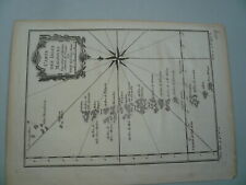
 1794 Laurie and Whittle Nautical Map of the Red Sea from Moka to Geddah (Mecca)
-
$440.00
 1794 Laurie and Whittle Nautical Map of Northeastern India
-
$1600.00
 Carte des Indes, de la Chine & des Iles de Sumatra, Java, Chatelain, anno 1719
-
$547.50
 Antique Print-SEA CHART-INDIA-COROMANDEL-ARMAGAON-PETEPOLY-Thronton-1750
-
$2700.00
 Carte de L ´Ile de Java... Chatelain, anno 1719, very good condition ORIGINAL
-
$1800.00
 Le Royaume de Siam, Isles Sumatra, Borneo, Chatelain anno 1719, in perfect condi
-
$1320.00
 1794 Laurie amd Whittle Nautical Map of the Northwest Java (Jakarta), Indonesia
-
$185.00
 India Coromandel Cost Old map D’Anvilles Harrison 1788


