 Antiques (US)
-
$83.30

 England & Wales United Kingdom London Cardiff York c. 1780 Conder decorative map
-
$97.75
 England & Wales United Kingdom London 1772 Jefferys decorative hand color map
-
$114.75
 Ancient Britain Roman England Wales 1797 Neele engraved historical map
-
$80.75
 England & Wales United Kingdom London Cardiff York c. 1730 Gordon engraved map
-
$50.00
 1748 Chart Of The Baltic Sea By T. Jeffery, Geographer To The Prince Of Wales
-
$99.95
 ORIGINAL 1794 HAND COLORED COPPER ENGRAVED MAP BRITAIN ECLIPSES LAURIE & WHITTLE
-
$43.81
 1784 Antique Map; North Wales
-
$281.73
 BRITISH ISLES Britain, Frederick De Wit original antique map circa 1675
-
$331.82
 BRITISH ISLES, Great Britain, UK, Nicolas De Fer original antique map 1706
-
$287.98
 1730 Antique Map; Regni Angliae et Walliae Principatus by Carel Allard
-
$18.77
 1720 Antique Map, Caernarfonshire, Wales - Owen & Bowen
-
$106.43
 ENGLAND, Anglia Cambdeni, Christoph Weigel, Weigelio, original antique map 1718
-
$16.27
 1720 Antique Road Map: Grantham to Tuxford, Owen & Bowen Shts 15/16
-
$83.30
 England & Wales United Kingdom 1780 engraved hand colored map
-
$125.80
 England & Wales United Kingdom c.1750 Kitchin engraved hand color decorative map
-
$212.50
 British Isles Ireland United Kingdom England Scotland Wales 1715 Sanson map
-
$169.04
 Antique Map of Great Britain by Christoph Weigel 1718
-
$62.54
 1719 LARGE ANTIQUE MAP ENGLAND - NOUVELLE CARTE DE L'ANGLETERRE - CHATELAIN
-
$50.09
 1780'S LARGE ANTIQUE COPPER PLATE MAP ROADS ENGLAND & WALES
-
$37.55
 MONTGOMERYSHIRE WALES c1787 BY SELLER / GROSE GENUINE ANTIQUE ENGRAVED MAP
-
$62.61
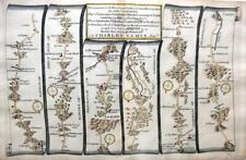
 LONDON TO HOLYHEAD ROAD MAP BY JOHN OGILBY REDUCED BY THOMAS GARDNER c1719
-
$80.75
 England & Wales U.K. 1766 Desnos Brion beautiful engraved map hand color
-
$18.77
 1720 Antique Map, Brecknockshire, Wales - Owen & Bowen
-
$62.61
 LONDON BIRMINGHAM TO SHREWSBURY BY JOHN OGILBY REDUCED BY THOMAS GARDNER c1719
-
$100.17
 Antique allegorical map of Britannia by John Hinton 1750
-
$200.34
 Antique Map of Great Britain and Ireland by Alexis Hubert Jaillot 1786
-
$75.13
 ENGLAND BY JOHN SENEX c1740 GENUINE ANTIQUE COPPER ENGRAVED MAP
-
$25.04
 OLD ANTIQUE MAP RADNOR WALES by OWEN & BOWEN c1740's 18c ENGRAVING
-
$127.50
 England & Wales British Isles London Cardiff York c 1750-75 Jeffrys engraved map
-
$127.50
 British Isles United Kingdom England Wales Scotland Ireland c. 1760 Bellin map
-
$62.61
 1747 Roman Britain Original Antique Map by Richard Seale
-
$127.50
 British Isles Ireland United Kingdom England Wales Scotland c. 1735 De Lat Map
-
$106.43
 BRITISH ISLES, Great Britain, UK, Schreiber original antique map c1730
-
$10.00
 1736 Antique Road Map - Emanuel Bowen - Bala Lake to Holywell, Flintshire, Wales
-
$62.61
 Antique map of Great Britain by Jacque Chiquet 1719
-
$56.35
 CHESTER LLANBEDR TO CARDIFF BY JOHN OGILBY REDUCED BY THOMAS GARDNER c1719
-
$106.43
 BRITISH ISLES, Britain, UK, Van Der Aa, original antique map 1707
-
$87.65
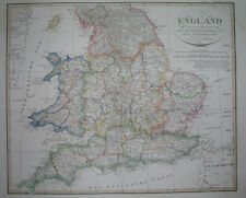
 Antique Map of England and Wales by John Cary 1789
-
$127.50
 British Isles Ireland United Kingdom England Wales Scotland 1744 charming map
-
$72.25
 Roman Britain Britannia Romana Pictland Wales 1732 engraved historical map
-
$25.03
 1720 Antique Map, Isle of Anglesey, Wales - Owen & Bowen
-
$62.61
 Antique map of England and Wales by John Senex 1744
-
$31.30
 Late 1700s Carnarvonshire Wales Original Seller/Grose Coloured Antique Map
-
$43.83
 Antique Map of England, Scotland and Wales by John Cary 1790
-
$100.17
 Antique map of the West Riding of Yorkshire by Robert Morden 1722
-
$56.35
 Antique Map of Great Britain by Claude Buffier 1746
-
$100.17
 Antique map of Roman Britain by Robert Morden 1720
-
$47.99
 1796 Blondeau Map England Wales London Bristol Oxford Salisbury Manchester
-
$34.97
 c1760 Antique Map//ENGLAND & WALES, DIVIDED INTO COUNTIES
-
$16.27
 1720 Antique Road Map: Newcastle-under-Lyme to Preston, Owen & Bowen Shts 91/92
-
$87.65
 Antique Map of South Wales by John Cary 1789
-
$62.61
 Antique map of England and Wales by Thomas Kitchin 1770
-
$62.61
 LONDON TO ST DAVIDS ROAD MAP BY JOHN OGILBY REDUCED BY THOMAS GARDNER c1719
-
$62.61
 LONDON TO ST DAVIDS ROAD MAP BY JOHN OGILBY REDUCED BY THOMAS GARDNER c1719
-
$31.30
 Late 1700s Anglesea Wales Original Seller/Grose Coloured Antique Map
-
$72.62
 ENGLAND & WALES, UK, BRITAIN, Brion de Tour original antique map c1780
-
$25.03
 WORCESTER HEREFORD LEOMINSTER RADNOR BY EMANUEL BOWEN c1720 GENUINE ANTIQUE
-
$11.26
 ORIGINAL FRAMED GLAMORGANSHIRE ROAD STRIP MAP J OWEN & E BOWDEN c 1720
-
$31.30
 Original antique copper-engraved map WALES MONMOUTHSHIRE, Badeslade & Toms, 1742
-
$749.95
 ORIGINAL c. 1740s HAND COLORED OTTENS COPPER ENGRAVED MAP,NORTHERN HEMISPHERE,VG
-
$63.75
 London to St. David's Pembrokeshire Wales 1775 Bowen engraved road map travel
-
$31.30
 Late 1700s Pembrokeshire Wales Original Seller/Grose Coloured Antique Map
-
$75.13
 BRITANNIA SAXONICA, ENGLAND & WALES original antique map, Robert Morden, 1722
-
$210.00
 BRITISH ISLES IRELAND 1701 NICOLAS DE FER ANTIQUE ENGRAVED MAP 18TH CENTURY
-
$23.16
 CARDIGAN, MONTGOMERYSHIRE, MACHYNLLETH, original antique road map, Bowen, 1759
-
$31.30
 Late 1700s Caermarthenshire Wales Original Seller/Grose Coloured Antique Map
-
$56.35
 NORTHERN ENGLAND, UK, BRITAIN, Rigobert Bonne, original antique map 1780
-
$62.61
 BRISTOL TO WEST CHESTER LUDLOW BY JOHN OGILBY REDUCED BY THOMAS GARDNER c1719
-
$52.49
 1823 ORIGINAL MAP UNITED KINGDOM ENGLAND WALES LONDON CAMBRIDGE LANCASTER YORK
-
$56.35
 LONDON WORCESTER TO MONTGOMERY BY JOHN OGILBY REDUCED BY THOMAS GARDNER c1719
-
$12.46
 1810 ANTIQUE MINIATURE COPPER PLATE MAP ENGLAND & WALES - WALLIS - HAND COLOURED
-
$35.06
 SALISBURY TO CAMPDEN, WILTSHIRE, antique road map, SENEX, OGILBY, pl 92-93, 1762
-
$25.03
 GLOUCESTER CHELTENHAM MONMOUTH BRECON BY PATERSON c1785 GENUINE ANTIQUE MAP
-
$23.79
 OWEN & BOWEN BRECKNOCKSHIRE original antique county map 1736
-
$100.00
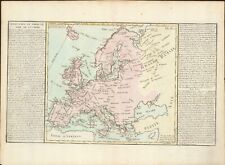 1767 Europe's Islands Capes & Seaports antique map by Clouet ~ 23" x 16.8"
-
$50.09
 CARMARTHEN TO CARDIGAN BY JOHN OGILBY REDUCED BY THOMAS GARDNER c1719
-
$50.09
 ST DAVIDS TO HOLYWELL CONTINUED BY JOHN OGILBY REDUCED BY THOMAS GARDNER c1719
-
$23.67
 Britannia Britain humorous satirical map England Wales J. Gillray 1791 art print
-
$56.35
 WELSHPOOL TO CAERNARFONSHIRE BY JOHN OGILBY REDUCED BY THOMAS GARDNER c1719
-
$56.35
 MONMOUTH TO LLANBEDER BY JOHN OGILBY REDUCED BY THOMAS GARDNER c1719
-
$23.16
 LUDLOW, BISHOP'S CASTLE, MONTGOMERY, original antique road map, Bowen, 1759
-
$50.09
 ST DAVIDS TO HOLYWELL BY JOHN OGILBY REDUCED BY THOMAS GARDNER c1719
-
$56.35
 PRESTEIGNE TO CARMARTHEN BY JOHN OGILBY REDUCED BY THOMAS GARDNER c1719
-
$62.61
 LONDON TO ABERYSTWYTH WORCESTER BY JOHN OGILBY REDUCED BY THOMAS GARDNER c1719
-
$50.09
 CHESTER TO CARDIFF LLANBEDR BY JOHN OGILBY REDUCED BY THOMAS GARDNER c1719
-
$244.38
 Antique Map of Southern England and Wales by Zatta (1784)
-
$75.13
 LONDON TO HOLYHEAD ROAD MAP BY JOHN OGILBY REDUCED BY THOMAS GARDNER c1719
-
$37.55
 MONMOUTHSHIRE MONMOUTH BY JOHN CARY c1787 GENUINE ANTIQUE ENGRAVED MAP
-
$31.29
 YORKSHIRE DURHAM WALES CAERNARVAN ROAD MAP BY JOHN SENEX c1757 GENUINE ANTIQUE
-
$231.65
 Antique Map "Nuova Carta dell' Isole Britanniche" (U.K.) Albrizzi - Tirion, 1743
-
$29.99
 1795 - DELAMARCHE - Small map BRITISH ISLES UK ENGLAND SCOTLAND WALES IRELAND
-
$62.61
 GLOUCESTER TO MONTGOMERY BY JOHN OGILBY REDUCED BY THOMAS GARDNER c1719
-
$18.77
 HEREFORD WORCESTER RADNOR BY PATERSON c1785 GENUINE ANTIQUE MAP
-
$37.56
 Kitchin 1752 Antique Map. Monmouthshire Wales
-
$31.30
 Late 1700s Brecknockshire Wales Original Seller/Grose Coloured Antique Map
-
$56.35
 SHREWSBURY TO CHESTER & HOLYWELL BY JOHN OGILBY REDUCED BY THOMAS GARDNER c1719
-
$27.97
 cJuly 1760 Antique Map//COUNTY MONTGOMERY, WALES//London Magazine
-
$18.77
 WALES RADNORSHIRE BRECKNOCK MONTGOMERY BY EMANUEL BOWEN c1720 GENUINE ANTIQUE
-
$335.75
 northern England Scotland Wales Ireland 1760 Bellin rare huge sea chart map
-
$467.50
 1794 Laurie & Whittle, John Rocque Large Antique Map England & Wales, Sea Battle


