 Antiques (US)
-
$83.30

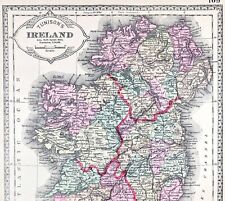
 Ireland Dublin Galway Waterford Limerick Derry 1830 miniature map
-
$72.25
 Education in Ireland Schools Colleges 1882 scarce large color map by Bevan
-
$83.30
 Island of Ireland Leinster Munster Connacht Ulster Dublin 1802 Whitehead map
-
$80.75
 Belfast Ireland 1874 detailed City Plan River Lagan uncommon map
-
$10.00
 1874 ANTIQUE MITCHELL ATLAS MAP OF IRELAND & SCOTLAND-HAND COLORED
-
$24.88
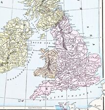
 OLD 1855 ENGLAND WALES SCOTLAND IRELAND Map Dublin London Aberdeen Orkney
-
$24.00
 1853 British Isles Map ORIGINAL England Wales Scotland Ireland London Dublin
-
$38.00
 1899 Europe Map ORIGINAL France Germany Austria Spain England Italy Turkey
-
$24.99
 Original 1897 Streetcar Map DUBLIN Ireland Bedlam Trinity Guinness Lunatic Docks
-
$6.00
 1856 ANTIQUE MITCHELL'S GEOGRAPHY ATLAS MAP-GREAT BRITAIN & IRELAND-HAND COLORED
-
$37.00
 1853 Europe Map ORIGINAL Turkey Russia Prussia Iceland Sardinia England Sweden
-
$46.75
 Cork Ireland Detailed Tourist Map 1874 A. & C. Black city plan
-
$37.88
 1898 British Islands ENGALND Map Anglo-Saxon and Celtic Kingdom Ireland Scotland
-
$72.25
 Ireland Munster Leinster Connaught Ulster Dublin 1809 Cooper nice hand color map
-
$83.30
 Ireland Economic Pauperism Poverty Welfare Relief 1882 Irish Unions color map
-
$72.25
 Ireland 1832 Carey & Lea charming miniature map w/ old hand color
-
$12.00
 1846 ANTIQUE MITCHELL'S SCHOOL ATLAS-MAP OF GREAT BRITAIN & IRELAND-HAND COLORED
-
$14.95
 Vintage IRELAND Map Wall Art ca 1890 Old Original Dublin Antique Sepia Tone
-
$19.99
 1869 Antique Mitchell COLOR Map / GREAT BRITAIN AND IRELAND
-
$9.99
 1892 Map Western Ireland Athlone Galway & Scotland Glencoe 1691 Original Antique
-
$52.00
 1898 British Isles Historical Map England Ireland Scotland Wales London
-
$48.00
 1843 Europe Map Prussia Germany Iceland Ireland POLITICAL Russia Moscow Austria
-
$44.88
 1899 Central Europe Map ORIGINAL France Belgium Germany STEAMSHIPS RAILWAYS
-
$19.99
 Vintage Map "Great Britain and Ireland" 1841
-
$9.25
 Rand, McNally & Co Antique 1899 Map Of Ireland 7x6
-
$43.88
 1898 DUBLIN Ireland Map Liffey River College Park Merrion Square Steam Railroads
-
$47.00
 1891 Ireland Map ORIGINAL Kerry Dublin Belfast Counties RAILROADS Townships
-
$38.88
 OLD 1896 Map PARIS LONDON BERLIN DUBLIN ROME ST PETERSBURG VIENNA EDINBURGH
-
$83.30
 Ireland Population Demographics showing change 1882 scarce Bevan folio color map
-
$83.30
 Ireland Prisons Crime Rates Reform Schools Assizes 1882 large color Criminal map
-
$29.74
 British Isles Britain geological palaeontological fossil map 1848 print poster
-
$127.50
 Ireland by itself 1883 Letts detailed large rare 4 sheet color map lifeboats
-
$10.00
 1844 AUTHENTIC ORIGINAL MORSE ANTIQUE ATLAS MAP-IRELAND-SCOTLAND-HANDCOLORED
-
$24.99
 1880 Antique Atlas Map / GREAT BRITAIN AND IRELAND
-
$15.99
 1835 Bradford Map - Northern Europe Germany Sweden Norway Holland Britain Russia
-
$112.94
 Antique Map "Ireland" R. Phillips, 1807
-
$12.00
 1892 Antique Map Ireland Desmond Ormande Family in 1570 Dublin Munster Leinster
-
$25.08
 1850 Antique Map; Ireland by John Dower / William Orr
-
$229.95
 1851 IRELAND ORIGINAL TALLIS RAPKIN MAP 11x14 WM30
-
$80.75
 Ireland Public Health Hospitals Deaths Asylums 1882 scarce large color map
-
$14.00
 IRELAND Antique Map Engraved 1885 - Fisk & Co. - Center Fold- Map XIX
-
$19.99
 Original 1897 Map LAKES OF KILLARNEY County Kerry Ireland Lough Leane Aghadoe
-
$45.00
 1844 1-page Atlas Map by Olney "BRITISH ISLES" including Ireland / Eire
-
$250.00
 Leinster Coal District Survey (Ireland) 1814. Map, plan,geology appendix. RARE
-
$63.75
 Scotland & Ireland 2 maps 1868 A.J. Johnson Scarce Issue large folio HC map
-
$9.75
 Rand, McNally & Co Antique 1899 Map Of Ireland 7x6
-
$5.00
 1875 ANTIQUE HARPER'S ATLAS MAP-BRITISH ISLES-GREAT BRITAIN & IRELAND
-
$11.99
 1835 Map x 2 - Europe Political & Physical - Austria Italy Spain Britain
-
$16.99
 1884 Large Antique COLOR Bradley Map of IRELAND
-
$5.00
 1888 ANTIQUE JOHNSTON ATLAS MAP-IRELAND-EXCELLENT DETAIL
-
$12.00
 Antique Map of Ireland..1894...by Philips, London. 7" X 8-1/2"
-
$25.90
 1924 HISTORY OF EUROPE Vintage Geographical Map Color ORIGINAL C12-3
-
$238.42
 Ireland. Antique engravings - massive lot of 100. Make an offer!
-
$29.99
 Original 1874 Augustus Mitchell Maps IRELAND & SCOTLAND Lovely Grapevine Border
-
$9.05
 Giant ’S Causeway Clochán An Aifir Northern Ireland Wood Engraving Um 1880
-
$94.10
 1836 Antique Map; Plan of Dublin by SDUK / W.B. Clarke
-
$16.00
 1867 Mitchell Map - Europe - Austria Italy Germany France Britain Spain Iceland
-
$9.99
 1888 Mitchell Map Europe France Germany Austria Hungary Italy Greece Sweden
-
$7.99
 ANTIQUE 1866 EUROPE HANDCOLORED MAP IRELAND FRANCE GERMANY ITALY MOUNTAIN SUPERB
-
$5.00
 1881 ANTIQUE HARPER'S ATLAS MAP-BRITISH ISLES-GREAT BRITAIN & IRELAND
-
$75.00
 1876 British Isles antique map ~ 27.5" x 19.6" hand colored - Scotland & Ireland
-
$31.99
 1839 Boynton Map - British Islands England Scotland Wales Ireland London Dublin
-
$80.00
 RARE 1857 Large Color Map of . EUROPE . Edward Stanford - ORIGINAL ANTIQUE MAP
-
$51.99
 1818 D'Anville Map British Isles Roman Period Londinium Hadrians Wall England
-
$9.99
 1857 Morse Map - Europe - Spain France Italy Germany Britain Russia Austria
-
$15.21
 1896 Louth, Meath, Cavan, Monaghan map. Victorian Ireland print. Ulster Leinster
-
$24.99
 Original 1897 Street Map BELFAST Northern Ireland Railways Flax Mills Tramway
-
$7.99
 1846 Bocage Map - Europe - Italy Spain France Germany Austria Britain Sweden
-
$51.00
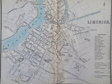 Limerick Ireland Detailed Tourist Map 1874 A. & C. Black city plan
-
$18.81
 1860 Antique Map; Ireland by G. Virtue / William Hughes
-
$20.19
 1890 ANTIQUE CITY MAP OF BELFAST NORTH IRELAND / KILLARNEY DUNDEE GLASGOW
-
$24.99
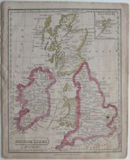 Original 1821 Map BRITISH ISLES England Scotland Ireland Wales Printed in Boston
-
$25.08
 SCOTLAND CAMPBELTOWN MULL OF KINTYRE JOHN CARY GENUINE ANTIQUE MAP c1822
-
$19.99
 1857 Findlay Map - Insulae Britannicae - England Scotland Ireland London Roman
-
$6.27
 1888 Map of environs Glengarriff Kenmare Bantry Ireland antique chromolithograph
-
$10.95
 Antique 1880 Ireland-England-Scotland book plate Map 9 x 12-suitable to frame
-
$8.00
 1899 ANTIQUE PEERLESS ATLAS MAP OF IRELAND-EXCELLENT DETAIL
-
$11.99
 1849 Bilder Atlas Map - Great Britain & Ireland - England Wales Scotland London
-
$13.32
 Bridges Of Ross Kilkee Ireland Steel Engraving From 1875 Ireland
-
$20.76
 1888 ORIGINAL ANTIQUE BATHY-OROGRAPHICAL MAP OF UNITED KINGDOM ENGLAND IRELAND
-
$8.86
 1892 Color Single Page Country Maps of Ireland and England & Wales
-
$140.00
 1812 Darton Union Atlas Map Ireland Dublin Belfast Cork Louth Limerick Galway
-
$25.08
 1841 Antique Map; Counties of Sligo & Roscommon, Ireland
-
$31.99
 c.1848 Glaser Atlas Map Great Britain & Ireland - England Wales Scotland London
-
$9.99
 1882 McNally Map - Europe - Spain France Austria Germany Russia Britain Italy
-
$12.00
 DUBLIN plan 1894 IRELAND ORIGINAL Map Baile Átha Cliath Éire
-
$19.99
 Original 1899 Map IRELAND Dublin Kerry Galway Ulster Londonderry Wicklow Tyrone
-
$56.47
 Original antique map x 3, IRELAND, ULSTER, MUNSTER, RAILWAYS, G.W. Bacon, 1896
-
$39.99
 1839 Stieler Physical Map Europe River Basins Mountain Ranges Rhine Danube Seine
-
$39.99
 1847 Stieler Map Europe France Spain Italy Germany England Austria Sweden Norway
-
$19.99
 1835 Smith Map - Europe - Spain France Germany Austria Russia Italy Sweden
-
$18.50
 1881 MAP OF COOK'S TOURS OF IRELAND SCOTLAND CENTRAL EUROPE RAILROADS STEAMSHIPS
-
$7.53
 3 antique maps of Wales in original colour by William Hughes pub c 1868
-
$24.99
 1885 Antique Atlas Map / BRITISH ISLES
-
$31.99
 1812 Malte Brun Lapie Map - England Wales London Oxford Liverpool Great Britain
-
$9.99
 Antique WICKLOW, CARLOW & WEXFORD County Map Ireland 1843 Original
-
$25.08
 1863 Lakes Of Killarney Antique Hand Coloured Weekly Dispatch Map
-
$19.99
 1887 Andrees Map - England Wales - London Liverpool Nottingham Bristol Thames UK
-
$106.25
 British Isles Ireland Railroads light houses coal field 1845 Copely scarce map
-
$63.75
 British Isles Ireland United Kingdom 1850's Brue large detailed map hand color


