 Antiques (US)
-
$247.49

 WAR DEPARTMENT MAP OF YELLOWSTONE & MISSOURI RIVERS Expedition of 1876 MAP
-
$148.75
 Chesapeake Bay York River James River Virginia Maryland 1833 Blunt coastal map
-
$63.75
 St. Louis Missouri City Plan Mississippi River 1853 scarce hand colored map
-
$127.50
 Wyoming & Idaho Teton Range Jackson Lake Snake River 1878 USGS large map
-
$29.99
 1894 SAN JOAQUIN RIVER CALIFORNIA NAGLEE'S FERRY TO NAGLEE'S WAREHOUSE COLOR MAP
-
$29.99
 1879 MAP OF THE COUNTRY PENINSULA OF FLORIDA CONSTRUCTION OF A SHIP CANAL MAP!
-
$26.80
 Original 1894 Antique Map NEW JERSEY Newark Toms River Edison Paterson Hamilton
-
$29.99
 1894 CHELSEA RIVER BOSTON HARBOR MA. FROM GRAND JUNCTION R.R. BRIDGE MAP!
-
$19.99
 1894 MAP OF THE REGION OF HOODS CANAL AND NORTH BAY WASHINGTON COLOR MAP!
-
$19.99
 1894 MAP OF A PART OF DENNIS CREEK NEW JERSEY 16.25 x 35.50!
-
$19.99
 1894 ENTRANCE TO QUILLAYUTE RIVER WASHINGTON W/VICINITY MAP COLOR MAP!
-
$29.99
 1894 MAP OF ALLOUEZ BAY WISCONSIN 27.50 x 40.50!
-
$19.99
 1895 MAP OF COOS RIVER OREGON SHOWING LOCATION OF SHOALS AND OBSTRUCTIONS!
-
$148.75
 Savannah River Georgia Jones Island Gibbet Island c. 1835 Blunt map Tybee Island
-
$63.75
 St. Louis Missouri Mississippi River Arsenal Island 1890 Bradley-Mitchell map
-
$181.99
 VTG CIVIL WAR MAP! REBEL FORTIFICATIONS ON THE MISSISSIPPI RIVER AT NEW MADRID!
-
$19.99
 1859 HYDROGRAPHY OF CRESCENT CITY HARBOR & APPROACHES CA & 1894 ROCKS SURVEY MAP
-
$18.73
 American Civil War. 29-31 December 1862. Battle of Stones River 1959 old map
-
$19.99
 1857 Map New York Bay & Hudson River Albany To New Baltimore
-
$10.00
 1883 SURVEY MAP-RAPPAHANNOCK RIVER, VA-FREDERICKSBURG BAR-US CORPS OF ENGINEERS
-
$12.00
 Large 1882 Antique Map: Mississipi River Delta to Memphis 13
-
$13.00
 1943 Vintage Map - Memphis to the Gulf - US Civil War - Mississippi River LA AR
-
$15.99
 Two Maps Florida Key West St. Johns River Surveys 1896 Free Ship
-
$9.99
 1894 PORTION OF DEEP CREEK UTILIZED BY THE DISMAL SWAMP CANAL VIRGINIA MAP!
-
$10.00
 1891 BEAUTIFUL MATTHEWS-NORTHRUP ANTIQUE ATLAS MAP-THE HUDSON RIVER-NICE DETAIL
-
$121.15
 1873 Plat Map CHARLES & MILLERS RIVER - B & L RAILROAD YARD, CAMBRIDGE, MA 14x17
-
$38.88
 1898 Mississippi River Map Missouri Illinois Powers Island Burnham Island
-
$44.88
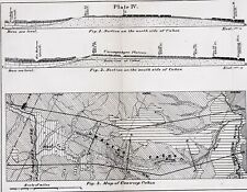 1869 Unaweep Canyon Colorado Map Dolores River Gunnison River ORIGINAL EXRARE
-
$63.75
 Cape Fear River Frying Pan Shoals North Carolina 1851 U.S. Coast Survey map
-
$55.25
 Alaska State Aleutian Islands Yukon River 1890 scarce folio Scribner-Black map
-
$83.30
 Blackstone River Valley Massachusetts drainage Worcester 1876 detailed map
-
$63.75
 Pittsburgh Pennsylvania City Plan Allegheny River 1853 scarce hand color map
-
$44.88
 1878 Blackfoot Basin Idaho Map Soda Springs Georgetown Bear River EXPLORATION
-
$38.88
 1877 WYOMING Map ORIGINAL Green River Basin Rocky Mountains Bitter Root
-
$4.00
 1883 ANTIQUE SURVEY MAP-SAVANNAH HARBOR & RIVER, GEORGIA-US CORPS OF ENGINEERS
-
$39.99
 Antique 1880 Mississippi River Survey Map Alton Illinois US Corps Engineers
-
$17.99
 1875 Warrens Report Wisconsin River Map Ghost Town Richland City Spring Green
-
$9.95
 1896 CIVIL WAR OFFICIAL RECORDS ATLAS MAP-SOUTH SIDE OF THE JAMES RIVER, VA-P 93
-
$139.01
 1889 George Rafter Antique Map The Rivers of New York State, Lake Ontario & Erie
-
$63.75
 Baltimore Maryland City Plan Patapsco River Green Mt. Cemetery 1872 Mitchell map
-
$35.00
 1855 Map of the Country Between SAN DIEGO AND THE COLORADO RIVER - CALIFORNIA
-
$9.99
 War of 1812 Map Battle of Lundy's Lane or Niagara Falls River Chippewa Canada US
-
$9.99
 Vintage Map "Map of Salmon River at and below Fort Covington, N.Y." 1884
-
$29.99
 1894 MAP SHOWING THE LOCKS OF THE MONONGAHELA NAVIGATION CO. & EACH DAM!
-
$29.99
 1894 MAP OF A PART OF COOPER CREEK NEW JERSEY 17.25 x 36.50!
-
$36.72
 NORTH & SOUTH CAROLINA/FLORIDA/GEORGIA.1897 DOUBLE SIDED 21.3" x 14.5 MAP*TAPED
-
$29.99
 1890 MISSOURI RIVER SHOWING LAND ERODED BETWEEN 1879 AND 1890 COLOR MAP!
-
$10.00
 1884 BEAUTIFUL ENGINEERING ANTIQUE ATLAS MAP OF MISSOURI RIVER AT KANSAS CITY
-
$24.99
 c1880 Antique Map of ST. LAWRENCE RIVER and GREAT LAKES
-
$79.00
 Original 1876 Dedham Map,Charles River,Mass MA,Old,Vintage,Massachusetts
-
$32.00
 1871 Tehuantepec Expedition River Map 52" x 22.5" Chart of Coatzacoalcos River
-
$51.00
 Hudson River Valley New York Manhattan NYC Albany 1882 uncommon color large map
-
$45.95
 1887 Plat Map ~ REECE, FALL RIVER, HAMILTON, NEAL, CLIMAX, KANSAS -#134
-
$64.00
 Original 1876 Needham Map,Lower Falls,Grantville,Charles River Village,Mass MA
-
$1800.00
 G W JOHNSON / Map of Niagara River 4 Miles above and 3 below the Falls 1849
-
$19.99
 1874 CUYAHOGA Co., OH Map 2nd, 3rd WARDS CLEVELAND, CUYAHOGA RIVER to MUIRSON ST
-
$45.95
 1877 Plat Map ~ WELLS RIVER, ORANGE Co., VERMONT (12x15)-#004
-
$21.99
 Antique NY Map Fort Bull William Mohawk River Wood Creek French Indian War 1849
-
$116.24
 Vintage New York Map Delaware and Hudson River Canal w/Railroads Mines 1828 1898
-
$11.95
 c. 1875 Index Map Principal Rivers in Massachusetts
-
$29.99
 1894 GEORGES RIVER MAINE NEAR THOMASTON MAP 22.25 x 39.25!
-
$7.99
 Vintage Map "Entrance of Coquille River, Oregon." 1885
-
$19.99
 1849 Map Niagara River Between Lakes Erie Ontario Great Island New York
-
$51.00
 Columbia River Mouth Oregon Territory 1851 U.S.C.S. map Cape Hancock lighthouse
-
$45.95
 1877 Plat Map ~ TOPSHAM, WAITS RIVER, ORANGE Co., VERMONT (12x15)-#002
-
$10.00
 1888 BEAUTIFUL ENGINEERING ANTIQUE ATLAS MAP-MISSISSIPPI RIVER-PLUM POINT REACH
-
$2.00
 1896 The mouths of the Mississippi. antique print Unites States US
-
$600.00
 1807 Yorktown River Attack in Virginia by JOHN MARSHALL, Revolutionary War MAP
-
$20.00
 1892 Perron map CONFLUENCE OF MISSISSIPPI AND OHIO RIVERS, CAIRO, ILLINOIS, #87
-
$109.99
 Antique Civil War Map Mississippi River Rebel Fortifications Pope Campaign 1866
-
$45.95
 1874 Plat Map ~ PENSONEAU STATION, OKAW RIVER, St. CLAIR Co., ILLINOIS -#018
-
$19.99
 1874 Antique CUYAHOGA Co. OH Map / TOWN OF BROOKLYN, Borders on Cuyahoga River
-
$5.00
 1866 ANTIQUE CIVIL WAR MAP OF SHENANDOAH RIVER AND MOUNTAIN RIDGE
-
$30.00
 Maps Showing Location of Work Done in White River, Arkansas 1896
-
$20.00
 1892 Perron map CONFLUENCE OF ARKANSAS AND MISSISSIPPI RIVERS, #90
-
$9.99
 Civil War Map Battle of Mechanicsville Beaver Dam Creek near Richmond Virginia
-
$57.80
 St. Lawrence River Montreal to Quebec Three Rivers 1826 Throop miniature map
-
$5.00
 1864 ANTIQUE CIVIL WAR MAP-BATTLEFIELD OF STONE RIVER-EXCELLENT DETAIL
-
$5.00
 1866 ANTIQUE CIVIL WAR MAP-MISSIONARY RIDGE & WEST CHICKAMAUGA RIVER, TENNESSEE
-
$55.25
 Quebec Canada Montreal Quebec City Three Rivers St. Lawrence 1870 Mitchell map
-
$51.00
 Quebec Canada Montreal Quebec City Three Rivers 1869 Mitchell hand color map
-
$17.50
 1913 Plat Map Delta Mills - Grand River City Mulliken Eaton County Michigan
-
$24.99
 1874 Antique CUYAHOGA Co., OHIO Map / CLEVELAND 8th WARD, along Cuyahoga River
-
$64.00
 Original 1872 Map Haverhill & Bradford,River,Not Repro,Massachusetts,MA,Mass,Old
-
$21.88
 ORIGINAL c.1870 NORTHERN MANITOBA CHURCHILL NELSON & HAYES RIVERS MAP 18.5”x10.5
-
$67.50
 1862 US Coast Survey Map of NEW YORK HUDSON RIVER, Poughkeepsie To Glasco
-
$19.99
 1874 CUYAHOGA Co., OH Map 1st WARD CLEVELAND, BORDERS CUYAHOGA RIVER, ERIE ST
-
$30.77
 NEW MEXICO/KENTUCKY & TENN/NEW ORLEANS.1897 DOUBLE SIDED 21.7" x 14.5 MAP
-
$20.00
 1892 Perron map FALL RIVER, MASSACHUSETTS, #39
-
$15.99
 ANTIQUE 1854 BLACK RIVER HARBOR IRONWOOD MICHIGAN DATED MAP DETAILED RARE FINE
-
$33.00
 Lt GK Warren's 1855 and 1856 Manuscript Maps of the Missouri River Callaway Wood
-
$14.99
 Vintage Map "Improving Upper Missouri River Bar Below Westcott ID." 1897
-
$80.00
 Mississippi/Wisconsin River - Map of a Geological Report (1852) - David D. Owen
-
$19.99
 1874 CUYAHOGA Co., OH Map / 4th WARD CLEVELAND, CUYAHOGA RIVER to EUCLID AVE.
-
$9.99
 Civil War Map Kentucky Tennessee Troops Island No 10 Murfreeboro Shiloh Battle
-
$20.00
 1892 Perron map ANCIENT RIVER BETWEEN TWO BASINS OF LAKE BONNEVILLE, UTAH, #153
-
$14.99
 Antique Map "Peninsula Between York and James Rivers." Civil War, 1868
-
$15.99
 Harper Civil War Map Mississippi River Cairo to Memphis Natchez New Orleans
-
$83.30
 Philadelphia & Camden Pennsylvania New Jersey Schuylkill River 1872 Mitchell map
-
$55.25
 Montague Athol Ct. river Northfield Franklin Massachusetts 1891 Walker map


