 Antiques (US)
-
$17.95

 1660 Castello Plan New Amsterdam Historic Vintage Style Wall Map - 20x28
-
$475.00
 1910 OREGON RELIEF WALL MAP 31x40" US GENERAL LAND OFFICE GLO color antique rare
-
$32.99
 1919 - 1940 Urbana Illinois IL 34" Historical Political Campaign County 1988 Map
-
$15.00
 Antique 1913 NY Hamilton County Geological Topography Survey Map 16&1/2"x20"
-
$495.00
 1916 antique ELDRIDGE MAP linen backed GLOUCESTER to KENNEBEC RIVER 24.5"x67"
-
$68.00
 Montgomery County Maryland Large Original Vintage 1916 Wall Map 33 by 39 Inches
-
$14.97
 1916 NY State Wall Map. Soft Pastels. 19x12. 1910s New York Map Art Print Decor
-
$34.95
 Barstow 1917 Sanborn Fire Insurance Map, Exquisitely Detailed Map - Poster
-
$8.00
 Topographic Map of Playas Quadrangle, New Mexico - 1918 - US Geological Survey
-
$32.95
 Hollywood 1913 Sanborn Fire Insurance Map, Exquisitely Detailed Map - Poster
-
$749.99
 1916 Color Wall Map GEOLOGY OF CALIFORNIA "Mother Lode" Oil Wells Roads Railways
-
$26.97
 ME 1912 MAINE RAILROAD Wall Map. BRIDGTON & SACO RIVER RR ; KENNEBEC CENTRAL RR
-
$26.97
 MA 1912 DATED MASSACHUSETTS / BOSTON RAILROAD Wall Map. 1910s CHESTER BECKET RR
-
$120.00
 ANTIQUE ORIGINAL NORTH AMERICA MAP 1913 RARE -W&AK JOHNSTON- SPECIAL PRICING!
-
$29.97
 MN 1909 MINNEAPOLIS ST SAINT PAUL City Wall Map.1900s Map Art Print Decor. MNPLS
-
$26.47
 XL 1916 EASTERN PENNSYLVANIA RAILROAD Wall Map. McNally COMMERCIAL. PA 1910s.
-
$28.47
 MO KS 1911 DATED KANSAS CITY Missouri & Kansas Wall Map. 1910s. Railroads
-
$39.95
 Antique Map 1914 Clinton County Illinois Topographic canvas 40" x 24" U.S Geo
-
$8.00
 Topographic Map of Henderson Quadrangle - Kentucky - 1916 - US Geo. Survey
-
$45.00
 1915 DODGE COUNTY Minnesota WALL MAP Mantorville Kasson Hayfield BANK Advertsing
-
$182.00
 1911 Cram's Superior Map New York, Wall Map, School Map, Original Rollers Rare
-
$15.00
 1915 - 1916 Lot of 5 Iowa Lake Maps Duck, Little Wall, Goose, & Silver Lakes
-
$55.00
 Antique 1904 Topography Map Castine, Maine Penobscot Bay Quadrangle
-
$125.00
 Vintage 1915 New Yok Wall Map.
-
$92.00
 GIANT HISTORICAL 1912 KNICKERBOCKER BEER NEW YORK CITY BIRD'S EYE VIEW WALL MAP
-
$75.99
 1913 Maine Wall Map post office routes postal mail canvas backed 48.5 x 38.5"
-
$375.00
 1913 RD George Geologic Map of Colorado Large pre-USGS Official State Geol Map
-
$100.00
 Vintage 1915 Wall Premiere Map of Ohio US WWI Pictures Dirigible Panama Canal
-
$59.95
 HUGE PANORAMIC 1912 KNICKERBOCKER BEER NEW YORK CITY BIRD'S EYE VIEW WALL MAP
-
$52.99
 Chadwicks 1912 Genesee County Cloth Wall Plat Map, 50 x 38 Inches, Davison,Flint
-
$34.00
 LARGE HISTORICAL 1912 KNICKERBOCKER BEER NEW YORK CITY BIRD'S EYE VIEW WALL MAP
-
$174.99
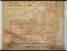
 ANTIQUE WALL MAP OF NEW YORK ON ROLLER CRAMS SUPERIOR 1911
-
$599.99
 H.C. Tunison Birds Eye View Map of The Holy Land Circa 1910 44” X 62”RARE!!!
-
$22.00
 VINTAGE PANORAMIC 1912 KNICKERBOCKER BEER NEW YORK CITY BIRD'S EYE VIEW WALL MAP
-
$99.99
 ANTIQUE PLAT MAP TAYLOR COUNTY WISCONSIN 32" X 32" 1916 ORIGINAL OLD ADS MEDFORD
-
$800.00
 1917 Marion County Kansas Platt Map Ownership by section. Original!! 49 x 37
-
$23.96
 Iowa Wright County Map Wall Lake Township 1912 K12#21


