 Antiques (US)
-
$24.90

 1922 England & Wales Fold Out Fabric Map / Automobile Association & Motor Union
-
$9.95
 1923 Orginial Antique Hammond Map of Netherlands & Belgium on rev. British Isles
-
$20.00
 Vintage Map,ENGLAND & WALES,Ordnance Survey,Color,C.1920's
-
$22.00
 Merionethshire, Montgomery & Radnor, Wales. Original 1922 Ordnance Survey Map
-
$185.00
 1927 Booklovers Map of the British Isles pictorial mounted framed P Paine Bowker
-
$25.03
 England and Wales Dissected Cloth Road Map Geographia 1920
-
$19.99
 1921 Johnston Map Netherlands Belgium Luxemburg Holland Amsterdam Brussels Ghent
-
$22.00
 Pembrokeshire Carmarthenshire Cardigan - Large Original 1922 Ordnance Survey Map
-
$19.99
 1921 Johnston Map South England Cornwall Lands End Devon Somerset Dorset Dexter
-
$15.99
 1921 Johnston Map Wales Bristol Anglesey Cardiff Pembroke Glamorgan - Dexter Ad
-
$24.89
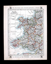
 1922 MAP OF GREAT BRITAIN SCOTLAND WALES IRELAND CLIMATE VEGETATION
-
$29.43
 1922 PHYSICAL MAP OF GREAT BRITAIN SCOTLAND WALES IRELAND MOUNTAINS RIVERS
-
$19.99
 1921 Johnston Physical Map British Isles Great Britain England Ireland Scotland
-
$24.00
 2 x England Maps 1922: British Isles / England Wales Times Atlas - Bartholomew
-
$12.95
 1926 ANTIQUE COLOR MAP ~ BRECON BEACONS DISTRICT ~ WALES UK ~ 100% AUTHENTIC
-
$12.95
 1926 ANTIQUE COLOR MAP ~ SNOWDON DISTRICT ~ WALES U.K. ~ 100% AUTHENTIC
-
$19.99
 1921 Johnston Map NW Scotland Hebrides Isles Skye Loch Ness Inverness Dexter Ad
-
$9.99
 c1925 Taschen Atlas Map British Isles England Scotland Ireland London Dublin UK
-
$19.99
 1921 Johnston Map England & Wales London Liverpool Bath Cornwall Bristol Dexter
-
$33.53
 1922 ANTIQUE MAP OF UNITED KINGDOM GREAT BRITAIN ENGLAND WALES SCOTLAND IRELAND
-
$22.57
 1927 ORIGINAL VINTAGE MAP OF VICINITY OF BARMOUTH DOLGELLAU DOLGELLEY / WALES
-
$5.00
 1921 RARE ANTIQUE CRAM ATLAS MAP-ENGLAND & WALES-EXCELLENT DETAIL
-
$14.99
 1921 Antique ORIGINAL 11" England Wales Map English Channel North Sea
-
$118.95
 LARGE 1922 ORDNANCE SURVEY ATLAS OF ENGLAND & WALES - 24 LINEN BACKED MAPS
-
$6.26
 c1920 Bacon's Cycling & Motoring Map of LIVERPOOL & NORTH WALES - Cloth Map
-
$12.75
 1926 ANTIQUE COLOR MAP ~ CHESTER, WALES UK ~ STREETS DETAIL ~ 100% AUTHENTIC
-
$27.00
 1926 COLOR MAP ~ SOUTH WALES U.K. ~ ORIGINAL ~ 100% AUTHENTIC
-
$6.26
 OS 1/4 inch to 1 mile map Sheet 7a South Wales
-
$93.91
 100% ORIGINAL EDGLAND WALES TRANSPORT FOLDING MAP LINEN BY G PHILLIP C1930/S
-
$18.23
 1922 Monmouthshire large county map. 101 years old. Wales. Newport, Pontypool.
-
$46.75
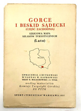 Vintage EUROPE Warsaw Map Mapa Sketch Map of Hiking Trails 1957
-
$11.26
 Readyfold Coloured Touring Map c1930 - JOHNSTON - Section 14, Wales Anglesey IOM
-
$29.43
 1927 ORIGINAL VINTAGE ITALIAN MAP OF ENGLAND WALES LONDON MANCHESTER LIVERPOOL
-
$27.97
 1927 ORIGINAL VINTAGE MAP OF UNITED KINGDOM GREAT BRITAN ENGLAND IRELAND
-
$61.36
 VINTAGE ADMIRALTY CHART. No.2878. APPROACHES TO MILFORD HAVEN. 1925 Edition.
-
$60.09
 LARGE 1922 ORDNANCE SURVEY ATLAS OF ENGLAND & WALES - 24 LINEN BACKED MAPS
-
$13.77
 ordnance survey maps One Inch, 1923, Picture Cover Wales, Brecon, Llandovery
-
$6.26
 c1920 NORTH WALES ~ Bartholomew's Coloured CLOTH MAP Sheet 11
-
$16.22
 100% ORIGINAL LARGE S WALES PEMBROKE CARDIGAN MAP BY ORDNANCE SURVEY C1922 VGC
-
$30.45
 c-1920 original Antique/Vintage map of Cambridge University , Varsity
-
$107.67
LARGE 1922 ORDNANCE SURVEY ATLAS OF ENGLAND & WALES - 24 LINEN BACKED MAPS
-
$9.99
 Antique 1920's Perrier Motor Map of England & Wales Map Sheets Set with Holder
-
$12.52
 c1920 Bacon's "Ever-Ready" Cycling and Motoring MAP of LIVERPOOL & NORTH WALES
-
$27.00
 1926 COLOR MAP ~ NORTH WALES U.K. ~ ORIGINAL ~ AUTHENTIC
-
$15.03
 ordnance survey maps One Inch, 1922, Picture Cover Wales, Barmouth, Aberystwyth
-
$16.27
 Bartholomew's Revised Survey Sussex Map (c1920) Sheet 32 - Dissected on Cloth
-
$20.00
 Vintage Map,NORTH WALES,UK,Bartholomew's 1/2" Contour,Sheet 11,Color,C.1920
-
$23.79
 BRISTOL, NEWPORT, CHEPSTOW, WESTON SUPER MARE.1928. ADMIRALTY SEA CHART. No.1176
-
$12.52
 ordnance Survey Map Half Inch Picture Cover 1925, Bristol and Cardiff
-
$25.03
 Philips' Ten Sheet Road Map of England and Wales (c1920) London, Home Counties
-
$123.95
 The Royal Atlas of England & Wales by J.G. Bartholomew 1926 - Large Book
-
$18.77
 Bartholomew's Survey Map of Aberdeen & Deeside (c1920) Sheet 17, England, Cloth
-
$38.82
 Map of South West England and South Wales from the 1920 Times Atlas (Plate 19)
-
$37.55
 1925 (1960) Antique Map; Admiralty Chart 2878, Approaches to Milford Haven Wales
-
$10.02
 ordnance survey maps One Inch, 1922, Picture Cover Wales, Portmadoc, Criccieth
-
$9.39
 c1920s NORTH WALES Dissected Cloth Map - THE MOTOR Coloured & Contoured 3 Miles
-
$12.51
 Vintage Bartholomew Folding Map; Carmarthen, Wales (c1930s) Stanford Sheet 22
-
$62.61
 Geographia Two-Sheet Map of England & Wales Book
-
$87.64
 Antique Bartholomews Ordnance Map Of England And Wales Area Of Focus Kent
-
$12.51
 Vintage Bartholomew Folding Map; North Wales & Angelsey (c1930s) Stanford 11
-
$25.03
 1920 MAP OF ENGLAND and WALES Southwestern Section Plate 19 Times Atlas of World
-
$66.36
 Bacon's Map of England and Wales Showing Railways Roads and Distances ca1920
-
$25.03
 1920 MAP OF ENGLAND AND WALES SouthEastern Section Plate 18 Times Atlas of World
-
$12.52
 Geographia Numbered Rd Touring Map England & Wales No.2 South West Counties 1928
-
$16.22
 100% ORIGINAL LARGE ANGLESEY NORTH WALES MAP BY ORDNANCE SURVEY C1922 VGC
-
$16.22
 100% ORIGINAL LARGE S WALES GLAMORGAN TENBY MAP BY ORDNANCE SURVEY C1922 VGC
-
$67.12
 1920 LARGE MAP ~ ENGLAND & WALES ~ SOUTH EAST 23" x 18"
-
$25.03
 Vintage Map of England & Wales (c1930s) North/South, London Inset, Road & Rail
-
$12.51
 ENGLAND & WALES Northern Section - Vintage Map 1922 by Bartholomew
-
$15.01
 Antique Map 1920 - England and Wales (North Section) Harmsworth Atlas
-
$8.77
 J. BARTHOLOMEW VINTAGE MAP-NEW SOUTH WALES- PUBL.W&R CHAMBERS LTD.-1924/1926
-
$8.14
 1926 AA ROAD "ROADS PATROLLED" MAP OF ENGLAND & WALES. (65cm x 60cm)
-
$12.51
 Motorists' Road Map of England, Scotland & Wales (c1930s) Russian Oil Products
-
$16.27
 Bartholomew's Revised Survey Herts & Bucks Map (c1940) Sheet 15 - Cloth, Folding
-
$26.30
 Map: South Northumberland - Bartholomew's Eng. & Wales, 2, 2 Miles to Inch, 1920
-
$31.29
 Bartholomew's Revised Map Half Inch to Mile Sheet II North Wales c 1925
-
$25.03
 Vintage map England & Wales 1922 Cloth
-
$12.52
 Geographia Numbered Rd Touring Map England & Wales No. South East Counties 1928
-
$12.51
 Cycling & Motoring Map of the Midlands (c1920) Birmingham, Warwickshire, Larby
-
$37.55
 Vintage Map of England & Wales (c1920s) North/South, Paper on Cloth, inc Index
-
$16.27
 Bartholomew's Revised Survey South Wales Map (c1920) Sheet 27 Dissected on Cloth
-
$18.77
 Vintage Bartholomew Map of Shropshire - c1920 - Sheet 17 - Welsh Borders, Wales
-
$18.77
 Original Antique Map of Southern Great Britain (c1920) England & Wales, Stanford
-
$18.77
 Phillips Ten Sheet Road Map of England and Wales c1920 - North Wales/Cheshire
-
$108.38
 1921 LARGE MAP ~ ENGLAND & WALES NORTHERN SECTION ~ LANCASHIRE YORK LINCOLN
-
$25.03
 VINTAGE COLLECTION OF ENGLAND / WALES MAPS AND CATALOGUES 1926 ONWARDS
-
$108.38
 1920 LARGE MAP ~ ENGLAND & WALES SOUTH-EASTERN SECTION CHANNEL MIDDLESEX LONDON
-
$71.43
 1926 MAP ~ ENGLAND & WALES COUNTIES PRINCIPAL CITIES & TOWNS YORK SHROPSHIRE
-
$108.38
 1920 MAP ~ ENGLAND & WALES ~ LIVERPOOL MANCHESTER ENVIRONS BIRMINGHAM LONDON
-
$71.43
 1920 LARGE MAP ~ ENGLAND & WALES YORK DURHAM ESSEX CORNWALL NORFOLK LINCOLN etc
-
$108.38
 1921 LARGE MAP ~ ENGLAND & WALES SOUTH WESTERN CORNWALL CARMARTHEN CARDIGAN
-
$108.38
 1921 LARGE MAP ~ ENGLAND & WALES ~ NORTHERN SECTION ISLE OF MAN LANCASHIRE
-
$108.38
 1920 LARGE MAP ~ ENGLAND & WALES NORTHERN SECTION WESTMORLAND DURHAM YORK
-
$108.38
 1920 COUNTY MAP of WALES ~ CENTRAL PEMBROKE MONTGOMERY BRECON & RADNOR CARDIGAN
-
$83.75
 1920 LARGE MAP ENGLAND WEST & WALES CORNWALL LIVERPOOL DOCKS MANCHESTER
-
$108.38
 1921 LARGE MAP ~ ENGLAND & WALES ~ SOUTH-WESTERN SECTION CARMARTHEN HEREFORD etc
-
$67.12
 1920 LARGE MAP ~ ENGLAND & WALES ~ SOUTH WEST 23" x 18"
-
$108.38
 1920 COUNTY MAP of WALES ~ SOUTH SHEET CARMARTHEN SWANSEA WELSH PLACE-NAMES
-
$83.75
 1920 LARGE MAP AUSTRALIA NEW SOUTH WALES VICTORIA QUEENSLAND TASMANIA MELBOURNE
-
$38.82
 Map of "England and Wales - Northern Section" from 1920 Times Atlas (Plate 20)


