 Antiques (US)
-
$184.33

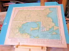
 1940 Lufkin Cane Map of Boston, Massachusetts WITH THE CANE!
-
$97.00
 1949 United States Map ORIGINAL West Indies America Mexico Florida Great Lakes
-
$50.00
 1940s Map of Bridgewaters and Middleboro, Taunton Mass., WW2 Map, Antique Map
-
$37.50
 Haverhill Groveland & Merrimac Massachusetts 1940 Manning lg. detailed city plan
-
$9.09
 Vintage 1948 Ray Walker's Resort Vacation Haverhill 1 Massachusetts Map (D4)
-
$9.09
 Vintage 1948 Ray Walker's Resort Vacation Haverhill 1 Massachusetts Map (D5)
-
$12.95
 1940s Vintage City Map of BOSTON Massachusetts Street Map Wall Art Decor
-
$5.99
 L@@K! Vintage 1940 World Atlas Colored Maps of Massachusetts MA Michigan MI WWII
-
$13.00
 1943 Vintage Map - Boston in 1775 and 1776 - Revolutionary War - Bunker Hill
-
$18.95
 1940s Vintage Boston Picture Map Liozu Boston Print Wall Art Decor 1560
-
$13.00
 1943 Vintage Map - The United States on March 4, 1861 - The Civil War
-
$26.00
 1940 Folding Map QUINCY, MA ~ Publ. Ernest W. Branch, Civil Engineers/Surveyors
-
$29.99
 1940's Army topo map Bridgewater Massachusetts- Sheet 6867 IV NW
-
$15.00
 Topographic Map Barre Massachusetts Antique Printed 1942 16x20 Wall Art
-
$36.00
 1941 Map MARLBORO QUAD MA Geological Survey 16x20" (folded) Northboro, etc
-
$129.99
 vtg art nouveau MAP antique sign MA CT NY photo crafts deco Hoover Vacuum sales
-
$14.41
 ca 1942 Vintage MASSACHUSETTS State Map Antique Map of Massachusetts Wall Art
-
$28.97
 Map Bridgewater, Ma. Geological Survey Topographic Quad 7.5 Minute 1962 Vintage
-
$4.99
 1949 state maps Michigan & Massachusetts 14x11" sheet counties cities towns
-
$21.37
 1949 VINTAGE OF MARYLAND DELAWARE BALTIMORE WASHINGTON D.C. MASSACHUSETTS BOSTON
-
$20.19
 1943 VINTAGE WWII MAP OF MARYLAND DELAWARE / MASSACHUSETTS RHODE ISLAND
-
$6.99
 Vintage World War WWII 1944 World Atlas City Map Boston, MA Cambridge Mass L@@K!
-
$24.99
 1940's Army topographic map Pepperell Massachusetts -Sheet 6669 II NE
-
$75.00
 Vintage 1941 Map of Martha's Vineyard Block Island, BUZZARDS AND NARRAGAN BAYS
-
$13.00
 1943 Vintage Map - The Thirteen Colonies - New York City Boston Charleston
-
$7.45
 Northfield Mass. N.H. VT 17" X 21" Vintage 1946 USGS Topographic Topo Map
-
$28.97
 Map Brocton Ma. Geological Survey Topographic Quad 7.5 Minute 1962 Vintage
-
$8.00
 Topographic Map of Cotuit, MA 1943 - US Geological Survey
-
$24.95
 Rare Vintage 1949 Shelburne Falls Massachusetts US Geological Survey Map
-
$24.95
 US GEOLOGICAL SURVEY 1948 TOPOGRAPHIC MAP SOMERSET QUADRANGLE MASSACHUSETTS
-
$36.00
 1946 Map SPRINGFIELD MA.-CT. QUAD War Dept. Geological Survey 17x21" (folded)
-
$19.95
 US GEOLOGICAL SURVEY 1949 TOPOGRAPHIC MAP FALL RIVER MASSACHUSETTS-RI
-
$24.99
 1940's Army (like USGS) topographic map Paxton Massachusetts -Sheet 6668 IV SW
-
$24.78
 1945 Two-Sided Color Railroad Map DE/MD/MA/RI Hammond 9.25x12.25"
-
$29.99
 1940's Army topo map Whitman Massachusetts- Sheet 6868 III SW
-
$12.00
 c. 1941 Massachusetts Original Rand McNally Atlas Map
-
$24.99
 1940's Army topographic map Shirley Massachusetts -Sheet 6669 II SW
-
$24.99
 1940's Army topo map Blackstone Massachusetts (like USGS) 6668 II SE Woonsocket
-
$36.00
 1946 Wales Mass/Conn. Quadrangle WAR DEPT. Topographical Map 17 x 19.5"
-
$40.00
 1944 - ANTIQUE Map of Tisbury Great Pond Quadrangle - Massachusetts
-
$187.49
 c.1941 Essex Co Salem Massachusetts Map New Post Office Location ? Delivery Area
-
$4.75
 1952 Antique MASSACHUSETTS Atlas Map - Vintage Hammond's New Supreme World Atlas
-
$12.00
 USGS topographic map Becket Mass
-
$24.99
 1940's Army topographic map Gardner Massachusetts -Sheet 6669 III SW
-
$29.99
 1940's Army topographic map (like USGS) Newton Massachusetts -Sheet 6768 I SW
-
$11.99
 1949 Antique Map Massachusetts Boston Cape Cod Plymouth Springfield Worcester
-
$29.99
 1940's Army topographic map Concord Massachusetts -Sheet 6768 IV NE
-
$4.99
 1949 City Map of Boston Massachusetts 14x11" sheet streets parks points interest
-
$24.99
 1940's Army topographic map Brockton Massachusetts -Sheet 6768 II SE
-
$29.99
 1940's Army (like USGS) topo map Weymouth Massachusetts- Sheet 6868 III NE
-
$7.50
 Map Massachusetts and Michigan 1944
-
$24.99
 1940's Army topographic map Bernardston Massachusetts -Sheet 6469 II NE
-
$8.99
 Topographic Map Dept interior Boston North 1986 Melrose Somerville Waltham more
-
$12.00
 USGS topographic map Tolland Mass-Conn
-
$29.99
 1940's Army topo map (like USGS) Onset Massachusetts- 6867 II NW Buzzards Bay
-
$34.99
 1940's Army topo map Scituate Massachusetts- Sheet 6867 II NW
-
$5.99
 L@@K! Vintage 1943 World Atlas Colored Maps of Massachusetts MA Michigan MI WWII
-
$49.99
 1940's Army (like USGS) topo map Plymouth Massachusetts w/ Photo -6967 III NW
-
$29.99
 1940's Army topo map Hull Massachusetts- Sheet 6868 IV SW
-
$17.76
 Boston Massachusetts Map 1947 Vintage ready to frame for art 11 x 14 inch
-
$20.00
 Antique Original 1945 USGS Westford (Mass) Quadrangle
-
$29.99
 1940's Army topo map Snipatuit Pond Massachusetts- Sheet 6867 IV SE
-
$29.99
 1940's Army topo map Plympton Massachusetts- Sheet 6867 IV NE
-
$18.99
 1946 Survey CAMBRIDGE, MA ~ General Cotton Supply Corp, Pleasant St & Putnam Ave
-
$24.99
 1940's Army topo map (like USGS) Wareham Massachusetts- Sheet 6867 I SW
-
$25.00
 Antique Original 1945 USGS Map Tyngsboro Quadrangle
-
$20.00
 Vintage-Map of the Cuttyhunk Quadrangle (Elizabeth Islands) Massachusetts 1944
-
$34.99
 1940's Army topo map Salem Massachusetts- Sheet 6869 III SW
-
$19.99
 1940's Army (like USGS) topographic map Winsor Dam Massachusetts -6568 IV SE
-
$95.00
 Vintage 1941 Map of Martha's Vineyard Block Island, BUZZARDS AND NARRAGAN BAYS
-
$29.99
 1940's Army topo map Hanover Massachusetts- Sheet 6868 III SE
-
$24.99
 1940's Army topographic map Framingham Massachusetts -Sheet 6768 IV SW
-
$24.99
 1940's Army topographic map Webster Massachusetts -Sheet 6668 III SW
-
$4.99
 Vintage 1893 Reprinted 1942 Topographical Map of Brookfield Sturbridge Mass
-
$125.00
 Scarce Vintage Illustrated History Map ~ Old Shawmut Boston to Modern
-
$24.99
 1940's Army topographic map Pittsfield West Massachusetts -Sheet 6368 IV NE
-
$29.99
 1940's Army topo map Sconticut Neck Massachusetts-Sheet 6867 III SE
-
$24.99
 1940's Army (like USGS) topographic map Ashby Massachusetts -Sheet 6669 II SW
-
$19.99
 1940's Army topographic map Winchendon Massachusetts -Sheet 6569 II NE
-
$29.99
 1940's Army topo map Sagamore Massachusetts- Sheet 6867 I SE
-
$19.99
 1940's Army topographic map Shutesbury Massachusetts -Sheet 6568 IV NW
-
$15.99
 Original 1941 USGS Road Map PAXTON Massachusetts Rutland North Spencer Railroad
-
$24.99
 1940's Army topographic map Oxford Massachusetts -Sheet 6668 III SE
-
$29.99
 1940's Army topo map Rockport Massachusetts- Sheet 6869 II NE
-
$19.99
 1940's Army topographic map Mount Grace Massachusetts -Sheet 6569 III NE
-
$14.99
 Original 1943 USGS Road Map MARLBOROUGH Massachusetts Westborough Railroads
-
$24.99
 1940's Army topographic map Fall River East Massachusetts -Sheet 6767 II NE
-
$24.99
 1940's Army topographic map Ashburnham Massachusetts -Sheet 6669 III NW
-
$19.99
 1940's Army topographic map Hudson Massachusetts -Sheet 6668 I NE
-
$24.99
 1940's Army topographic map Maynard Massachusetts -Sheet 6768 IV NW
-
$24.99
 1940's Army (like USGS) topographic map Haverhill Massachusetts -Sheet 6769 I SE
-
$24.99
 1940's Army topographic map Northfield Massachusetts -Sheet 6569 III NW
-
$24.99
 1940's Army topographic map Woronoco Massachusetts -Sheet 6468 III NE
-
$29.99
 1940's Army (like USGS) topographic map Blue Hills Massachusetts -6768 II NE
-
$24.99
 1940's Army (like USGS) topographic map Southwick Massachusetts -6468 III SE
-
$24.99
 1940's Army (like USGS) topographic map Palmer Massachusetts -Sheet 6568 III NE
-
$24.99
 1940's Army (like USGS) topographic map Ware Massachusetts -Sheet 6568 I SW
-
$24.99
 1940's Army (like USGS) topographic map Shelburne Falls Massachusetts 6469 II SW
-
$39.95
 Springfield Massachusetts 1948 Original Vintage USGS Topo Map
-
$21.78
 ORIGINAL 1948 LYNN MASSACHUSETTS LYNN WOODS SLUICE & WALDEN POND ATLAS MAP


