 Antiques (US)
-
$11.75

 1966 SCOTLAND + NORTHERN ENGLAND Atlas Map, vintage World Book Atlas, full color
-
$9.39
 1960's Vintage IRELAND Atlas Map - Old Antique Rand McNally World Atlas
-
$11.75
 1966 BRITISH ISLES Atlas Map, vintage World Book Atlas, color, Ireland England
-
$8.17
 Vintage IRELAND Atlas Map Print 1964 Encyclopedia Britannica World Atlas Page
-
$21.19
 Vintage Tourist Map of Great Britain and Northern Ireland United Kingdom 1960
-
$19.50
 Historical Map of Ireland by L.G. Bullock Color Map 1962 printing
-
$3.75
 VINTAGE SEA CHART / NAUTICAL MAP 1961 - Ireland - Kinsale - To Frame?
-
$3.99
 VTG 1964 National Geographic Shakespeare's Great Britain Ireland England Map
-
$4.08
 VINTAGE SEA CHART / NAUTICAL MAP 1961 Ireland Arklow Ardglass Killough Rosslare
-
$149.99
 Vintage Framed 1964 National Geographic Shakespeare's Britain England & Ireland
-
$19.99
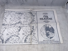 National Geographic August 1970 Map The Heavens w/ Monthly Star Chart 2 Hemisphe
-
$22.57
 Antique/Vintage Map of Changes in Cultivation in Cornwall 1485 - 1952
-
$7.99
 VTG 1964 National Geographic Shakespeare's Great Britain Ireland England Map
-
$8.48
 VTG 1964 National Geographic Shakespeare's Great Britain Ireland England Map
-
$5.98
 Map of Dublin 1969 Suirbheireacht Ordonais
-
$61.48
 VINTAGE ADMIRALTY CHART. No.1753. BELFAST LOUGH and DOCKS. 1962 Edition.
-
$24.99
 1964 BRITISH AUTOMOBILE ASSOCIATION IRELAND ROUTE MAP (TRIPTIK)
-
$4.08
 VINTAGE SEA CHART / NAUTICAL MAP 1961 - Ireland - Baltimore & Crookhaven
-
$4.08
 VINTAGE SEA CHART / NAUTICAL MAP 1961 Ireland - Teelin & Killybegs Harbours
-
$4.08
 VINTAGE SEA CHART / NAUTICAL MAP 1961 Ireland - Westport Bay - To Frame?
-
$9.99
 VTG 1964 National Geographic Shakespeare's Great Britain Ireland England Map
-
$4.08
 VINTAGE SEA CHART / NAUTICAL MAP 1961 Ireland Castletown Harbour Bearhaven
-
$4.08
 VINTAGE SEA CHART / NAUTICAL MAP 1961 Ireland - Portrush & Lough Larne To Frame?
-
$4.08
 VINTAGE SEA CHART / NAUTICAL MAP 1961 - Ireland COBH (Queenstown) To Frame?
-
$4.08
 VINTAGE SEA CHART / NAUTICAL MAP 1961 - Ireland Kilmakilloge Ardgroom & Sneem
-
$4.08
 VINTAGE SEA CHART / NAUTICAL MAP 1961 - Ireland - Glengariff & Bantry Harbours
-
$4.08
 VINTAGE SEA CHART / NAUTICAL MAP 1961 -Ireland - Galway & Tralee Bays & Fenit H
-
$4.08
 VINTAGE SEA CHART / NAUTICAL MAP 1961 - Ireland - Valencia Island - To Frame?
-
$12.55
 Ireland AA Automobile Association 1966 Folding Map
-
$4.08
 VINTAGE SEA CHART / NAUTICAL MAP 1961 Ireland Birterbuy Round stone & Cloonile
-
$3.76
 Vintage Ordnance Survey 1: 575,000 Map of Ireland (1964)
-
$4.08
 VINTAGE SEA CHART / NAUTICAL MAP 1961 Ireland - Slyne Approaches..to frame!
-
$4.08
 VINTAGE SEA CHART / NAUTICAL MAP 1961 - Ireland Waterford & Dun Laoghaire Hbours
-
$15.06
 1964 IRELAND IRISH FOLDOUT MAP
-
$25.08
 Vintage1964 LETTERKENNY Ireland Irish Fo,d Out Wall Map Railways Road Grid 1960s
-
$18.81
 Coleraine Wall Map Govt of Ireland OS 1962 Fold Out Ordnance Survey VGC
-
$35.13
 PICTORIAL HISTORY MAP OF IRELAND - 30" x 20" PHOTOGRAPHIC PRINT
-
$20.00
 VTG 1964 National Geographic Shakespeare's Great Britain Ireland England Map
-
$12.55
 Ordnance survey Ireland Killarney district circa 1964
-
$20.00
 VTG 1964 National Geographic Shakespeare's Great Britain Ireland England Map


