 Antiques (US)
-
$79.00

 Denoyer-Geppert Visual Relief Wall Map S170vr 1968 Northeatern U.S. Chicago
-
$50.00
 Huge Carter Coordinate map of Kentucky 58"x 28" (1960)
-
$39.95
 Mount Washington Kentucky 1960 Original Vintage USGS Topo Map
-
$34.95
 Linton Kentucky 1960 Original Vintage USGS Topo Map
-
$9.95
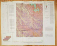
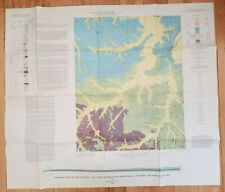
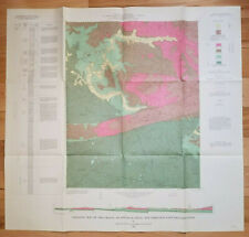
 Vintage 1967 Geologic Map of Clay City, Powell and Estill Counties, Kentucky
-
$19.95
 Vintage 1967 Geologic Map of Clay City, Powell and Estill Counties, Kentucky
-
$15.00
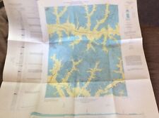
 Winchester KY 1967 USGS Topographical Geological Survey Quadrangle Map 22 x 32
-
$19.95
 Vtg 1968 Geologic Map of Nicholasville, Jessamine & Fayette Counties, Kentucky
-
$19.95
 Vintage 1968 Geologic Map of Olney, Caldwell and Hopkins Counties, Kentucky
-
$39.95
 Lewisport Kentucky 1962 Original Vintage USGS Topo Map
-
$34.95
 Delmer Kentucky 1962 Original Vintage USGS Topo Map
-
$6.32
 1960's Vintage KENTUCKY Atlas Map - Old Antique Rand McNally World Atlas
-
$19.95
 Vintage 1967 Geologic Map of Williamsburg, Whitley County, Kentucky
-
$39.95
 Artemus Kentucky 1961 Original Vintage USGS Topo Map
-
$34.95
 Dekoven Kentucky 1960 Original Vintage USGS Topo Map
-
$34.95
 Cowcreek Kentucky 1961 Original Vintage USGS Topo Map
-
$19.95
 Vintage 1968 Geologic Map of Moberly, Madison and Estill Counties, Kentucky
-
$19.95
 Vintage 1968 Geologic Map of Ezel, Morgan & Menifee Counties, Kentucky
-
$19.95
 Vtg 1967 Geologic Map of Fallsburg, Kentucky-West Virginia & Prichard, Kentucky
-
$19.95
 Vintage 1969 Geologic Map of Union, Boone County, Kentucky
-
$19.95
 Vintage 1968 Geologic Map of Cravens, Bullitt and Nelson Counties, Kentucky
-
$19.95
 Vintage 1968 Geologic Map of Exie, Green County, Kentucky
-
$19.95
 Vintage 1967 Geologic Map of Smithland, Livingston County, Kentucky
-
$19.95
 Vintage 1967 Geologic Map of Vanceburg, Kentucky - Ohio
-
$39.95
 Kosmosdale Kentucky 1961 Original Vintage USGS Topo Map
-
$39.95
 Halls Gap Kentucky 1961 Original Vintage USGS Topo Map
-
$39.95
 Kosmosdale Kentucky 1961 Original Vintage USGS Topo Map
-
$19.99
 Kentucky Cadiz Quadrangle Trigg United States Geological Survey USGS 1965 33x30
-
$39.95
 Bowling Green North Kentucky 1960 Original Vintage USGS Topo Map
-
$39.95
 Bowling Green South Kentucky 1960 Original Vintage USGS Topo Map
-
$34.95
 Grove Center Kentucky 1960 Original Vintage USGS Topo Map
-
$39.95
 Springdale Kentucky 1961 Original Vintage USGS Topo Map
-
$19.95
 Vtg 1969 Geologic Map Bandana & Olmsted, Mc Cracken & Ballard Counties, Kentucky
-
$19.95
 Vintage 1967 Geologic Map of Brodhead, East-Central Kentucky
-
$19.95
 Vintage 1969 Geologic Map of Sutherland, Daviess County, Kentucky
-
$19.95
 Vintage 1968 Geologic Map of Greensburg, Green and Taylor Counties, Kentucky
-
$19.95
 Vintage 1967 Geologic Map of Lexington West, Fayette & Scott Counties, Kentucky
-
$19.95
 Vintage 1967 Geologic Map of Vine Grove, Hardin & Meade Counties, Kentucky
-
$34.95
 Austerlitz Kentucky 1960 Original Vintage USGS Topo Map
-
$39.95
 Brooks Kentucky 1960 Original Vintage USGS Topo Map
-
$19.95
 Vintage 1968 Geologic Map of Riverside, Butler and Warren Counties, Kentucky
-
$19.95
 Vintage 1967 Geologic Map of Joppa, Mc Cracken County, Kentucky
-
$19.95
 Vintage 1967 Geologic Map of Palmer, East-Central Kentucky
-
$19.95
 Vtg 1969 Geologic Map of Samuels, North-Central Kentucky
-
$19.99
 Kentucky South Union Quadrangle United States Geological Survey USGS 1963 33x30
-
$19.95
 Vintage 1968 Geologic Map of Oak Level, Western Kentucky
-
$19.95
 Vintage 1967 Geologic Map of Dubre, Southern Kentucky
-
$19.95
 Vintage 1969 Geologic Map of Hudgins, Green & Hart Counties, Kentucky
-
$19.95
 Vintage 1967 Geologic Map of Berea, East-Central Kentucky
-
$19.95
 Vintage 1967 Geologic Map of Centerville, Central Kentucky
-
$34.95
 Halls Gap Kentucky 1961 Original Vintage USGS Topo Map
-
$34.95
 Mason Kentucky 1962 Original Vintage USGS Topo Map
-
$19.95
 Vtg 1969 Geologic Map of Central City West, Muhlenberg & Ohio Counties, Kentucky
-
$39.95
 Louisville West Kentucky 1961 Original Vintage USGS Topo Map
-
$19.95
 Vintage 1969 Geologic Map of Woodstock, South-Central Kentucky
-
$19.95
 Vintage 1968 Geologic Map of Ford, Central Kentucky
-
$19.95
 Vintage 1967 Geologic Map of Park Quadrangle, South-Central Kentucky
-
$19.95
 Vintage 1967 Geologic Map of Union City, Madison and Clark Counties, Kentucky
-
$19.95
 Vtg 1967 Geologic Map of Richmond North, Madison & Fayette Counties, Kentucky
-
$34.95
 Verona Kentucky 1962 Original Vintage USGS Topo Map
-
$34.95
 Waterford Kentucky 1961 Original Vintage USGS Topo Map
-
$19.95
 Vintage 1968 Geologic Map of Gracey, Trigg and Christian Counties, Kentucky
-
$19.95
 Vintage 1967 Geologic Map of Center Quadrangle South Central Kentucky
-
$19.95
 Vtg 1968 Geologic Map of Lexington East, Fayette & Bourbon Counties, Kentucky
-
$34.95
 Vine Grove Kentucky 1961 Original Vintage USGS Topo Map
-
$19.95
 Vtg 1967 Geologic Map of Saint Charles, Hopkins & Christian Counties, Kentucky
-
$34.95
 Rock Haven Kentucky 1961 Original Vintage USGS Topo Map
-
$19.95
 Vintage 1968 Geologic Map of Pleasant Ridge, Ohio & Daviess Counties, Kentucky
-
$19.95
 Vintage 1967 Geologic Map of Rockholds, Whitley & Knox Counties, Kentucky
-
$19.95
 Vintage 1968 Geologic Map of Repton, Crittenden County, Kentucky
-
$19.95
 Vintage 1967 Geologic Map of Oil Springs, Eastern Kentucky
-
$19.95
 Vintage 1968 Geologic Map of Dundee, Ohio County, Kentucky
-
$19.95
 Vintage 1969 Geologic Map of Independence, Kenton & Boone Counties, Kentucky
-
$39.95
 Elizabethtown Kentucky 1962 Original Vintage USGS Topo Map
-
$34.95
 Independence Kentucky 1962 Original Vintage USGS Topo Map
-
$19.95
 Vintage 1968 Geologic Map of Mays Lick, Mason County, Kentucky
-
$19.95
 Vintage 1969 Geologic Map of Nebo, Webster & Hopkins Counties, Kentucky
-
$19.95
 Vintage 1967 Geologic Map of West Liberty, Morgan County, Kentucky
-
$19.95
 Vintage 1967 Geologic Map of Coiltown, Hopkins County, Kentucky
-
$34.95
 Alexandria Kentucky 1962 Original Vintage USGS Topo Map
-
$19.95
 Vintage 1967 Geologic Map of Grayson, Carter County, Kentucky
-
$39.95
 Garrison Kentucky 1961 Original Vintage USGS Topo Map
-
$34.95
 Walton Kentucky 1962 Original Vintage USGS Topo Map
-
$19.95
 Vintage 1967 Geologic Map of Lebanon Junction, Central Kentucky
-
$19.99
 Kentucky Cumberland Falls Quadrangle US Geological Survey USGS 1963 33x30
-
$34.95
 Anchorage Kentucky 1961 Original Vintage USGS Topo Map
-
$34.95
 Anchorage Kentucky 1961 Original Vintage USGS Topo Map
-
$34.95
 Somerset Kentucky 1962 Original Vintage USGS Topo Map
-
$19.95
 Vintage 1968 Geologic Map of Jamboree, Pike County, Kentucky
-
$20.00
 1960 Topographic Index & Carter Coordinate Map Of Kentucky, Series X, Ky. Geo.
-
$34.95
 Coletown Kentucky 1960 Original Vintage USGS Topo Map
-
$34.95
 Exie Kentucky 1962 Original Vintage USGS Topo Map
-
$34.95
 Big Clifty Kentucky 1961 Original Vintage USGS Topo Map
-
$19.99
 Kentucky Philpot Quadrangle United States Geological Survey USGS 1964 33x30
-
$19.95
 Original Vintage 1969 Geologic Map of Ivyton Quadrangle Eastern Kentucky
-
$19.95
 1962 Argillite Quadrangle Kentucky USGS Geological Survey Map
-
$11.75
 1966 KENTUCKY Atlas Map, vintage World Book Atlas, full color
-
$19.00
 Vintage Map Of The Fairdealing Quadrangle, Kentucky 1964


