 Antiques (US)
-
$149.99

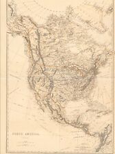
 1903 Rand McNally Co. Map of Alaska and the Yukon Gold Fields Canada California
-
$17.00
 The America's - Original 1924 German Physical Map by Meyers. Vintage
-
$17.00
 The America's - Original 1928 Physical Map by Meyers. German Language Map
-
$17.00
 Original Physical & Economic Map of the Americas in 1910 by Meyers. German
-
$500.00
 1845 North America map by A.K. Johnston 25.8" x 21.2" Antique Republic of Texas
-
$31.70
 1906 PHYSICAL RELIEF MAP OF WESTERN CANADA ALBERTA BRITISH COLUMBIA / ROCKIES
-
$15.00
 1901 Tunison Dominion of Canada antique map ~ 14.8" x 11.9" - nice color
-
$500.00
 1840 North America antique map by Greenleaf - 14.2" x 12" scarce 1st edition
-
$75.00
 1860 US Canada Mexico C. America Mitchell antique map 15.3" x 12.5" hand color
-
$125.00
 1830 Pacific Ocean - islands coasts & US antique map by Huntington ~ 11" x 8.25"
-
$15.99
 1875 Lange Physical Map - North America - United States Canada Mexico Alaska
-
$19.99
 1885 Drioux Map - North America Physical - United States Canada Mexico Mountains
-
$22.85
 Manitoba, BC, Canada & NW Territories Map; Genuine 1907 (Dated) City Topog Rails
-
$110.00
 1820 North & South America antique map by Lavoisne ~ 21.8" x 17.6" hand colored
-
$89.00
 1849 Canada East by Mitchell antique map ~ 17.4" x 13.8" - Quebec city
-
$30.00
 1901 Tunison North America antique map ~ 22.7" x 14.6" - nice color - old cities
-
$105.00
 1849 Canada West by Mitchell antique map ~ 17.4" x 13.8" - Toronto
-
$75.00
 1876 North America antique map ~ 27.3" x 19.5" hand colored Mexico USA Canada
-
$25.89
 Manitoba, BC, Canada & NW Territories Map; Genuine 1906 (Dated) City Topog Rails
-
$175.00
 1767 America's Lakes, Rivers & Mountains antique map by Clouet ~ 22.8" x 16.8"
-
$109.00
 1849 North America by Mitchell antique map ~ 17.4" x 13.8" - US Canada Mexico +
-
$175.00
 1767 America's Islands, Capes & Seaports antique map by Clouet ~ 22.8" x 17.1"
-
$47.49
 1848 ORIGINAL MAP UNITED STATES TEXAS FLORIDA CANADA CUBA MEXICO HAWAII NEW YORK


