 Antiques (US)
-
$129.99

 ANTIQUE 1900's Souvenir of a Visit to the Bon Marche WITH Fold Out PARIS Map!!
-
$249.86
 Antique 1801? FOLDING MAP ON A CLOTH A NEW MAP OF MIDDLESEX JOHN CARY
-
$250.00
 Very old map of Sarreguemines, France. Sarreguemi
-
$35.00
 Germany, Map of Nuremburg in 1872
-
$40.00
 Lot of 5 Vintage Carte Taride FRANCE Cloth Maps
-
$20.00
 Lot of 4 Vintage Ordnance Survey SCOTLAND 1" Maps
-
$30.00
 Lot of 8 Vintage Bartholomew's SCOTLAND "Half-Inch" Cloth Maps
-
$15.00
 Lot of 5 Vintage Ordnance Survey GREAT BRITAIN 1" Maps
-
$52.50
 WWI WORLD WAR PLATES MAPS FOLDING JOHNSON BATTLEFIELDS PANORAMA 1921 SLIP CASE
-
$22.00
 Large Antique French vertical map Europe / Africa / Mediterranean
-
$20.00
 Lot of 6 Vintage Bartholomew's GREAT BRITAIN Cloth 1" to Mile Maps
-
$15.00
 1945--PARIS METRO--SUBWAY MAP--WORLD WAR II--XLNT
-
$17.95
 1918 MAP OF THE WESTERN THEATRE OF WAR National Geographic Society Antique
-
$100.00
 Antique Map Of France By Bretano's Paris, France No#3 Pre-Owned Folded
-
$112.44
 * Rare * Copperplate Engraved Map of Essex By John Seller Hand Coloured 1695
-
$218.63
 1794 Country Around Manchester Large Folding Map by Stockdale 84 cm x 81 cm
-
$25.99
 Map Cimetiere Du Pere Lachaise Map Vintage Antique Late 1800s Paris Cemetary
-
$70.00
 Eighteenth Century Hand-Col. Map of London & Environs, 1787 - PRICE REDUCED
-
$20.00
 Lot of 11 Vintage Bartholomew's & Ordnance Survey GREAT BRITAIN Maps
-
$50.00
 1748 Chart Of The Baltic Sea By T. Jeffery, Geographer To The Prince Of Wales
-
$9.45
 Preu MICHELIN Map 140 Carte Touristique de la PROVENCE 1950's France
-
$195.00
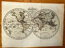 An Correct Map of the World with the Latest Discoveries 1799 Original Look!!!
-
$39.99
 "Siege of Sebastopol" Crimea in Crimean War - antique 19th century map
-
$15.00
 Lot of 3 Vintage GEOGRAPHIA GREAT BRITAIN Maps
-
$19.99
 1927 TOUR EUROPE IN YOUR OWN CAP BROCHURE MAP INTERNATIONAL MERCANTILE MARINE CO
-
$19.99
 WILLIAM SHAKESPEARE Map GREAT BRITAIN England Scotland Wales Castles John Speed
-
$23.95
 1917 World War I Large Scale Cloth Folding Color Map Western Front
-
$225.00
 An Accurate Map of North America with the New Discoveries 1799 D. Ogilby Wow!!
-
$30.00
 map Germany WW2 westlicher Kriegsschauplatz Leipzig 1940
-
$49.97
 Antique Folding Map of Jerusalem & Environs 1860 W Hughes 20" x 13.5"
-
$437.26
 1793 Plan Manchester & Salford Large Folding Map by Charles Laurent 106 cm x 91
-
$31.23
 1885 Antique map of Spain & Portugal - Virtue & Co Ltd 13" x 10.5"
-
$30.00
 WWII map Germany WW2 Turkey Italian Italy German Kriegsschauplatz Leipzig 1940's
-
$24.99
 Antique 1930 Map Of New England In Excellent Condition
-
$25.00
 Lot of 14 Vintage Ordnance Survey GREAT BRITAIN Quarter Inch Maps
-
$20.00
 Lot of 7 Vintage Ordnance Survey ENGLAND & WALES 1" Maps
-
$6.23
 THE CAPTURE OF CHERBOURG 19-30 JUNE 1944, WW2 Map of OPERATION OVERLORD
-
$35.00
 Original 1918 WWI Map France Belgium Battle Line battlefield old
-
$31.22
 1795 West Yorkshire Original Antique Map by John Stockdale
-
$162.40
 1695 JOHN MORDEN MAP CUMBERLAND CAMDENS BRITANNICA HAND COLOURED Swale Awnsham
-
$59.99
 1917 World War I Large Scale Cloth Folding Color Map Western & Italian Front
-
$99.00
 JOHNSTONS' 1854 MAP of THE BALTIC SEA ~ GERMAN OCEAN ~ GULF OF RIGA ~ 2 TITLES
-
$35.00
 1905 Leuzinger’s Foldout Relief Map Of Switzerland - German And French
-
$17.10
 Berwick and Haddington Antique 1912 Bartholomews Map Edinburgh Dunbar
-
$20.00
 Mähren Und Schlesien Map Wagner Böhmen Prag 1905 30+22’ Kytka
-
$10.00
 Vintage French Military Maps Of Defense 22in By 18in Suitable For Framing
-
$37.50
 Large Post WWI Liberty Map of New Europe & New Map Of Africa 1914-1920
-
$6.23
 THE ADVANCE OF THE ALLIED ARMIES INTO GERMANY, 1 April to 1 May 1945, WW2 Maps
-
$12.00
 Vintage French Military Map Of Montdidier 18in By 12 1/2in Suitable For Framing
-
$80.00
 Patriotic World War I Linen Map of Europe, First World War, 1914, Pictorial
-
$6.18
 OPERATION OVERLORD - BASIC CONCEPTION OF THE ARMY PLAN - Rare WW2 Map 1944
-
$187.40
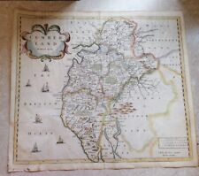
 Durham & Northumberland Large John Cary Maps, 1821 Census, Town Distances
-
$14.99
 ORDNANCE SURVEY 1" TO 1 MILE TOURIST MAP OF THE NEW FOREST c1930
-
$99.99
 Hand Map ~ County of Moravia ~ Duchy of Silesia ~ Circa. 1888
-
$11.23
 Shropshire Vintage Bartholomews Map Shrewsbury Kidderminster C1910 Welshpool Old
-
$200.00
 Rare Antique "New Map of England by John Senex" (Framed 29"x26")
-
$25.74
 Rare Large Map Of Nuova Pianta Di firenze 1969 Florence Italy 
-
$7.99
 1965 Panoramic Map ALPS Matterhorn Austria Italy Switzerland Chamonix St. Moritz
-
$95.00
 Antique Map The Road from London to New Haven in Sussex England Hand Colored Map
-
$206.13
 SURREY c1816 GENUINE 1st EDITION ORDNANCE SURVEY MAP BY WILLIAM MUDGE
-
$14.99
 Ordnance Survey half inch layered map Portsmouth & Isle of Wight Sheet 38. 1914
-
$69.00
 19th C. Map United States (West)-Texas- Engraved & Hand Color -Mackenzie 1867
-
$295.00
 Francis Marie Joseph Garnier Antique 1860 Map Tableau des Regions Circumpolaires
-
$43.73
 Bacon's New Large Print Map of London and Suburbs - Circa 1914
-
$15.00
 FOUR 1884 Antique Baedeker City Plans / Maps - Germany Travels Decor
-
$17.77
 1954 Copenhagen District Pictoral Vtg Map Old Town Politikens Forlag 19" x 13"
-
$4.98
 THE ALLIED ARMIES CLOSE TO THE RHINE. BATTLE POST ARDENNES March 1945, WW2 Map
-
$20.95
 Large Antique French map Metz region NE France
-
$6.23
 THE ADVANCE TO THE RIVER SEINE & LIBERATION OF PARIS, WW2 Map of OVERLORD 1944
-
$18.00
 Antique French map Bar-le-Duc NE France region Vaubecourt
-
$24.00
 Scotland~1905 Ordnance Survey Map, Sheet 15 antique Linen Map~20" x 17"
-
$18.00
 Antique French map Lunéville NE France region Nancy
-
$140.00
 1850s French Map of the Crimean War, with Detailed Views, Sevastopol, Ukraine
-
$31.23
 1910 map of Switzerland. Visperthal. 1:50000. Topographischer. Schweiz Bern
-
$4.68
 ARNHEM AND THE THREE RIVERS 17 Sept 1944, WW2 Map
-
$6.25
 c1940s KENT County Road Map - Geographers Map Co
-
$275.00
 Large Hand-Colored Holy Roman Empire Map of Provinces 1692 Rare
-
$15.00
 Cook’s Handbook To London - 1926.
-
$4.98
 THE DEVELOPMENT OF ALLIED OPERATIONS EAST OF THE RHINE March/April 1945 WW2 Map
-
$68.71
 Stanford's Road and Railway Map of Scotland - 1858 - 24 Panels Laid On Linen
-
$168.66
 SOMERSET BATH BY WILLIAM MUDGE c1817 GENUINE 1st EDITION ORDNANCE SURVEY MAP
-
$8.75
 THE TIMES Contour Road Map of Hampshire, Dorset, Wiltshire & Adjacent Counties
-
$10.00
 Vintage French Military Map The Attack 1st Phase 22in By 18in
-
$168.66
 WILTSHIRE BY WILLIAM MUDGE c1817 GENUINE 1st EDITION ORDNANCE SURVEY MAP
-
$12.00
 Vintage French Military Map Battle Of Bautzen 18in By 22in Suitable For Framing
-
$12.00
 Vintage French Military Map Battle Of Lutzen 22in By 18in Suitable For Framing
-
$10.00
 Vintage French Military Map The 4th Corps at Virton 22in By 18in
-
$9.99
 Lg Fold-Out Map of Loch Ness, Scotland. 23” X 16-1/2”..Loch Ness Monster
-
$8.00
 1940’s MOTOR ROAD MAP of London & South-East England B.P. Anglo-Iranian Oil Co.
-
$5.27
 Vintage Ordnance Survey Map of Bournemouth & Weymouth,1939 Linen Map,Fifth Ed.
-
$10.00
 Vintage French Military Map French And German Trenches In 1916 22in By 18in
-
$40.00
 Vintage 1921 Illustré Guide de voyage français Carcassonne In French A3
-
$10.00
 Vintage French Military Map Castiglione Maneuver 22in By 18in
-
$335.00
 CAPT FYERS Personal 1854 "THE CRIMEA" Fold Out Hand Colored MAP -John Arrowsmith
-
$81.20
 1868 Handcoloured Geological Map Ayr Scotland Scottish Geology Geikie Peach RARE
-
$10.00
 Vintage French Military Map Maneuvers Of The 1st Army 22in By 18in
-
$10.00
 Vintage French Military Map Attack fronts in 1918 22in By 18in
-
$19.95
 Atq 1903 (121 yrs old) Railway Map of the British Isles John Bartholomew F.R.G.S
-
$49.97
 Antique Folding Map of Palestine at Time of Jesus 1860 W Hughes 20" x 13.5"
-
$60.00
 1900s Map Of England/Wales By Bretano's Paris,France Pre-Owned


