 Antiques (US)
-
$175.00

 VINTAGE COUNTY MAP DEVONSHIRE w/ EXETER GUILDHALL CARTOUCHE FRAMED 18” x 15.5”
-
$39.99
 EASTERN EUROPE NORTH AFRICA Egypt Asia Minor Arabia ANTIQUE MAP Matted
-
$59.99
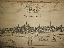 1613 Copper engraving Lodovico Guicciardini "Valenciennes" France
-
$59.90
 1873 German Language Palestinian Historical 1800s Antique Map Folded Wall
-
$27.50
 Antique 1808 Map of Asia Published By Robert Wilkinson, London. Engr. W. Palmer
-
$65.00
 ARMENIA 1887 ÉCOLE SPÉCIALE MILITAIRE UNUSUAL ANTIQUE WAR MAP
-
$4.95
 Road Map centered on Stuttgart Germany, about 1965, used
-
$43.73
 Antique Original View "Rotterdam" Anonymous, c. 1700.
-
$10.00
 ELGAR'S BELOVED COUNTRY Booklet - By Michael Grundy - Elgar Route122523
-
$27.50
 Antique 1825 Chart of the World. Published by Fisher, Son & Co. Caxton, London.
-
$12.48
 19thC Trade Card Map Great Britain WRONG! Newcastle in Scotland Scottish Postman
-
$12.48
 CROWLANDS FENS - Land Use Map - 1:25000 - (Please see Photo's for Size)
-
$30.00
 c1720 Spain & Portugal 9" x 7.6" Authentic & original antique map
-
$59.90
 1873 German Scandinavian Norway Finland Sweden Historical 1800s Antique Map
-
$43.73
 1862 map of the northeast of spain . to illustrate caesar's campaign !
-
$69.99
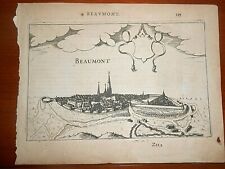 1613 Copper engraving Lodovico Guicciardini View of Beaumont in Belgium
-
$300.00
 1740's ORIGINAL MEXICO NEW HISPANIA MAP
-
$70.00
 MOSCOW RUSSIA 1964 LARGE URBAN TRANSPORT CITY MAP
-
$12.48
 c1900 Post Card Map Great Britain Patriotic Imperial Boy Flag Ship Hunt London
-
$8.72
 BATTLE OF NORMANDY MAP (FRENCH)/CARTE GÉOGRAPHIQUE BATAILLE DE NORMANDIE 35"X25"
-
$43.73
 Lincoln Cathedral engraving & Lincolnshire Map. T. Allom, published circa 1830
-
$31.23
 Early Cartography Original Small Size Printed/Engraved Paper Map of Spain 1650
-
$12.48
 EASTBORNE GEOLOGICAL MAP - Sheet 334 - (Please see Photo's for Size)
-
$59.90
 1873 German Language Austrian Hungarian Monarch Historical 1800s Antique Map
-
$79.90
 1873 German Language Australia Polynesian Ocean Historical 1800s Antique Map
-
$19.10
 Physical Europe Western Asia Northern Africa Arabia 1910's Vintage Map Wall Art
-
$12.00
 Map ROME Italy WWII Vintage map Antique
-
$6.23
 NEW FOREST MAP - Ordnance Survvey O/S Map - Tourist Map & Guide
-
$99.90
 1873 German Language Ocean World 1800s Antique Map Folded Wall Art
-
$99.90
 1873 German Language Planets Mathematician Historical 1800s Antique Map Wall
-
$79.90
 1800's German Language North Germany Netherlands Belgium Map Folded Ink Marked
-
$99.90
 1873 German Language Physical Europe Historical 1800s Antique Map Folded Wall
-
$18.74
 Antique Map Movements for Relief of Kimberley & Capture of Bloemfontein
-
$75.00
 Map Plan of ANTRIM TOWN Ulster 1798 Irish Rebellion Ireland 1801 Musgrave 11x16
-
$59.90
 1873 German England Ireland Scotland London Historical 1800s Antique Map Wall
-
$249.86
 Antique Map "Plan de la Haye et de ses environs" (The Hague) Anonymous, c. 1850
-
$17.49
 Austrian Dominions London Original c1785 publisher unknown
-
$7.00
 Vintage Rhein River From Mainz To Köln , Germany Map
-
$18.73
 PUB WALKS ALONG THE KENNET & AVON CANAL - By Nigel Vile - 1997
-
$106.19
 1748 framed map of merionethshire in north wales
-
$1200.00
 1747.ORIGINAL ANTIQUE MAP.BRUGES ONE OF THE PRINCIPAL CITIES OF FLANDERS.26"x22"
-
$249.86
 Circa 1830-40 STANDEN HEY & PRIMROSE ESTATE Clitheroe, Lancs, Hand coloured plan
-
$16.72
 Pair of Vintage Prague Tourist Maps from 1967 — ČSA, Čedok, Czech Cities, Praha
-
$12.48
 UPTON - UPON - SEVEN - 1969 Edition of the official guide
-
$31.22
 1829 original map titled " warwickshire "
-
$59.90
 1873 German Language South America Historical 1800s Antique Map Folded
-
$22.00
 Antique Atlas Map: "Argentine Confederation" / Columbia Equador Peru
-
$18.73
 let's see INVERNESS & LOCH NESS - By Dr Mould
-
$59.90
 1873 German Language European Greece Turkey Historical 1800s Antique Map Wall
-
$59.90
 1873 German Language Italy Corsica Historical 1800s Antique Map Folded Wall
-
$32.47
 1808 original small mounted map of worchestershire
-
$106.19
 VINTAGE MAP OF HAMPSTEAD WITH VARIOUS ASSOCIATED ADVERTS CHAMBER OF COMMERCE
-
$62.45
 PLAN OF THE ESTATE OF KIRROUGHTREE, STEWARTRY OF KIRKCUDBRIGHT Scotland 1919
-
$10619.05
 Antique Map "Isola di Corfù. Giugno 1825" Anonymous, June 1825
-
$59.90
 1873 German Language North America Historical Map Folded Wall 1800s Antique
-
$1200.00
 1747. ORIGINAL ANTIQUE MAP. "PORT TOWN IN FLANDERS".26"x22"
-
$29.00
 1910s Imperial Russia SPAIN PORTUGAL Antique Russian COLOUR Map
-
$47.47
 1790s original map of " prussia " from the best authorities
-
$59.90
 1873 German Language Asia Historical 1800s Antique Map Folded Wall Art
-
$59.90
 1873 German Language Spain Portugal Historical 1800s Antique Map Folded Wall
-
$59.90
 1873 German Language Mountainous Asia Historical 1800s Antique Map Wall Art
-
$59.90
 1873 German Language Germany Alps Historical 1800s Antique Map Folded Wall Art
-
$59.90
 1873 German Language Africa Historical 1800s Antique Map Folded Wall Art
-
$59.90
 1873 Russia Russland Schulatlas Reiner German Historical 1800s Antique Map
-
$59.90
 1873 German Language Mountains Middle Europe Historical 1800s Antique l Map
-
$59.90
 1873 German lang. France Paris Brussels Holland Historical 1800s Antique Map
-
$59.97
 1850s map " the life and times of wellington " southern italy - vignette's
-
$24.00
 1896 Russian Wall Map of France Road and Waterway
-
$12.48
 THE VALE OF WHITE HORSE - Official Street & Area Plan
-
$31.22
 1911 antique colour map - spain and portugal
-
$47.47
 1790s original color map of " turkey in europe & part of austria "
-
$18.73
 ELTON COLLEGE - The Pictorial History - By B J W Hill
-
$18.73
 CORNWALL Touring Map - Geographers Map Company - 1970's
-
$31.22
 1911 antique colour map - switzerland
-
$6.23
 EXMOOR MAP - Tourist Map - Ordnance Survvey O/S Map - Scale 1:25000
-
$12.48
 Original Victorian Map of Northamptonshire (c1850) County, Northampton, England
-
$12.48
 CENTRAL AND EAST AFRICA MAP - (Please see Photo's for Size)
-
$47.47
 1790s original map of the " netherlands " from the best authorities .
-
$6.23
 MALVERN MAP - Sheet SO 74 - Ordnance Survvey / O/S Map - Scale 1:25,000
-
$6.23
 GLOUCESTER & FOREST OF DEAN MAP - Landranger No 162 - Ordnance Survey Map
-
$6.23
 HERMITAGE Bershire - Sheet SU 57 - Ordnance Survvey / O/S Map - Scale 1:25,000
-
$12.48
 JUNEAU GEOLOGICAL MAP - (Please see Photo's for Size)
-
$56.22
 1790s original map of " france divided into circles & departments "
-
$300.00
 France / Eftaple Map by Anon (Unknown) 1634 Map 4.25” x 6” w/mat 6.75" X 7.75"
-
$12.48
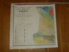 GEOLOGIQUE MAP OF FRANCE - (Please see Photo's for Size)
-
$18.73
 INVERNESS - In & Around Inverness - By J Arthur Dixon
-
$18.73
 BERKSHIRE - Barnetts official Street Plan - 1970's
-
$18.73
 INVERNESS - The capitol of the highlands - Holiday Guide
-
$6.23
 EXETER & SIDMOUTH MAP - Landranger No 192 - Ordnance Survey Map
-
$199.99
 Original Antique French Map Geographical Location 1600-1700
-
$6.23
 BARNSTAPLE & ILFRACOMBE MAP - Landranger No 180 - Ordnance Survey Map
-
$6.23
 PLYMOUTH ordnance SURVEY MAP - Sheet 201 - Landranger Ordnance Survey Map
-
$12.48
 THE VALUE OF WHITE HORSE - Offical Guide
-
$6.23
 EXMOOR MAP - Outdoor Leisure - No 9 - Ordnance Survvey O/S Map - Scale 1:25000
-
$6.23
 YEOVIL & FROME MAP - Landranger No 183 - Ordnance Survey Map
-
$6.23
 NEWBURY & WANTAGE MAP - Landranger No 174 - Ordnance Survey Map
-
$18.73
 WINCHESTER - A walk around Guide - Where to go & what to see
-
$6.23
 PRESTEIGNE & HAY-ON-WYE area MAP - Landranger No 148 - Ordnance Survey Map
-
$31.22
 DENBIGH MAP - Sheet 108 - One-Inch Ordnance Survey Map - 6th Edition
-
$31.22
 BEDFORD & LUTON MAP - Sheet 147 - One-Inch Ordnance Survey Map - 6th Edition


