 Antiques (US)
-
$250.00

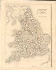
 1857 Huge 4-Panel Color Map . ENGLAND & WALES . Stanford - Original Antique Rare
-
$62.61
 1747 Roman Britain Original Antique Map by Richard Seale
-
$50.36
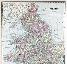
 Vintage 1900 ENGLAND & WALES Map 14"x22" Old Antique Original BRITAIN UK LONDON
-
$39.56
 Vintage 1900 EUROPE Map 11"x14" ~ Old Antique Original EU UK IRELAND SCOTLAND
-
$18.00
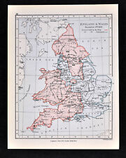
 England & Wales - Original 1905 Geological Map by Meyers Geologische Karte
-
$100.00
 WALES CAERNARVONSHIRE 23.5” BLAEU 1640 ANTIQUE ORIGINAL COPPER ENGRAVED MAP.
-
$21.00
 1843 Europe Map Prussia Germany Iceland Ireland POLITICAL Russia Moscow Austria
-
$21.00
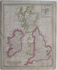
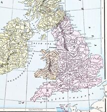 1898 British Isles Historical Map England Ireland Scotland Wales London
-
$9.39
 c1895 5 x Maps of England & Wales antique vintage Britannica 9th
-
$24.88
 OLD 1855 ENGLAND WALES SCOTLAND IRELAND Map Dublin London Aberdeen Orkney
-
$17.00
 England & Wales - Original 1903 Map by Dodd Mead & Company. Antique
-
$24.00
 1853 British Isles Map ORIGINAL England Wales Scotland Ireland London Dublin
-
$13.95
 Antique Map of ENGLAND WALES Map Wall Art Decor ca 1890 Vintage London
-
$25.03
 1884 Southeast Wales Original Antique Coloured Map by Letts
-
$28.04
 Vintage 1901 ENGLAND & WALES Map 14"x22" Old Antique Original CARDIFF LONDON
-
$25.03
 1853 England & Wales Antique Map with Ornate Border by Alexander Findlay
-
$37.88
 1898 British Islands ENGALND Map Anglo-Saxon and Celtic Kingdom Ireland Scotland
-
$21.00
 1899 Northern England Wales Map Liverpool Sheffield STEAMSHIPS RAILWAYS PORTS
-
$15.00
 Vintage Map of England & Wales 1660-1892 by Longmans Green 1914. Antique
-
$6.26
 c1895 Map of Monmouthshire Wales antique vintage Britannica 9th
-
$37.00
 1853 Europe Map ORIGINAL Turkey Russia Prussia Iceland Sardinia England Sweden
-
$28.88
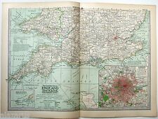
 OLD 1899 Southern England Wales Map London Cornwall STEAMSHIPS RAILWAYS PORTS
-
$28.00
 1890 Saxon Medieval England Scotland Map London Hadrian's Wall Picts Shetland
-
$19.99
 1869 Antique Mitchell COLOR Map / GREAT BRITAIN AND IRELAND
-
$8.14
 1902 Map of England and Wales Northern Part antique vintage Britannica 10th
-
$15.00
 Vintage Map of England & Wales on May 1, 1643 by Longmans Green 1905
-
$18.00
 Western England & Wales - Original 1909 Map by John Bartholomew. Antique
-
$28.76
 Vintage 1901 ENGLAND & WALES UK Map 14"x22" Old Antique Original LONDON CARDIFF
-
$43.81
 1830 Monmouthsire by Hoare & Reeves Large Antique Hand Coloured Map
-
$35.96
 Vintage 1900 ENGLAND WALES Map 11"x14" ~ Old Antique Original UNITED KINGDOM
-
$400.00
 Antique Original 1645 Wales Irish Sea Map by Johannes (Joan) Blaeu Listed
-
$95.00
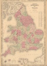
 Johnson's 1864 Large colored map of England and Wales
-
$5.99
 Antique 1914 Old Atlas Map World War WWI Scotland + Edinburgh, England & Wales
-
$38.00
 ENGLAND WALES Map 1889 ORIGINAL London Dover Railways Counties Townships G. CRAM
-
$28.88
 1897 England and Wales Map Cornwall Dorsey Cardiff Portsmouth Hastings Bristol
-
$17.00
 England & Wales - Original 1891 Map by Hunt & Eaton. Antique
-
$19.99
 1830 Original Sidney Hall Map - ENGLAND & WALES - Double-Sheet - Great Detail
-
$24.99
 1880 Antique Atlas Map / GREAT BRITAIN AND IRELAND
-
$25.03
 1885 British Isles & North Sea Antique Map by John Bartholomew & George Philip
-
$25.03
 1863 North West England & Wales, Isle Of Man Hand Coloured Weekly Dispatch Map
-
$9.99
 1892 Crowell Kirkpatrick Map - England & Wales London Liverpool Bristol Cornwall
-
$281.73
 BRITISH ISLES Britain, Frederick De Wit original antique map circa 1675
-
$29.99
 1852 Antique Atlas Map / GREAT BRITAIN, IRELAND
-
$331.82
 BRITISH ISLES, Great Britain, UK, Nicolas De Fer original antique map 1706
-
$287.98
 1730 Antique Map; Regni Angliae et Walliae Principatus by Carel Allard
-
$15.00
 Vintage Longmans Map of England in the Years 584 and 626 AD
-
$27.99
 1838 Gilbert Antique Map England & Wales London Liverpool Oxford Great Britain
-
$20.00
 England & Wales - Original 1895 Map by W & A.K. Johnston. Antique
-
$17.00
 Northern England & Wales - Original 1897 Map by The Century Company, Antique
-
$16.00
 Southern England & Wales - Original 1902 Map by The Century Company. Antique
-
$19.00
 Northern Part of England & Wales - Original 1896 Map by Velhagen & Klasing
-
$14.00
 Vintage Longmans Map of England & France in the Year 1259
-
$17.00
 Northern England & Wales - Original 1902 Map by The Century Company. Antique
-
$17.00
 Great Britain - Original 1905 Map by Meyers. German Language Map. Antique
-
$30.05
 Original antique map ENGLAND AND WALES, Laurie, 1823
-
$49.50
 1864 Map England and Wales County Map Antique Original Hand Colored Mitchell
-
$19.00
 Eastern England & Wales - Original 1909 Map by John Bartholomew. Antique
-
$16.00
 Southern England & Wales - Original 1897 Map by The Century Company. Antique
-
$17.00
 Southern England & Wales - Original 1902 Map by The Century Company. Antique
-
$9.99
 1888 Mitchell Map Europe France Germany Austria Hungary Italy Greece Sweden
-
$14.00
Vintage Map of England & Wales on May 1, 1643 by Longmans Green 1905
-
$22.00
 Merionethshire, Montgomery & Radnor, Wales. Original 1922 Ordnance Survey Map
-
$15.00
 Vintage Map of England & Wales on December 9, 1643 by Longmans Green 1905
-
$15.00
 Vintage Map of England & Wales on November 23, 1644 by Longmans Green 1905
-
$8.49
 CRAM'S ATLAS MAP PAGES OF EUROPE - ENGLAND & WALES 1890 VINTAGE
-
$19.99
 1831 Lewis Map Herefordshire Hereford Leominster Malvern Ledbury England UK
-
$11.99
 1900 Meyers Map England Wales London Liverpool Oxford Newcastle Great Britain
-
$9.99
 1892 Map of Europe in 912 Franks Saxony Cordoba Spain Italy Hungary Germany UK
-
$50.07
 1805 Antique Map; John Cary large map of England and Wales, Camden's Britannia
-
$32.36
 Vintage 1900 ENGLAND WALES Map 11"x14" ~ Old Antique Original CAMBRIDGE LONDON
-
$9.99
 1892 Map England Wales Dec. 9, 1643 King & Parliament Districts London Original
-
$19.99
 1921 Johnston Map Netherlands Belgium Luxemburg Holland Amsterdam Brussels Ghent
-
$62.54
 1719 LARGE ANTIQUE MAP ENGLAND - NOUVELLE CARTE DE L'ANGLETERRE - CHATELAIN
-
$16.00
 1867 Mitchell Map - Europe - Austria Italy Germany France Britain Spain Iceland
-
$23.99
 1831 Lewis Map Carnarvonshire Caernarfonshire Carnarvon Bangor Pwllheli Wales UK
-
$9.99
 1902 Century Map - South England Wales London Plan Stonehenge Cornwall Bristol
-
$31.30
 Original antique map, Isle of Wight by Thomas Moule
-
$51.99
 1818 D'Anville Map British Isles Roman Period Londinium Hadrians Wall England
-
$24.99
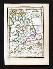
 Original 1821 Map BRITISH ISLES England Scotland Ireland Wales Printed in Boston
-
$25.16
 Vintage 1902 ENGLAND & WALES Map 11"x14" ~ Old Antique Original LEEDS LINCOLN
-
$19.99
 1901 Antique Map / ENGLAND AND WALES
-
$9.95
 1923 Orginial Antique Hammond Map of Netherlands & Belgium on rev. British Isles
-
$16.43
 1895 Carmarthenshire county map. Victorian print. Carmarthen.
-
$50.09
 1780'S LARGE ANTIQUE COPPER PLATE MAP ROADS ENGLAND & WALES
-
$22.00
 Pembrokeshire Carmarthenshire Cardigan - Large Original 1922 Ordnance Survey Map
-
$14.36
 Vintage 1900 SCOTLAND & ENGLAND Maps ~ Old Antique Original EDINBURGH LONDON UK
-
$17.16
 Vintage 1900 BRITISH ISLES Map ~ Old Antique Original 11"x14" ENGLAND IRELAND
-
$9.99
 1892 Map England Wales London Oxford Durham York Cardiff Cornwall - Original
-
$19.99
 1831 Lewis Map Buckinghamshire Buckingham Stratford Aylesbury Olney England UK
-
$25.00
 1854 England & Wales by A.C. Black beautiful antique map 21.8" x 17.4
-
$19.99
 1830 Nathan Hale Map - England & Wales - London Liverpool Cornwall Dover Bristol
-
$39.99
 1810 Delalain Map British Isles Great Britain England Wales Scotland Ireland
-
$19.99
 1921 Johnston Map South England Cornwall Lands End Devon Somerset Dorset Dexter
-
$18.95
 1942 Antique MAP of ENGLAND & WALES Map Vintage England Atlas Map 8955
-
$20.00
 1864 England & Wales by Johnson Ward beautiful antique map 25.8" x 17.6"
-
$28.00
 1801 Wilkinson Map Dioceses England Wales London Canterbury Gloucester York UK
-
$46.76
 Vintage 1900 ENGLAND & WALES Map 14"x22" ~ Old Antique Original UNITED KINGDOM
-
$19.99
 1832 Murphy Map Britannia Antiqua Britain England Wales Roman Londinum London UK
-
$31.29
 1860 South England & Wales Hand Coloured Antique Map by G.W. Blackie
-
$25.03
 1854 NORTHERN ENGLAND & WALES LARGE HAND COLOURED ANTIQUE MAP 165 YEARS OLD


