 Antiques (US)
-
$62.31

 3 Maps of Germany Southern, Weastern, Eastern Sections 1920 Times Survey Atlas
-
$24.92
 2 Maps British Isles from the 1920 Times Atlas Plates 15,17 Political, Climate
-
$49.85
 3 Maps fromTimes Atlas Towns of England and Scotland, Scotland Plates 21, 22, 26
-
$49.85
 2 Maps Northern Russia & Finland and Southern Russia from 1920 Times Atlas
-
$12.45
 1898 Antique/Vintage Map of Spain & Portugal - Citizens Atlas, J. G. Bartholomew
-
$54.83
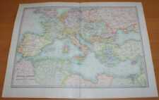 Map: 1890 Bartholomew; Central Europe and Mediterranean, Library Reference Atlas
-
$12.45
 1898 Antique/Vintage Map of East of England - Citizens Atlas, J. G. Bartholomew
-
$11.22
 Antique County Map of YORKSHIRE, WEST RIDING - Phillips Handy Atlas , 1887
-
$12.45
 1898 Antique/Vintage Map of Northern France - Citizens Atlas, J. G. Bartholomew
-
$11.22
 Antique/Vintage County Map of NORTH WALES - Phillips Handy Atlas , 1887
-
$11.22
 Antique/Vintage County Map of ISLE OF MAN - Phillips Handy Atlas , 1887
-
$11.22
 Antique/Vintage County Map of LINCOLNSHIRE - Phillips Handy Atlas , 1887
-
$11.22
 Antique County Map of FIFE AND KINROSS, Scotland - Phillips Handy Atlas , 1882
-
$162.00
 Framed Antique Map Of The World.1891.John Bartholomew.Frame size 57cm x 47cm
-
$12.45
 1898 Antique/Vintage Map of Southern France - Citizens Atlas, J. G. Bartholomew
-
$11.22
 Antique/Vintage County Map of DORSET - Phillips Handy Atlas , 1887
-
$11.22
 Antique/Vintage County Map of SHROPSHIRE - Phillips Handy Atlas , 1887
-
$11.22
 Antique/Vintage County Map of STAFFORDSHIRE - Phillips Handy Atlas , 1887
-
$11.22
 Antique/Vintage County Map of SUTHERLAND, Scotland - Phillips Handy Atlas , 1882
-
$11.22
 Antique/Vintage County Map of DURHAM - Phillips Handy Atlas , 1887
-
$12.45
 1898 Antique/Vintage Map of Turkey & Greece - Citizens Atlas, J. G. Bartholomew
-
$11.22
 Antique/Vintage County Map of NORTHUMBERLAND - Phillips Handy Atlas , 1887
-
$11.22
 Antique/Vintage County Map of PERTH, Scotland - Phillips Handy Atlas , 1882
-
$11.22
 Antique County Map of WESTERN ISLANDS, Scotland - Phillips Handy Atlas , 1882
-
$11.22
 Antique County Map of KIRKCUDBRIGHT, Scotland - Phillips Handy Atlas , 1882
-
$11.22
 Antique/Vintage County Map of SURREY - Phillips Handy Atlas , 1887
-
$11.22
 Antique/Vintage County Map of WORCESTERSHIRE - Phillips Handy Atlas , 1887
-
$42.36
 SOLWAY & BORDERS MAP, PLATE 75 BARTHOLOMEW'S SURVEY ATLAS OF ENGLAND WALES 1939
-
$16.19
 1890 small map of " environs of dublin etc " by j. bartholomew 1890
-
$11.22
 Antique County Map of ELGIN AND NAIRN, Scotland - Phillips Handy Atlas , 1882
-
$12.45
 1898 Antique/Vintage Map of Irish Towns - Citizens Atlas, J. G. Bartholomew
-
$11.22
 Antique/Vintage County Map of SOUTH WALES - Phillips Handy Atlas , 1887
-
$11.22
 Antique/Vintage County Map of HAMPSHIRE - Phillips Handy Atlas , 1887
-
$11.22
 Antique County Map of ROSS AND CROMARTY, Scotland - Phillips Handy Atlas , 1882
-
$38.63
 Map: 1958 Times Atlas; World Physiography; Vulcanolgy, Structural Geology etc.
-
$12.45
 1898 Antique/Vintage Map of Switzerland - Citizens Atlas, J. G. Bartholomew
-
$45.48
 NEWCASTLE MORPETH MAP PLATE 76 BARTHOLOMEW'S SURVEY ATLAS OF ENGLAND WALES 1939
-
$8.10
 Plate 54, SCOURIE, ATLAS of SCOTLAND. 1912. John Bartholomew & Co
-
$11.22
 Antique County Map of YORKSHIRE, NORTH AND EAST - Phillips Handy Atlas , 1887
-
$11.22
 Antique County Map of ENGLAND (Railway Map) - Phillips Handy Atlas , 1887
-
$41.11
 LIVERPOOL & MANCHESTER MAP BARTHOLOMEW'S SURVEY ATLAS OF ENGLAND & WALES 1939
-
$42.36
 CHATHAM & TONBRIDGE MAP - BARTHOLOMEW'S SURVEY ATLAS OF ENGLAND WALES 1939 Kent
-
$11.22
 Antique/Vintage County Map of DUMBARTON, Scotland - Phillips Handy Atlas , 1882
-
$11.22
 Antique/Vintage County Map of ABERDEEN, Scotland - Phillips Handy Atlas , 1882
-
$11.20
 Antique Map 1910 - Spain and Portugal by John Bartholomew from Cassells Atlas
-
$11.22
 Antique/Vintage County Map of INVERNESS, Scotland - Phillips Handy Atlas , 1882
-
$11.22
 Antique/Vintage County Map of Scotland Railways - Phillips Handy Atlas , 1882
-
$11.22
 Antique/Vintage County Map of EDINBURGH, Scotland - Phillips Handy Atlas , 1882
-
$11.22
 Antique/Vintage County Map of BERWICK, Scotland - Phillips Handy Atlas , 1882
-
$11.22
 Antique/Vintage County Map of North Lancashire - Phillips Handy Atlas , 1887
-
$16.19
 1890 small map of " environs of cities " by john bartholomew 1890
-
$37.37
 MILFORD HAVEN MAP, PLATE 29, BARTHOLOMEW'S SURVEY ATLAS OF ENGLAND & WALES 1939
-
$11.22
 Antique/Vintage County Map of WARWICKSHIRE - Phillips Handy Atlas , 1887
-
$8.10
 Plate 49, HELMSDALE, ATLAS of SCOTLAND. 1912. John Bartholomew & Co
-
$39.86
 NEWCASTLE SHEFFIELD BIRMINGHAM LEEDS BARTHOLOMEW'S SURVEY ATLAS OF ENGLAND 1939
-
$52.34
 Map: Map of India Plains & Mt. Everest, Plate 30, 1959 Mid-Century Times Atlas
-
$11.22
 Antique County Map of LEICESTER AND RUTLAND - Phillips Handy Atlas , 1887
-
$11.22
 Antique/Vintage County Map of BANFF, Scotland - Phillips Handy Atlas , 1882
-
$11.22
 Antique County Map of EDINBURGH ENVIRONS, Scotland - Phillips Handy Atlas , 1882
-
$11.22
 Antique/Vintage County Map of DEVONSHIRE - Phillips Handy Atlas , 1887
-
$11.22
 Antique County Map of ENVIRONS OF GLASGOW Scotland - Phillips Handy Atlas , 1882
-
$11.22
 Antique/Vintage County Map of AYR, Scotland - Phillips Handy Atlas , 1882
-
$8.10
 Plate 53, STORNOWAY, ATLAS of SCOTLAND. 1912. John Bartholomew & Co
-
$11.22
 Antique/Vintage County Map of DUMFRIES, Scotland - Phillips Handy Atlas , 1882
-
$11.22
 Antique/Vintage County Map of RENFREW, Scotland - Phillips Handy Atlas , 1882
-
$11.22
 Antique/Vintage County Map of South Lancashire - Phillips Handy Atlas , 1887
-
$33.65
 France in Departments by John Bartholomew. With Savoy/Savoie & Nice 1859 map
-
$43.62
 Map: 1958 Times Atlas; Japan with Iwo Jima and Okinawa, inset plan of Tokyo Bay
-
$42.36
 CANTERBURY MAP PLATE 28 BARTHOLOMEW'S SURVEY ATLAS OF ENGLAND WALES 1939 Kent
-
$11.22
 Antique/Vintage County Map of WILTSHIRE - Phillips Handy Atlas , 1887
-
$11.22
 Antique County Map of STIRLING & CLACKMANNAN - Phillips Handy Atlas , 1882
-
$11.22
 Antique/Vintage County Map of HADDINGTON, Scotland - Phillips Handy Atlas , 1882
-
$11.22
 Antique/Vintage County Map of DERBYSHIRE - Phillips Handy Atlas , 1887
-
$11.22
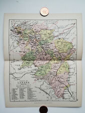 Antique/Vintage County Map of LANARK, Scotland - Phillips Handy Atlas , 1882
-
$11.22
 Antique/Vintage County Map of FORFAR, Scotland - Phillips Handy Atlas , 1882
-
$11.22
 Antique/Vintage County Map of LINLITHGOW, Scotland - Phillips Handy Atlas , 1882
-
$11.22
 Antique/Vintage County Map of ROXBURGH, Scotland - Phillips Handy Atlas , 1882
-
$11.22
 Antique/Vintage County Map of KINCARDINE, Scotland - Phillips Handy Atlas , 1882
-
$11.22
 Antique/Vintage County Map of CHANNEL ISLANDS - Phillips Handy Atlas , 1887
-
$11.22
 Antique/Vintage County Map of CAITHNESS, Scotland - Phillips Handy Atlas , 1882
-
$11.22
 Antique/Vintage County Map of SELKIRK, Scotland - Phillips Handy Atlas , 1882
-
$11.22
 Antique/Vintage County Map of WIGTOWN, Scotland - Phillips Handy Atlas , 1882
-
$45.48
 ALDERSHOT MAP, PLATE 26, BARTHOLOMEW'S SURVEY ATLAS OF ENGLAND WALES 1939 Hants
-
$11.22
 Antique/Vintage County Map of HERTFORDSHIRE - Phillips Handy Atlas , 1887
-
$11.22
 Antique/Vintage County Map of GLOUCESTER - Phillips Handy Atlas , 1887
-
$11.22
 Antique/Vintage County Map of BERKSHIRE - Phillips Handy Atlas , 1887
-
$11.22
 Antique/Vintage County Map of MONMOUTHSHIRE - Phillips Handy Atlas , 1887
-
$41.75
 NEWARK & GRANTHAM MAP PLATE 55 BARTHOLOMEW'S SURVEY ATLAS OF ENGLAND WALES 1939
-
$11.22
 Antique/Vintage County Map of PEEBLES, Scotland - Phillips Handy Atlas , 1882
-
$8.10
 Plate 32, COLONSAY, ATLAS of SCOTLAND. 1912. John Bartholomew & Co
-
$11.22
 Antique/Vintage County Map of HEREFORDSHIRE - Phillips Handy Atlas , 1887
-
$11.22
 Antique/Vintage County Map of NORTHAMPTONSHIRE - Phillips Handy Atlas , 1887
-
$11.22
 Antique/Vintage County Map of BEDFORDSHIRE - Phillips Handy Atlas , 1887
-
$11.22
 Antique/Vintage County Map of MIDDLESEX - Phillips Handy Atlas , 1887
-
$46.11
 Map: Map of 'Pakistan, Kashmir and Afghanistan', Plate 31 1959 Times Atlas
-
$16.19
 1890 small map of " switzerland " by j. bartholomew 1890
-
$37.37
 Rare Antique map of Cvmbria by Johan Blaeu Atlas Novus 1648 Framed 22" x 19"
-
$32.40
 France in provinces showing railways. JOHN BARTHOLOMEW 1854 old antique map
-
$16.19
 1890 small map of " route chart of central europe " by j. bartholomew 1890


