 Antiques (US)
-
$75.00

 Boston Bay & Cape Cod c. 1940's cartoon pictorial folding map shipwrecks
-
$280.00
 Antique 1800s Hand-Colored Map of Brighton Massachusetts Ward 25 Plate J Bromley
-
$280.00
 Antique 1800s Hand-Colored Map of Brighton Massachusetts Ward 25 Plate I Bromley
-
$28.00
 Map South End Boston Fort Hill 1925 Historical Massachusetts DWX3A
-
$29.99
 1894 CHELSEA RIVER BOSTON HARBOR MA. FROM GRAND JUNCTION R.R. BRIDGE MAP!
-
$11.00
 Shell Map of metropolitan Boston and Cape Cod 1939 vintage
-
$26.99
 Rand-McNally city map: WEST SUBURBAN BOSTON Massachusetts © 1992 -Index -
-
$39.95
 Latest Map and Index of Boston City MA Walker Lithograph Co. Early 1900's Foldup
-
$109.00
 BEVERLY, MA ~ 1893 Map ~ Pub. by E.A. Jones, 79 Milk St., Boston
-
$31.50
 1891 MASSACHUSETTS MAP ANTIQUE FULL COLOR RAILROAD MOUNTAIN VICTORIAN ERA BOSTON
-
$79.00
 Original 1937s Pictorial Boston & Environs Tourist Map,Cambridge,Mass,MA,Old
-
$11.25
 USGS Topographic Map BOSTON NORTH Massachusetts 1985 1:25000 scale folded map
-
$79.00
 Original 1957s Romantic Map Boston Bay & Cape Cod,Provincetown Guide,Mass,MA,Old
-
$28.00
 Map Shawmut Trimountain c1630 Boston 1925 Historical Massachusetts DWX3A
-
$28.00
 Map The Neck Boston Charles River 1925 Historical Massachusetts DWX3A
-
$39.99
 Antique Original Boston Pocket Folding Map Circa 1900
-
$26.00
 1921 Folding Map BOSTON Sampson & Murdock Publishers 36" x 32"
-
$15.00
 Boston and Cambridge Walking & Driving Tour Guide Travel Map Year 2007
-
$5.00
 antique folding travel map 1915 Hotel Thorndike Map of Boston
-
$13.95
 USGS Topographic Map BOSTON Massachusetts/RI/CT 1989 1:100000 scale folded map
-
$125.00
 1896 Appalachian Mountain Club Map of Country About Boston Massachusetts Topo
-
$49.95
 Antique 1910 Topography Map Boston Bay Harbor Massachusetts
-
$299.00
 1860 E.P. Dutton Vicinity of BOSTON Case Map on linen
-
$150.00
 Scarborough's 1903 Topographical Map of Massachusetts - EB 219
-
$28.00
 Map West End Boston Copper Works 1925 Historical Massachusetts DWX3A
-
$47.75
 HTF Dibblee Geologic Map DF-44 LOS OLIVOS Santa Barbara County 1st printing 1993
-
$24.90
 Antique Map 1912 Barton County Missouri Nashville Boston Milford Okaloosa #13100
-
$40.00
 1887 ANTIQUE LARGE COLOR MAP ~ BOSTON & LOWEL RAILROADS ~ ORIGINAL & VERY RARE
-
$28.00
 Map Town Of Boston c1645 Book Possessions 1925 Historical Massachusetts DWX3A
-
$28.00
 Map North End Boston 1925 Mill Pond Wharf Historical Massachusetts DWX3A
-
$28.00
 Map Boston Government Business Center 1925 Historical Massachusetts DWX3A
-
$12.50
 AAA Vintage 1987 Boston and Vicinity Cambridge Brookline Topographic Map
-
$19.00
 1882 ANTIQUE GUYOT LARGE COLOR MAP ~ MASSACHUSETTS BOSTON ~ ORIGINAL & VERY RARE
-
$20.00
 Map of metropolitan Boston and Cape Cod 1939
-
$99.00
 c1900 Walker Lithograph Co Map Of BOSTON MA Downtown area 33x27
-
$274.95
 PLAN OF PART OF THE CHARLES RIVER BOSTON MASSACHUSETTS HUGE FOLDING MAP 1882
-
$21.45
 USGS Topographic Map SOUTH BOSTON - Virginia North Carolina - 1994 - 100K -
-
$34.00
 1919 Folding Map of the City of BOSTON Published by Sampson & Murdock ~ 36"x31"
-
$12.50
 Boston Massachusetts MBTA Rapid Transit Map AAA Year 2005 2006 Visitor Guide Map
-
$44.75
 HTF Dibblee Geologic Map DF-44 LOS OLIVOS Santa Barbara County 1st 1993 folded
-
$50.00
 Mexican Central Railway Large Color Folding Map Texas Connections 1901 Boston
-
$26.48
 Rand-McNally regional map: Connecticut Massachusetts Rhode Island © 1994 -BAD-
-
$70.00
 1900s New Mexico Map Showing Areas with Sufficient Water for Settlement
-
$15.00
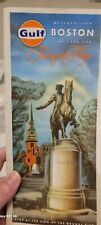 Vintage Antique 1966 Metropolitan Boston And Cape Cod Tourguide Map Gulf Mass
-
$21.45
 USGS Topographic Map BOSTON - Massachusetts Rhode Island Connecticut -1989- 100K
-
$25.99
 Rand-McNally state map: MASSACHUSETTS © 1994 - paper - highway -
-
$95.00
 Automobile Map of Eastern Massachusetts 1915 Walker Lith.& Pub.Co.Boston
-
$125.00
 1835 Collapsible Double Sided Map Of Boston; Print Of 1722 Map, Folds Into Book
-
$80.00
 Large Map of Boston's Tunnels, 1910, Existing & Proposed Tunnels, Elevated Rail
-
$24.50
 MILFORD N.H. Quadrangle 1950 TOPOGRAPHICAL MAP Hollis, New Boston, Mont Vernon
-
$699.99
 U.S. Hotel Breast Pocket Map of Boston, Ma with Railway Lines Tilly Haynes 1883
-
$24.00
 1910 Map Boston & Vicinity, 10 x 8 image, 1 fold, chromalithograph, Railroads
-
$9.99
 Atlantic Imperial Gas Pump Boston Tour Map 1961 Advertisement
-
$90.00
 Original 1879 Antique Map ~ CITY of BOSTON and SUBURBS ~ STREET DETAIL ~ RARE
-
$168.00
 1934 Cape Cod Map Chamber Of Commerce Official
-
$15.04
 BOSTON City Street Plan - 1909 Mounted Antique Map - United States USA America
-
$248.97
 Correct Map Of Boston - The Metropolis Map Co Publishers New York 1890
-
$34.95
 Antique 1903 Boston Quadrangle topographical map on linen 13-5/8 x 20-1/2
-
$55.00
 Map of The Northeast of Boston 1896 ORIGINAL By The Appalachian Mountain Club
-
$55.00
 Map of The Country Southeast of Boston 1896 ORIGINAL by The Appalachian Mnt Club
-
$55.00
 Map of Country Southwest of Boston 1896by The Appalachian Mountain Club ORIGINAL


