 Antiques (US)
-
$17.05

 1921 Antique LOUISVILLE Kentucky Street Map of Louisville City Map 1223
-
$75.00
 Franklinville Kentucky Mason County City Plan c. 1795 Russell engraved map
-
$31.05
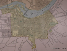
 1894 Antique LOUISVILLE Kentucky Street Map George Cram Louisville City Map 701
-
$34.95
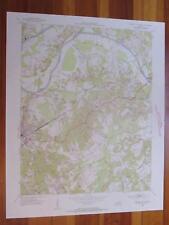
 Calvert City Kentucky 1969 Original Vintage USGS Topo Map
-
$19.51
 1920s Vintage LOUISVILLE Map City Street Suburb Kentucky Derby State Fairgrounds
-
$12.71
 1910 Antique LOUISVILLE City Map Vintage Louisville Kentucky Street Map Wall Art
-
$7.95
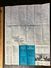 Vintage Lexington KENTUCKY 2nd National Bank Map of LEXINGTON & Fayette County
-
$35.00
 Rand-McNally city map: Paducah Kentucky © 1998 -Index- Metropolis Brookport
-
$7.50
 Antique 1926 World Atlas City Map of Louisville, Kentucky KY + Madrid Spain Plus
-
$5.00
 1894 Cram's Atlas Map of Louisville and Sioux Falls SD
-
$20.68
 1896 Fisk & Co. Atlas Map ~ KENTUCKY - TENNESSEE ~ Free S&H ~(11x14) ~#251
-
$20.68
 1891 Cram's Atlas Map ~ LOUISVILLE, KENTUCKY ~ Free S&H (11x14)
-
$18.94
 1951 ORIGINAL VINTAGE MAP OF LOUISVILLE KENTUCKY DOWNTOWN BUSINESS CENTER
-
$30.00
 Cincinnati Ohio Covington Newport Kentucky 1870 Mitchell fine city plan map
-
$75.00
 Large 21" X 14" COLOR Map of the city of Louisville, Kentucky -(1905)
-
$34.95
 Tell City Kentucky 1981 Original Vintage USGS Topo Map
-
$20.68
 Old Antique 1896 Atlas Map ~ LOUISVILLE, KENTUCKY ~ Vintage Authentic ~ Free S&H
-
$35.00
 Rand-McNally city map: BOWLING GREEN Kentucky © 1993 WARREN COUNTY
-
$18.97
 KY 1898 LOUISVILLE KENTUCKY City Map. Tremendous Detail, Named Streets Railroads
-
$12.00
 1904 Rowland Map - Cincinnati City Plan Ohio River & Covington Newport Kentucky
-
$15.00
 1891 Cram's Atlas Map, 78 of the tallest buildings .Towers, Cathedral and more
-
$14.95
 1919 Vintage Map Louisville Kentucky B & W Original From Collier Atlas
-
$9.99
 Harper Civil War Map Siege of Vicksburg Mississippi River Union Positions Canal
-
$40.00
 Rand-McNally city map: GREATER CINCINNATI Ohio Kentucky © 1996 -Index-
-
$45.00
 Rand-McNally city map: LEXINGTON BLUEGRASS AREA Kentucky © 1991 - Horse Farms
-
$40.00
 Rand-McNally city map: CLARKSVILLE Tennessee Fort Campbell, KY ©1994 Zip Code
-
$32.49
 1867 Map Plan of Cincinnati, Ohio and Vicinity Mitchell Brothers Atlas Kentucky
-
$29.99
 1875 Antique COLOR Gray’s Atlas Map / CITY OF LOUISVILLE, KY b/w STATE OF OHIO
-
$39.95
 Clay City Kentucky 1953 Original Vintage USGS Topo Map
-
$39.95
 Central City East Kentucky 1954 Original Vintage USGS Topo Map
-
$34.95
 Park City Kentucky 1955 Original Vintage USGS Topo Map
-
$34.95
 Central City East Kentucky 1965 Original Vintage USGS Topo Map
-
$22.00
 1891 Cram's Atlas Map LOUISVILLE, KENTUCKY . 130 year old true antique. 
-
$24.00
 1897 Colored City Map LOUISVILLE, Jockey Club ~Reverse Indianapolis 13.75 x 11"
-
$31.99
 1904 George Cram Map Cincinnati Plan Ohio River Downtown Riverfront Railroads OH
-
$28.00
 Vintage Downtown Lexington Kentucky Map Large Approx 34x42
-
$75.00
 Louisville, Kentucky. New Orleans, Louisiana Engraving Map by Colton 1856
-
$50.00
 1884 Gray's Atlas Map of Cincinnati, Kentucky, Tennessee, Louisville & Indy
-
$45.00
 1897 Map of Louisville, Kentucky
-
$35.00
 Rand-McNally city map: BOWLING GREEN Kentucky © 1993 WARREN COUNTY - University
-
$39.99
 Original 1893 Streetcar Map LOUISVILLE Kentucky Churchill Downs Shippingport
-
$40.00
 Rand-McNally city map: CLARKSVILLE Tennessee Fort Campbell, KY ©1994 Zip Code
-
$19.45
 KY Antique 1898 LOUISVILLE KENTUCKY City Map from George Cram Railroad Atlas
-
$12.50
 Antique 1921 USA Map Double Sided Louisville KY / Atlas Text Reynold


