 Antiques (US)
-
$22.50

 Pocket NOAA Nautical Chart of Lake Erie #14820
-
$31.49
 NOAA NAUTICAL CHART #11438 11441 11439 11434 Florida Key West Harbor Tortugas
-
$22.50
 Pocket NOAA Nautical Chart of Lake Ontario #14800
-
$11.55
 LARGE 23" X 17" Togiak Bristol Bay Alaska Nautical navigation chart maps Atlas
-
$32.57
 NOAA Nautical Chart of Lake Huron # 14913 Lake Michigan Grand Traverse Bay
-
$89.99
 Block Island Rhode Island Wood Chart 3-D Nautical 16"x20" O9H
-
$10.00
 Marine Chart, Laminated Michigan NW Lower Peninsula, 11x17, West Marine
-
$4.00
 Chart of the Ocean Sea - 1513 - Gallipoli - Navigational Map - 13”x9.75”
-
$22.57
 NOAA Nautical Chart of Lake Huron # 14885 Port Dolomite Marquette Island.....
-
$22.57
 NOAA Nautical Chart of Lake Huron # 14885 Port Dolomite Marquette Island.....
-
$49.00
 4 Florida Frog Chart Nautical, Fishing and Dive Charts Waterproof 24” x 36” Dbl
-
$5.00
 NIMA 62222 Nautical Chart Strait of Tiran, Red Sea, Gulf of Aqaba 2003
-
$4.50
NIMA 62222 Nautical Chart Strait of Tiran, Red Sea, Gulf of Aqaba 2000
-
$20.00
 Pocket NOAA Nautical Chart of Lake Huron # 14860 in excellent condition
-
$54.95
 Vintage 1978 Navigation Charts Upper Mississippi US Army Corp of Engineers
-
$22.00
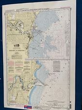 Pocket NOAA Nautical Chart of Manitowoc and Sheboygan #14922
-
$32.57
 NOAA Nautical Chart of Lake Huron #14881 Straits Of Mackinac, St.Igace, Cheboy
-
$28.57
 NOAA Nautical Chart of Lake Huron Michigan Make Great Wall Poster Free SHIPPIN
-
$30.00
 U.S. Army Corps Engineers Charts of the Illinois Waterway Grafting Chicago 1987
-
$15.00
 1974 U.S. Army Corps Engineers Charts of the Illinois Waterway


