 Antiques (US)
-
$62.61

 1747 Roman Britain Original Antique Map by Richard Seale
-
$45.00
 Vintage Saxton’s Map of England and Wales 1579 -High Quality Old Map / Poster
-
$120.00
 RARE, Saxton’s Map of England and Wales 1579, by Taylowe Limited 1969 Map Poster
-
$369.38
 Antique Map of Merionithshire by John Speede 1610 Original. Framed
-
$100.00
 WALES CAERNARVONSHIRE 23.5” BLAEU 1640 ANTIQUE ORIGINAL COPPER ENGRAVED MAP.
-
$21.00
 1843 Europe Map Prussia Germany Iceland Ireland POLITICAL Russia Moscow Austria
-
$24.88
 OLD 1855 ENGLAND WALES SCOTLAND IRELAND Map Dublin London Aberdeen Orkney
-
$24.00
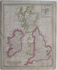
 1853 British Isles Map ORIGINAL England Wales Scotland Ireland London Dublin
-
$37.00
 1853 Europe Map ORIGINAL Turkey Russia Prussia Iceland Sardinia England Sweden
-
$43.81
 1784 Antique Map; North Wales
-
$281.73
 BRITISH ISLES Britain, Frederick De Wit original antique map circa 1675
-
$331.82
 BRITISH ISLES, Great Britain, UK, Nicolas De Fer original antique map 1706
-
$287.98
 1730 Antique Map; Regni Angliae et Walliae Principatus by Carel Allard
-
$68.87
 ANTIQUE ADMIRALTY CHART. No. 1167, BURRY INLET, WALES. 1887 Edition.
-
$25.03
 1808 Brecknockshire Antique Hand Coloured County Map by Cole & Roper
-
$540.00
 WALES BRITAIN 1575 MAP ORTELIUS GENUINE OLD BRITISH ANTIQUE PRINT 16th ENGRAVING
-
$18.77
 1720 Antique Map, Caernarfonshire, Wales - Owen & Bowen
-
$106.43
 ENGLAND, Anglia Cambdeni, Christoph Weigel, Weigelio, original antique map 1718
-
$30.05
 Original antique map ENGLAND AND WALES, Laurie, 1823
-
$9.99
 1888 Mitchell Map Europe France Germany Austria Hungary Italy Greece Sweden
-
$16.27
 1720 Antique Road Map: Grantham to Tuxford, Owen & Bowen Shts 15/16
-
$19.99
 1831 Lewis Map Herefordshire Hereford Leominster Malvern Ledbury England UK
-
$50.07
 1805 Antique Map; John Cary large map of England and Wales, Camden's Britannia
-
$169.04
 Antique Map of Great Britain by Christoph Weigel 1718
-
$62.54
 1719 LARGE ANTIQUE MAP ENGLAND - NOUVELLE CARTE DE L'ANGLETERRE - CHATELAIN
-
$23.99
 1831 Lewis Map Carnarvonshire Caernarfonshire Carnarvon Bangor Pwllheli Wales UK
-
$51.99
 1818 D'Anville Map British Isles Roman Period Londinium Hadrians Wall England
-
$24.99
 Original 1821 Map BRITISH ISLES England Scotland Ireland Wales Printed in Boston
-
$25.03
 1832 England & Wales Original Antique Map by Thomas Starling
-
$250.43
 Original antique Blaeu Atlas Title Page 'Theatre du Monde ou Nouvel Atlas', 1645
-
$25.03
 1848 Monmouthshire, Wales Original Antique Hand Coloured Map 172 Years Old
-
$25.03
 1848 Caernarfonshire, Wales Original Antique Hand Coloured Map 172 Years Old
-
$50.09
 1780'S LARGE ANTIQUE COPPER PLATE MAP ROADS ENGLAND & WALES
-
$37.55
 MONTGOMERYSHIRE WALES c1787 BY SELLER / GROSE GENUINE ANTIQUE ENGRAVED MAP
-
$62.61
 LONDON TO HOLYHEAD ROAD MAP BY JOHN OGILBY REDUCED BY THOMAS GARDNER c1719
-
$18.77
 1720 Antique Map, Brecknockshire, Wales - Owen & Bowen
-
$19.99
 1831 Lewis Map Buckinghamshire Buckingham Stratford Aylesbury Olney England UK
-
$62.61
 LONDON BIRMINGHAM TO SHREWSBURY BY JOHN OGILBY REDUCED BY THOMAS GARDNER c1719
-
$61.36
 ANTIQUE ADMIRALTY CHART. No.1484. PLANS & ANCHORAGES in CARDIGAN BAY. 1892 Edn.
-
$25.03
 1848 Flintshire, Wales Original Antique Hand Coloured Map 172 Years Old
-
$100.17
 Antique allegorical map of Britannia by John Hinton 1750
-
$39.99
 1810 Delalain Map British Isles Great Britain England Wales Scotland Ireland
-
$200.34
 Antique Map of Great Britain and Ireland by Alexis Hubert Jaillot 1786
-
$75.13
 ENGLAND BY JOHN SENEX c1740 GENUINE ANTIQUE COPPER ENGRAVED MAP
-
$12.51
 1833 Antique Map: Glamorganshire by Creighton
-
$28.00
 1801 Wilkinson Map Dioceses England Wales London Canterbury Gloucester York UK
-
$19.99
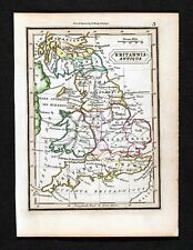 1832 Murphy Map Britannia Antiqua Britain England Wales Roman Londinum London UK
-
$15.99
 1882 Cowperthwait Map Great Britain Ireland Scotland England Wales London Dublin
-
$19.99
 1831 Lewis Map Carmarthenshire Carmarthen Llandovery Llanelli Kidwelly Wales UK
-
$106.43
 BRITISH ISLES, Great Britain, UK, Schreiber original antique map c1730
-
$47.99
 1814 John Cary Road Map Sussex Brighton Chichester Hastings Beachy Head England
-
$93.91
 Antique Map of Britain by Petrus Bertius 1618
-
$62.61
 Antique map of Great Britain by Jacque Chiquet 1719
-
$56.35
 1809 LARGE ANTIQUE COPPER PLATE MAP ENGLAND & WALES - STOCKDALE / CARY
-
$27.99
 1814 John Cary Road Map Somerset Bristol Taunton Glastonbury Wells Bath England
-
$56.35
 CHESTER LLANBEDR TO CARDIFF BY JOHN OGILBY REDUCED BY THOMAS GARDNER c1719
-
$106.43
 BRITISH ISLES, Britain, UK, Van Der Aa, original antique map 1707
-
$37.55
 CHESHIRE LANCASHIRE LIVERPOOL CHESTER BY JOHN CARY c1824 GENUINE ANTIQUE MAP
-
$19.99
 1831 Lewis Map Flintshire Flint St Asaph Mold Caerwys Holywell Hawarden Wales
-
$19.99
 1831 Lewis Map Cambridgeshire Cambridge Linton Ely Caxton Wisbeach England UK
-
$87.65
 Antique Map of England and Wales by John Cary 1789
-
$39.99
 1845 Stieler Map England Wales London Liverpool Canterbury Cardiff Manchester UK
-
$93.90
 WALES MONTGOMERYSHIRE c1637 BY SAXTON & KIP GENUINE ENGRAVED ANTIQUE MAP
-
$23.99
 1831 Lewis Map Montgomeryshire Montgomery Maldwyn Bishop's Castle Wales UK
-
$23.99
 1831 Lewis Map Radnorshire Rhayader Knighton Llandrindod Presteigne Wales UK
-
$31.99
 1814 John Cary Road Map South Wales De Cymru Cardiff Swansea Newport Glamorgan
-
$23.99
 1814 John Cary Road Map Warwickshire Stratford on Avon Birmingham England UK
-
$25.03
 1720 Antique Map, Isle of Anglesey, Wales - Owen & Bowen
-
$56.35
 Antique Map of Anglo Saxon England by John Cary 1813
-
$31.99
 1800 Wilkinson Map Ancient Britannica England Scotland Ireland Wales Roman Era
-
$62.61
 Antique map of England and Wales by John Senex 1744
-
$750.00
 BRITISH ISLES 1678 NICOLAS SANSON/HUBERT JAILLOT ANTIQUE WALL MAP 1ST EDITION
-
$43.83
 Antique Map of England, Scotland and Wales by John Cary 1790
-
$100.17
 Antique map of the West Riding of Yorkshire by Robert Morden 1722
-
$31.99
 1834 Carey Map British Isles England Wales Scotland Ireland London Britain UK
-
$31.99
 1844 Smith Map British Isles Great Britain England Scotland Ireland London Wales
-
$206.60
 MONMOUTHSHIRE, WALES Saxton & Hole, Camden original antique map 1637
-
$56.35
 Antique Map of Great Britain by Claude Buffier 1746
-
$100.17
 Antique map of Roman Britain by Robert Morden 1720
-
$16.27
 1812 Genuine Antique Map; South Wales by Neele from New British Traveller
-
$47.99
 1796 Blondeau Map England Wales London Bristol Oxford Salisbury Manchester
-
$47.99
 1847 Stieler Map British Isles England Scotland Ireland London United Kingdom UK
-
$93.91
 BRITISH ISLES BRITAIN UK Insulae Albion et Hibernia John Seller Antique Map 1694
-
$169.04
 BRECKNOCKSHIRE BRECONSHIRE WALES Saxton & Kip, Vaughan, Camden antique map 1637
-
$16.27
 1720 Antique Road Map: Newcastle-under-Lyme to Preston, Owen & Bowen Shts 91/92
-
$31.99
 1830 Nathan Hale Map England & Wales London Bristol Oxford Salisbury Manchester
-
$87.65
 Antique Map of South Wales by John Cary 1789
-
$29.99
 Original 1824 Macpherson Engraved Map BRITANNIA ROMANA HIBERNIA Thule Insula
-
$750.00
 BRITISH ISLES DATED 1677 GIACOMO ROSSI LARGE ANTIQUE MAP 17TH CENTURY
-
$62.61
 Antique map of England and Wales by Thomas Kitchin 1770
-
$27.99
 1814 John Cary Road Map Westmorland Brough Kendal Appleby Brougham England UK
-
$231.65
 PEMBROKESHIRE, WALES, Saxton & Kip, Camden Original antique map 1637
-
$62.61
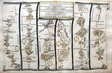
 LONDON TO ST DAVIDS ROAD MAP BY JOHN OGILBY REDUCED BY THOMAS GARDNER c1719
-
$27.99
 1814 John Cary Road Map Wiltshire Bath Salisbury Wilton Stonehenge England UK
-
$24.99
 Original 1834 Map ENGLAND & WALES Yorkshire Devon Oxford London Liverpool Exeter
-
$344.34
 Rare original map by Michael Drayton of North Wales, beautifully framed
-
$219.13
 CARDIGANSHIRE, WALES, C.Saxton, W.Kip, W.Camden original antique map 1637
-
$62.61
 LONDON TO ST DAVIDS ROAD MAP BY JOHN OGILBY REDUCED BY THOMAS GARDNER c1719
-
$102.02
 1780 Bonne - UNITED KINGDOM Ireland hand coloured engraved map
-
$25.03
 1848 Brecknockshire, Wales Original Antique Hand Coloured Map 172 Years Old


