 Antiques (US)
-
$250.00

 Guilielmo Blaeuw Map EVROPA recens delcripta Reprint 20”x15” Matted Frame 26x21
-
$21.00
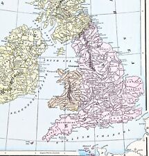 1898 British Isles Historical Map England Ireland Scotland Wales London
-
$18.06
 1906 Environs of London map. Large antique map. 117 years old. Surrey, Essex.
-
$8.14
 c1895 Map of London England antique vintage Britannica 9th
-
$27.97
 Vintage framed Hand Stitched Map Of England And Wales 20.5" x 16.5"
-
$18.77
 London environs Antique Colour Map Thomas Moule County Maps of Old England 14“
-
$19.99
 1921 Johnston Map South England Cornwall Lands End Devon Somerset Dorset Dexter
-
$73.88
 Antique 1930s The Practical Motorist's Touring Maps & Gazettee / Boxed
-
$87.64
 1810 Antique Map: Plan of Woolwich & Ordnance Ground after Thomas Yeakell
-
$1565.19
 1757 Antique Folding Map: Rocque's Map of Middlesex
-
$15.03
 London Ramblers Chiltern map NW section 55 Fleet Street Footpaths & Bus Routes
-
$15.99
 LARGE ANTIQUE 1880 ENGLAND WALES COUNTY BOROUGH HANDCOLORED MAP LONDON MARITIME
-
$23.78
 Vintage Map 1939 N.W London & Watford Cloth Ministry Of Agriculture & Fisheries
-
$68.87
 1741-1746 Exact Survey of The Cities London Westminster John Rocque 1971 Reprint
-
$20.02
 London Antique Colour Map by Thomas Moule County Maps of Old England 14“
-
$43.83
 Original UK Map 1802 J BAKER IMPERIAL GUIDE POST ROAD KENSINGTON READING
-
$25.03
 1884 Letts Middlesex W London Statistics 220 Deaths Daily! Railways Antique Map
-
$25.32
 VINTAGE Geographer's A to Z; Atlas of London and Suburbs with House Numbers
-
$23.16
 ANTIQUE COLOUR MAP LONDON AND ENVIRONS1895
-
$31.29
 1814 Surrey Antique Map J Wallis Handcoloured Small Guildford London Croydon
-
$12.51
 Late 19thC Victorian Surrey Sussex Antique Folding Map Brighton Chain Pier Smith
-
$36.39
 1930/40’s Royal Automobile Club Road Map Of England & Wales George Philip London
-
$81.39
 LONDON to HYTHE KENT Ashford Maidstone Bowles/Senex Antique Strip Road Map c1749
-
$93.91
 1720 Bowen County Map Sussex & Road London to Arundel Britannia Depicta 2 Pages
-
$25.03
 Philips' Ten Sheet Road Map of England and Wales (c1920) London, Home Counties
-
$31.99
 ANTIQUE 1762 ENGLAND WALES VAUGONDY HANDCOLORED DATED MAP LONDON OXFORD COUNTY
-
$108.38
 1896 MAP STREET PLAN COUNTY OF LONDON GEOLOGY GRAVEL CHALK CLAY BRICK EARTH
-
$12.52
 Reproduction Historic map Thomas Moule of County London, 1830
-
$75.12
 1811 Antique Map: Plan shewing the Ordnance Ground and parts adjacent, Woolwich
-
$106.43
 MIDDLESEX, LONDON, P. Meijer Very scarce original antique county map 1759
-
$16.27
 AA Duplex Map of London & the Home Counties (1934) Paper on Linen, Throughway
-
$56.35
 ORDNANCE SURVEY PLAN CRYSTAL PALACE AND ITS ENVIRONS c1864
-
$12.52
 Reproduction Historic map Thomas Moule of County London, 1830
-
$50.09
 RARE - London To Portsmouth Road Map By T. Gardener - C1719 HANDCOLOUR
-
$31.29
 Edward Weller Eastern County Railway Map (c1860) London to Cambridge Ely Norwich
-
$162.77
 Rare Early RAC Large Scale Inner London Route Map c1915 - George Philip Official


