 Antiques (US)
-
$435.00

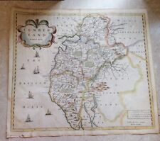
 Map of "Cumberland and the Ancient Citie Carlile.." circa 1676
-
$162.36
 1695 JOHN MORDEN MAP CUMBERLAND CAMDENS BRITANNICA HAND COLOURED Swale Awnsham
-
$243.56
 100% ORIGINAL LARGE MAP CUMBERLAND WESTMORLAND BY E BOWEN C1753 VGC COLOUR
-
$18.94
 1940 ORIGINAL VINTAGE WWII MAP OF NORTHERN ENGLAND YORK MANCHESTER CUMBERLAND
-
$24.97
 LANCASHIRE LANCASTER CUMBRIA KENDAL BY EMANUEL BOWEN c1720 GENUINE ANTIQUE MAP
-
$8.12
 1902 Map of Yorkshire Westmorland Lancashire antique vintage Britannica 10th
-
$37.46
 CHESHIRE LANCASHIRE LANCASTER KENDAL CARLISLE ROAD MAP BY JOHN SENEX c1757
-
$14.99
 c1880 Antique Map of COUNTY CUMBERLAND, ENGLAND
-
$6.25
 1902 Map of Northumberland Durham Isle of Man antique vintage Britannica 10th
-
$22.00
 Cumberland, Northumberland & Durham - Large Original 1922 Ordnance Survey Map.
-
$28.67
 Lake District Thomas Moule Cumberland Antique Map English Counties Delineated
-
$19.99
 c 1850 Thomas Moule Map Cumberland Cumbria England Carlisle Whitehaven Maryport
-
$14.98
 Owen and Bowen Original County Map of Cumberland and Strip Road Map. c.1720
-
$24.97
 1863 North Cumberland & Westmorland Antique Hand Coloured Weekly Dispatch Map
-
$24.97
 1883 North Cumberland & Westmorland Hand Coloured County Map by G.W. Bacon
-
$24.97
 1886 North Cumberland & Westmorland Antique Hand Coloured Map by G.W. Bacon
-
$24.97
 1830 Original Pigot & Co. Map: Cumberland
-
$28.00
 1830 Nathan Hale Map England Wales London Liverpool Oxford Cornwall Bristol UK
-
$17.47
 Antique 1897 large map of Cumberland & Westmorland. 125 years old. Carlisle.
-
$43.70
 WESTMORELAND CUMBRIA LAKE DISTRICT BY JOHN CARY c1793 GENUINE ANTIQUE MAP
-
$37.46
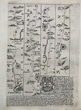
 CUMBERLAND DISTANCE CHART MORDEN / VAN LANGEREN c1720 GENUINE ANTIQUE ENGRAVING
-
$31.21
 WESTMORLAND CUMBRIA BY SELLER / GROSE GENUINE ANTIQUE ENGRAVED MAP
-
$61.20
 VINTAGE ADMIRALTY CHART. No.1826. BURROW HEAD to LIVERPOOL . 1953 Edition.
-
$23.99
 1814 John Cary Road Map Cumberland Cumbria Keswick Carlisle Penrith England UK
-
$156.13
 NORTH ENGLAND, ISLE OF MAN, 'Regni Angliae' original antique map, De Wit, c.1680
-
$16.39
 1895 Cumberland county map. Victorian. Carlisle, Whitehaven, Keswick.
-
$16.23
 1802 Genuine Antique Map; Cumberland by Neele from Encyclopaedia Londinensis
-
$11.23
 FRAMED VICTORIAN 1842 DUGDALE'S MAP: WARWICK SHIRE: COVENTRY: STRATFORD: RUGBY
-
$22.47
 1720 Carlisle - Jedburgh - Kelso - Berwick Antique Road Map by Emanuel Bowen
-
$112.40
 RARE Antique Map , W Pinnock , 1832 , Cumberland , England
-
$24.98
 100% ORIGINAL CUMBERLAND FOX HUNTING MAP BY HOBSON C1860/S VGC COLOURED
-
$37.47
 100% ORIGINAL CUMBERLAND MAP BY JOHN GIBSON C1759 VGC HAND COLOURED
-
$56.21
 TYNEMOUTH TINMOUTH TO CARLISLE BY JOHN OGILBY REDUCED BY THOMAS GARDNER c1719
-
$56.21
 CARLISLE TO BERWICK ON TWEED BY JOHN OGILBY REDUCED BY THOMAS GARDNER c1719
-
$34.97
 CUMBERLAND, CUMBRIA, Seller/Grose, Original Antique County Map c1780
-
$11.99
 Original 1888 Shire Map CUMBERLAND England Carlisle Penrith Caledonian Railway
-
$12.48
 Antique/Vintage County Map of Cumberland & Lake District - John Heywood, 1868
-
$23.11
 CUMBERLAND, CARLISLE, SCOTLAND, KELSO, original antique road map, Bowen, 1759
-
$4.36
![1950s Wonderful Britain map, Places to visit, Cumberland, 26x20cm [26636]](https://i.ebayimg.com/thumbs/images/g/oUkAAOSwDupjvwAa/s-l225.jpg) 1950s Wonderful Britain map, Places to visit, Cumberland, 26x20cm [26636]
1950s Wonderful Britain map, Places to visit, Cumberland, 26x20cm [26636]
-
$16.18
 100% ORIGINAL CUMBERLAND MAP BY WALLIS C1810 VGC HAND COLOURED SCARCE
-
$18.72
 CUMBERLAND COCKERMOUTH YORK OXFORD BY PATERSON c1785 GENUINE ANTIQUE MAP
-
$14.99
 Original Ordnance Survey Map - Cumberland Sheet LXIII Ard Crags, Keskadale, 1935
-
$18.86
 1898 Cumberland, Carlisle with northern Lakes large map. 125 years old. England.
-
$37.47
 CUMBERLAND, PENRITH, WESTMORLAND, KENDAL, Pl 58, original antique map, Cary 1794
-
$43.70
 CUMBERLAND CUMBRIA c1787 BY JOHN SELLER AND FRANCIS GROSE GENUINE ANTIQUE MAP
-
$15.61
 Dugdale & Neele 1819 Antique Map. Cumberland
-
$7.99
 SUPERB ANTIQUE 1885 CUMBERLAND CARLISLE ENGLAND RAILROAD MAP DETAILED RARE FINE
-
$11.24
 Thomas Moule C1835 Antique Map. Cumberland
-
$49.95
 CUMBERLAND CUMBRIA BY JOHN CARY c1809 GENUINE COPPER ENGRAVED ANTIQUE MAP
-
$49.95
 CUMBERLAND CUMBRIA LAKE DISTRICT BY EMANUEL BOWEN c1720 GENUINE ANTIQUE MAP
-
$56.21
 Cumberland: antique map (smaller) by Robert Morden, 1704-31
-
$49.95
 WESTMORELAND CUMBRIA BY THOMAS KITCHIN c1770 GENUINE ANTIQUE ENGRAVED MAP
-
$31.23
 Cumberland: antique map by Thomas Moule, c1840
-
$49.95
 WESTMORLAND CUMBRIA BY JOHN ROCQUE c1769 GENUINE ANTIQUE ENGRAVED MAP
-
$18.72
 Cumberland Antique Colour Map by Thomas Moule County Maps of Old England 14“
-
$99.92
 Antique map of Cumberland by Robert Morden 1695
-
$12.48
 OLD COPY OF JOHN SPEED MAP OF CUMBERLAND CARLISLE TOWN PLAN PICTS WALL 1610
-
$61.20
 ANTIQUE ADMIRALTY CHART. No. 1346. THE FIRTH of SOLWAY. 1890 Edition.
-
$9.37
 BARTHOLOMEW'S 2 MILES:1" CLOTH BACKED TOURISTS & CYCLISTS MAP OF DERBY & NOTTS
-
$24.98
 c1740 MAP PAGE ROAD to POOLE HANTS from OWEN + BOWEN BOOK + CUMBERLAND 125x185MM
-
$18.01
 1904 Cumberland North & Westmorland large antique map. 120 years old. Carlisle.
-
$56.21
 Antique map of Cumberland by John Seller 1701
-
$19.98
 GEORGE COLE c1835: Cumberland
-
$28.09
 OLD ANTIQUE ROAD MAP YORK TADCASTER by OWEN BOWEN c1740 YORKSHIRE BURROWBRIDGE
-
$18.72
 3 x Vintage Bartholomews Tourist & Cycling Maps , Cloth Sheffield , Cumberland
-
$18.19
 1922 Westmorland large county map. Antique 101 years old. Kendal, Windermere.
-
$12.48
 1818 Cumberland J Robins Antique Map Dugdale Carlisle Lake District Handcoloured
-
$43.70
 CUMBERLAND CUMBRIA KENDAL KESWICK PENRITH BY JOHN CARY c1822 ANTIQUE MAP
-
$42.46
 SOLWAY & BORDERS MAP, PLATE 75 BARTHOLOMEW'S SURVEY ATLAS OF ENGLAND WALES 1939
-
$31.23
 Original antique copper-engraved map CUMBERLAND, Badeslade & Toms, 1742
-
$18.74
 Antique map of Cumberland by Thomas Moules 1842
-
$34.97
 CUMBERLAND, CUMBRIA, Thomas Moule, Original Antique County Map c1840
-
$7.48
 Old Antique map Cumberland Cumbria England c1830's Moule: Reprint Carlisle View
-
$21.23
 Original antique road map, Cumberland, Scotland, Paterson 1796
-
$20.61
 CUMBERLAND, original antique map, RAILWAYS, Sidney Hall, c.1848
-
$52.49
 1823 ORIGINAL MAP UNITED KINGDOM ENGLAND WALES LONDON CAMBRIDGE LANCASTER YORK
-
$5.62
 KESWICK 1898 - Old Ordnance Survey Maps Godfrey Edition
-
$41.21
 OLD ANTIQUE MAP CUMBERLAND c1850 by J & C WALKER 19th C HAND COLOURED ENGRAVING
-
$22.47
 1841 Antique Map; Cumberland by Thomas Moule
-
$49.95
 CUMBERLAND CUMBRIA KESWICK BY JOHN ROCQUE c1769 GENUINE COPPER ENGRAVED MAP
-
$5.62
 VINTAGE BARTHOLOMEW’S CLOTH SHEET MAP - CUMBERLAND SHEET 3 - c1935
-
$34.97
 TYNEMOUTH TO CARLISLE, HEXHAM, antique road map, SENEX, OGILBY, pl 94-95, 1762
-
$61.20
 ANTIQUE ADMIRALTY CHART. No.1826. SOUTHPORT to CARLISLE . 1915 Edition.
-
$31.23
 1777 map of Cumberland by thomas kitchin sr
-
$49.96
 Antique map of Cumberland by Alexander Hogg and Thomas Conder 1784
-
$9.48
 ORIGINAL 19th CENTURY 1889 ANTIQUE BACON MAP CUMBERLAND WESTMORLAND #9
-
$206.09
 OGILBY original antique road map, LANCASTER, KENDAL, CARLISLE, Plate 38, c.1675
-
$12.48
 Vintage decorative sheet map of Cumberland Carlisle town plan John Speede 1610
-
$23.73
 CUMBERLAND, original antique county map, LEWIS, CREIGHTON, STARLING, 1848
-
$16.24
 1904 Westmorland large antique map. 120 years old. Ambleside, Kendal & Keswick.
-
$31.23
 CUMBERLAND & WESTMORLAND, original antique Victorian county map, Bacon, 1890
-
$8.73
 Antique Map 1808 - Cumberland by Cooper. Published by R Phillips
-
$12.48
 CUMBERLAND County Map in 1610 by John Speed - Uncoloured
-
$43.72
 Antique map of Cumberland by John Rocque 1769
-
$24.97
 NORTHUMBERLAND NEWCASTLE CUMBERLAND BY PATERSON c1785 GENUINE ANTIQUE MAP
-
$36.22
 The County Palatine of Chester with that most ancient city described
-
$54.96
 CUMBERLAND, Darton Hand Coloured Original Miniature Antique County Map c 1822
-
$24.98
 Original antique map ISLE OF MAN, CUMBERLAND, WESTMORLAND, SDUK, 1845
-
$93.68
 original mounted map - kitchen / baldwin 1786 " cumberland "
-
$24.98
 100% ORIGINAL CUMBERLAND MAP BY WALKER C1843 VGC HAND COLOURED RAILWAYS


