 Antiques (US)
-
$349.99

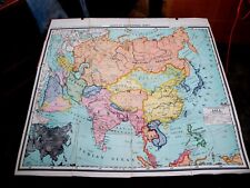 HUGE MAP 51.5" x 48" Asia Since The Great War WWI A. J. NYSTROM China India 1st
-
$199.99
 Trott 1912 Large MAP Railway System INDIA Burma Ceylon. 30in x 30in
-
$29.00
 1884 HIMALAYAN Mountain Ranges Large Map by Godwin Austen, Royal Geographical
-
$59.95
 WW2 CBI 1942 Road Map of India Linen Backed / 1" = 50miles / Folded and Bounded
-
$29.99
 United Presbyterian Mission Field in India Map early 1900s E F Fisk Engr. NY
-
$25.19
 Mysore Geological Department Records Vol V India Lots of Maps 1903- 1904
-
$100.00
 61” x 53” 1914 Rand McNally Color Foldout Cloth Map Of British India
-
$45.00
 1971 Large Pune & Khadki Survey Guide Folding Map Of India 35" x 30"
-
$49.99
 Antique India Maps & Pictures Tej Bros Road Map Vtg Taj Mahal in Color
-
$50.00
 1925 India Maps Of The United Provinces, Linen Backed Folding Maps No. 53 O & P
-
$12.49
 1882 Map of Marhatta Country Bombay Mumbai India antique vintage
-
$81.16
 Antique Map of Persia and Gujarat & Malabar Coasts of India, 1758, by Bellin
-
$32.50
 GUIDE MAP OF CALCUTTA INDIA 1957 + P&O PORTS of BOMBAY Information Pamphlet RARE
-
$199.99
 5x LARGE MAPS - NATIONAL ATLAS OF INDIA North South East West Central 1960'S
-
$149.99
 1930 Large Map INDIA PROVINCES ADMINISTERED BY CHIEF COMMISSIONERS Stanford
-
$29.99
 Original 1936 Map Alaska. Lituya Bay and Mount Crillon District. 15in x 9.50in
-
$43.70
 1781 ANTIQUE COPPER PLATE MAP - EAST INDIES OR INDOSTAN - THOMAS KITCHIN - INDIA
-
$19.99
 Antique 1910 Folding Color Map Of India! Railroads, Canals Etc.! Ready To Frame
-
$19.99
 Antique 1910 Folding Color Map Of India (Northern Part)! Railroads, Canals Etc.!
-
$49.94
 1750'S ORIGINAL ANTIQUE COPPERPLATE MAP - MADRAS & FORT ST GEORGE INDIA 1746
-
$93.64
 India Showing Railways (Open & Under Construction) 1944 Survey of India Offices
-
$99.99
 Map of the Arcot Mission in India 1914
-
$49.99
 1902 MAP Survey from HANKAU To CANTON. By W. Barclay Parsons 20in x 20in
-
$18.73
 C1920's?? Folding Map DEHRA DUN FISHING ASSOCIATION Leased Waters INDIA Rare
-
$17.47
 Antique Print Map Of India Northern Part Asia Dated C1870's Map Of The World
-
$43.70
 1754 ORIGINAL ANTIQUE COPPERPLATE MAP - COROMANDEL COAST INDIA - SEAT OF WAR
-
$29.99
 Original 1936 Map The British Somaliland - Ethiopia Boundary 9in x 9.50in
-
$16.99
 map of the United Presbytarian Mission Field in India
-
$29.99
 1936 Map ELLESMERE ISLAND EXPEDITION 7in x 9.50in
-
$31.20
 1911 antique colour map - india ( northern part )
-
$49.99
 1880 Map of Kuldja District & Russo- Chinese Frontier in Turkistan 18in x 9.25in
-
$39.99
 1931 map Langia Acholi Mountain Anglo- Egyptian Sudan Uganda Border 13in x 14in
-
$39.99
 1880 Map Reduction of The Map of British Guiana 12in x 17in
-
$475.00
 Tourist map of India, Indian State Railways
-
$79.99
 Madura Mission Map in India early 1900s
-
$39.99
 1880 Map Expedition East Africa LAKE NYASSA & TANGANYIKA 20in x 9.25in
-
$49.99
 Original 1890's Map The Great Bend of The Indus. Rowland Ward. 11.50in x 16.50in
-
$29.99
 1931 Map Norwegian Expeditions Antarctic Regions. Olaf Holtedal 16in x 13.50in
-
$49.99
 Original 1941 TOPOGRAPHICAL MAP INDIA BURMA 25.50in x 22.50in
-
$725.00
 GUIDE MAP OF CALCUTTA & HOWRAH ORIGINAL Circa 1950
-
$14.99
 1960's New Alignments of China Traditional Frontiers map 13.75in x 13in
-
$68.67
 India Showing Railways (Open & Under Construction) 1944 Survey of India Offices
-
$5.99
 Vtg C.S Hammond Folded Specimen Map INDIA & CEYLON + CALCUTTA Inset 16" X 12.25"
-
$18.00
 1903 MAP oF India, Nepal, French, Portuguese Possessions, Railroads, Canals
-
$29.99
 1936 Original Map Southampton Island Canada. T.H Manning 13in x 12.50in
-
$39.99
 1880 Map ESTANCIA DE SAN JORGE URUGUAY. Frugoni 10.50in x 9.25in
-
$39.99
 1939 Map The Gold Coast. With Togoland Under British Mandate 13in x 21.25in
-
$29.99
 Vintage Map of The Minbu Anticline 11in x 47in
-
$29.99
 1939 Map The Gold Coast. With Togoland Under British Mandate 13.50in x 21.25in
-
$29.99
 1936 Map Botanical and Geographical Explorations in Tibet by Ward 11in x 14.50in
-
$49.99
 1880 Map of Russian Lapland 11.50in x 14.50in
-
$112.37
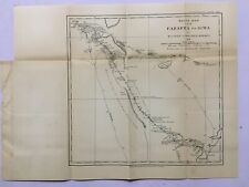
 SOUTHERN INDIA - FINELY ENGRAVED TALLIS / RAPKIN MAP, 1851 - WITH VIGNETTE VIEWS
-
$29.99
 1936 Map of The Colony and Protectorate of Nigeria. 20in x 17in
-
$106.13
 NORTHERN INDIA - FINELY ENGRAVED TALLIS / RAPKIN MAP, 1851 WITH FINE VIGNETTES
-
$29.99
 Original 1936 Map NEW GUINEA Headwaters of Purari and Yuat Rivers 20.50in x 14in
-
$39.99
 1880 Map Route Survey of The Western Side of Lake Nyasa. 9.25in x 15in
-
$49.99
 C 1910's. Map of The Area in which The Kashmiri Language is spoken 13in x 16in
-
$29.99
 Vintage Map Ramri Island, Arakan. 11in x 16in
-
$49.99
 1902 ROUTE MAP from FARAFRA TO SIWA. By Wilfred Jennings Bramly. 12in x 12in
-
$49.99
 1902 Map P.H Selby's Route in NORTH EASTERN RHODESIA 18in x 9.25in
-
$49.99
 c 1910's Map of Localities where The Ghalchah Languages are Spoken 16in x 13in
-
$49.99
 c 1910's Map localities in India Siamese-Chinese language is spoken 9in x 13in
-
$29.99
 1880 Map of Route From Kagei to Tabora. By Rev C.T Wilson 5in x 9.25in
-
$49.99
 c 1910's Map Illustrating Distribution of Pashto and Ormuri Language 16in x 13in
-
$49.99
 1902 SKETCH MAP of QUEENSLAND. Illustrating Artesian Water Supply 11in x 15in
-
$49.99
 c 1910's Map The Localities in which the Balochi Language is Spoken 18in x 20in
-
$49.99
 c 1910's Map Illustrating area where DARDIC languages are spoken 13in x 10.50in
-
$99.99
 1880 Map of The Country between Sind and Candahar PROPOSED RAILWAY. 15in x 14in
-
$49.99
 Vintage Map Yenangyaung Oil Field 56in x 27in


