 Antiques (US)
-
$130.00

 Map of Holland, Circa 1730
-
$25.08
 1891 DENMARK & SCHLESWIG HOLSTEIN COLOUR MAP BY W.G. BLACKIE
-
$25.08
 1891 HOLLAND & BELGIUM LARGE COLOUR MAP BY W.G. BLACKIE
-
$480.00
 Antique map 1654 Blaeu/Pont England Scotland Border ORIGINAL ETCHING Liddisdale
-
$50.00
 maps, Bonne, Carte de la Hollande / sept provinces unies des Pays Bas 1780
-
$24.90
 1889 HOLLAND Vintage Geographical Map Netherlands Original 10 x 9.5" COLOR C13
-
$11.00
 1932 Rhine River Delta Interpretive Map Print Van Loon Geography Art Pen and Ink
-
$145.00
 Map of The Hague, published 1646. Framed.
-
$36.39
 Admiralty Chart with Decca Harwich Terschelling Cromer Rotterdam Hook
-
$408.00
 1839 Rare Map, Antique Netherlands Holland Map, Siege of Deventer
-
$4.08
 VINTAGE SEA CHART / NAUTICAL MAP 1961 - France - Brest Approaches
-
$4.08
 VINTAGE SEA CHART / NAUTICAL MAP 1961 - France - Lezardrieux
-
$4.08
 VINTAGE SEA CHART / NAUTICAL MAP 1961 - Dunkerque, Ostend Niueport Zeebrugge
-
$21.27
 Vintage Admiralty Chart Noordzeekaal Netherlands No.124.
-
$61.48
 RIVER MASS, HOLLAND, NORTH SEA. ADMIRALTY SEA CHART. No.122. 1928 Edition.
-
$112.92
 NETHERLANDS, HOLLAND, NEDERLAND, THOMSON original antique map 1817
-
$4.08
 VINTAGE SEA CHART / NAUTICAL MAP 1961 - France - Douarnenez & Audierne
-
$4.08
 VINTAGE SEA CHART / NAUTICAL MAP 1961 - France - Rivers Aven & Belon, Houat,Tudy
-
$4.08
 VINTAGE SEA CHART / NAUTICAL MAP 1961 - Holland - Flushing Breskens Groningen
-
$4.08
 VINTAGE SEA CHART / NAUTICAL MAP 1961 - France - Concarneau, Port Breton, Louis
-
$4.08
 VINTAGE SEA CHART / NAUTICAL MAP 1961 - Cherbourg
-
$4.08
 VINTAGE SEA CHART / NAUTICAL MAP 1961 - Channel Islands - Alderney & St Helier
-
$4.08
 VINTAGE SEA CHART / NAUTICAL MAP 1961 - St Peter Port Channel Islands
-
$4.08
 VINTAGE SEA CHART / NAUTICAL MAP 1961 - Dieppe, Havre, Trouville, Ouidtreham,
-
$4.08
 VINTAGE SEA CHART / NAUTICAL MAP 1961 - Holland - Delfzul, Langeoog, Ijmuiden
-
$4.08
 VINTAGE SEA CHART / NAUTICAL MAP 1961 - France - L’Abervrac’h
-
$56.46
 Antique maps, Bonne, Carte de la Hollande / sept provinces unies des Pays Bas
-
$4.08
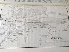 VINTAGE SEA CHART / NAUTICAL MAP 1961 - Honfleur
-
$24.87
 HOLLAND - 1905 PHYSICAL MAP incl. Railways Roads 11.5 x 12" (29 x 30 cm)
-
$100.31
 1845 Holland & Belgium Luxembourg Antique Map WR Chambers Gellatly Hand Coloured
-
$720.00
 KINGDOM OF NAPOLI. ENGRAVING. WILLEM JANZSOON. EDIT. JOAN BLAEU. AMSTERDAM. 1640
-
$34.50
 HOLLAND, BELGIUM, LUXEMBOURG, Sidney Hall Antique Map c1840
-
$9.41
 Vintage Map. c1920. HOLLAND. Harmsworth's Atlas. VG.
-
$4.08
 VINTAGE SEA CHART / NAUTICAL MAP 1961 - Calais St Valery Treport Etaples, Etc
-
$4.08
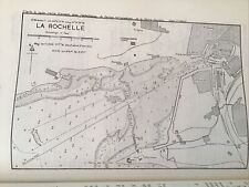 VINTAGE SEA CHART / NAUTICAL MAP 1961 - France - La Rochelle
-
$4.08
 VINTAGE SEA CHART / NAUTICAL MAP 1961 - France - Four Channel
-
$4.08
 VINTAGE SEA CHART / NAUTICAL MAP 1961 - France - Paimpol
-
$4.08
 VINTAGE SEA CHART / NAUTICAL MAP 1961 - France - MORLAIX Road
-
$100.31
 1845 Europe Russia UK Germany France Antique Map Chambers Gellatly Hand Coloured
-
$50.13
 c1840s Holland Belgium Luxemburg FP Becker George Virtue Map Print Hand Coloured
-
$4.08
 VINTAGE SEA CHART / NAUTICAL MAP 1961 - France - Morbihan
-
$4.08
 VINTAGE SEA CHART / NAUTICAL MAP 1961 - St Malo France
-
$4.08
 VINTAGE SEA CHART / NAUTICAL MAP 1961 - France -river Odet Benodet - Quimper
-
$4.08
 VINTAGE SEA CHART / NAUTICAL MAP 1961 - France - Benodet, Loctudy
-
$4.08
 VINTAGE SEA CHART / NAUTICAL MAP 1961 - France Lannion River, Primer, Port Blanc
-
$4.08
 VINTAGE SEA CHART / NAUTICAL MAP 1961 - France - Perros
-
$4.08
 VINTAGE SEA CHART / NAUTICAL MAP 1961 - France - Ile Du Bec To Argenton Porsal
-
$4.08
 VINTAGE SEA CHART / NAUTICAL MAP 1961 - France - Le Pouliguen, Le Croisic
-
$16.30
 1841 Antique Map; Holland & Belgium - Alexander Findlay
-
$4.08
 VINTAGE SEA CHART / NAUTICAL MAP 1961 - France - Ile Noirmoutier, St Gilles
-
$4.08
 VINTAGE SEA CHART / NAUTICAL MAP 1961 - France - Ile De Bas & Roscoff
-
$4.08
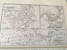 VINTAGE SEA CHART / NAUTICAL MAP 1961 - France St Guenole, L’Aberildut
-
$30.00
 Antique Johnson's Map of Holland and Belgium
-
$275.00
 ORIG. NAUTICAL CHART - COASTS OF ENGLAND, FLANDERS & HOLLAND -MOUNT & PAGE -1750
-
$3.75
 VINTAGE SEA CHART / NAUTICAL MAP 1961 - France - Les Sables D’olonne, St Martin
-
$15.06
 Antique Map. HOLLAND and BELGIUM. c1899. F.S. Weller. Pub'd Cassell & Co. VG.
-
$25.08
 1821 Antique Map; Netherlands Distance Chart by Evert Maaskamp Amsterdam
-
$313.68
 1753 Euler Southern Hemisphere New Holland Zealand Australis S Pole Antique Map
-
$37.63
 1828 Antique Map; Holland - L. Hebert
-
$60.03
 1908 LARGE VICTORIAN MAP ~ HOLLAND BRABANT UTRECHT ENVIRONS TOWN PLAN AMSTERDAM
-
$18.81
 1840 Antique Map; Holland after John Russell
-
$21.27
 Vintage Admiralty Chart Goeree to Texel No. 2322 The Netherlands.
-
$144.29
 Antique Caricature Map "Holland" Lilian Lancaster Tennant, 1912
-
$25.08
 1842 Antique Map; Holland and Belgium by F.P. Becker
-
$56.46
 c1815 Asia Walker New Atlas Thomson Antique New Holland Great Wall China Siam
-
$24.47
 Vintage Admiralty Chart ZEEGAT VANTEXEL to FRIESCH ZEGAT. No. 2593.
-
$37.58
 c1810 Netherlands Best Authorities Brightly Kennersly Barlow Antique Map Holland
-
$17.57
 Folio Hydrographic maps Netherlands 1810 Nautical Sea Charts Holland Dutch
-
$37.58
 c1817 Frontiers of France Germany & Holland (1792-96) Antique Original Map Print
-
$57.72
 Map: 1890 Bartholomew; 'German Empire, Holland & Belgium' - Sheet 32
-
$16.31
 Vintage Maritime Chart Germany Sundet Og Baelterne Nautical Navigational map
-
$221.00
 Holland Amsterdam Nederland Netherlands Antique Map Johann Baptist Homann 1733
-
$72.73
 1912 LARGE ANTIQUE MAP ~ HOLLAND & BELGIUM ENVIRONS AMSTERDAM BRUSSELS ANTWERP
-
$112.92
 Johnson's France, Holland & Belgium. 2 maps on one sheet 1862 old antique
-
$408.97
 Antique Map of Belgium and Luxembourg by Homann Heirs (1747)


