 Antiques (US)
-
$22.57

 1888 ORIGINAL ANTIQUE MAP OF SOUTHERN ENGLAND AND WALES / LONDON CORNWALL
-
$28.23
 Bartholomew's New Reduced Survey Map Sheet 35 North Devon FREE POSTAGE
-
$28.23
 Bartholomew's New Reduced Survey Map Sheet 30 Surrey FREE POSTAGE
-
$20.76
 1888 ORIGINAL ANTIQUE BATHY-OROGRAPHICAL MAP OF UNITED KINGDOM ENGLAND IRELAND
-
$9.99
 Original 1888 Shire Map YORK England Halifax Leeds Whitby Keighley Selby Moras
-
$24.92
 A framed map of London c1904
-
$12.00
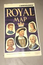 John Bartholomew Royal Map of England United Kingdom Scotland Kings and Queens
-
$6.23
 Brtholomew's Street Index Plan of London - North-East Section c1930
-
$19.00
 Eastern England & Wales - Original 1909 Map by John Bartholomew. Antique
-
$33.97
 1888 ANTIQUE MAP LONDON TUBE RAILWAYS ENGLAND DUBLIN IRELAND EDINBURGH SCOTLAND
-
$18.69
 Bartholomews Half Inch Maps Sheet 5 New Forest
-
$11.22
 Antique County Map of YORKSHIRE, WEST RIDING - Phillips Handy Atlas , 1887
-
$11.22
 Antique/Vintage County Map of NORTH WALES - Phillips Handy Atlas , 1887
-
$36.30
 1890 John Bartholomew Large Antique Physical & Political Maps of British Isles
-
$189.50
 Post WWI-The Great War Bartholomews Contour Motoring Map Central Europe On Cloth
-
$14.57
 Oxford Vintage Bartholomews Map Stratford Cirencester Banbury Antique Old C 1910
-
$11.22
 Antique/Vintage County Map of ISLE OF MAN - Phillips Handy Atlas , 1887
-
$12.45
 Oxford Vintage C 1910 Bartholomews Map Cheltenham Cirencester Banbury Witney Old
-
$11.22
 Antique/Vintage County Map of LINCOLNSHIRE - Phillips Handy Atlas , 1887
-
$11.22
 Antique County Map of FIFE AND KINROSS, Scotland - Phillips Handy Atlas , 1882
-
$9.96
 Oxford Vintage 1937 Bartholomews Map Cheltenham Cirencester Banbury Antique Old
-
$11.22
 Antique/Vintage County Map of SHROPSHIRE - Phillips Handy Atlas , 1887
-
$11.22
 Antique/Vintage County Map of STAFFORDSHIRE - Phillips Handy Atlas , 1887
-
$11.22
 Antique/Vintage County Map of SUTHERLAND, Scotland - Phillips Handy Atlas , 1882
-
$11.22
 Antique/Vintage County Map of DURHAM - Phillips Handy Atlas , 1887
-
$9.99
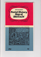 GREAT BRITAIN Postal History Map of Britain
-
$11.22
 Antique/Vintage County Map of NORTHUMBERLAND - Phillips Handy Atlas , 1887
-
$11.22
 Antique County Map of WESTERN ISLANDS, Scotland - Phillips Handy Atlas , 1882
-
$11.22
 Antique/Vintage County Map of DORSET - Phillips Handy Atlas , 1887
-
$42.37
 Bartholomew's Road Surface Map of London and Neighbourhood (early 20th Century)
-
$49.83
 VINTAGE 2 SIDED MACMILLAN MAP POSTER BRITISH ISLES RESOURCES & PHYSICAL COATED
-
$11.22
 Antique County Map of ELGIN AND NAIRN, Scotland - Phillips Handy Atlas , 1882
-
$11.22
 Antique County Map of KIRKCUDBRIGHT, Scotland - Phillips Handy Atlas , 1882
-
$11.22
 Antique/Vintage County Map of PERTH, Scotland - Phillips Handy Atlas , 1882
-
$11.22
 Antique/Vintage County Map of SURREY - Phillips Handy Atlas , 1887
-
$11.22
 Antique/Vintage County Map of WORCESTERSHIRE - Phillips Handy Atlas , 1887
-
$11.22
 Antique/Vintage County Map of HAMPSHIRE - Phillips Handy Atlas , 1887
-
$11.22
 Antique County Map of ROSS AND CROMARTY, Scotland - Phillips Handy Atlas , 1882
-
$11.22
 Antique/Vintage County Map of SOUTH WALES - Phillips Handy Atlas , 1887
-
$11.22
 Antique County Map of YORKSHIRE, NORTH AND EAST - Phillips Handy Atlas , 1887
-
$14.95
 Vintage map of UK BRITAIN ENGLAND BRITISH ISLES - 1930s, approx A3 size - VGC
-
$8.71
 Vintage Scotland Touring Map 1981 Bartholomew Large Good 26cmx10cm
-
$11.22
 Antique/Vintage County Map of DUMBARTON, Scotland - Phillips Handy Atlas , 1882
-
$11.22
 Antique/Vintage County Map of ABERDEEN, Scotland - Phillips Handy Atlas , 1882
-
$8.71
 VINTAGE BARTHOLOMEWS VALE OF SEVERN FOLD OUT MAP ON PAPER
-
$6.23
 Bartholomews Paper Map 15, Herts and Bucks, Very Good condition 1946
-
$11.22
 Antique/Vintage County Map of INVERNESS, Scotland - Phillips Handy Atlas , 1882
-
$11.22
 Antique/Vintage County Map of Scotland Railways - Phillips Handy Atlas , 1882
-
$11.22
 Antique County Map of ENGLAND (Railway Map) - Phillips Handy Atlas , 1887
-
$8.71
 VINTAGE BARTHOLOMEWS NORTH WALES FOLD OUT MAP ON PAPER
-
$11.22
 Antique/Vintage County Map of EDINBURGH, Scotland - Phillips Handy Atlas , 1882
-
$24.92
 HAMPSTEAD, HENDON, NEASDEN Original Vintage London Street Plan Antique Map 1921
-
$11.22
 Antique/Vintage County Map of BERWICK, Scotland - Phillips Handy Atlas , 1882
-
$11.22
 Antique/Vintage County Map of North Lancashire - Phillips Handy Atlas , 1887
-
$11.22
 Antique/Vintage County Map of WARWICKSHIRE - Phillips Handy Atlas , 1887
-
$24.92
 LEYTON, LEYTONSTONE, STRATFORD Original London Street Plan Antique Map 1921
-
$11.22
 Antique County Map of LEICESTER AND RUTLAND - Phillips Handy Atlas , 1887
-
$11.22
 Antique/Vintage County Map of BANFF, Scotland - Phillips Handy Atlas , 1882
-
$11.22
 Antique County Map of EDINBURGH ENVIRONS, Scotland - Phillips Handy Atlas , 1882
-
$6.23
 Bartholomew's Map, Sheet 16, Aberystwyth, 3 Shillings
-
$11.22
 Antique/Vintage County Map of DEVONSHIRE - Phillips Handy Atlas , 1887
-
$11.22
 Antique County Map of ENVIRONS OF GLASGOW Scotland - Phillips Handy Atlas , 1882
-
$11.22
 Antique/Vintage County Map of AYR, Scotland - Phillips Handy Atlas , 1882
-
$11.22
 Antique/Vintage County Map of DUMFRIES, Scotland - Phillips Handy Atlas , 1882
-
$11.22
 Antique/Vintage County Map of RENFREW, Scotland - Phillips Handy Atlas , 1882
-
$11.22
 Antique/Vintage County Map of South Lancashire - Phillips Handy Atlas , 1887
-
$11.22
 Antique County Map of STIRLING & CLACKMANNAN - Phillips Handy Atlas , 1882
-
$11.22
 Antique/Vintage County Map of HADDINGTON, Scotland - Phillips Handy Atlas , 1882
-
$11.22
 Antique/Vintage County Map of DERBYSHIRE - Phillips Handy Atlas , 1887
-
$11.22
 Antique/Vintage County Map of WILTSHIRE - Phillips Handy Atlas , 1887
-
$11.22
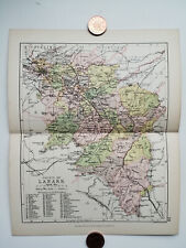 Antique/Vintage County Map of LANARK, Scotland - Phillips Handy Atlas , 1882
-
$11.22
 Antique/Vintage County Map of FORFAR, Scotland - Phillips Handy Atlas , 1882
-
$11.22
 Antique/Vintage County Map of LINLITHGOW, Scotland - Phillips Handy Atlas , 1882
-
$11.22
 Antique/Vintage County Map of ROXBURGH, Scotland - Phillips Handy Atlas , 1882
-
$11.22
 Antique/Vintage County Map of KINCARDINE, Scotland - Phillips Handy Atlas , 1882
-
$14.95
 Vintage map of SCOTLAND - 1930s, approx A3 size - VGC
-
$11.22
 Antique/Vintage County Map of CHANNEL ISLANDS - Phillips Handy Atlas , 1887
-
$11.22
 Antique/Vintage County Map of CAITHNESS, Scotland - Phillips Handy Atlas , 1882
-
$11.22
 Antique/Vintage County Map of SELKIRK, Scotland - Phillips Handy Atlas , 1882
-
$11.22
 Antique/Vintage County Map of WIGTOWN, Scotland - Phillips Handy Atlas , 1882
-
$11.22
 Antique/Vintage County Map of HERTFORDSHIRE - Phillips Handy Atlas , 1887
-
$11.22
 Antique/Vintage County Map of GLOUCESTER - Phillips Handy Atlas , 1887
-
$24.92
 THAMES VALLEY READING UXBRIDGE MAIDENHEAD Original London Antique Map 1925
-
$11.22
 Antique/Vintage County Map of BERKSHIRE - Phillips Handy Atlas , 1887
-
$6.23
 English Lakes Bartholomew's Revised Half Inch Contoured Map Sheet 34
-
$11.22
 Antique/Vintage County Map of MONMOUTHSHIRE - Phillips Handy Atlas , 1887
-
$11.22
 Antique/Vintage County Map of PEEBLES, Scotland - Phillips Handy Atlas , 1882
-
$36.75
 OLD ANTIQUE MAP CITY PLAN LEEDS YORKSHIRE c1880's by BARTHOLOMEW / FULLARTON
-
$11.22
 Antique/Vintage County Map of HEREFORDSHIRE - Phillips Handy Atlas , 1887
-
$11.22
 Antique/Vintage County Map of NORTHAMPTONSHIRE - Phillips Handy Atlas , 1887
-
$11.22
 Antique/Vintage County Map of BEDFORDSHIRE - Phillips Handy Atlas , 1887
-
$11.22
 Antique/Vintage County Map of MIDDLESEX - Phillips Handy Atlas , 1887
-
$31.15
 5 x Vintage Bartholomew Revised "Half-Inch" Contoured Maps 1946 - 1947 Wales
-
$31.15
 LONDON RAILWAY MAP With Postal Districts Original Antique Lithographed Map 1925
-
$3.74
 Vintage Bartholomew Contoured Map Teesdale Sheet 35 Cloth
-
$2.48
 Bartholomew's Revised Half Inch Contoured Map Sheet 35 - Teesdale
-
$3.74
 Vintage Bartholomew Contoured Map Pembroke Sheet 11 Cloth
-
$6.17
 Bartholomew's Vintage Revised Half-Inch Cloth Map sheet 29 SALISBURY PLAIN 1936
-
$12.45
 BARTHOLOMEW'S NEW REDUCED SURVEY FOR TOURISTS & CYCLISTS - SHROPSHIRE - 1922 C3
-
$6.23
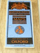 Great Vintage Bartholomew’s Half Inch Contoured Sheet Map Oxford, Inscribed 1946


